STS062-98-171
| NASA Photo ID | STS062-98-171 |
| Focal Length | 250mm |
| Date taken | 1994.03.12 |
| Time taken | 16:40:22 GMT |
Resolutions offered for this image:
3904 x 3904 pixels 639 x 639 pixels 5700 x 5900 pixels 500 x 518 pixels 640 x 480 pixels
3904 x 3904 pixels 639 x 639 pixels 5700 x 5900 pixels 500 x 518 pixels 640 x 480 pixels


Cloud masks available for this image:
Spacecraft nadir point: 28.8° N, 87.2° W
Photo center point: 30.5° N, 87.5° W
Photo center point by machine learning:
Photo center point: 30.5° N, 87.5° W
Photo center point by machine learning:
Nadir to Photo Center: North
Spacecraft Altitude: 161 nautical miles (298km)
Country or Geographic Name: | USA-FLORIDA |
Features: | PENSACOLA, BAY, AGRICULTURE |
| Features Found Using Machine Learning: | |
Cloud Cover Percentage: | 5 (1-10)% |
Sun Elevation Angle: | 53° |
Sun Azimuth: | 146° |
Camera: | Hasselblad |
Focal Length: | 250mm |
Camera Tilt: | 33 degrees |
Format: | 5048: Kodak, natural color positive, Lumiere 100x/5048, ASA 100x, standard base |
Film Exposure: | Normal |
| Additional Information | |
| Width | Height | Annotated | Cropped | Purpose | Links |
|---|---|---|---|---|---|
| 3904 pixels | 3904 pixels | No | No | Earth From Space collection | Download Image |
| 639 pixels | 639 pixels | No | No | Earth From Space collection | Download Image |
| 5700 pixels | 5900 pixels | No | No | Download Image | |
| 500 pixels | 518 pixels | No | No | Download Image | |
| 640 pixels | 480 pixels | No | No | Download Image |
Download Packaged File
Download a Google Earth KML for this Image
View photo footprint information
Download a GeoTIFF for this photo
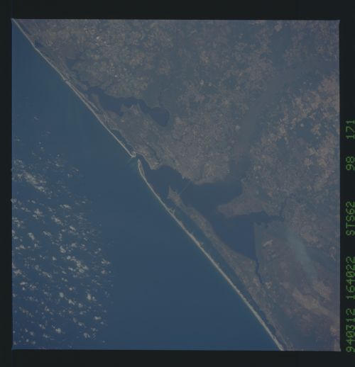
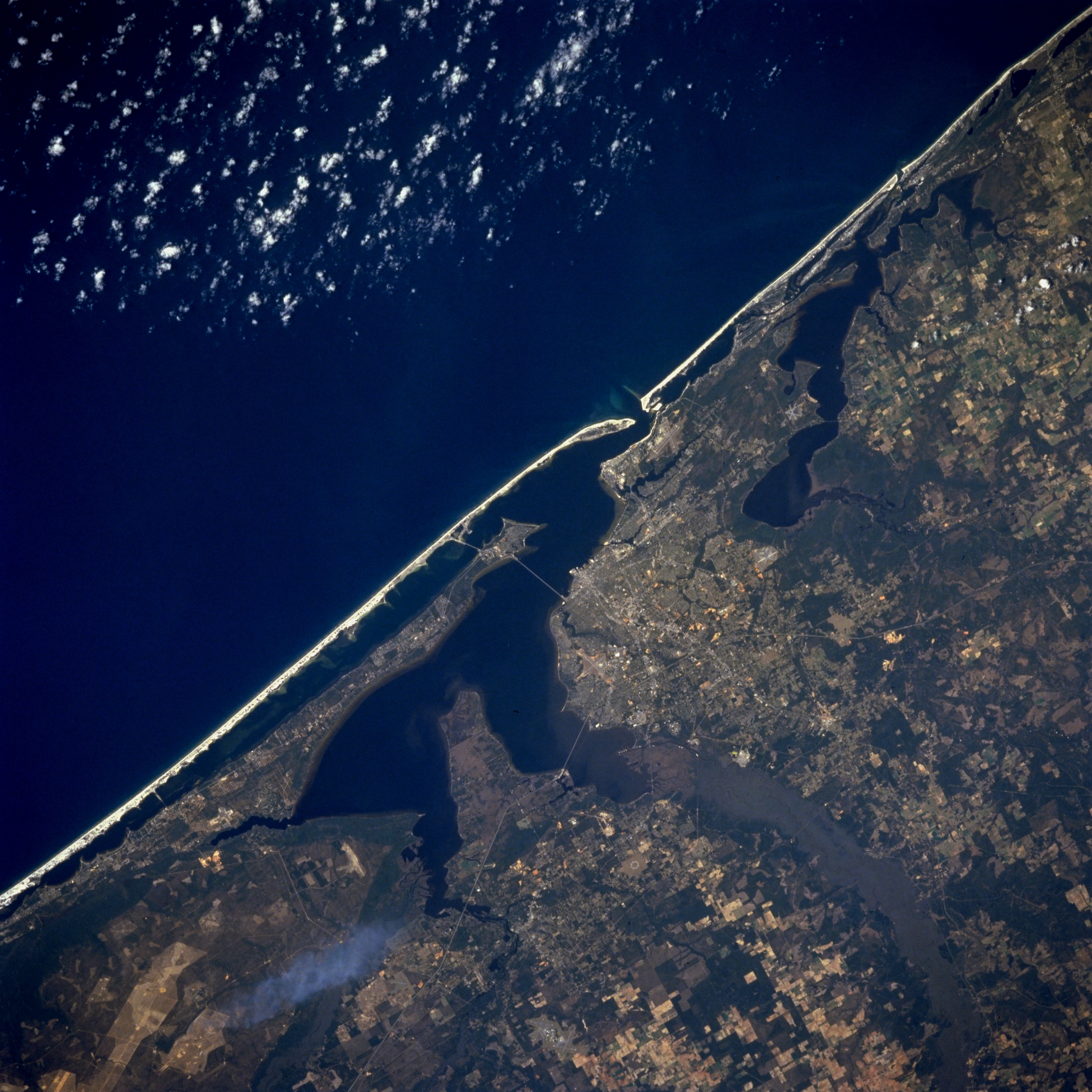
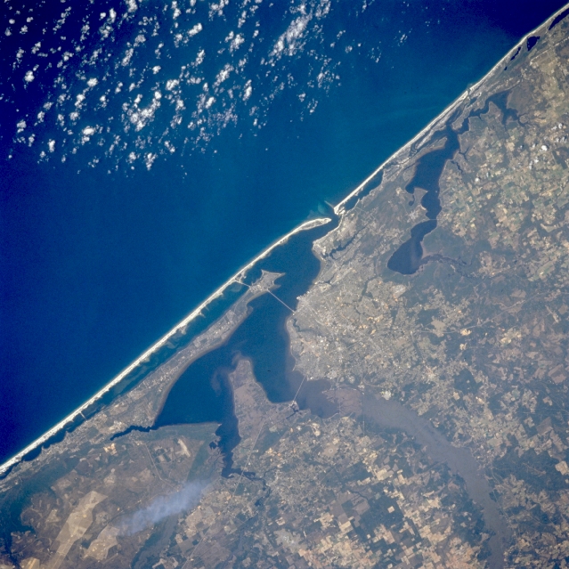
Image Caption: STS062-098-171 Pensacola, Florida, U.S.A. March 1994
The highly reflective, sandy beaches that are characteristic of the Florida panhandle barrier islands are evident in this synoptic photograph. Discernible are the general outline of the city on land that juts southeast to Escambia and Pensacola Bays; the south-flowing Escambia River with its vegetated floodplain and delta (lower right corner); and large, cultivated fields east of Escambia Bay (bottom center). The Perdido River and Perdido Bay, immediately west of Pensacola, form the Alabama-Florida panhandle border. A narrow peninsula that extends westward and separates Pensacola Bay from the Intracoastal Waterway roughly parallels Santa Rosa Island, a sandy barrier island, and the east-west-oriented lagoon that separates the island from the mainland.
The highly reflective, sandy beaches that are characteristic of the Florida panhandle barrier islands are evident in this synoptic photograph. Discernible are the general outline of the city on land that juts southeast to Escambia and Pensacola Bays; the south-flowing Escambia River with its vegetated floodplain and delta (lower right corner); and large, cultivated fields east of Escambia Bay (bottom center). The Perdido River and Perdido Bay, immediately west of Pensacola, form the Alabama-Florida panhandle border. A narrow peninsula that extends westward and separates Pensacola Bay from the Intracoastal Waterway roughly parallels Santa Rosa Island, a sandy barrier island, and the east-west-oriented lagoon that separates the island from the mainland.
