STS062-98-161
| NASA Photo ID | STS062-98-161 |
| Focal Length | 250mm |
| Date taken | 1994.03.12 |
| Time taken | 16:33:15 GMT |
Resolutions offered for this image:
3904 x 3840 pixels 639 x 629 pixels 5700 x 5900 pixels 500 x 518 pixels 640 x 480 pixels
3904 x 3840 pixels 639 x 629 pixels 5700 x 5900 pixels 500 x 518 pixels 640 x 480 pixels

Cloud masks available for this image:
Spacecraft nadir point: 38.2° N, 117.6° W
Photo center point: 38.0° N, 119.0° W
Photo center point by machine learning:
Photo center point: 38.0° N, 119.0° W
Photo center point by machine learning:
Nadir to Photo Center: West
Spacecraft Altitude: 160 nautical miles (296km)
Country or Geographic Name: | USA-CALIFORNIA |
Features: | MONO LAKE, CATHEDRAL RA. |
| Features Found Using Machine Learning: | |
Cloud Cover Percentage: | 5 (1-10)% |
Sun Elevation Angle: | 27° |
Sun Azimuth: | 118° |
Camera: | Hasselblad |
Focal Length: | 250mm |
Camera Tilt: | 28 degrees |
Format: | 5048: Kodak, natural color positive, Lumiere 100x/5048, ASA 100x, standard base |
Film Exposure: | Normal |
| Additional Information | |
| Width | Height | Annotated | Cropped | Purpose | Links |
|---|---|---|---|---|---|
| 3904 pixels | 3840 pixels | No | No | Earth From Space collection | Download Image |
| 639 pixels | 629 pixels | No | No | Earth From Space collection | Download Image |
| 5700 pixels | 5900 pixels | No | No | Download Image | |
| 500 pixels | 518 pixels | No | No | Download Image | |
| 640 pixels | 480 pixels | No | No | Download Image |
Download Packaged File
Download a Google Earth KML for this Image
View photo footprint information
Download a GeoTIFF for this photo
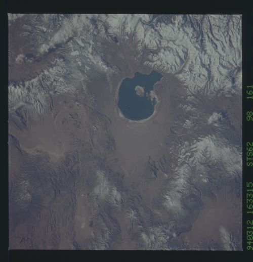
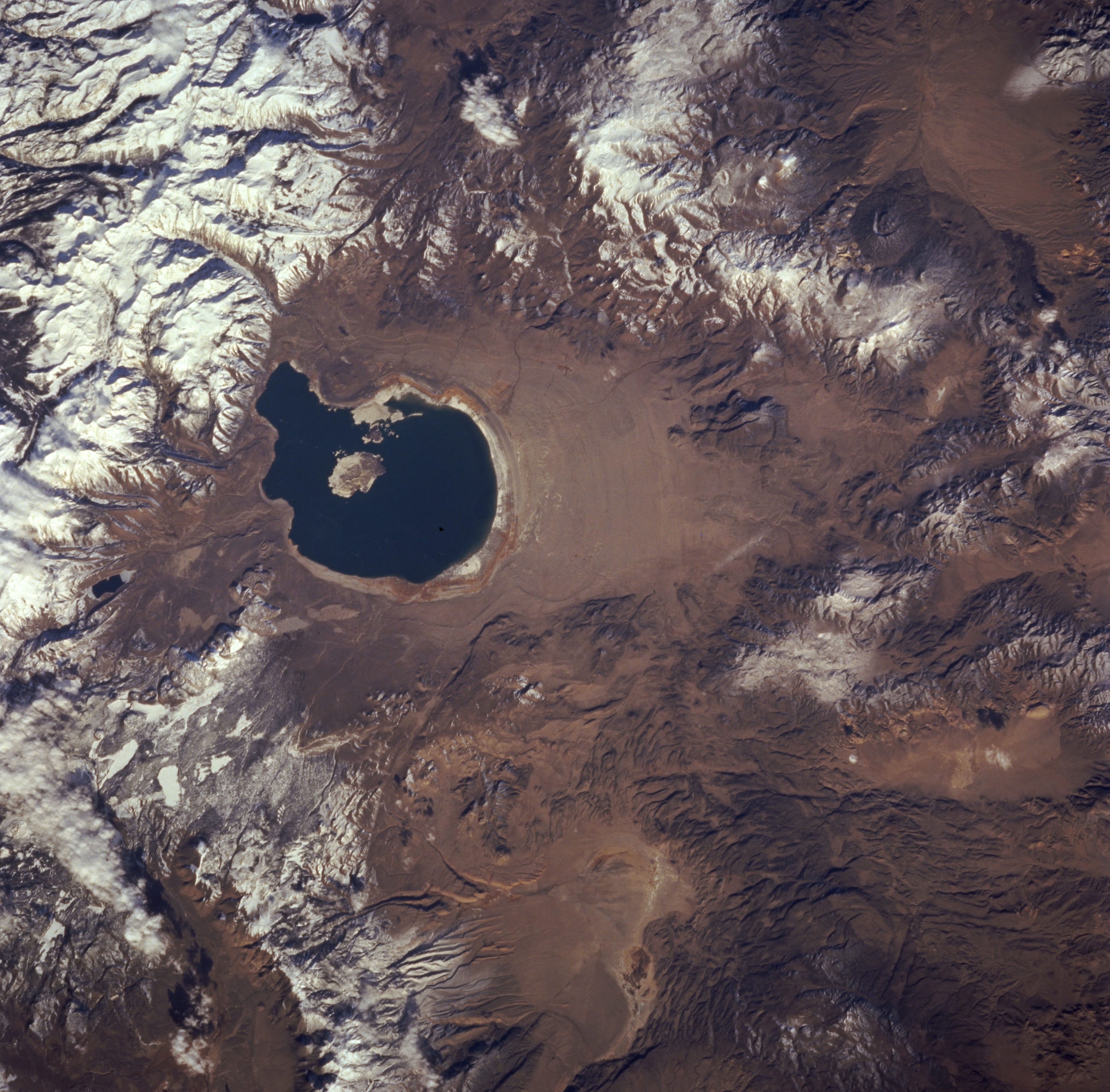
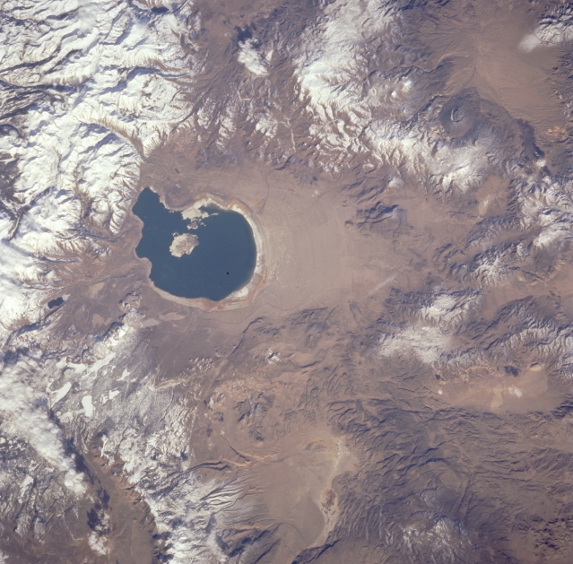
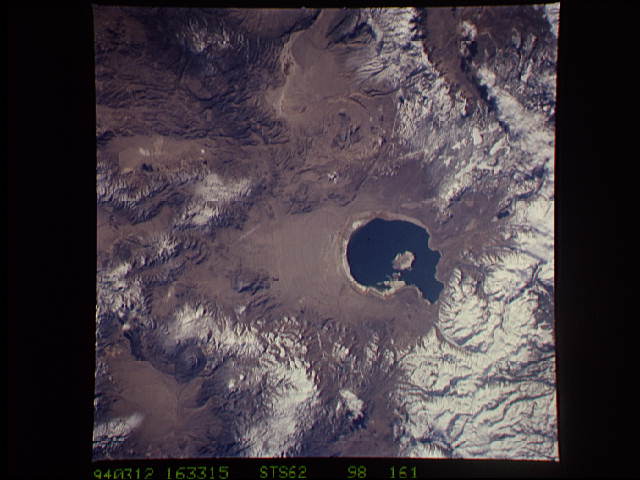
Image Caption: STS062-098-161 Mono Lake, Sierra Nevada Mountains, and Excelsior Mountains, California, U.S.A. March 1994
The dark blue, saline waters of Mono Lake are featured in this low-oblique, northwest-looking photograph. Mono Lake, approximately 14 miles (23 kilometers) long and 9 miles (14 kilometers) wide, is fed by springs that rise through beds of saline sands. Visible are the snow-covered Sierra Nevada Mountains to the west and the Excelsior Mountains to the north and east. Because the lake has supplied water for the growing population of Los Angeles for the last 10 to 20 years, the ecosystem of the lake and its surrounding habitat are at risk if water conservation measures are not implemented.
The dark blue, saline waters of Mono Lake are featured in this low-oblique, northwest-looking photograph. Mono Lake, approximately 14 miles (23 kilometers) long and 9 miles (14 kilometers) wide, is fed by springs that rise through beds of saline sands. Visible are the snow-covered Sierra Nevada Mountains to the west and the Excelsior Mountains to the north and east. Because the lake has supplied water for the growing population of Los Angeles for the last 10 to 20 years, the ecosystem of the lake and its surrounding habitat are at risk if water conservation measures are not implemented.
