STS062-98-158
| NASA Photo ID | STS062-98-158 |
| Focal Length | 250mm |
| Date taken | 1994.03.12 |
| Time taken | 16:32:55 GMT |
Resolutions offered for this image:
3872 x 3872 pixels 639 x 639 pixels 5700 x 5900 pixels 500 x 518 pixels 640 x 480 pixels 3437 x 3387 pixels
3872 x 3872 pixels 639 x 639 pixels 5700 x 5900 pixels 500 x 518 pixels 640 x 480 pixels 3437 x 3387 pixels


Cloud masks available for this image:
Spacecraft nadir point: 38.4° N, 119.2° W
Photo center point: 37.5° N, 120.0° W
Photo center point by machine learning:
Photo center point: 37.5° N, 120.0° W
Photo center point by machine learning:
Nadir to Photo Center: Southwest
Spacecraft Altitude: 160 nautical miles (296km)
Country or Geographic Name: | USA-CALIFORNIA |
Features: | MERCED, RES., AGRICULTURE, VALLEY |
| Features Found Using Machine Learning: | |
Cloud Cover Percentage: | 0 (no clouds present) |
Sun Elevation Angle: | 26° |
Sun Azimuth: | 117° |
Camera: | Hasselblad |
Focal Length: | 250mm |
Camera Tilt: | 24 degrees |
Format: | 5048: Kodak, natural color positive, Lumiere 100x/5048, ASA 100x, standard base |
Film Exposure: | Normal |
| Additional Information | |
| Width | Height | Annotated | Cropped | Purpose | Links |
|---|---|---|---|---|---|
| 3872 pixels | 3872 pixels | No | No | Earth From Space collection | Download Image |
| 639 pixels | 639 pixels | No | No | Earth From Space collection | Download Image |
| 5700 pixels | 5900 pixels | No | No | Download Image | |
| 500 pixels | 518 pixels | No | No | Download Image | |
| 640 pixels | 480 pixels | No | No | Download Image | |
| 3437 pixels | 3387 pixels | Download Image |
Download Packaged File
Download a Google Earth KML for this Image
View photo footprint information
Download a GeoTIFF for this photo
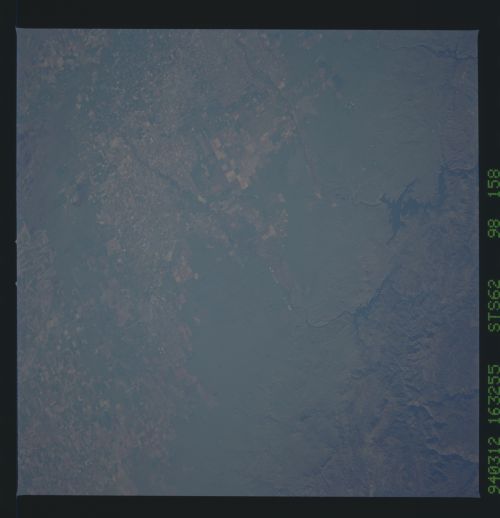
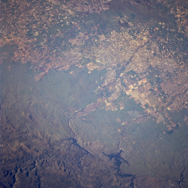
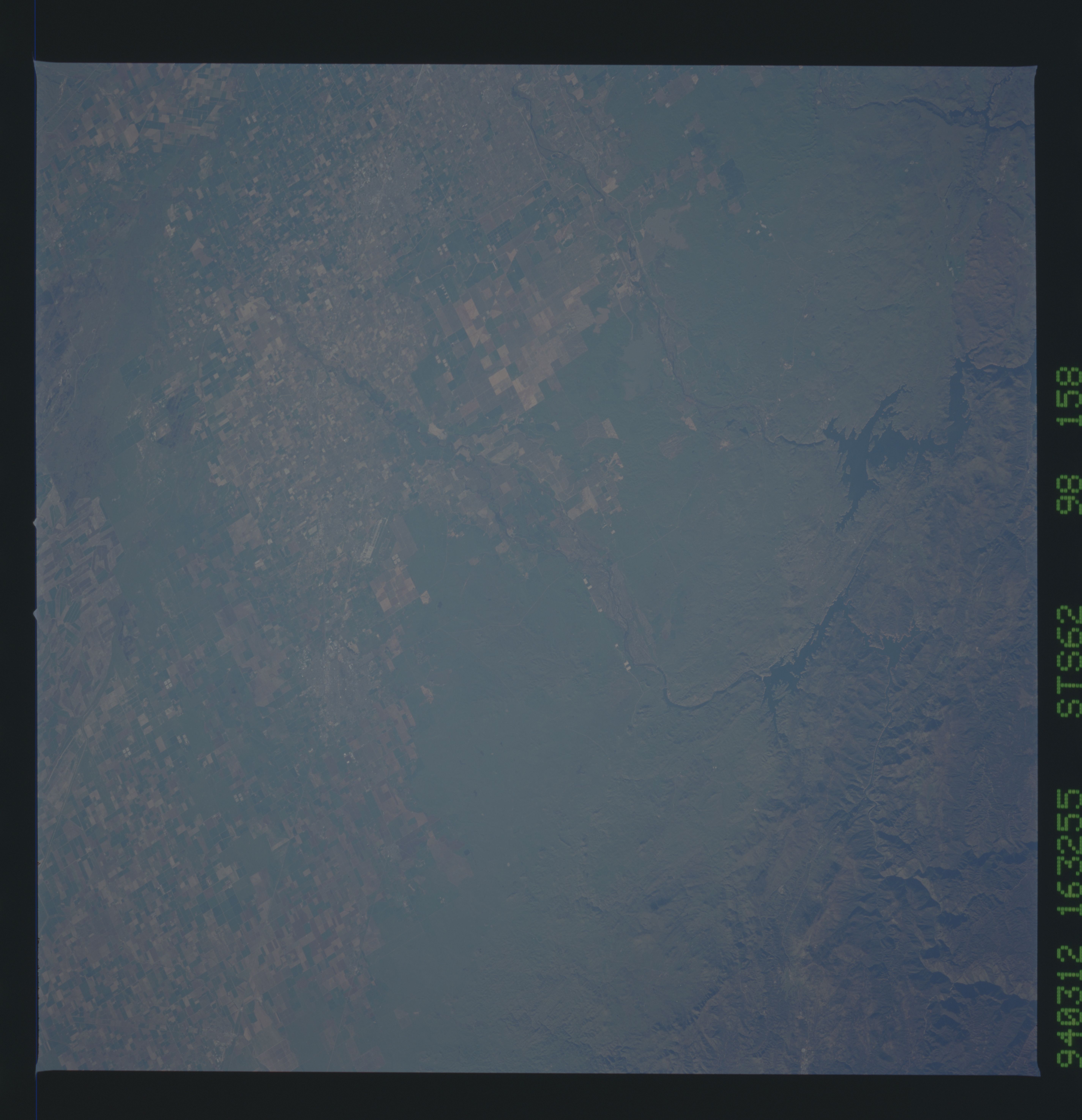
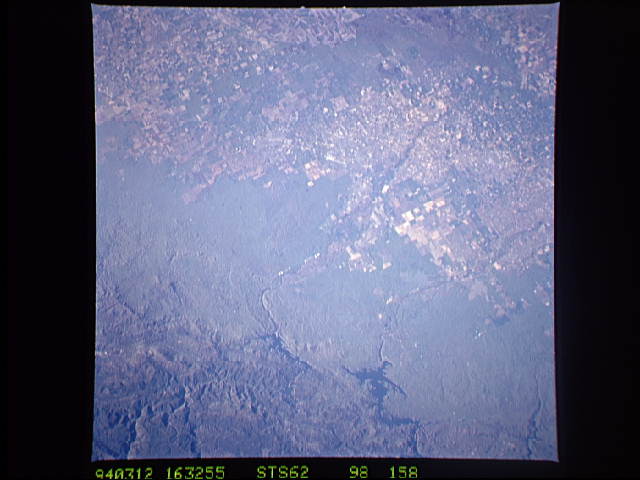
Image Caption: STS062-098-158 San Joaquin Valley, Lake McClure, and Don Pedro Reservoir, California, U.S.A. March 1994
The agriculturally rich San Joaquin Valley is captured in this low-oblique, north-northeast-looking photograph. The boundary is distinct between agricultural field patterns of the valley and the grass- and scrub-covered alluvial fan, which becomes more tree covered as the altitude of the Sierra Nevada Mountains increases. Two large reservoirs--broader and more northerly Don Pedro Reservoir, fed and drained by the Tuolumne River, and narrower and more southerly Lake McClure, fed and drained by the Merced River--modify the valley's water flow for drinking water and crop irrigation. The higher Sierra Nevada Mountains are visible to the east.
The agriculturally rich San Joaquin Valley is captured in this low-oblique, north-northeast-looking photograph. The boundary is distinct between agricultural field patterns of the valley and the grass- and scrub-covered alluvial fan, which becomes more tree covered as the altitude of the Sierra Nevada Mountains increases. Two large reservoirs--broader and more northerly Don Pedro Reservoir, fed and drained by the Tuolumne River, and narrower and more southerly Lake McClure, fed and drained by the Merced River--modify the valley's water flow for drinking water and crop irrigation. The higher Sierra Nevada Mountains are visible to the east.
