STS062-94-92
| NASA Photo ID | STS062-94-92 |
| Focal Length | 250mm |
| Date taken | 1994.03.17 |
| Time taken | 14:44:04 GMT |
Resolutions offered for this image:
3881 x 3904 pixels 636 x 639 pixels 5700 x 5900 pixels 500 x 518 pixels 640 x 480 pixels
3881 x 3904 pixels 636 x 639 pixels 5700 x 5900 pixels 500 x 518 pixels 640 x 480 pixels

Cloud masks available for this image:
Spacecraft nadir point: 29.1° N, 96.6° W
Photo center point: 30.0° N, 95.0° W
Photo center point by machine learning:
Photo center point: 30.0° N, 95.0° W
Photo center point by machine learning:
Nadir to Photo Center: Northeast
Spacecraft Altitude: 108 nautical miles (200km)
Country or Geographic Name: | USA-TEXAS |
Features: | HOUSTON |
| Features Found Using Machine Learning: | |
Cloud Cover Percentage: | 0 (no clouds present) |
Sun Elevation Angle: | 27° |
Sun Azimuth: | 108° |
Camera: | Hasselblad |
Focal Length: | 250mm |
Camera Tilt: | 46 degrees |
Format: | 5046: Kodak, natural color positive, Lumiere 100/5046, ASA 100, standard base |
Film Exposure: | Normal |
| Additional Information | |
| Width | Height | Annotated | Cropped | Purpose | Links |
|---|---|---|---|---|---|
| 3881 pixels | 3904 pixels | No | No | Earth From Space collection | Download Image |
| 636 pixels | 639 pixels | No | No | Earth From Space collection | Download Image |
| 5700 pixels | 5900 pixels | No | No | Download Image | |
| 500 pixels | 518 pixels | No | No | Download Image | |
| 640 pixels | 480 pixels | No | No | Download Image |
Download Packaged File
Download a Google Earth KML for this Image
View photo footprint information
Download a GeoTIFF for this photo
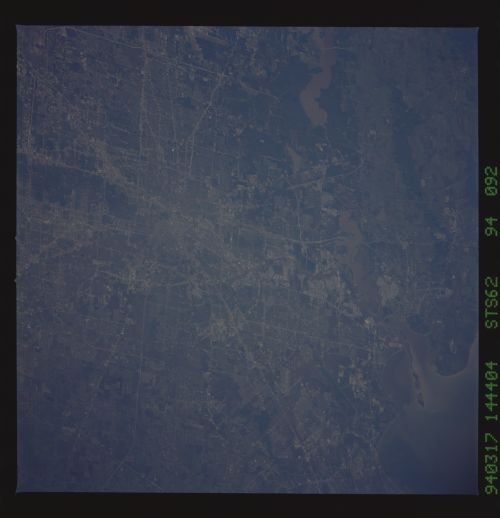
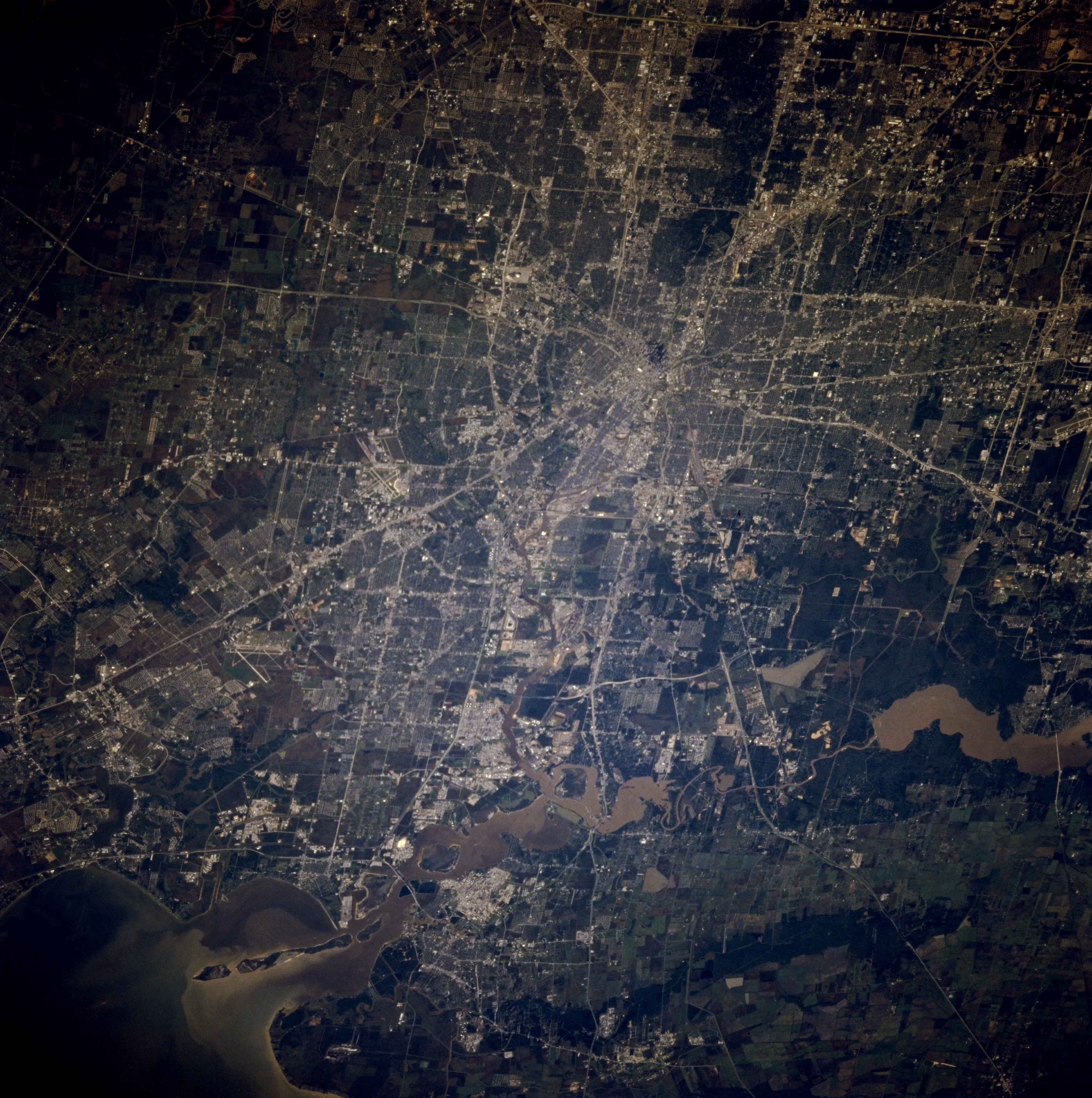
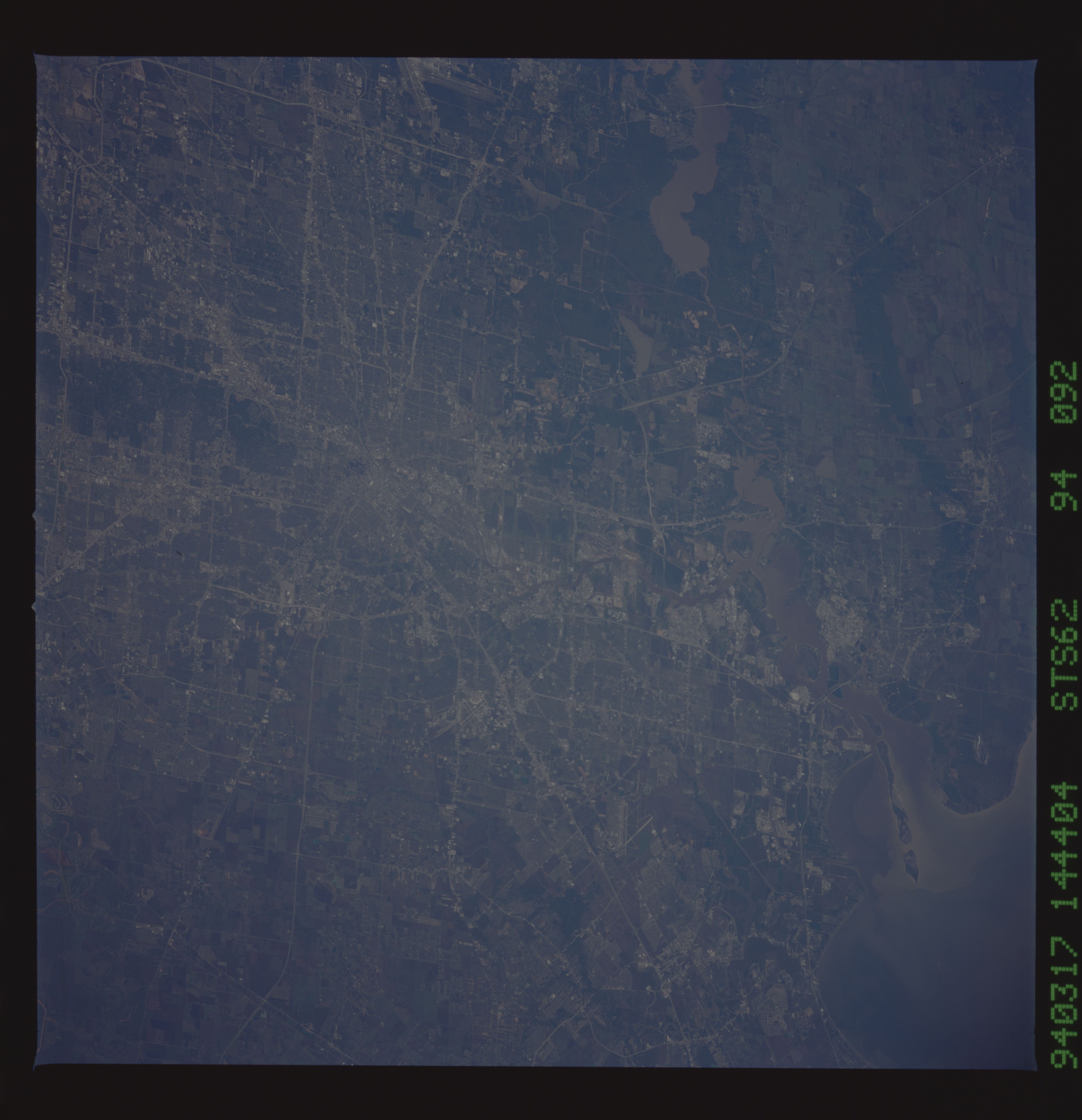
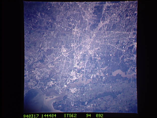
Image Caption: STS062-094-092 Houston, Texas, U.S.A. March 1994
The central business district is the point of convergence of an extensive highway network that services Houston, especially the eastern half of the city, in this west-looking photograph. The highly reflective, heavily industrialized corridor extending eastward from downtown borders the Houston Ship Channel. Much of the internal, grid street network shows a classic checkerboard design. The lower San Jacinto River system that includes muddy Lake Houston flows southward into the northwest corner of Galveston Bay.
The central business district is the point of convergence of an extensive highway network that services Houston, especially the eastern half of the city, in this west-looking photograph. The highly reflective, heavily industrialized corridor extending eastward from downtown borders the Houston Ship Channel. Much of the internal, grid street network shows a classic checkerboard design. The lower San Jacinto River system that includes muddy Lake Houston flows southward into the northwest corner of Galveston Bay.
