STS062-94-37
| NASA Photo ID | STS062-94-37 |
| Focal Length | 250mm |
| Date taken | 1994.03.17 |
| Time taken | 06:19:29 GMT |
Resolutions offered for this image:
3936 x 3872 pixels 639 x 629 pixels 5700 x 5900 pixels 500 x 518 pixels 640 x 480 pixels
3936 x 3872 pixels 639 x 629 pixels 5700 x 5900 pixels 500 x 518 pixels 640 x 480 pixels

Cloud masks available for this image:
Spacecraft nadir point: 35.4° S, 136.2° E
Photo center point: 34.5° S, 135.5° E
Photo center point by machine learning:
Photo center point: 34.5° S, 135.5° E
Photo center point by machine learning:
Nadir to Photo Center: Northwest
Spacecraft Altitude: 138 nautical miles (256km)
Country or Geographic Name: | AUSTRALIA-SA |
Features: | COAST, EYRE PENINSULA |
| Features Found Using Machine Learning: | |
Cloud Cover Percentage: | 0 (no clouds present) |
Sun Elevation Angle: | 33° |
Sun Azimuth: | 295° |
Camera: | Hasselblad |
Focal Length: | 250mm |
Camera Tilt: | 26 degrees |
Format: | 5046: Kodak, natural color positive, Lumiere 100/5046, ASA 100, standard base |
Film Exposure: | Normal |
| Additional Information | |
| Width | Height | Annotated | Cropped | Purpose | Links |
|---|---|---|---|---|---|
| 3936 pixels | 3872 pixels | No | No | Earth From Space collection | Download Image |
| 639 pixels | 629 pixels | No | No | Earth From Space collection | Download Image |
| 5700 pixels | 5900 pixels | No | No | Download Image | |
| 500 pixels | 518 pixels | No | No | Download Image | |
| 640 pixels | 480 pixels | No | No | Download Image |
Download Packaged File
Download a Google Earth KML for this Image
View photo footprint information
Download a GeoTIFF for this photo
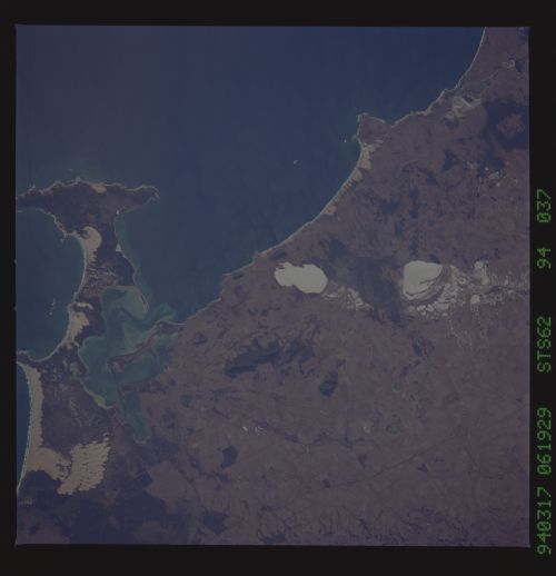
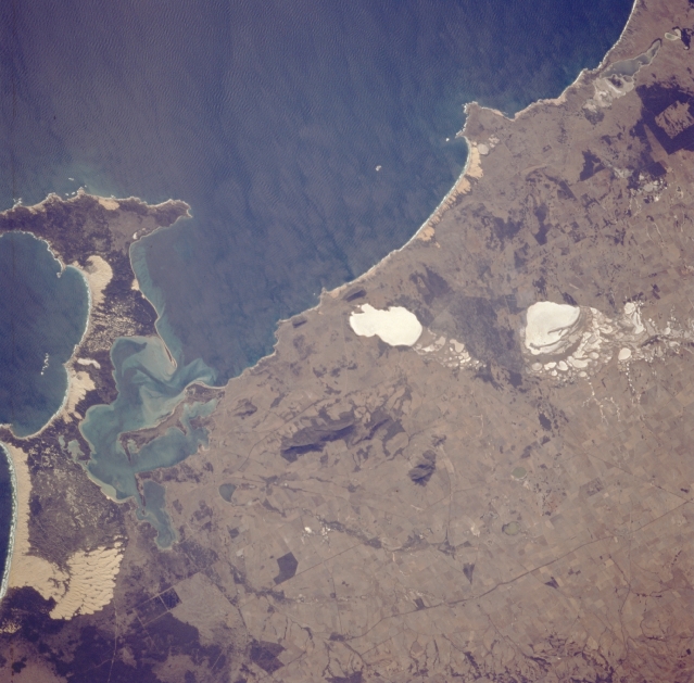
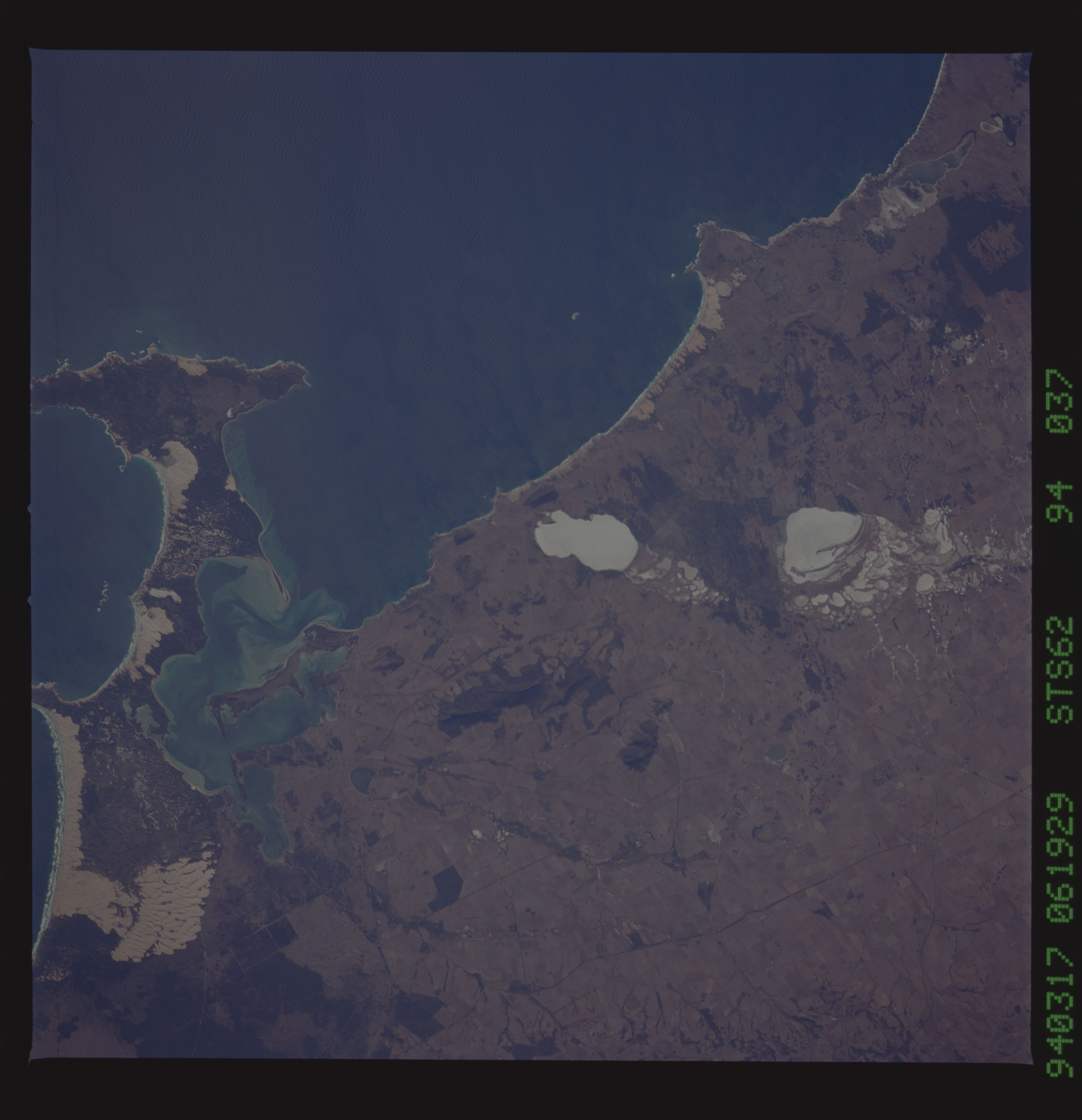
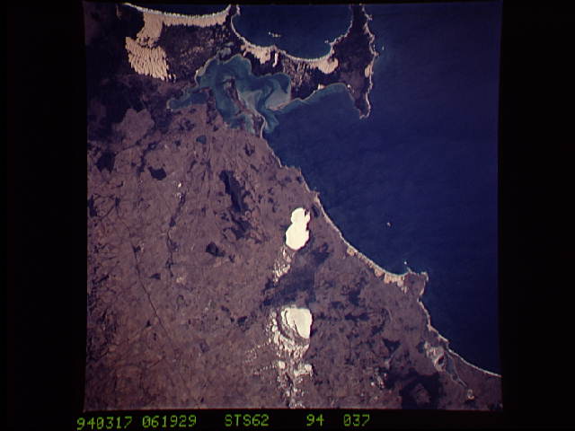
Image Caption: STS062-094-037 Eyre Peninsula, South Australia, Australia March 1994
The relatively small, irregular-shaped peninsula that extends northwest from the much larger Eyre Peninsula in South Australia is Coffin Bay Peninsula. Coffin Bay Peninsula is part of the Coffin Bay National Park, a 75000 acre (30380 hectare) coastal wilderness that contains extensive sandy beaches (lighter, yellowish-looking features along the coastline--left middle). Other smaller sandy beaches are visible west of the two dry lakes (highly reflective, whitish-looking features) named Lake Greenly and Lake Malata (northernmost lake). The small darker brown features (just below center of the picture) are low mountains that include Mount Dutton and South Block (respective elevations above sea level are 1430 feet (435 meters) and 1282 feet (390 meters). The dark, linear feature that extends diagonally across the bottom right corner of the image is the location of a highway and a railroad right-of-way that connects Port Lincoln with the interior.
The relatively small, irregular-shaped peninsula that extends northwest from the much larger Eyre Peninsula in South Australia is Coffin Bay Peninsula. Coffin Bay Peninsula is part of the Coffin Bay National Park, a 75000 acre (30380 hectare) coastal wilderness that contains extensive sandy beaches (lighter, yellowish-looking features along the coastline--left middle). Other smaller sandy beaches are visible west of the two dry lakes (highly reflective, whitish-looking features) named Lake Greenly and Lake Malata (northernmost lake). The small darker brown features (just below center of the picture) are low mountains that include Mount Dutton and South Block (respective elevations above sea level are 1430 feet (435 meters) and 1282 feet (390 meters). The dark, linear feature that extends diagonally across the bottom right corner of the image is the location of a highway and a railroad right-of-way that connects Port Lincoln with the interior.
