STS062-86-107
| NASA Photo ID | STS062-86-107 |
| Focal Length | 250mm |
| Date taken | 1994.03.11 |
| Time taken | 16:30:08 GMT |
Resolutions offered for this image:
3904 x 3875 pixels 639 x 635 pixels 5700 x 5900 pixels 500 x 518 pixels 640 x 480 pixels
3904 x 3875 pixels 639 x 635 pixels 5700 x 5900 pixels 500 x 518 pixels 640 x 480 pixels
Cloud masks available for this image:
Spacecraft nadir point: 34.8° N, 93.2° W
Photo center point: 33.5° N, 91.0° W
Photo center point by machine learning:
Photo center point: 33.5° N, 91.0° W
Photo center point by machine learning:
Nadir to Photo Center: Southeast
Spacecraft Altitude: 161 nautical miles (298km)
Country or Geographic Name: | USA-MISSISSIPPI |
Features: | MISSISSIPPI R, AGRICULTURE |
| Features Found Using Machine Learning: | |
Cloud Cover Percentage: | 5 (1-10)% |
Sun Elevation Angle: | 43° |
Sun Azimuth: | 140° |
Camera: | Hasselblad |
Focal Length: | 250mm |
Camera Tilt: | 44 degrees |
Format: | 5046: Kodak, natural color positive, Lumiere 100/5046, ASA 100, standard base |
Film Exposure: | Normal |
| Additional Information | |
| Width | Height | Annotated | Cropped | Purpose | Links |
|---|---|---|---|---|---|
| 3904 pixels | 3875 pixels | No | No | Earth From Space collection | Download Image |
| 639 pixels | 635 pixels | No | No | Earth From Space collection | Download Image |
| 5700 pixels | 5900 pixels | No | No | Download Image | |
| 500 pixels | 518 pixels | No | No | Download Image | |
| 640 pixels | 480 pixels | No | No | Download Image |
Download Packaged File
Download a Google Earth KML for this Image
View photo footprint information
Download a GeoTIFF for this photo
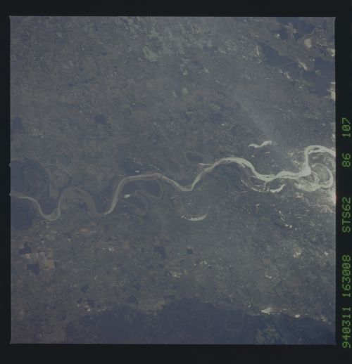
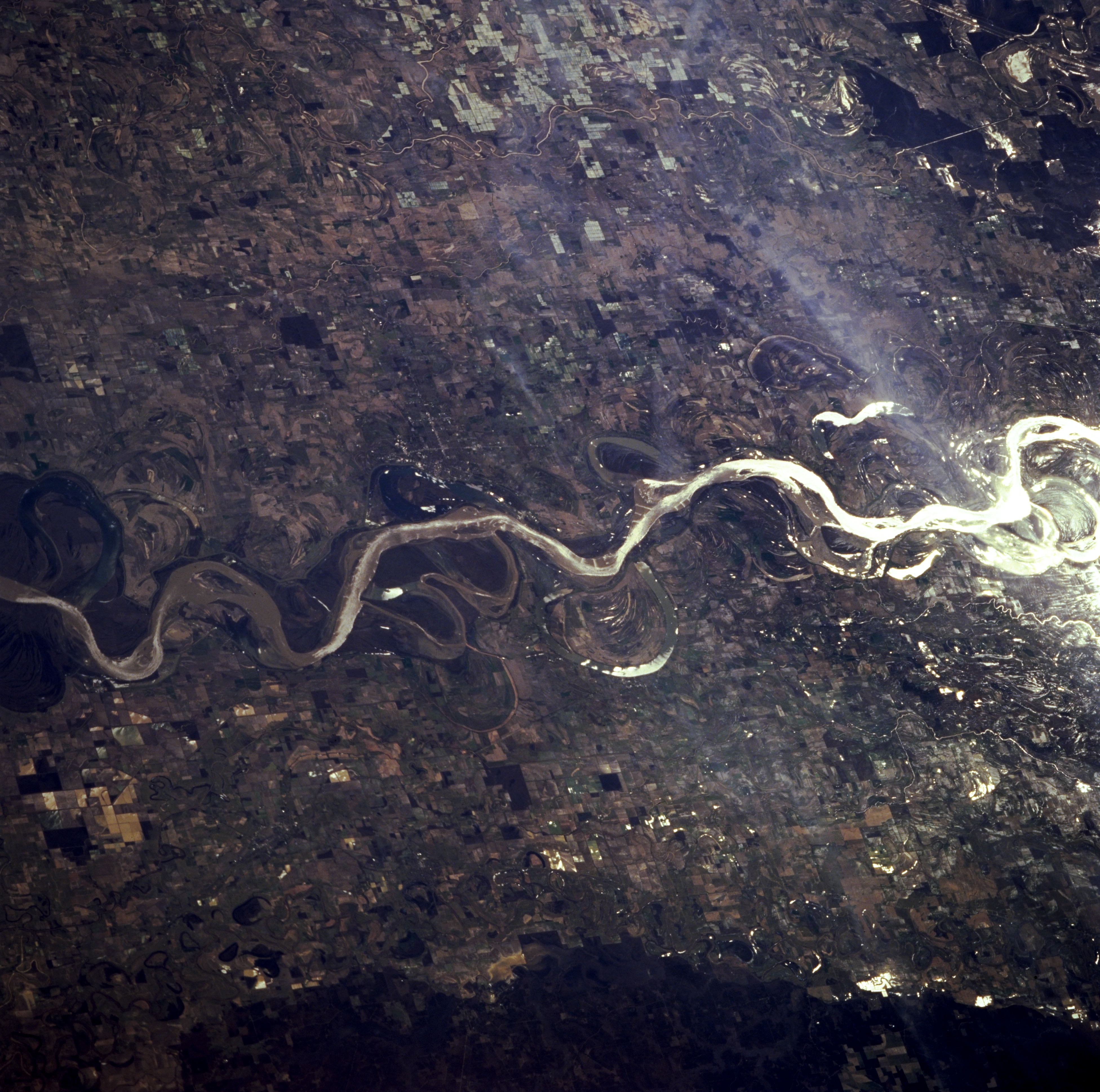
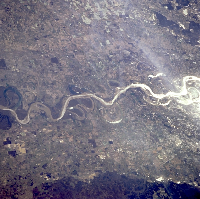
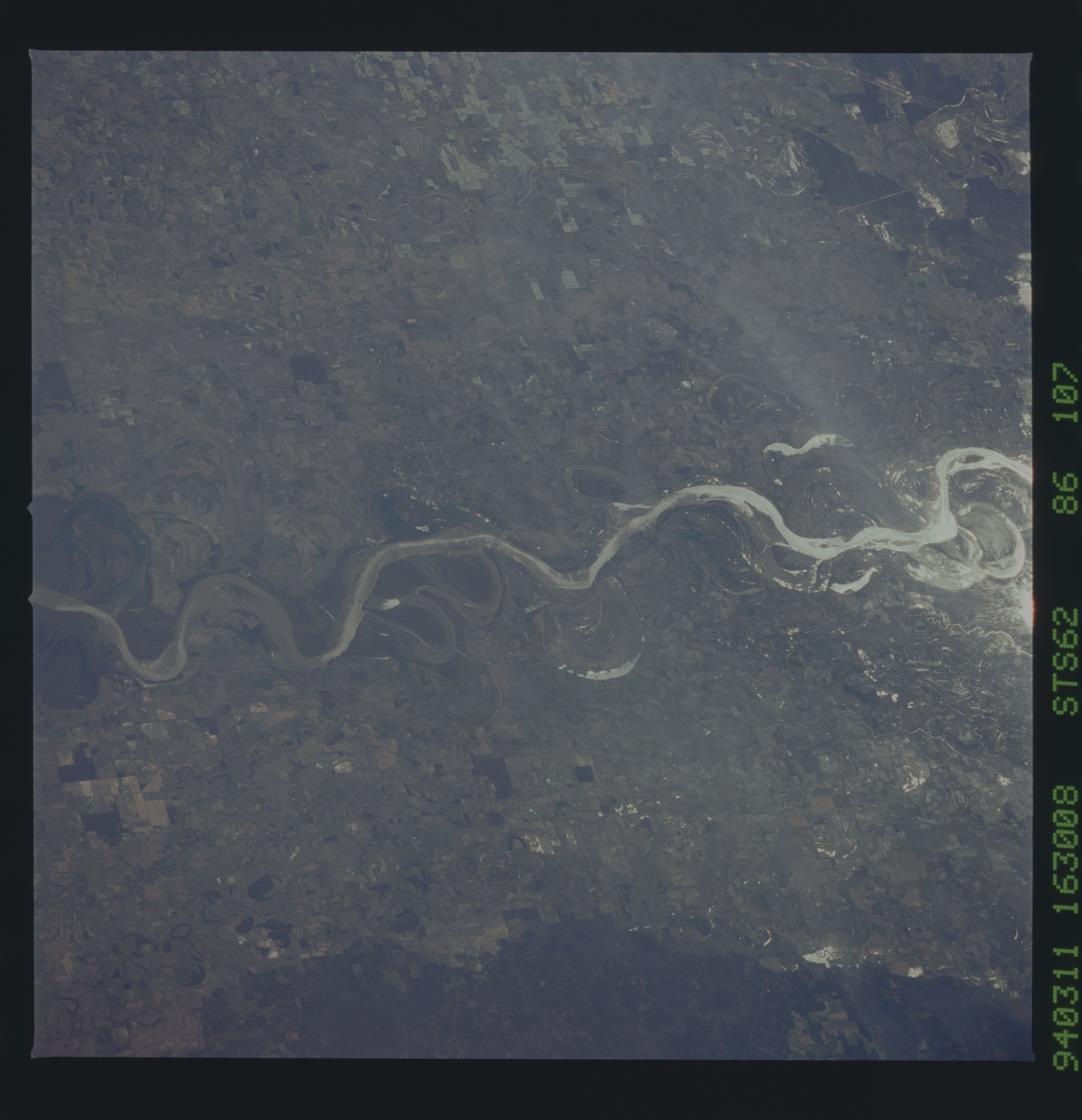
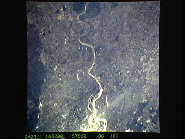
Image Caption: STS062-086-107 Mississippi River Floodplain, Arkansas, U.S.A. March 1994
Sunglint, the sun's reflection off water surfaces, helps to identify exposed water surfaces. Apparent are cultivated agricultural field patterns throughout the flat, fertile Mississippi River floodplain and old meander scars and oxbow lakes along the river's main channel. Greenville (barely discernible) is situated on the east bank of the Mississippi River (near the center of the photograph). The darker area (bottom right) is slightly elevated, forested terrain.
Sunglint, the sun's reflection off water surfaces, helps to identify exposed water surfaces. Apparent are cultivated agricultural field patterns throughout the flat, fertile Mississippi River floodplain and old meander scars and oxbow lakes along the river's main channel. Greenville (barely discernible) is situated on the east bank of the Mississippi River (near the center of the photograph). The darker area (bottom right) is slightly elevated, forested terrain.
