STS062-83-65
| NASA Photo ID | STS062-83-65 |
| Focal Length | 250mm |
| Date taken | 1994.03.05 |
| Time taken | 18:52:21 GMT |
Resolutions offered for this image:
3904 x 3875 pixels 639 x 635 pixels 5700 x 5900 pixels 500 x 518 pixels 640 x 480 pixels
3904 x 3875 pixels 639 x 635 pixels 5700 x 5900 pixels 500 x 518 pixels 640 x 480 pixels
Cloud masks available for this image:
Spacecraft nadir point: 34.4° N, 82.6° W
Photo center point: 33.5° N, 82.0° W
Photo center point by machine learning:
Photo center point: 33.5° N, 82.0° W
Photo center point by machine learning:
Nadir to Photo Center: Southeast
Spacecraft Altitude: 162 nautical miles (300km)
Country or Geographic Name: | USA-SOUTH CAROLINA |
Features: | AUGUSTA, CLARK HILL RES. |
| Features Found Using Machine Learning: | |
Cloud Cover Percentage: | 5 (1-10)% |
Sun Elevation Angle: | 47° |
Sun Azimuth: | 206° |
Camera: | Hasselblad |
Focal Length: | 250mm |
Camera Tilt: | 22 degrees |
Format: | 5046: Kodak, natural color positive, Lumiere 100/5046, ASA 100, standard base |
Film Exposure: | Normal |
| Additional Information | |
| Width | Height | Annotated | Cropped | Purpose | Links |
|---|---|---|---|---|---|
| 3904 pixels | 3875 pixels | No | No | Earth From Space collection | Download Image |
| 639 pixels | 635 pixels | No | No | Earth From Space collection | Download Image |
| 5700 pixels | 5900 pixels | No | No | Download Image | |
| 500 pixels | 518 pixels | No | No | Download Image | |
| 640 pixels | 480 pixels | No | No | Download Image |
Download Packaged File
Download a Google Earth KML for this Image
View photo footprint information
Download a GeoTIFF for this photo
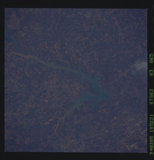
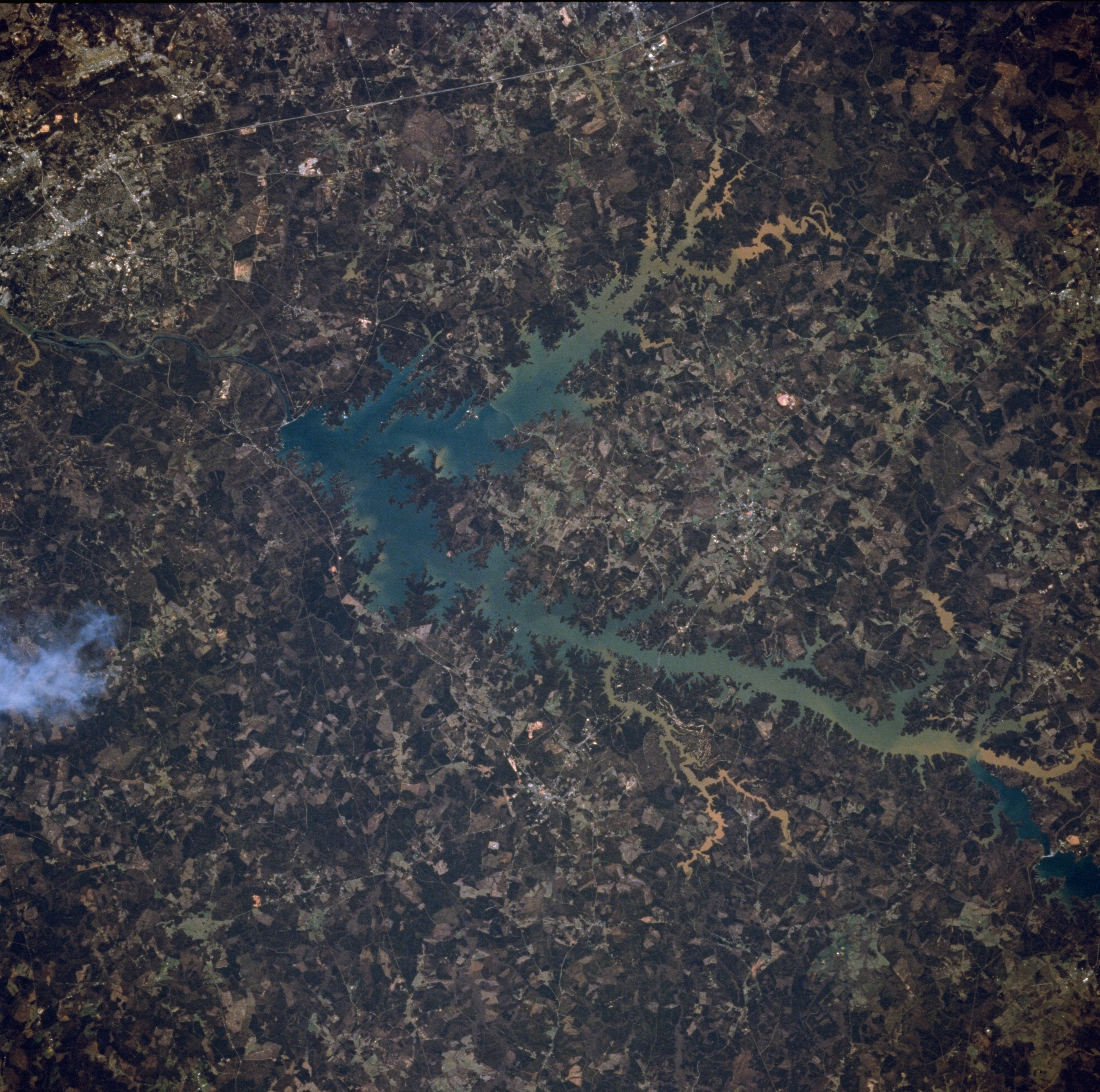
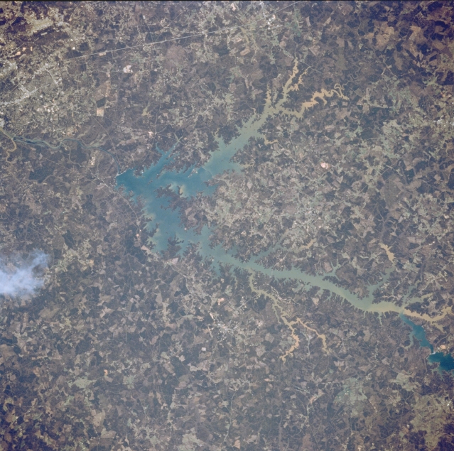
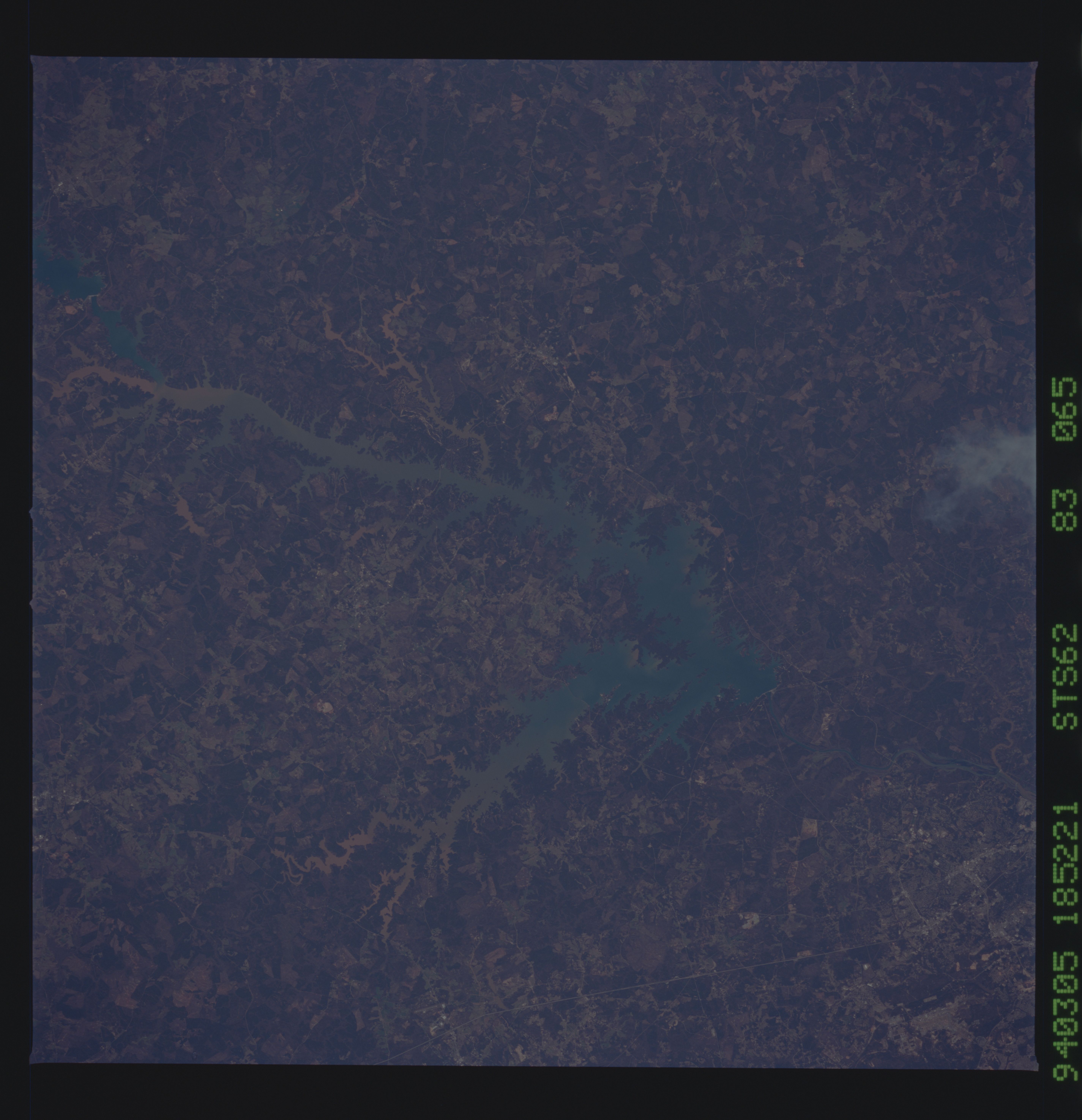
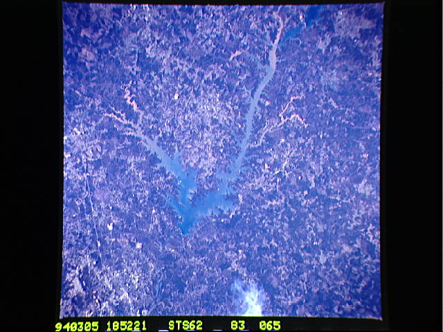
Image Caption: STS062-083-065 Clark Hill Lake, Georgia and South Carolina, U.S.A. March 1994
The Savannah River flows southeasterly through the longer northwest arm of Clark Hill Lake, which receives muddy sediment plumes from numerous tributary streams. Below Strom Thurmond Dam at the lake's southeast end, the vegetated floodplain of the Savannah River widens, and the meandering main channel of the river passes north and eventually east of Augusta. Some street patterns of northern Augusta are discernible (upper left corner). Linear, light Interstate Highway 20 enters the western suburbs of Augusta. The general terrain consists of rolling, wooded areas and lighter agricultural fields.
The Savannah River flows southeasterly through the longer northwest arm of Clark Hill Lake, which receives muddy sediment plumes from numerous tributary streams. Below Strom Thurmond Dam at the lake's southeast end, the vegetated floodplain of the Savannah River widens, and the meandering main channel of the river passes north and eventually east of Augusta. Some street patterns of northern Augusta are discernible (upper left corner). Linear, light Interstate Highway 20 enters the western suburbs of Augusta. The general terrain consists of rolling, wooded areas and lighter agricultural fields.
