STS062-81-8
| NASA Photo ID | STS062-81-8 |
| Focal Length | 250mm |
| Date taken | 1994.03.04 |
| Time taken | 17:08:09 GMT |
Resolutions offered for this image:
3904 x 3904 pixels 639 x 639 pixels 5700 x 5900 pixels 500 x 518 pixels 640 x 480 pixels
3904 x 3904 pixels 639 x 639 pixels 5700 x 5900 pixels 500 x 518 pixels 640 x 480 pixels
Cloud masks available for this image:
Spacecraft nadir point: 39.1° N, 84.0° W
Photo center point: 38.5° N, 83.5° W
Photo center point by machine learning:
Photo center point: 38.5° N, 83.5° W
Photo center point by machine learning:
Nadir to Photo Center: Southeast
Spacecraft Altitude: 161 nautical miles (298km)
Country or Geographic Name: | USA-KENTUCKY |
Features: | SMALL TOWNS ON OHIO R. |
| Features Found Using Machine Learning: | |
Cloud Cover Percentage: | 0 (no clouds present) |
Sun Elevation Angle: | 44° |
Sun Azimuth: | 166° |
Camera: | Hasselblad |
Focal Length: | 250mm |
Camera Tilt: | 16 degrees |
Format: | 5046: Kodak, natural color positive, Lumiere 100/5046, ASA 100, standard base |
Film Exposure: | Normal |
| Additional Information | |
| Width | Height | Annotated | Cropped | Purpose | Links |
|---|---|---|---|---|---|
| 3904 pixels | 3904 pixels | No | No | Earth From Space collection | Download Image |
| 639 pixels | 639 pixels | No | No | Earth From Space collection | Download Image |
| 5700 pixels | 5900 pixels | No | No | Download Image | |
| 500 pixels | 518 pixels | No | No | Download Image | |
| 640 pixels | 480 pixels | No | No | Download Image |
Download Packaged File
Download a Google Earth KML for this Image
View photo footprint information
Download a GeoTIFF for this photo
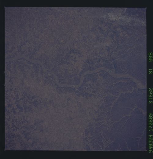
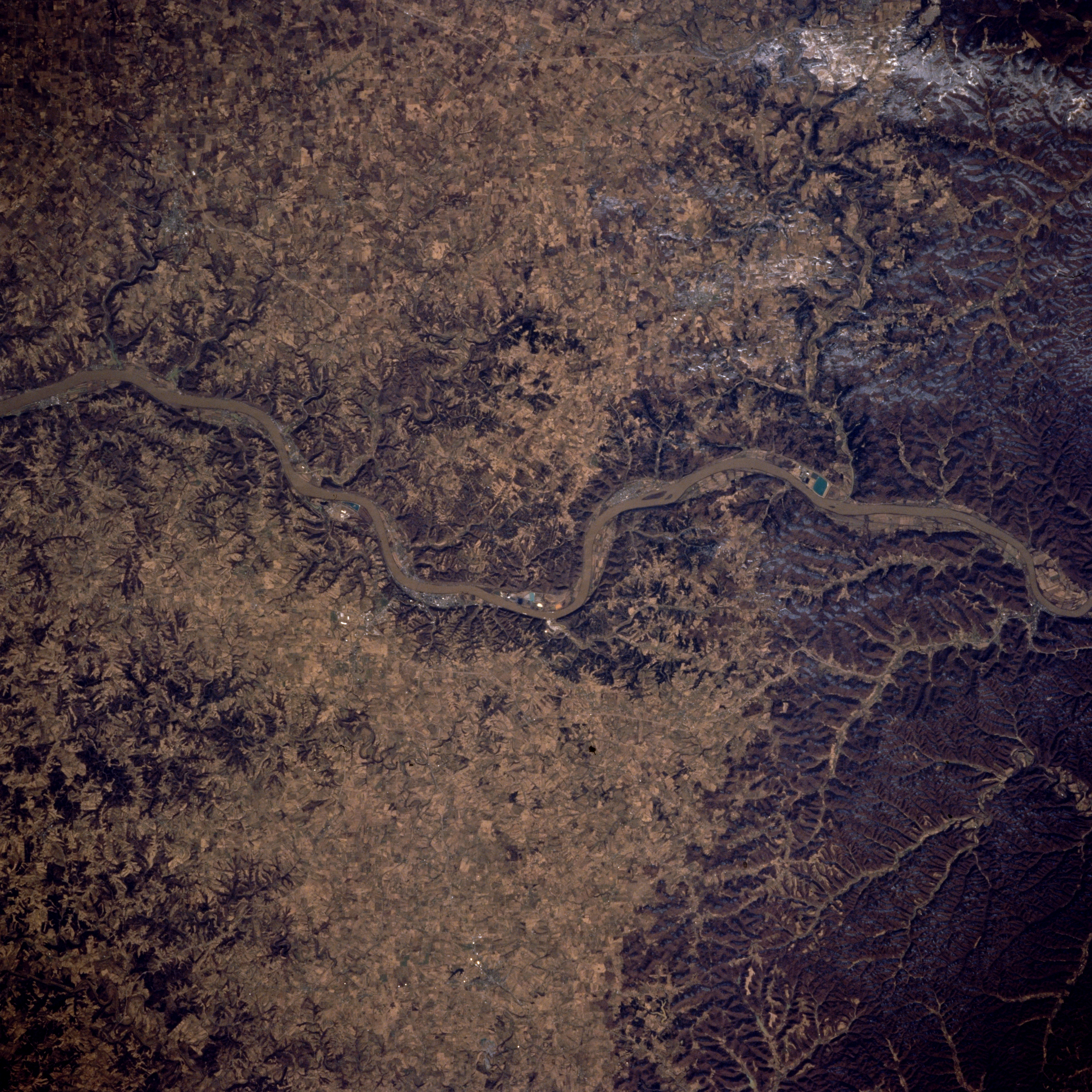
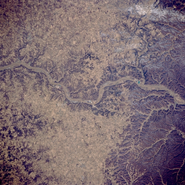
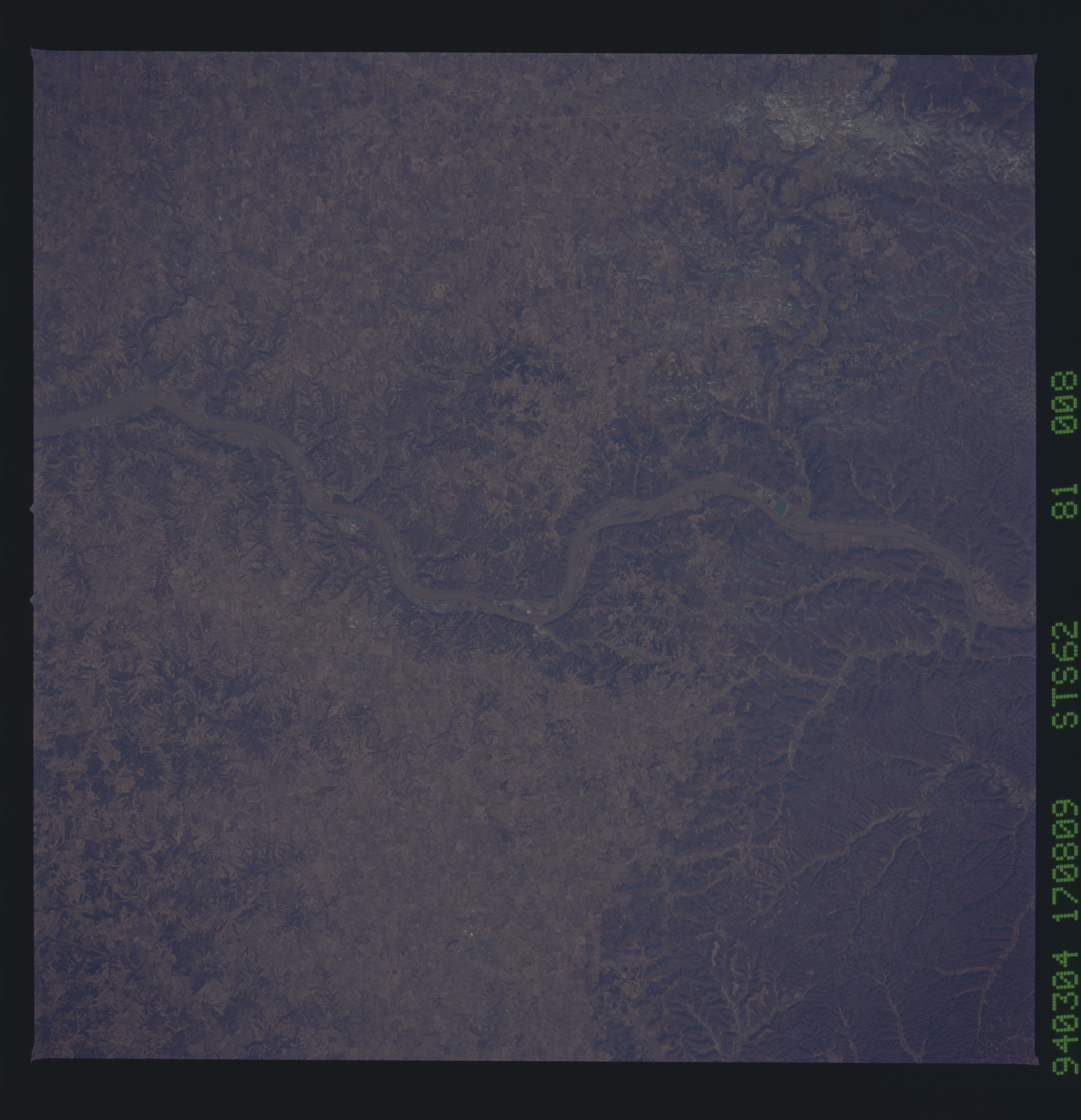
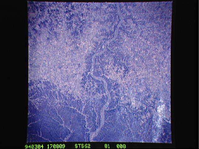
Image Caption: STS062-081-008 Ohio River, Kentucky March 1994
This near-nadir view shows the Ohio River traversing the scene near Maysville, Kentucky. The Ohio River is 981 miles (1578 km) long. The river begins it flow generally westward at Pittsburgh, Pennsylvania at the confluence of the Allegheny and Monongahela Rivers. The Ohio River joins the Mississippi River at Cario, Illinois. The river's course follows a portion of the southern edge of the region covered by continental ice during the last Ice Age approximately 12000 to 14000 years ago. Glacial melt-water most likely cut the river's original channel. In this view with the state of Ohio north (upper half of the image) and the state of Kentucky south (lower half of the image), the river leaves the Appalachian Plateau (left quarter of the image) and crosses a rich agricultural region on its way to join the Mississippi River. The Ohio River is prone to Spring flooding, and extensive flood control and protection devices have been constructed along the Ohio River and its many tributaries. These devices also improve the river's navigability; a 9-foot (almost 3 meters) channel is maintained along the Ohio River's entire length.
This near-nadir view shows the Ohio River traversing the scene near Maysville, Kentucky. The Ohio River is 981 miles (1578 km) long. The river begins it flow generally westward at Pittsburgh, Pennsylvania at the confluence of the Allegheny and Monongahela Rivers. The Ohio River joins the Mississippi River at Cario, Illinois. The river's course follows a portion of the southern edge of the region covered by continental ice during the last Ice Age approximately 12000 to 14000 years ago. Glacial melt-water most likely cut the river's original channel. In this view with the state of Ohio north (upper half of the image) and the state of Kentucky south (lower half of the image), the river leaves the Appalachian Plateau (left quarter of the image) and crosses a rich agricultural region on its way to join the Mississippi River. The Ohio River is prone to Spring flooding, and extensive flood control and protection devices have been constructed along the Ohio River and its many tributaries. These devices also improve the river's navigability; a 9-foot (almost 3 meters) channel is maintained along the Ohio River's entire length.
