STS062-153-146
| NASA Photo ID | STS062-153-146 |
| Focal Length | 90mm |
| Date taken | 1994.03.14 |
| Time taken | 15:17:31 GMT |
Cloud masks available for this image:
Spacecraft nadir point: 30.1° N, 84.0° W
Photo center point: 29.5° N, 82.0° W
Photo center point by machine learning:
Photo center point: 29.5° N, 82.0° W
Photo center point by machine learning:
Nadir to Photo Center: East
Spacecraft Altitude: 140 nautical miles (259km)
Country or Geographic Name: | USA-FLORIDA |
Features: | UPPER PEN., LAKES, CITIES |
| Features Found Using Machine Learning: | |
Cloud Cover Percentage: | 5 (1-10)% |
Sun Elevation Angle: | 42° |
Sun Azimuth: | 126° |
Camera: | Linhof |
Focal Length: | 90mm |
Camera Tilt: | 42 degrees |
Format: | 5046: Kodak, natural color positive, Lumiere 100/5046, ASA 100, standard base |
Film Exposure: | Normal |
| Additional Information | |
| Width | Height | Annotated | Cropped | Purpose | Links |
|---|---|---|---|---|---|
| 5184 pixels | 4096 pixels | No | No | Earth From Space collection | Download Image |
| 640 pixels | 505 pixels | No | No | Earth From Space collection | Download Image |
| 640 pixels | 480 pixels | No | No | ISD 1 | Download Image |
Download Packaged File
Download a Google Earth KML for this Image
View photo footprint information
Download a GeoTIFF for this photo
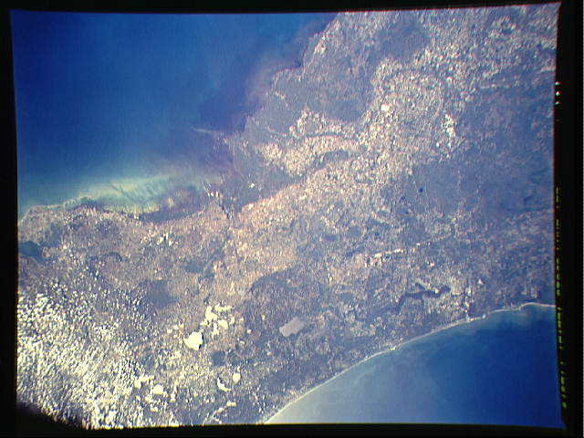
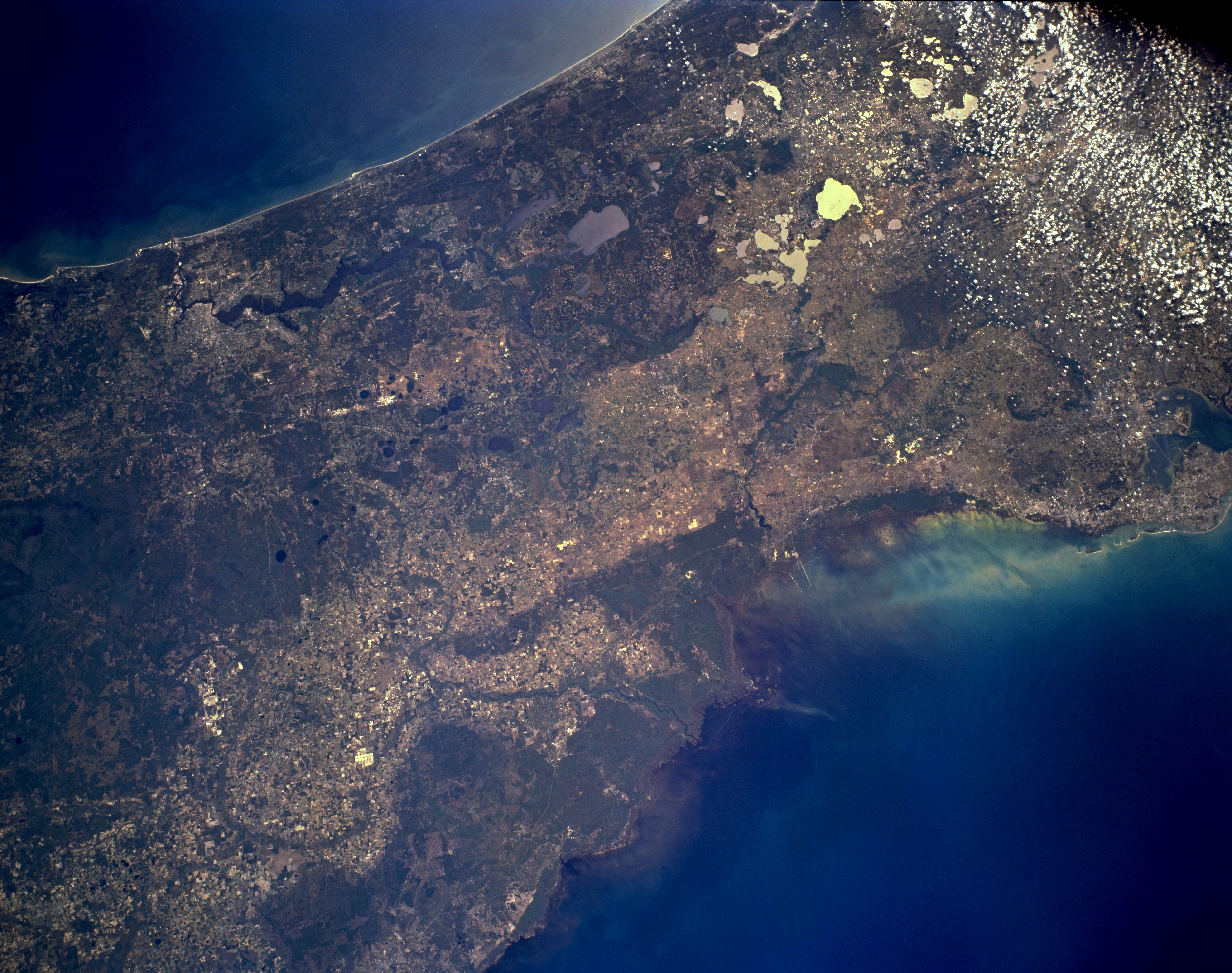
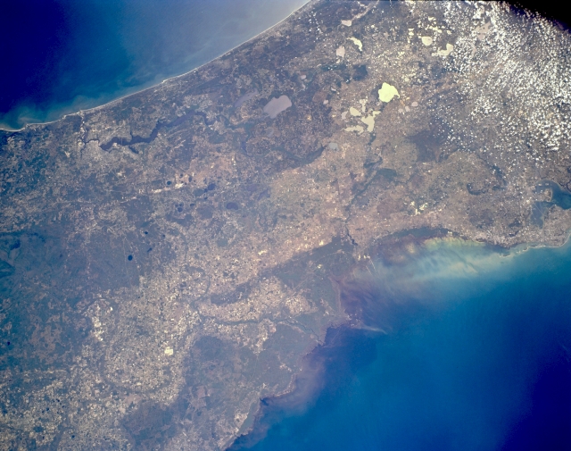
Image Caption: STS062-153-146 Northeast Florida, U.S.A. March 1994
Northeastern Florida is a land bridge between the Atlantic Ocean (top) and the Gulf of Mexico (bottom right). In addition to three of Florida's popular cities--Jacksonville (upper left), Clearwater, and Tampa (barely discernible along middle right)--several natural features are apparent--north-flowing Saint Johns River south of Jacksonville; numerous oval karst lakes with sunglint, which helps identify scattered lakes throughout north-central Florida; large Okefenokee Swamp of southeast Georgia with a small section in Florida northwest of Jacksonville; and the Gulf of Mexico surrounding the delta of the winding Suwanne River (near bottom center). Because this is an area of very low relief (relatively flat topography near sea level), most of the densely vegetated areas are swamplands. Scattered cumulus clouds are apparent in the upper right corner.
Northeastern Florida is a land bridge between the Atlantic Ocean (top) and the Gulf of Mexico (bottom right). In addition to three of Florida's popular cities--Jacksonville (upper left), Clearwater, and Tampa (barely discernible along middle right)--several natural features are apparent--north-flowing Saint Johns River south of Jacksonville; numerous oval karst lakes with sunglint, which helps identify scattered lakes throughout north-central Florida; large Okefenokee Swamp of southeast Georgia with a small section in Florida northwest of Jacksonville; and the Gulf of Mexico surrounding the delta of the winding Suwanne River (near bottom center). Because this is an area of very low relief (relatively flat topography near sea level), most of the densely vegetated areas are swamplands. Scattered cumulus clouds are apparent in the upper right corner.
