STS062-151-366

| NASA Photo ID | STS062-151-366 |
| Focal Length | 250mm |
| Date taken | 1994.03.09 |
| Time taken | 19:18:54 GMT |
Resolutions offered for this image:
5088 x 3968 pixels 640 x 499 pixels 640 x 480 pixels 5860 x 7441 pixels
5088 x 3968 pixels 640 x 499 pixels 640 x 480 pixels 5860 x 7441 pixels

Cloud masks available for this image:
Spacecraft nadir point: 33.7° N, 117.5° W
Photo center point: 34.5° N, 118.0° W
Photo center point by machine learning:
Photo center point: 34.5° N, 118.0° W
Photo center point by machine learning:
Nadir to Photo Center: Northwest
Spacecraft Altitude: 161 nautical miles (298km)
Country or Geographic Name: | USA-CALIFORNIA |
Features: | SAN ANDREAS FAULT |
| Features Found Using Machine Learning: | |
Cloud Cover Percentage: | 5 (1-10)% |
Sun Elevation Angle: | 51° |
Sun Azimuth: | 163° |
Camera: | Linhof |
Focal Length: | 250mm |
Camera Tilt: | 19 degrees |
Format: | 5046: Kodak, natural color positive, Lumiere 100/5046, ASA 100, standard base |
Film Exposure: | Normal |
| Additional Information | |
| Width | Height | Annotated | Cropped | Purpose | Links |
|---|---|---|---|---|---|
| 5088 pixels | 3968 pixels | No | No | Earth From Space collection | Download Image |
| 640 pixels | 499 pixels | No | No | Earth From Space collection | Download Image |
| 640 pixels | 480 pixels | No | No | ISD 1 | Download Image |
| 5860 pixels | 7441 pixels | Download Image |
Download Packaged File
Download a Google Earth KML for this Image
View photo footprint information
Download a GeoTIFF for this photo
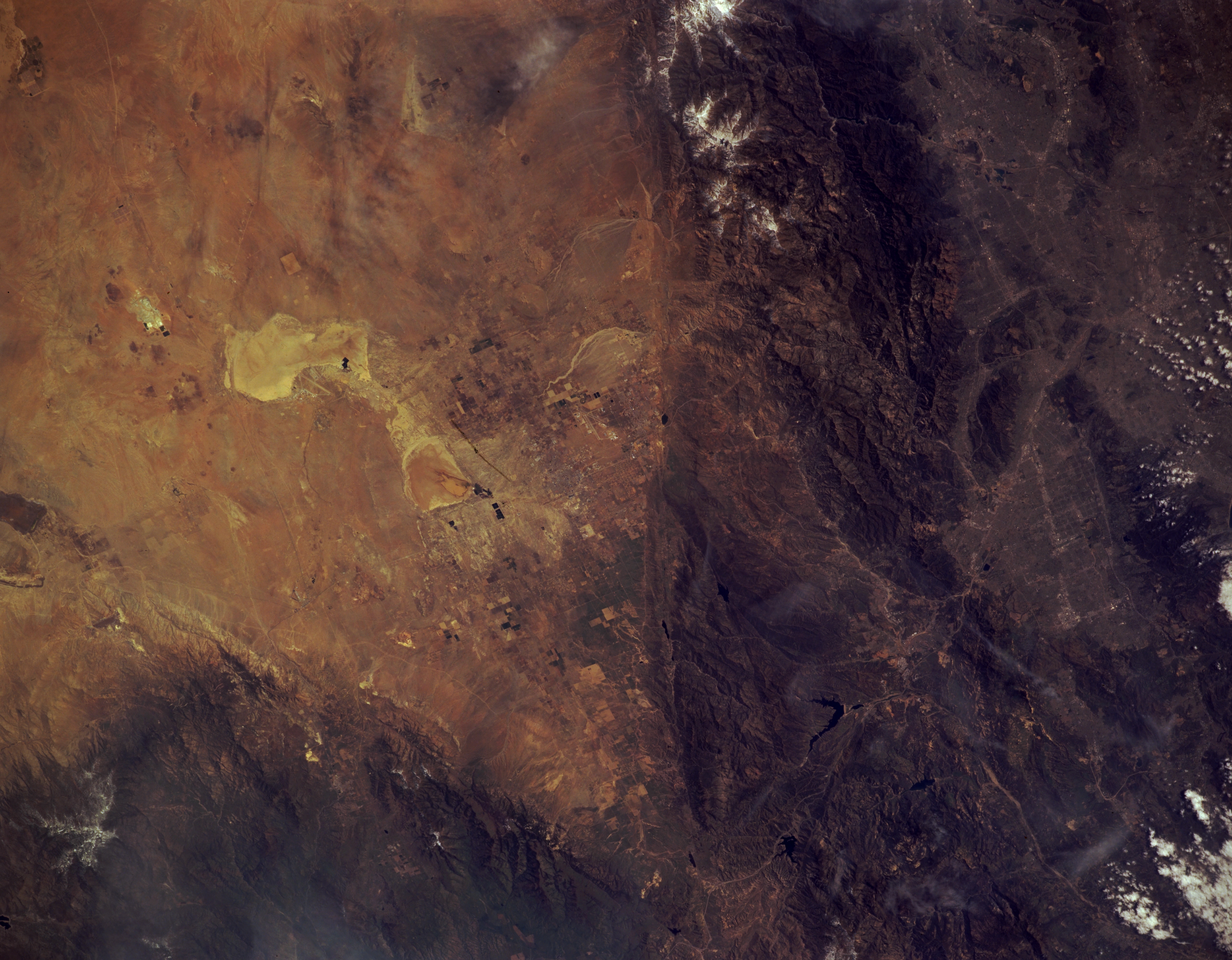
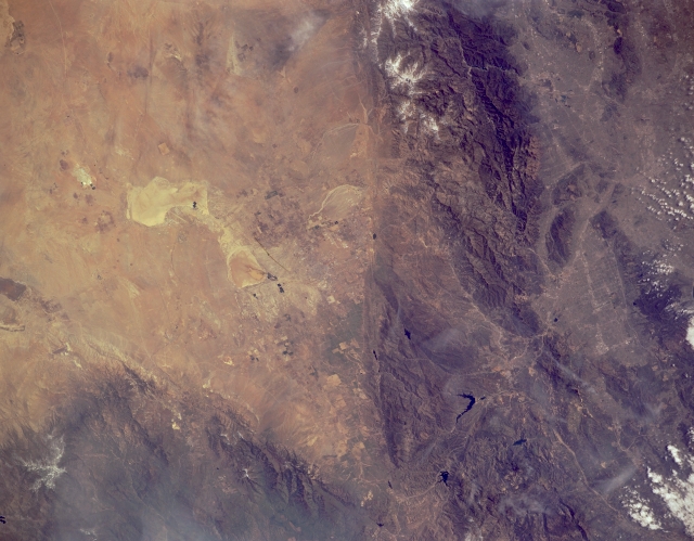
Image Caption: STS062-151-366 San Andreas Fault and San Gabriel Mountains, California, U.S.A. March 1994
The San Andreas Fault is captured in this low-oblique photograph. A great fracture in the Earth's crust and the principal fault in an intricate network of faults extending more than 600 miles (695 kilometers) from northwest California to the Gulf of California, San Andreas is the boundary of the North American Plate to the east and the Pacific Plate to the west. The Pacific Plate, moving northwest in relation to the North American Plate, causes numerous moderate-to-severe earthquakes. Visible west of the fault are the rugged San Gabriel Mountains, and still farther west is Los Angeles with the San Fernando Valley to its north. East of the San Andreas Fault are Rosamond Dry Lake and Rogers Dry Lake. To the northwest appear the Tehachapi Mountains.
The San Andreas Fault is captured in this low-oblique photograph. A great fracture in the Earth's crust and the principal fault in an intricate network of faults extending more than 600 miles (695 kilometers) from northwest California to the Gulf of California, San Andreas is the boundary of the North American Plate to the east and the Pacific Plate to the west. The Pacific Plate, moving northwest in relation to the North American Plate, causes numerous moderate-to-severe earthquakes. Visible west of the fault are the rugged San Gabriel Mountains, and still farther west is Los Angeles with the San Fernando Valley to its north. East of the San Andreas Fault are Rosamond Dry Lake and Rogers Dry Lake. To the northwest appear the Tehachapi Mountains.
