STS062-108-58
| NASA Photo ID | STS062-108-58 |
| Focal Length | 250mm |
| Date taken | 1994.03.14 |
| Time taken | 07:49:08 GMT |
Resolutions offered for this image:
5194 x 5300 pixels 627 x 640 pixels 5700 x 5900 pixels 500 x 518 pixels 640 x 480 pixels
5194 x 5300 pixels 627 x 640 pixels 5700 x 5900 pixels 500 x 518 pixels 640 x 480 pixels
Cloud masks available for this image:
Spacecraft nadir point: 30.1° N, 30.2° E
Photo center point: 30.0° N, 31.5° E
Photo center point by machine learning:
Photo center point: 30.0° N, 31.5° E
Photo center point by machine learning:
Nadir to Photo Center: East
Spacecraft Altitude: 141 nautical miles (261km)
Country or Geographic Name: | EGYPT |
Features: | CAIRO, NILE RIVER, AGRICULTURE |
| Features Found Using Machine Learning: | |
Cloud Cover Percentage: | 0 (no clouds present) |
Sun Elevation Angle: | 43° |
Sun Azimuth: | 128° |
Camera: | Hasselblad |
Focal Length: | 250mm |
Camera Tilt: | 29 degrees |
Format: | 5048: Kodak, natural color positive, Lumiere 100x/5048, ASA 100x, standard base |
Film Exposure: | Normal |
| Additional Information | |
| Width | Height | Annotated | Cropped | Purpose | Links |
|---|---|---|---|---|---|
| 5194 pixels | 5300 pixels | No | No | Earth From Space collection | Download Image |
| 627 pixels | 640 pixels | No | No | Earth From Space collection | Download Image |
| 5700 pixels | 5900 pixels | No | No | Download Image | |
| 500 pixels | 518 pixels | No | No | Download Image | |
| 640 pixels | 480 pixels | No | No | Download Image |
Download Packaged File
Download a Google Earth KML for this Image
View photo footprint information
Download a GeoTIFF for this photo
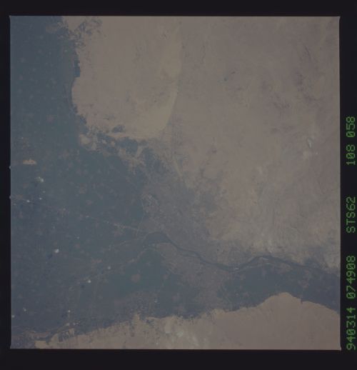
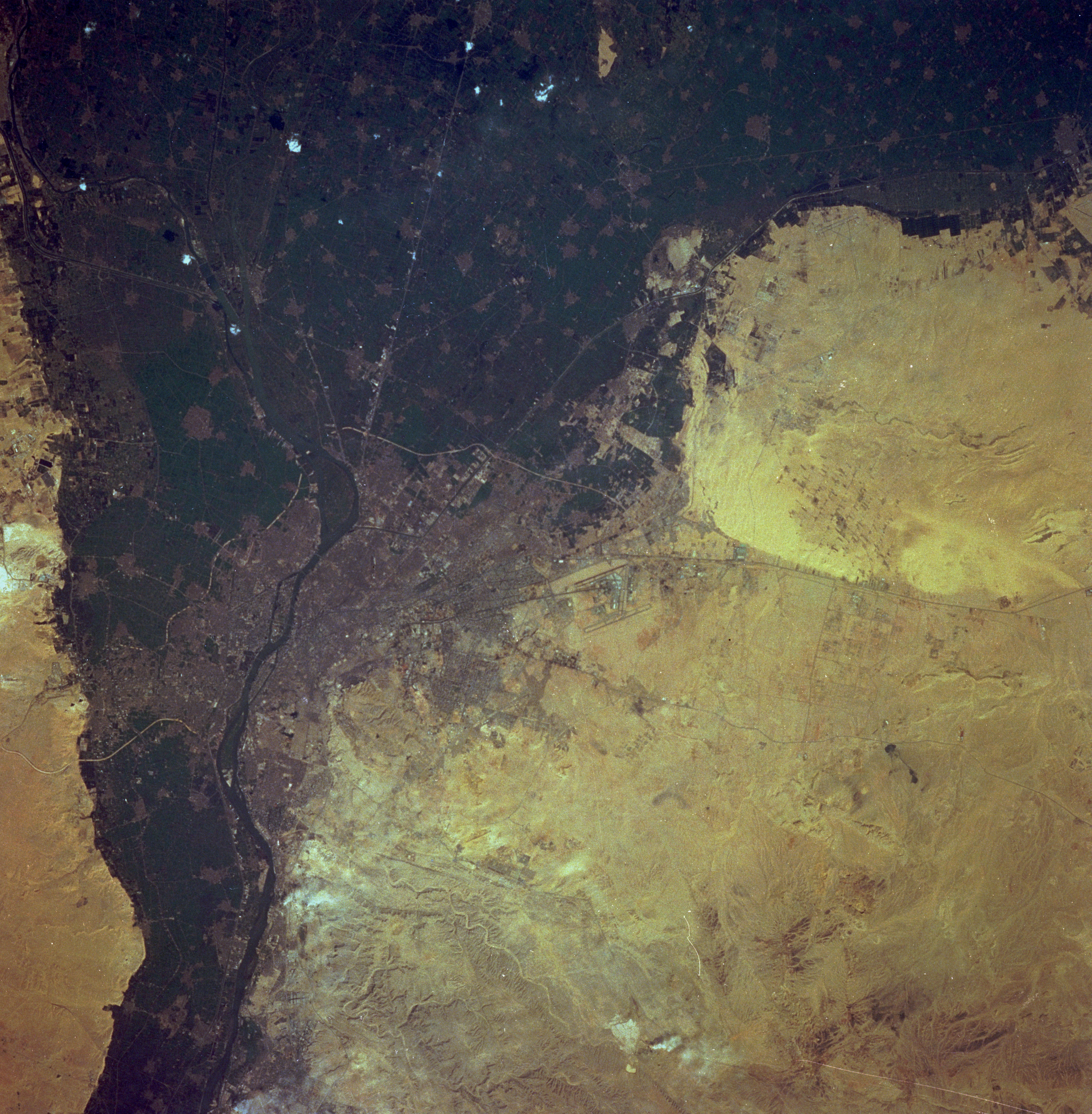
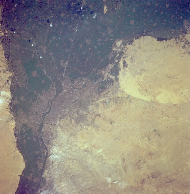
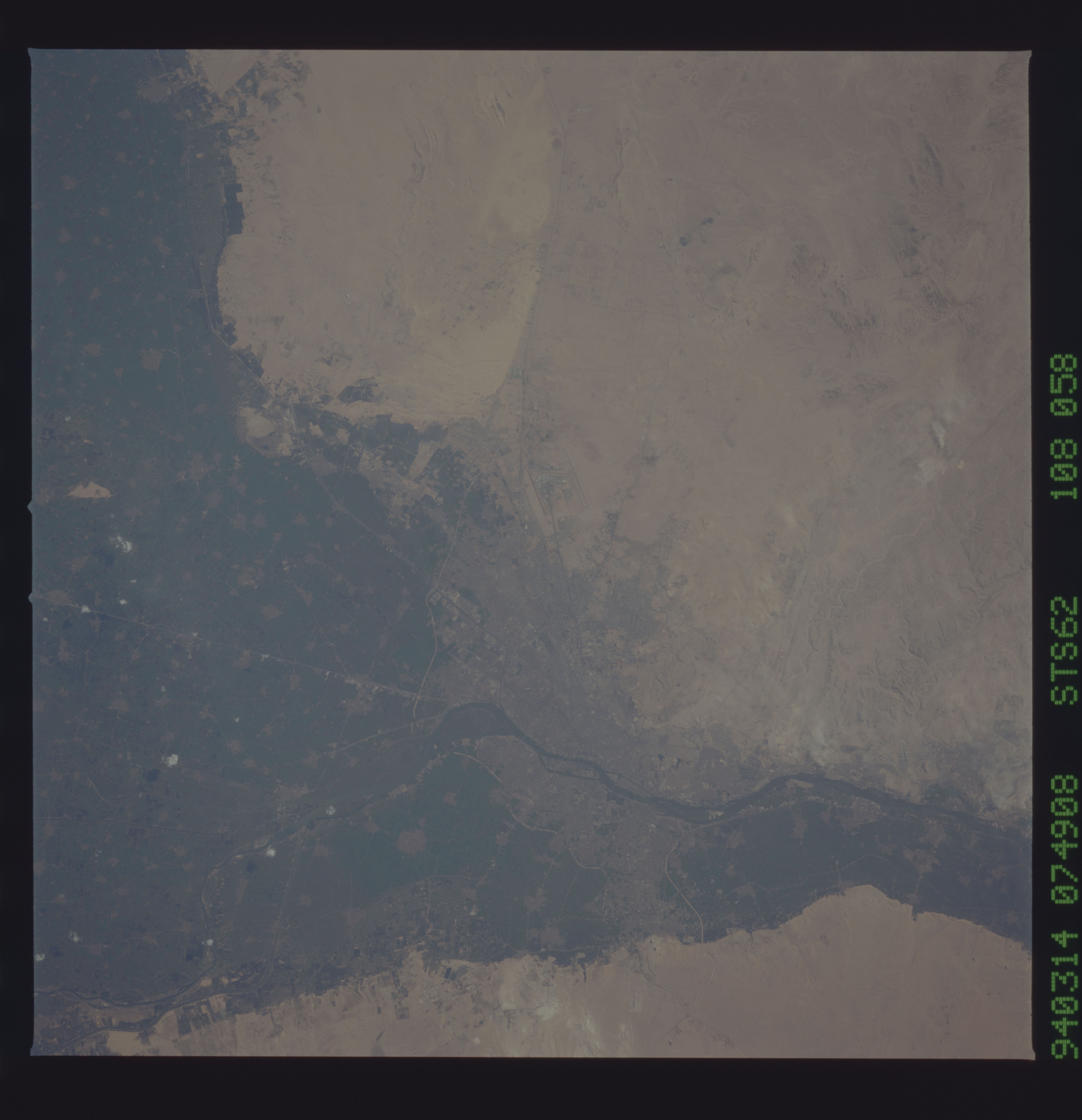
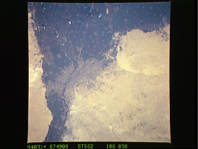
Image Caption: STS062-108-58 Close-up of Cairo, pyramids March 1994
Cairo, the capital of Egypt, is visible near the center of the photograph. Cairo is the largest city in Africa, with almost 10 million people in the greater metropolitan area, and is located at the southern apex (east side) of the Nile River. Roads and railroads radiate from central Cairo. Giza, the third largest city in Egypt, with more than 1 million people, is located along the west bank of the Nile directly across from Cairo. The dark green areas are the intensively cultivated, irrigated agricultural lands along the Nile River and on the fan-shaped Nile River Delta. The grayish areas show the locations of numerous towns and cities on the delta or on the floodplain where there is less vegetation. Cairo International Airport is barely visible northeast of the city. The desert area southeast of Cairo is part of the Arabian Desert, which extends southward along the western edge of the Gulf of Suez.
Cairo, the capital of Egypt, is visible near the center of the photograph. Cairo is the largest city in Africa, with almost 10 million people in the greater metropolitan area, and is located at the southern apex (east side) of the Nile River. Roads and railroads radiate from central Cairo. Giza, the third largest city in Egypt, with more than 1 million people, is located along the west bank of the Nile directly across from Cairo. The dark green areas are the intensively cultivated, irrigated agricultural lands along the Nile River and on the fan-shaped Nile River Delta. The grayish areas show the locations of numerous towns and cities on the delta or on the floodplain where there is less vegetation. Cairo International Airport is barely visible northeast of the city. The desert area southeast of Cairo is part of the Arabian Desert, which extends southward along the western edge of the Gulf of Suez.
