STS062-105-184
| NASA Photo ID | STS062-105-184 |
| Focal Length | 100mm |
| Date taken | 1994.03.11 |
| Time taken | 14:58:06 GMT |
Resolutions offered for this image:
3904 x 3904 pixels 639 x 639 pixels 5700 x 5900 pixels 500 x 518 pixels 640 x 480 pixels
3904 x 3904 pixels 639 x 639 pixels 5700 x 5900 pixels 500 x 518 pixels 640 x 480 pixels

Cloud masks available for this image:
Spacecraft nadir point: 36.8° N, 77.5° W
Photo center point: 37.5° N, 76.5° W
Photo center point by machine learning:
Photo center point: 37.5° N, 76.5° W
Photo center point by machine learning:
Nadir to Photo Center: Northeast
Spacecraft Altitude: 161 nautical miles (298km)
Camera: | Hasselblad |
Focal Length: | 100mm |
Camera Tilt: | 24 degrees |
Format: | 5048: Kodak, natural color positive, Lumiere 100x/5048, ASA 100x, standard base |
Film Exposure: | Normal |
| Additional Information | |
| Width | Height | Annotated | Cropped | Purpose | Links |
|---|---|---|---|---|---|
| 3904 pixels | 3904 pixels | No | No | Earth From Space collection | Download Image |
| 639 pixels | 639 pixels | No | No | Earth From Space collection | Download Image |
| 5700 pixels | 5900 pixels | No | No | Download Image | |
| 500 pixels | 518 pixels | No | No | Download Image | |
| 640 pixels | 480 pixels | No | No | Download Image |
Download Packaged File
Download a Google Earth KML for this Image
View photo footprint information
Download a GeoTIFF for this photo
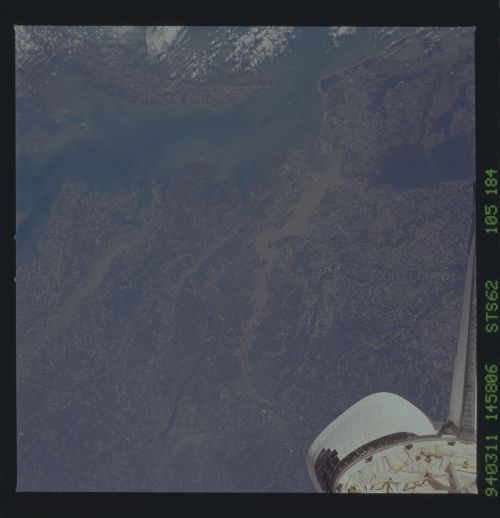
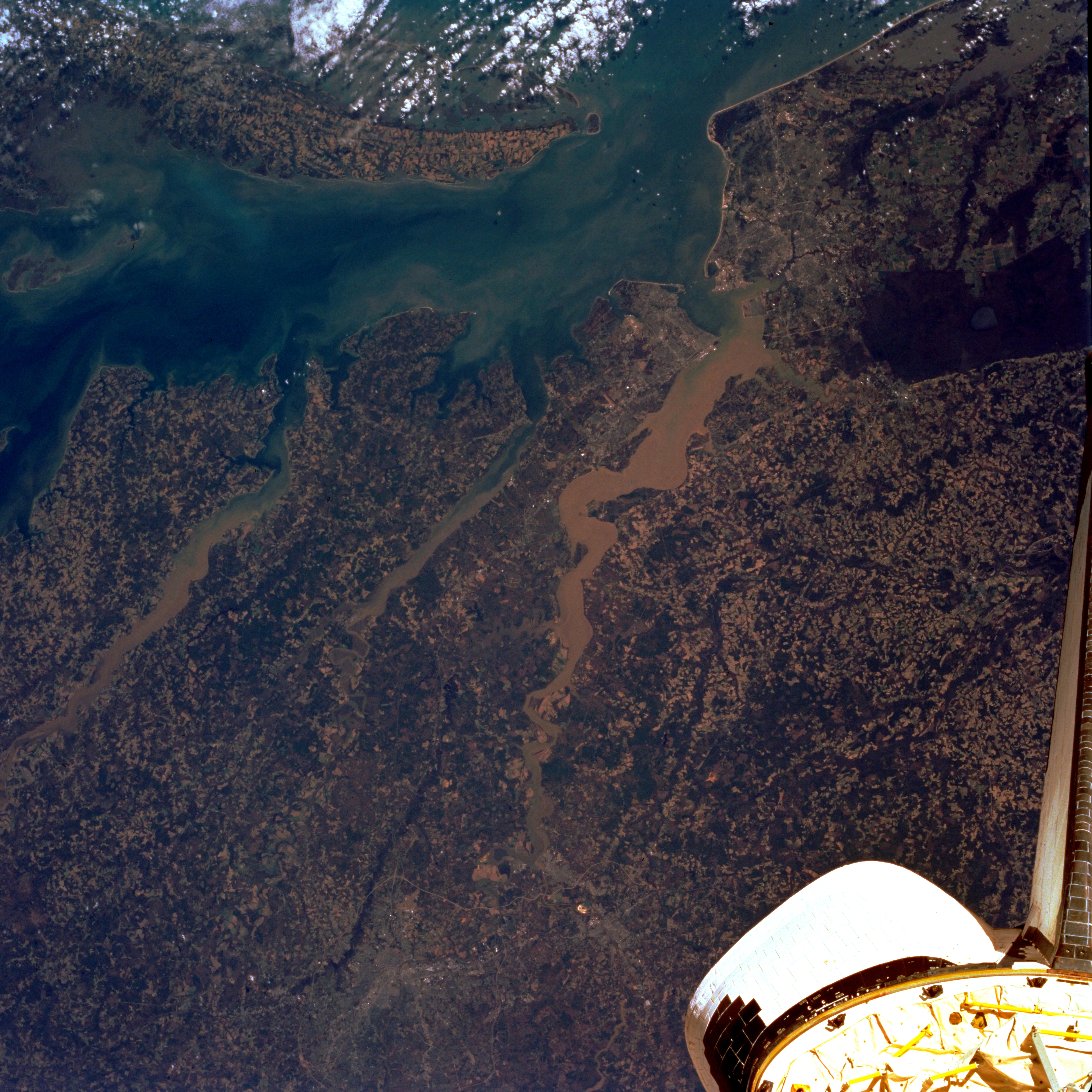
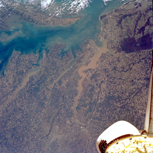
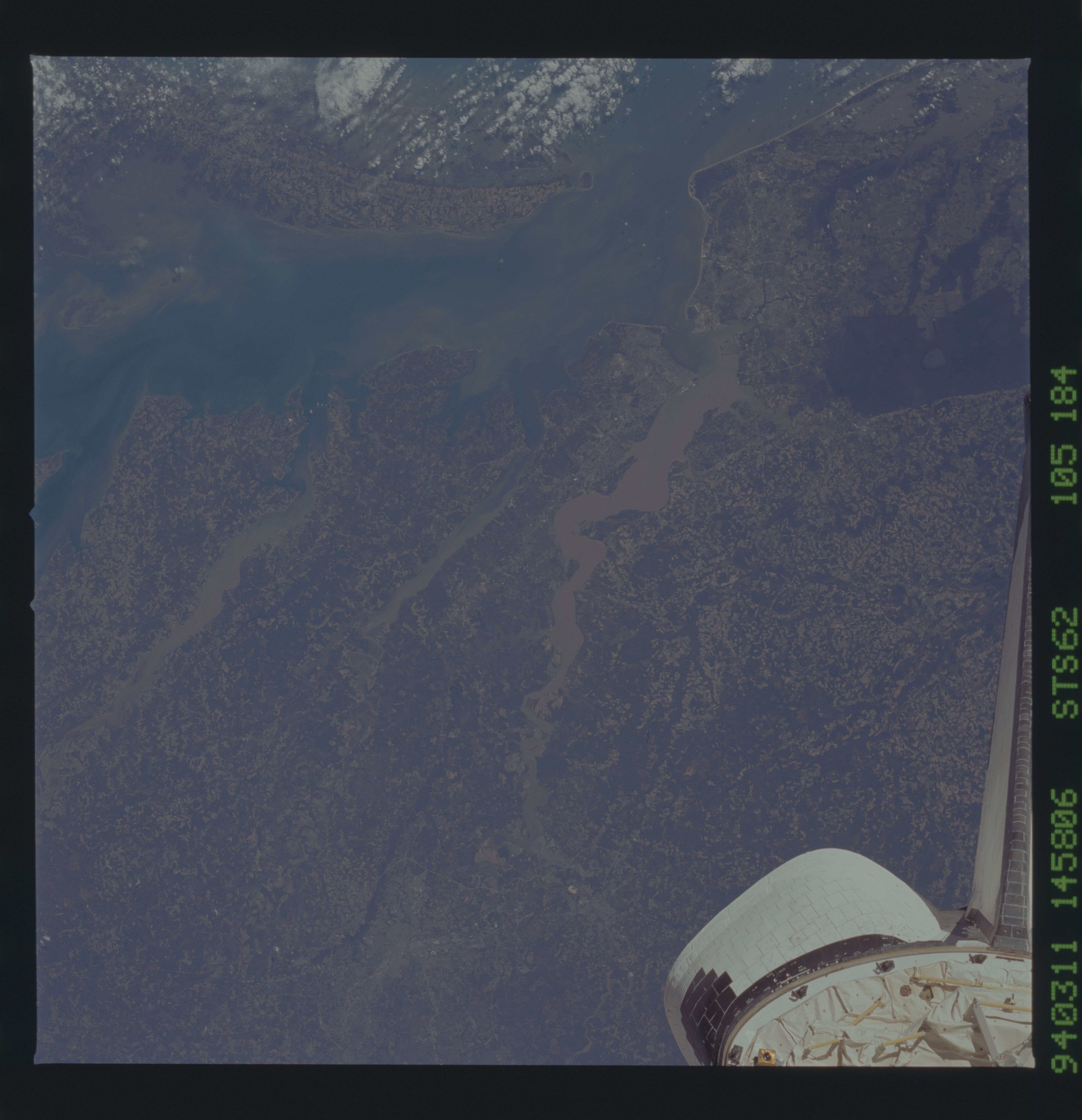
Image Caption: STS062-105-184 Chesapeake Bay, Rappahannock and James Rivers, Virginia March 1994
Three rivers empty into Chesapeake Bay in this east-southeast-looking view. Chesapeake Bay, a 200 mile (320 km) long drowned river mouth is visible at upper left and center. The southern end of the Delmarva Peninsula is discernible through scattered clouds. The forested Dismal Swamp appears as a dark area on the upper right side of the image. The Rappanhannock (left-center) is a 212 mile (340 km) long river that originates in the Blue Ridge Mountains of northern Virginia. The Rappanhannock is navigable to Fredricksburg, Virginia. To the south of the Rappanhannock is the smaller York River, which is nearly 40 miles (64 km) long. The sediment laden 340 mile (547 km) long James River flows into the southern portion of Chesapeake Bay. Formed in west central Virginia, the James River flows from the scenic gorges in the Blue Ridge Mountains and the Piedmont to the Chesapeake Bay. The James River is navigable for large ships to near the city of Petersburg, Virginia, a distance of 100 miles ( 160 km ). The tail of the Space Shuttle is also visible in the image.
Three rivers empty into Chesapeake Bay in this east-southeast-looking view. Chesapeake Bay, a 200 mile (320 km) long drowned river mouth is visible at upper left and center. The southern end of the Delmarva Peninsula is discernible through scattered clouds. The forested Dismal Swamp appears as a dark area on the upper right side of the image. The Rappanhannock (left-center) is a 212 mile (340 km) long river that originates in the Blue Ridge Mountains of northern Virginia. The Rappanhannock is navigable to Fredricksburg, Virginia. To the south of the Rappanhannock is the smaller York River, which is nearly 40 miles (64 km) long. The sediment laden 340 mile (547 km) long James River flows into the southern portion of Chesapeake Bay. Formed in west central Virginia, the James River flows from the scenic gorges in the Blue Ridge Mountains and the Piedmont to the Chesapeake Bay. The James River is navigable for large ships to near the city of Petersburg, Virginia, a distance of 100 miles ( 160 km ). The tail of the Space Shuttle is also visible in the image.
