STS062-104-29

| NASA Photo ID | STS062-104-29 |
| Focal Length | 250mm |
| Date taken | 1994.03.07 |
| Time taken | 14:24:06 GMT |
Resolutions offered for this image:
3904 x 3904 pixels 639 x 639 pixels 5700 x 5900 pixels 500 x 518 pixels 640 x 480 pixels
3904 x 3904 pixels 639 x 639 pixels 5700 x 5900 pixels 500 x 518 pixels 640 x 480 pixels

Cloud masks available for this image:
Spacecraft nadir point: 37.9° N, 79.6° W
Photo center point: 38.5° N, 78.5° W
Photo center point by machine learning:
Photo center point: 38.5° N, 78.5° W
Photo center point by machine learning:
Nadir to Photo Center: Northeast
Spacecraft Altitude: 161 nautical miles (298km)
Country or Geographic Name: | USA-VIRGINIA |
Features: | APPALACHIANS, HARRISONBUR |
| Features Found Using Machine Learning: | |
Cloud Cover Percentage: | 0 (no clouds present) |
Sun Elevation Angle: | 29° |
Sun Azimuth: | 124° |
Camera: | Hasselblad |
Focal Length: | 250mm |
Camera Tilt: | 25 degrees |
Format: | 5048: Kodak, natural color positive, Lumiere 100x/5048, ASA 100x, standard base |
Film Exposure: | Normal |
| Additional Information | |
| Width | Height | Annotated | Cropped | Purpose | Links |
|---|---|---|---|---|---|
| 3904 pixels | 3904 pixels | No | No | Earth From Space collection | Download Image |
| 639 pixels | 639 pixels | No | No | Earth From Space collection | Download Image |
| 5700 pixels | 5900 pixels | No | No | Download Image | |
| 500 pixels | 518 pixels | No | No | Download Image | |
| 640 pixels | 480 pixels | No | No | Download Image |
Download Packaged File
Download a Google Earth KML for this Image
View photo footprint information
Download a GeoTIFF for this photo
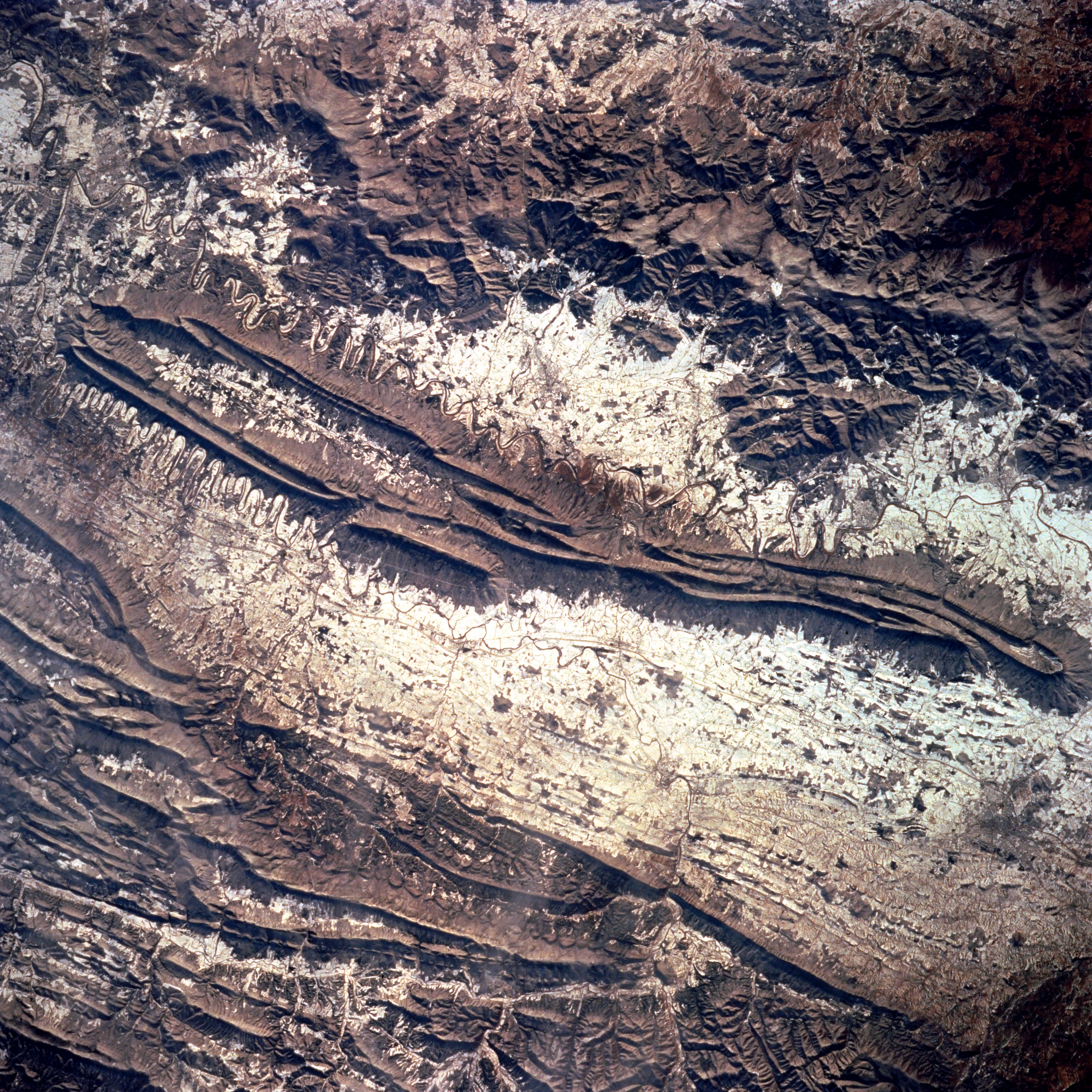
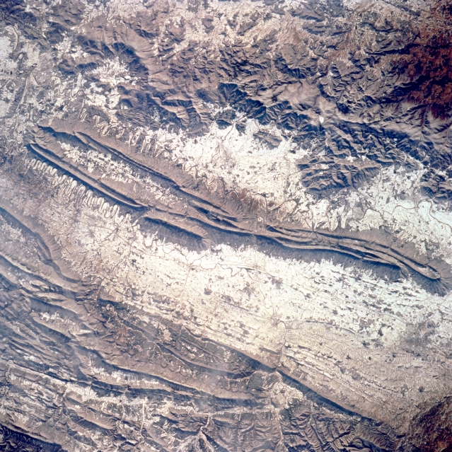
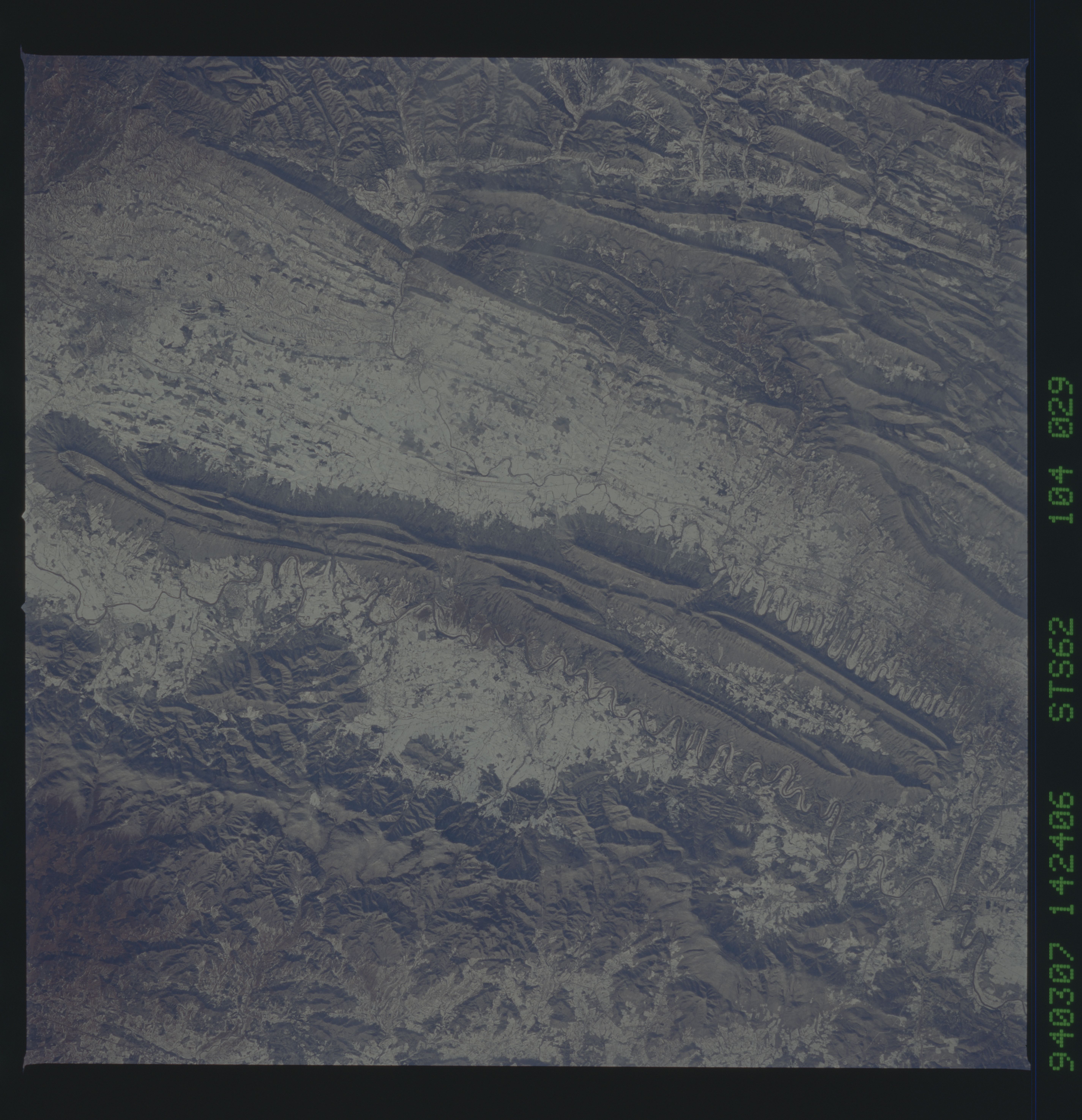
Image Caption: STS062-104-029 Appalachian Mountains, Shenandoah Valley, Virginia, U.S.A. March 1994
Snow covers the valleys and lower ridges of the Appalachian Mountains in this near-nadir view. The city of Harrisonburg is barely visible as a dark smudge in the valley midway between the lower right and right center of the image. The Blue Ridge Mountains extend from the upper left (northeast) to near center right(southwest) of the image. Snow covers the agricultural fields of the Shenandoah River Valley; the meandering river contrasts with the snow at bottom center. Shenandoah National Park, a popular East Coast recreational destination, is in the heavily forested Blue Ridge Mountains. The linear ridges of the Allegheny Mountains in the state of West Virginia are visible at lower left of the image. Maximum elevations for some peaks in this area exceed 4,000 feet (1,220 meters).
Snow covers the valleys and lower ridges of the Appalachian Mountains in this near-nadir view. The city of Harrisonburg is barely visible as a dark smudge in the valley midway between the lower right and right center of the image. The Blue Ridge Mountains extend from the upper left (northeast) to near center right(southwest) of the image. Snow covers the agricultural fields of the Shenandoah River Valley; the meandering river contrasts with the snow at bottom center. Shenandoah National Park, a popular East Coast recreational destination, is in the heavily forested Blue Ridge Mountains. The linear ridges of the Allegheny Mountains in the state of West Virginia are visible at lower left of the image. Maximum elevations for some peaks in this area exceed 4,000 feet (1,220 meters).
