STS062-102-7
| NASA Photo ID | STS062-102-7 |
| Focal Length | 40mm |
| Date taken | 1994.03.07 |
| Time taken | 15:59:49 GMT |
Resolutions offered for this image:
3904 x 3904 pixels 639 x 639 pixels 5700 x 5900 pixels 500 x 518 pixels 640 x 480 pixels
3904 x 3904 pixels 639 x 639 pixels 5700 x 5900 pixels 500 x 518 pixels 640 x 480 pixels
Cloud masks available for this image:
Spacecraft nadir point: 38.8° N, 76.9° W
Photo center point: 39.0° N, 77.0° W
Photo center point by machine learning:
Photo center point: 39.0° N, 77.0° W
Photo center point by machine learning:
Nadir to Photo Center: North
Spacecraft Altitude: 161 nautical miles (298km)
Country or Geographic Name: | USA-DC |
Features: | WASHINGTON DC, SNOW LINE |
| Features Found Using Machine Learning: | |
Cloud Cover Percentage: | 5 (1-10)% |
Sun Elevation Angle: | 43° |
Sun Azimuth: | 153° |
Camera: | Hasselblad |
Focal Length: | 40mm |
Camera Tilt: | 5 degrees |
Format: | 5048: Kodak, natural color positive, Lumiere 100x/5048, ASA 100x, standard base |
Film Exposure: | Normal |
| Additional Information | |
| Width | Height | Annotated | Cropped | Purpose | Links |
|---|---|---|---|---|---|
| 3904 pixels | 3904 pixels | No | No | Earth From Space collection | Download Image |
| 639 pixels | 639 pixels | No | No | Earth From Space collection | Download Image |
| 5700 pixels | 5900 pixels | No | No | Download Image | |
| 500 pixels | 518 pixels | No | No | Download Image | |
| 640 pixels | 480 pixels | No | No | Download Image |
Download Packaged File
Download a Google Earth KML for this Image
View photo footprint information
Download a GeoTIFF for this photo
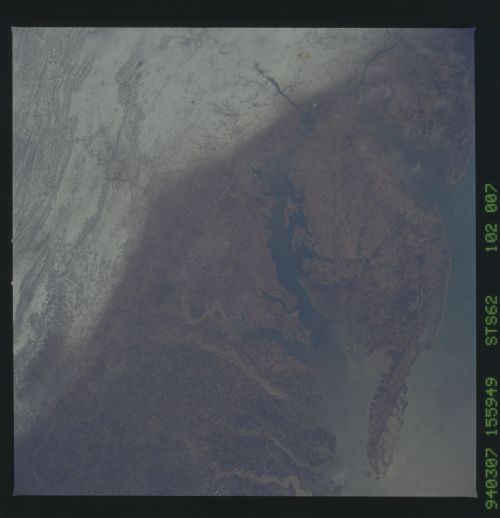
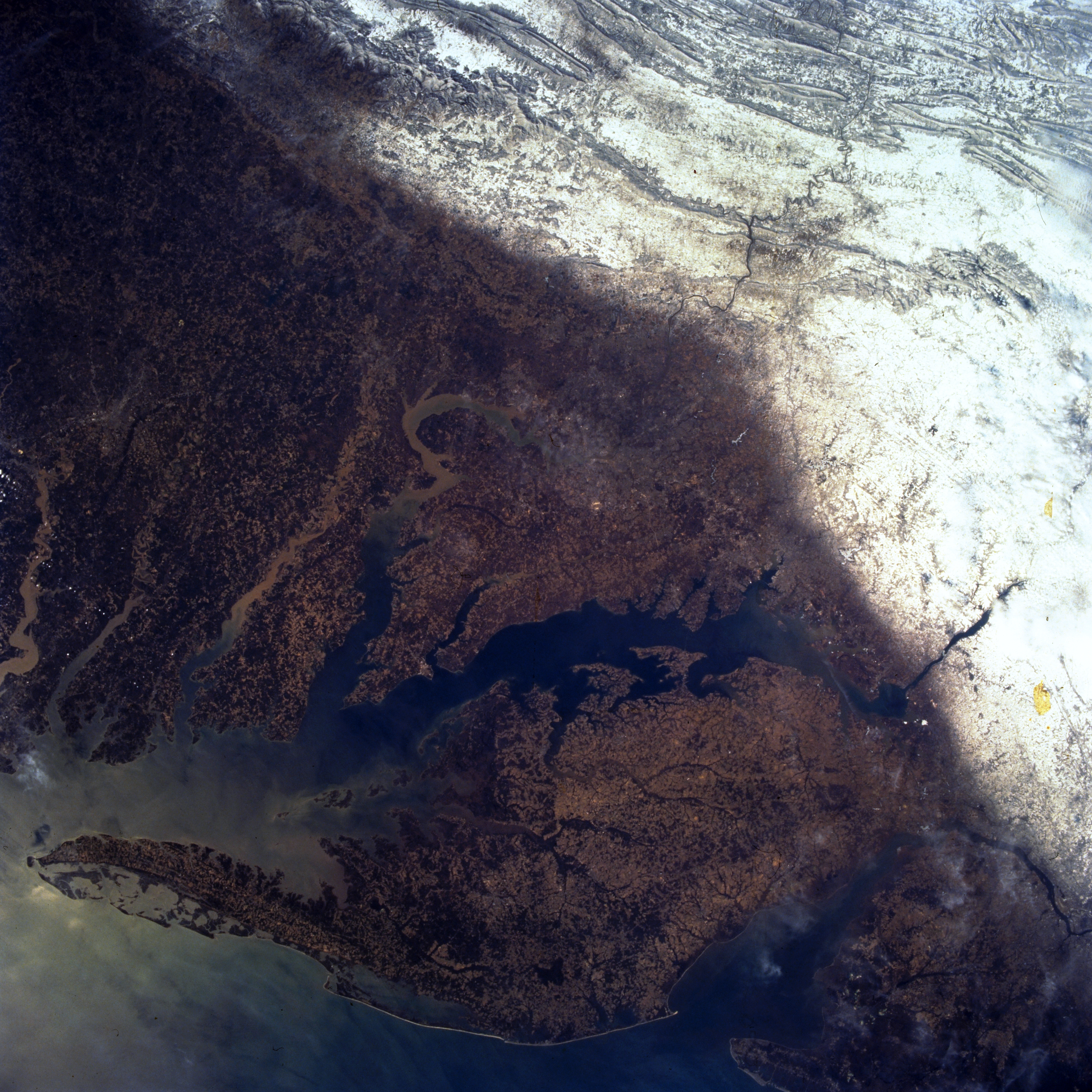
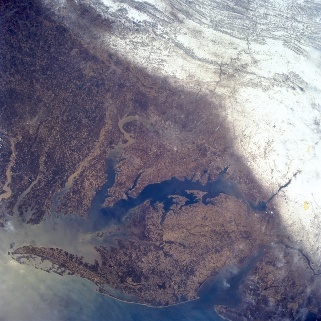
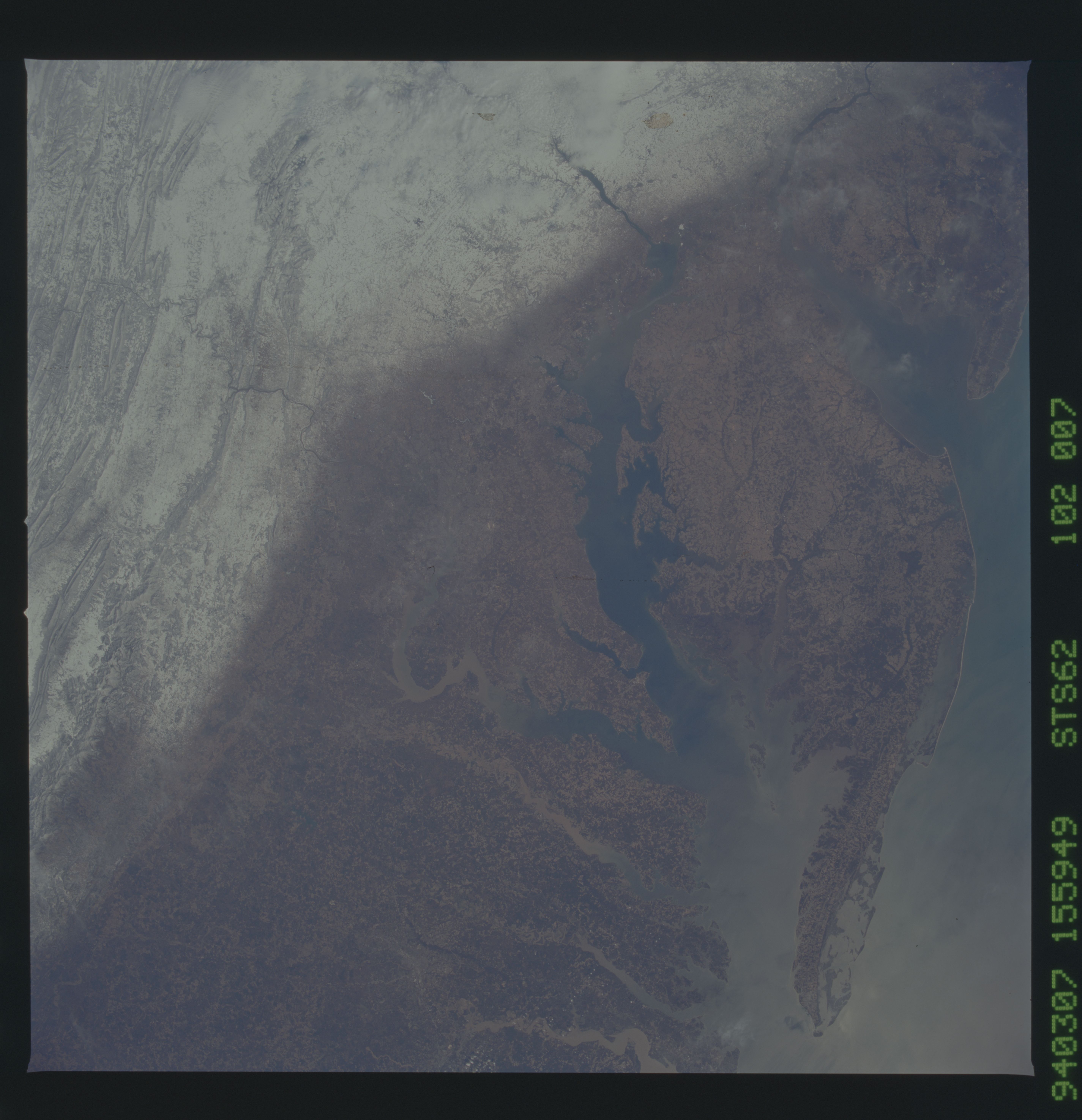
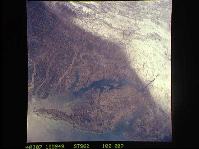
Image Caption: STS062-102-007 Appalachian Mountains; Chesapeake Bay; Delmarva Peninsula, U.S.A. March 1994
This panoramic southwest-looking view delineates between the white snow covered ridges and valleys of the Appalachian Mountains to the topographically lower Piedmont and coastal plains. The 180 mile (290 km) long Delmarva Peninsula is visible in the lower portion of the image. Immediately to the peninsula's west (between the Delmarva Peninsula and the mainland) is the 200 mile (320 km) long Chesapeake Bay. Numerous sediment-laden rivers, including the Patuxent, Potomac, Rappahannock, York, and James, can be seen flowing into Chesapeake Bay. Near the bottom right of the image is Delaware Bay.
This panoramic southwest-looking view delineates between the white snow covered ridges and valleys of the Appalachian Mountains to the topographically lower Piedmont and coastal plains. The 180 mile (290 km) long Delmarva Peninsula is visible in the lower portion of the image. Immediately to the peninsula's west (between the Delmarva Peninsula and the mainland) is the 200 mile (320 km) long Chesapeake Bay. Numerous sediment-laden rivers, including the Patuxent, Potomac, Rappahannock, York, and James, can be seen flowing into Chesapeake Bay. Near the bottom right of the image is Delaware Bay.
