STS061-83-15
| NASA Photo ID | STS061-83-15 |
| Focal Length | 100mm |
| Date taken | 1993.12.13 |
| Time taken | GMT |
Resolutions offered for this image:
3904 x 3936 pixels 634 x 639 pixels 5700 x 6000 pixels 500 x 526 pixels 640 x 480 pixels 1294 x 1291 pixels
3904 x 3936 pixels 634 x 639 pixels 5700 x 6000 pixels 500 x 526 pixels 640 x 480 pixels 1294 x 1291 pixels
Cloud masks available for this image:
Spacecraft nadir point:
Photo center point: 27.0° S, 115.0° E
Photo center point by machine learning:
Photo center point: 27.0° S, 115.0° E
Photo center point by machine learning:
Nadir to Photo Center:
Spacecraft Altitude: nautical miles (0km)
Country or Geographic Name: | AUSTRALIA-WA |
Features: | PAN-SHARK B., DARLING RA. |
| Features Found Using Machine Learning: | |
Cloud Cover Percentage: | 30 (26-50)% |
Sun Elevation Angle: | ° |
Sun Azimuth: | ° |
Camera: | Hasselblad |
Focal Length: | 100mm |
Camera Tilt: | High Oblique |
Format: | 5017: Kodak, natural color positive, Ektachrome, X Professional, ASA 64, standard base |
Film Exposure: | Normal |
| Additional Information | |
| Width | Height | Annotated | Cropped | Purpose | Links |
|---|---|---|---|---|---|
| 3904 pixels | 3936 pixels | No | No | Earth From Space collection | Download Image |
| 634 pixels | 639 pixels | No | No | Earth From Space collection | Download Image |
| 5700 pixels | 6000 pixels | No | No | Download Image | |
| 500 pixels | 526 pixels | No | No | Download Image | |
| 640 pixels | 480 pixels | No | No | Download Image | |
| 1294 pixels | 1291 pixels | No | No | Download Image |
Download Packaged File
Download a Google Earth KML for this Image
View photo footprint information
Download a GeoTIFF for this photo
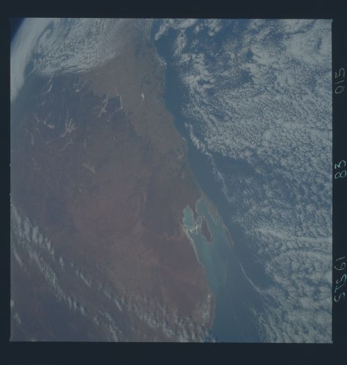
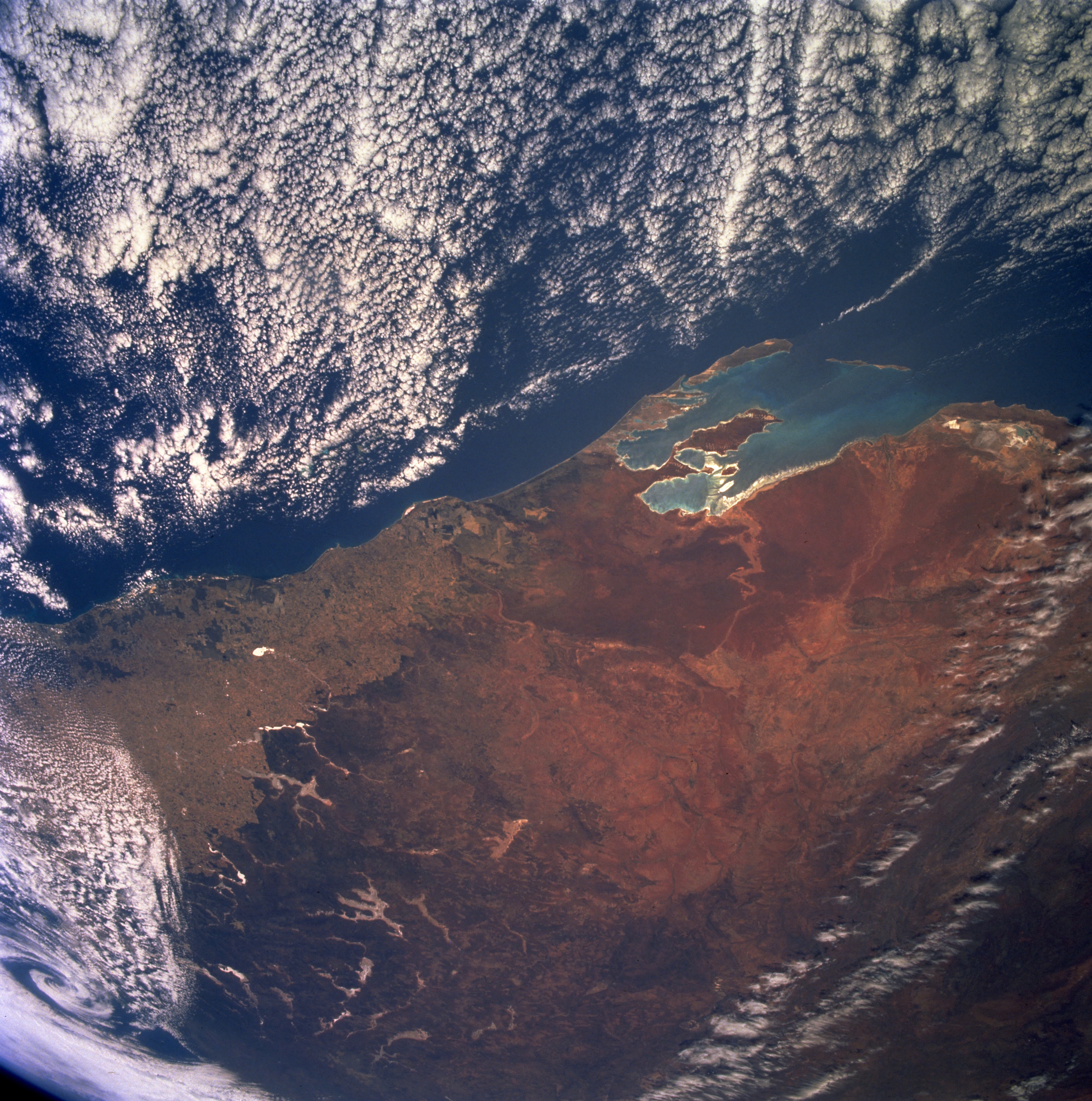
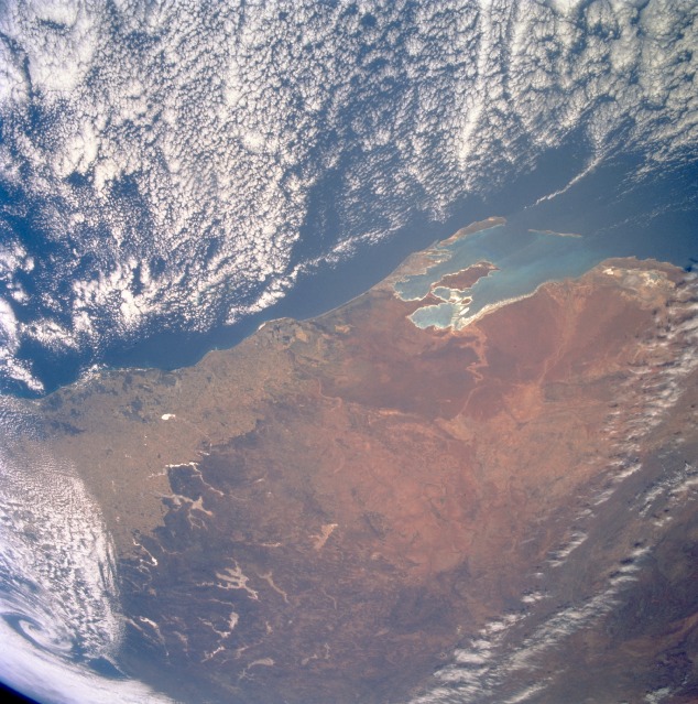
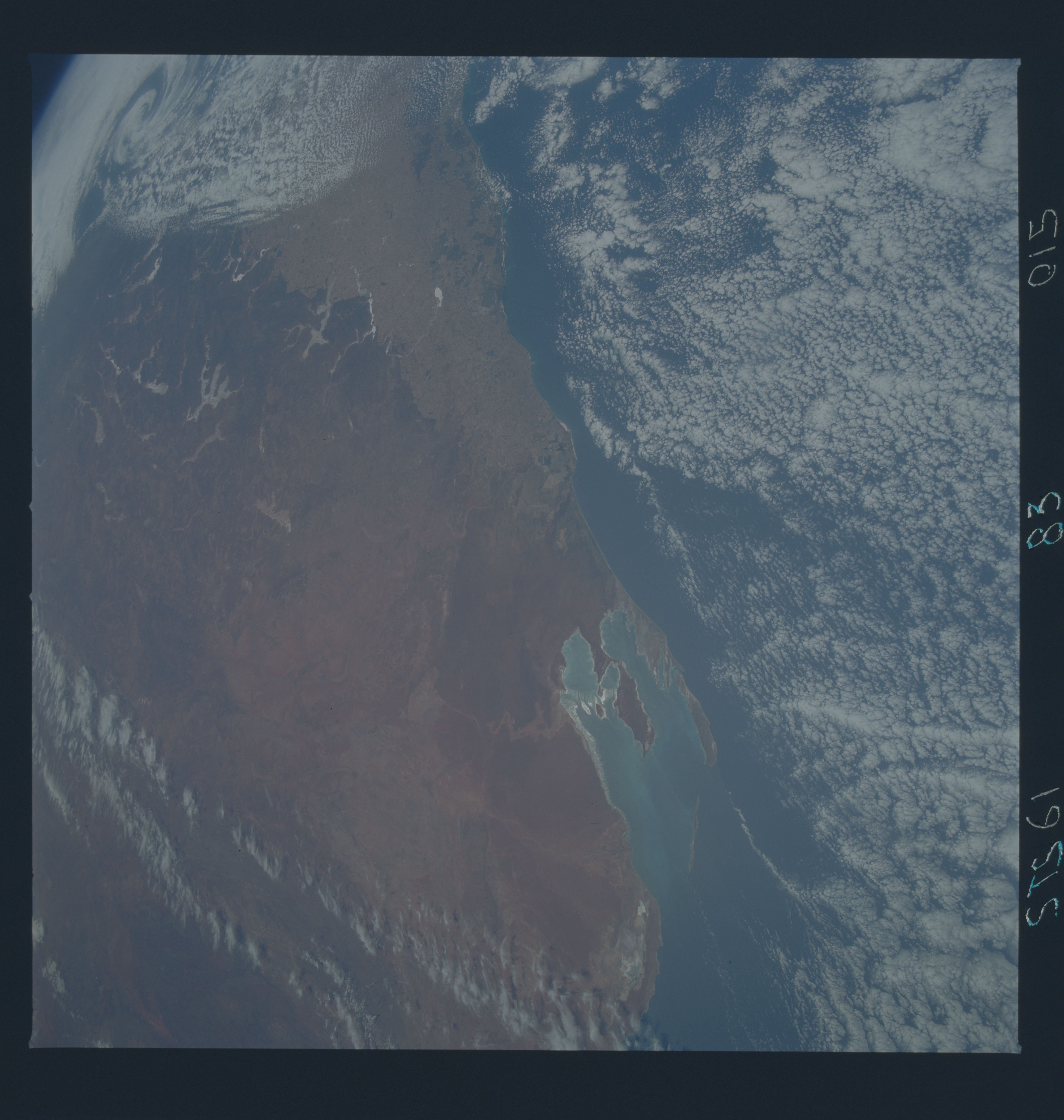
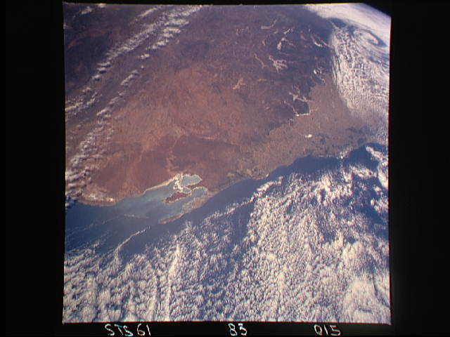
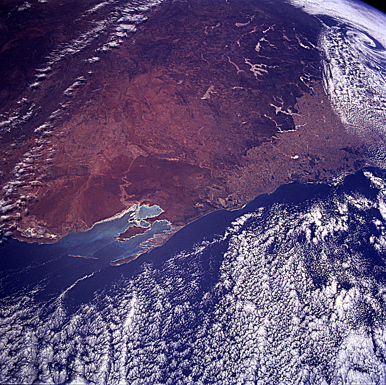
Image Caption: STS061-83-15 Shark Bay Area, Western Australia, Australia December 1993
Even though clouds obscure part of this picture, the synoptic scale provides a southeast-looking view of west central Western Australia. Shark Bay, the large divided embayment, is visible in the foreground. The entire subregion of the Geraldton Sandplains (the region with the uniform reddish color) can be seen south of Shark Bay. The linear patterns marking boundaries between lighter and darker regions show the extent of human ownership and intrusion into a more rugged and dry landscape in the semiarid region of Western Australia. The very light features that seem to follow valley contours in the undeveloped Bush landscape are a series of dry lakes (highly reflective surfaces, not to be confused with cloud patterns). Cleared fields of the western wheat belt and the outback inland. Nice land-breeze effect on the cumulus cloud field.
Even though clouds obscure part of this picture, the synoptic scale provides a southeast-looking view of west central Western Australia. Shark Bay, the large divided embayment, is visible in the foreground. The entire subregion of the Geraldton Sandplains (the region with the uniform reddish color) can be seen south of Shark Bay. The linear patterns marking boundaries between lighter and darker regions show the extent of human ownership and intrusion into a more rugged and dry landscape in the semiarid region of Western Australia. The very light features that seem to follow valley contours in the undeveloped Bush landscape are a series of dry lakes (highly reflective surfaces, not to be confused with cloud patterns). Cleared fields of the western wheat belt and the outback inland. Nice land-breeze effect on the cumulus cloud field.
