STS061-103-32
| NASA Photo ID | STS061-103-32 |
| Focal Length | 40mm |
| Date taken | 1993.12.11 |
| Time taken | 12:21:12 GMT |
Resolutions offered for this image:
5276 x 5276 pixels 640 x 640 pixels 5700 x 5900 pixels 500 x 518 pixels 640 x 480 pixels
5276 x 5276 pixels 640 x 640 pixels 5700 x 5900 pixels 500 x 518 pixels 640 x 480 pixels
Cloud masks available for this image:
Spacecraft nadir point: 27.6° S, 22.0° E
Photo center point: 31.0° S, 22.0° E
Photo center point by machine learning:
Photo center point: 31.0° S, 22.0° E
Photo center point by machine learning:
Nadir to Photo Center: South
Spacecraft Altitude: 320 nautical miles (593km)
Country or Geographic Name: | REPUBLIC SOUTH AFRICA |
Features: | GREAT KAROO, ORANGE RIVER |
| Features Found Using Machine Learning: | |
Cloud Cover Percentage: | 10 (1-10)% |
Sun Elevation Angle: | 63° |
Sun Azimuth: | 273° |
Camera: | Hasselblad |
Focal Length: | 40mm |
Camera Tilt: | 32 degrees |
Format: | VELVI: Fuji, natural color positive, Velvia 50, CS 135-36, ASA 32, standard base |
Film Exposure: | Normal |
| Additional Information | |
| Width | Height | Annotated | Cropped | Purpose | Links |
|---|---|---|---|---|---|
| 5276 pixels | 5276 pixels | No | No | Earth From Space collection | Download Image |
| 640 pixels | 640 pixels | No | No | Earth From Space collection | Download Image |
| 5700 pixels | 5900 pixels | No | No | Download Image | |
| 500 pixels | 518 pixels | No | No | Download Image | |
| 640 pixels | 480 pixels | No | No | Download Image |
Download Packaged File
Download a Google Earth KML for this Image
View photo footprint information
Download a GeoTIFF for this photo
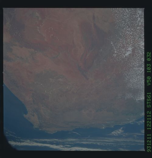
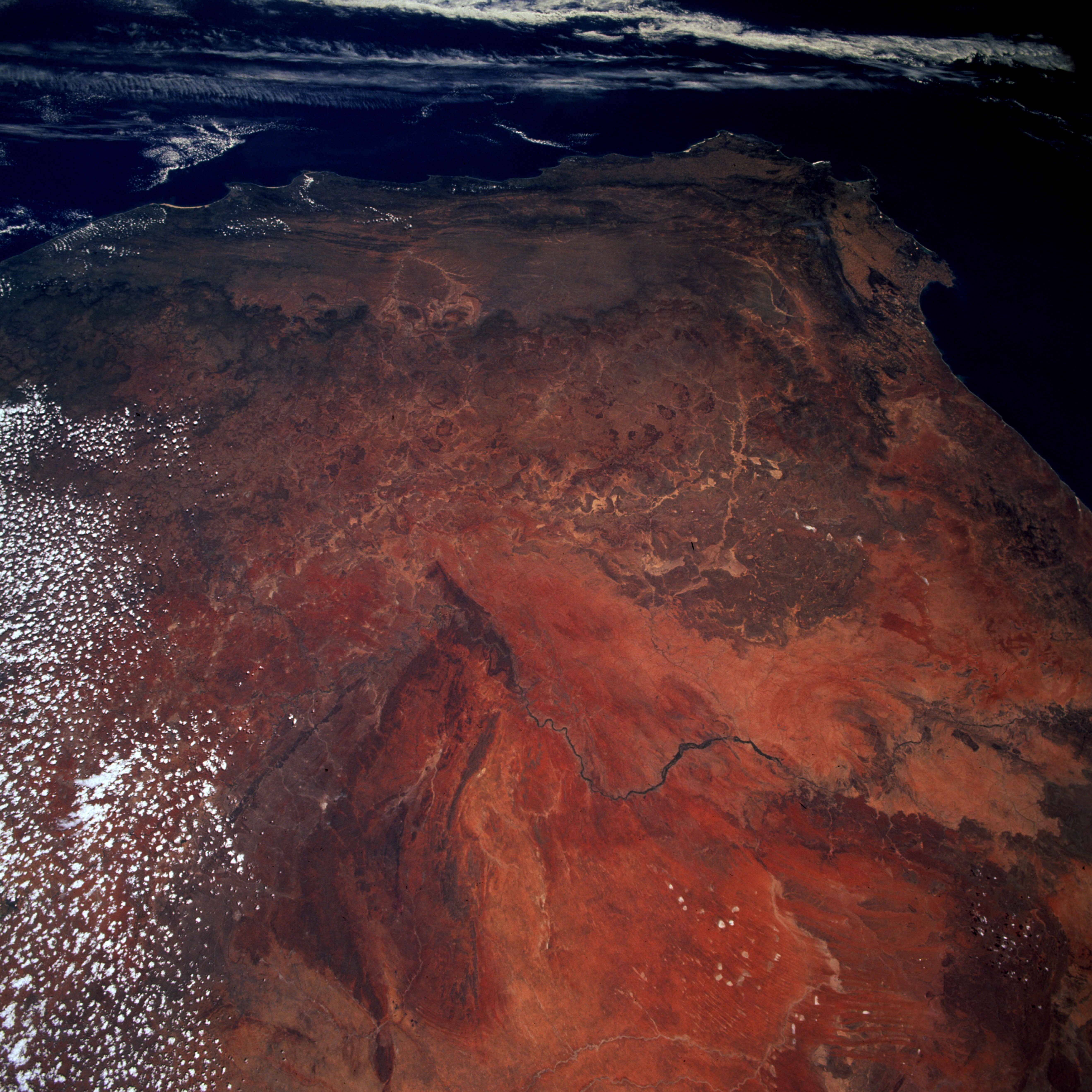
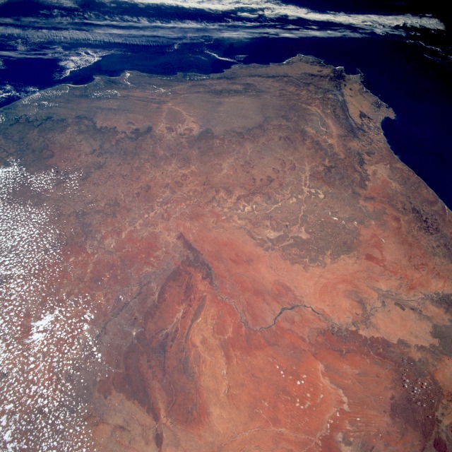
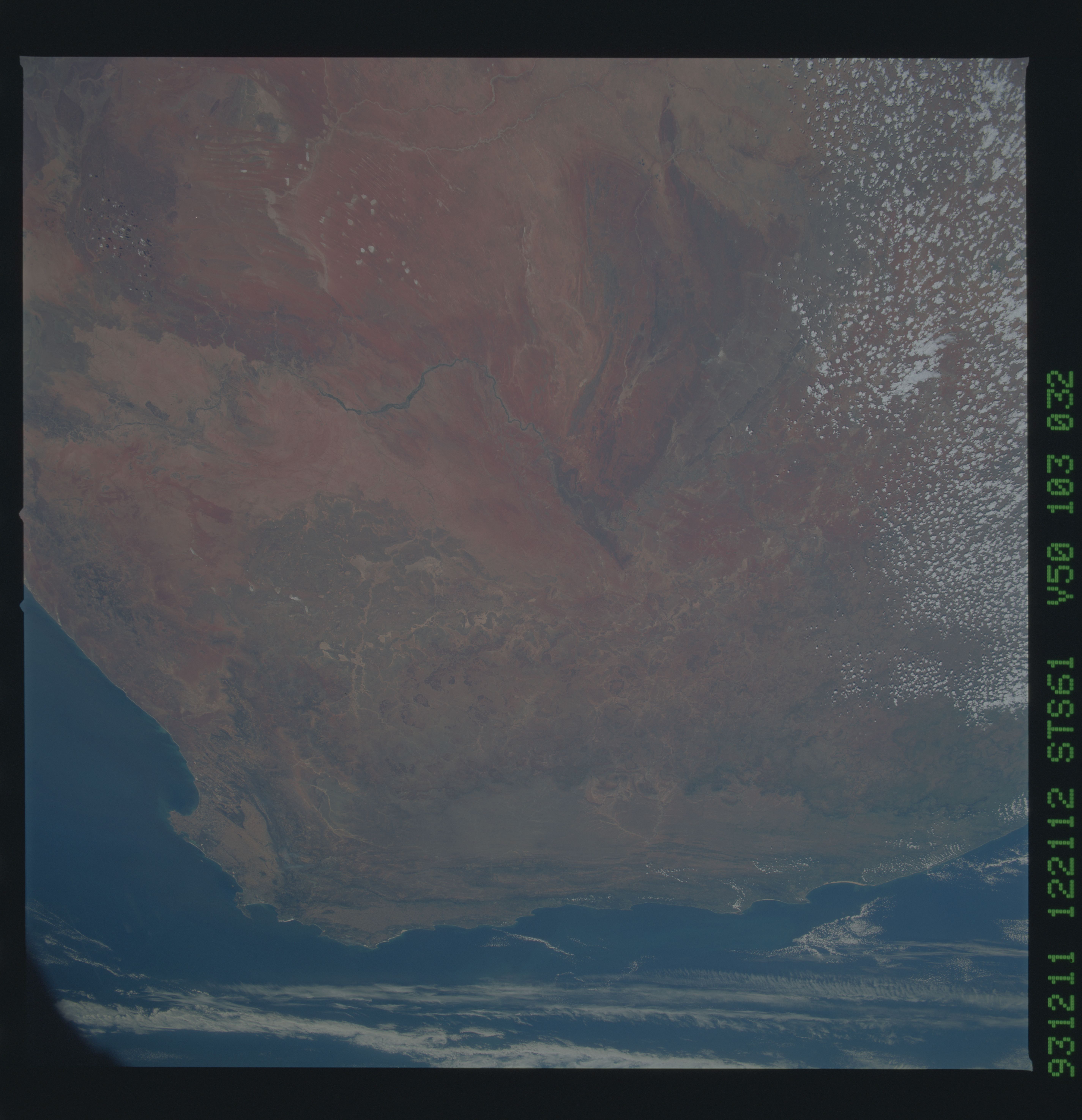
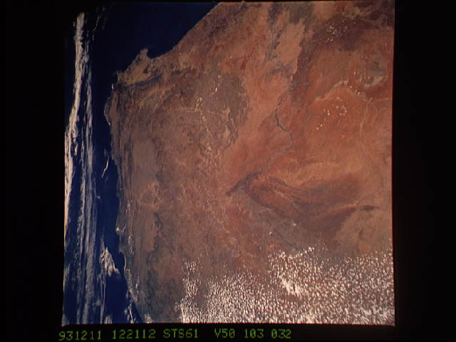
Image Caption: STS061-103-032 Republic of South Africa December 1993
Several features are visible in this south-looking, low-oblique photograph of the Republic of South Africa--the southern extent of the reddish-brown Kalahari Desert with its northwest-southeast-trending sand dunes and dry lakebeds to the northwest; the westward-flowing Orange River south of the true desert; Cape Town, the Cape of Good Hope, and Cape Agulhas barely discernible near the southern horizon; and the cape ranges of folded mountains near the extreme southern point of South Africa. The area between the Kalahari and the southern mountains, the heart of South Africa, is not mountainous, but is an elevated plateau with some hilly topography. Much of the plateau, some of it 5000 feet (1525 meters) above sea level, is covered by tall grasses that give a prairie-like appearance. Some areas surrounding the elevated plateau (called the veld by Dutch settlers) contain sizable escarpments that drop several thousand feet (several thousand meters).
Several features are visible in this south-looking, low-oblique photograph of the Republic of South Africa--the southern extent of the reddish-brown Kalahari Desert with its northwest-southeast-trending sand dunes and dry lakebeds to the northwest; the westward-flowing Orange River south of the true desert; Cape Town, the Cape of Good Hope, and Cape Agulhas barely discernible near the southern horizon; and the cape ranges of folded mountains near the extreme southern point of South Africa. The area between the Kalahari and the southern mountains, the heart of South Africa, is not mountainous, but is an elevated plateau with some hilly topography. Much of the plateau, some of it 5000 feet (1525 meters) above sea level, is covered by tall grasses that give a prairie-like appearance. Some areas surrounding the elevated plateau (called the veld by Dutch settlers) contain sizable escarpments that drop several thousand feet (several thousand meters).
