STS060-99-41

| NASA Photo ID | STS060-99-41 |
| Focal Length | 250mm |
| Date taken | 1994.02.09 |
| Time taken | 10:31:52 GMT |

Cloud masks available for this image:
Spacecraft nadir point: 44.3° N, 33.2° E
Photo center point: 46.5° N, 32.0° E
Photo center point by machine learning:
Photo center point: 46.5° N, 32.0° E
Photo center point by machine learning:
Nadir to Photo Center: Northwest
Spacecraft Altitude: 190 nautical miles (352km)
Country or Geographic Name: | UKRAINE |
Features: | DNEPER R. DEL., BLACK SEA |
| Features Found Using Machine Learning: | |
Cloud Cover Percentage: | 5 (1-10)% |
Sun Elevation Angle: | 31° |
Sun Azimuth: | 189° |
Camera: | Hasselblad |
Focal Length: | 250mm |
Camera Tilt: | 38 degrees |
Format: | 2443: Kodak Aerochrome 2443, color IR, thin base, EA-5 process thru June 1999, E-6 process afterward |
Film Exposure: | Normal |
| Additional Information | |
| Width | Height | Annotated | Cropped | Purpose | Links |
|---|---|---|---|---|---|
| 5700 pixels | 5900 pixels | No | No | Download Image | |
| 500 pixels | 518 pixels | No | No | Download Image | |
| 640 pixels | 480 pixels | No | No | Download Image |
Download Packaged File
Download a Google Earth KML for this Image
View photo footprint information
Download a GeoTIFF for this photo
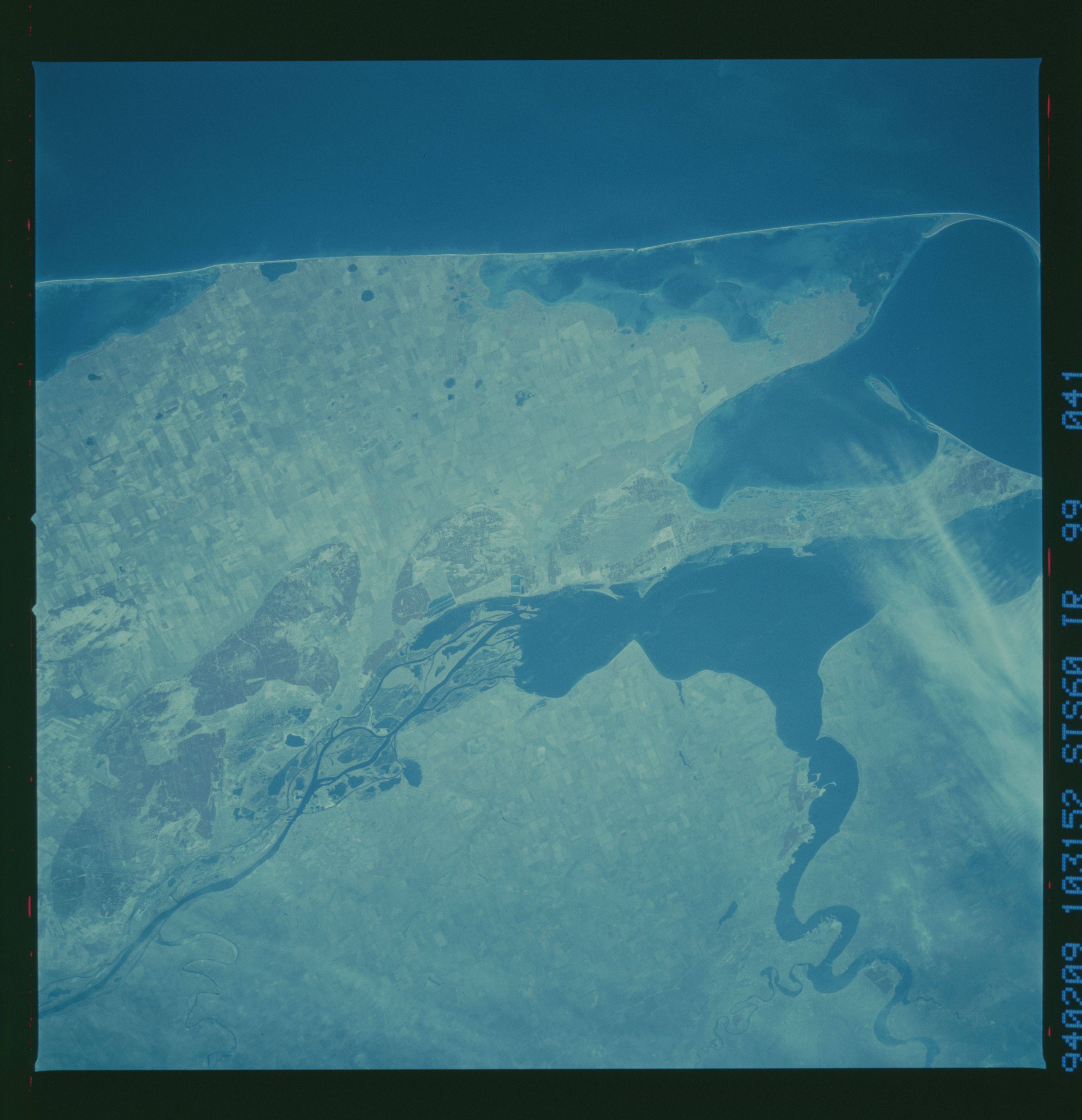
Image Caption: Dneper River delta, Black Sea.
Demonstrating how nature changes shorelines; This shore
line of the Dneper River delta has apparently undergone
several changes over history. There was a shore line behind
the current barrier island shoreline. In relatively recent
history the delta has grown out to the barrier island
shoreline. This is a color infrared photo taken in Feb.
1994.
