STS060-94-7
| NASA Photo ID | STS060-94-7 |
| Focal Length | 100mm |
| Date taken | 1994.02.10 |
| Time taken | 10:52:45 GMT |

Cloud masks available for this image:
Spacecraft nadir point: 53.4° N, 1.0° E
Photo center point: 50.5° N, 1.0° W
Photo center point by machine learning:
Photo center point: 50.5° N, 1.0° W
Photo center point by machine learning:
Nadir to Photo Center: Southwest
Spacecraft Altitude: 190 nautical miles (352km)
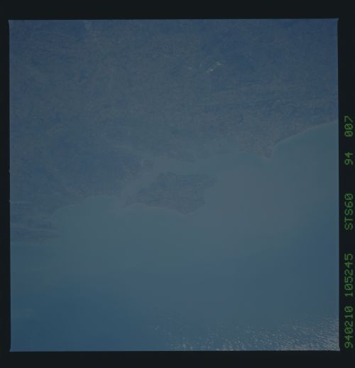
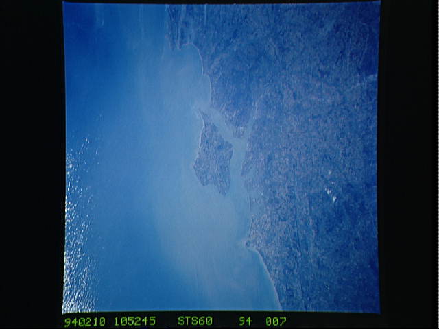
Country or Geographic Name: | UK-ENGLAND |
Features: | PORTSMOUTH, ISLE OF WIGHT |
| Features Found Using Machine Learning: | |
Cloud Cover Percentage: | 5 (1-10)% |
Sun Elevation Angle: | 20° |
Sun Azimuth: | 160° |
Camera: | Hasselblad |
Focal Length: | 100mm |
Camera Tilt: | 48 degrees |
Format: | 5017: Kodak, natural color positive, Ektachrome, X Professional, ASA 64, standard base |
Film Exposure: | Normal |
| Additional Information | |
| Width | Height | Annotated | Cropped | Purpose | Links |
|---|---|---|---|---|---|
| 5700 pixels | 5900 pixels | No | No | Download Image | |
| 500 pixels | 518 pixels | No | No | Download Image | |
| 640 pixels | 480 pixels | No | No | Download Image |
Download Packaged File
Download a Google Earth KML for this Image
View photo footprint information
Download a GeoTIFF for this photo
Image Caption: The Isle of Wight, over 380 kilometers, is a diamond-shaped island located off the south coast of England. Separated from the mainland by The Solent, a narrow channel of water, the island is a popular resort area due to its scenery and mild climate. Sediment from English Lowland drainage systems, most notably the River Test, is visible entering the Solent and spilling into the English Channel. At the tip of the linear, northwestward inlet is the mouth of the Test and the city of Southampton, discernible as a small patch of lighter gray. Further east is a series of protected bays which are, from west to east; Portsmouth Harbour, Langstone Harbour, and Chichester Harbour.
