STS060-90-65
| NASA Photo ID | STS060-90-65 |
| Focal Length | 250mm |
| Date taken | 1994.02.11 |
| Time taken | 12:56:46 GMT |
Resolutions offered for this image:
4030 x 4030 pixels 639 x 639 pixels 5700 x 5900 pixels 500 x 518 pixels 640 x 480 pixels
4030 x 4030 pixels 639 x 639 pixels 5700 x 5900 pixels 500 x 518 pixels 640 x 480 pixels

Cloud masks available for this image:
Spacecraft nadir point: 37.0° N, 4.6° W
Photo center point: 37.0° N, 3.0° W
Photo center point by machine learning:
Photo center point: 37.0° N, 3.0° W
Photo center point by machine learning:
Nadir to Photo Center: East
Spacecraft Altitude: 191 nautical miles (354km)
Country or Geographic Name: | SPAIN |
Features: | ALMERIA PLAINS |
| Features Found Using Machine Learning: | |
Cloud Cover Percentage: | 0 (no clouds present) |
Sun Elevation Angle: | 39° |
Sun Azimuth: | 187° |
Camera: | Hasselblad |
Focal Length: | 250mm |
Camera Tilt: | 27 degrees |
Format: | 5017: Kodak, natural color positive, Ektachrome, X Professional, ASA 64, standard base |
Film Exposure: | Normal |
| Additional Information | |
| Width | Height | Annotated | Cropped | Purpose | Links |
|---|---|---|---|---|---|
| 4030 pixels | 4030 pixels | No | No | Earth From Space collection | Download Image |
| 639 pixels | 639 pixels | No | No | Earth From Space collection | Download Image |
| 5700 pixels | 5900 pixels | No | No | Download Image | |
| 500 pixels | 518 pixels | No | No | Download Image | |
| 640 pixels | 480 pixels | No | No | Download Image |
Download Packaged File
Download a Google Earth KML for this Image
View photo footprint information
Download a GeoTIFF for this photo
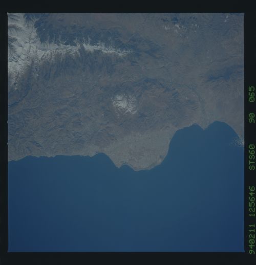
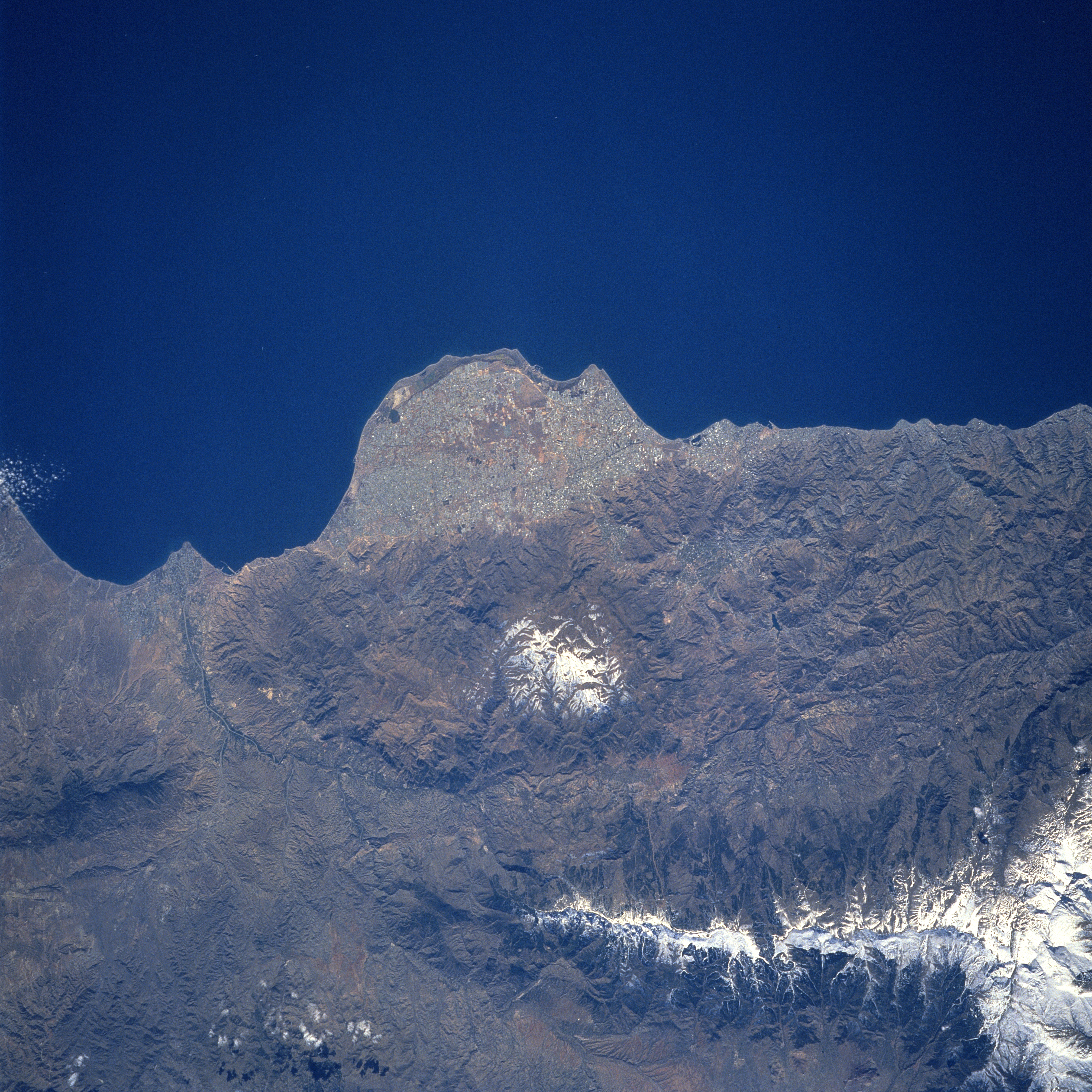
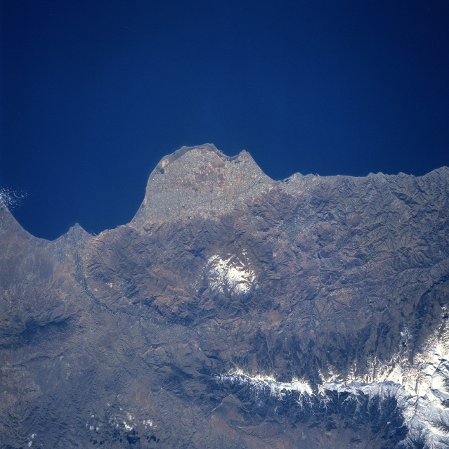
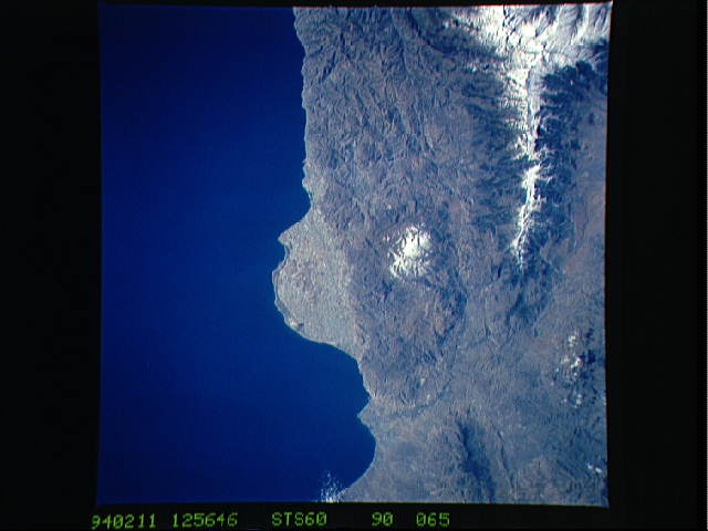
Image Caption: STS060-090-065 Almeria Peninsula, Spain February, 1994
The Plains of Almeria (center of image) is a unique looking landform along the southeast coast of Spain. In spite of a desert-like climate, recent economic development along this flat surfaced, rounded peninsula that protrudes into the Mediterranean Sea has stimulated a growing tourist industry along this coast. The port city of Almeria (estimated population over 160000) is located between the eastern edge of the Plains of Almeria and the Almeria River delta (left of center). The two white areas on the image are two mountain ranges: the Sierra de Gador (smaller range near the center of the image) and the more massive and higher Sierra Nevada range. Several tributary streams (ephemeral) of the Almeria River are discernible in the lower left quadrant of the image.
The Plains of Almeria (center of image) is a unique looking landform along the southeast coast of Spain. In spite of a desert-like climate, recent economic development along this flat surfaced, rounded peninsula that protrudes into the Mediterranean Sea has stimulated a growing tourist industry along this coast. The port city of Almeria (estimated population over 160000) is located between the eastern edge of the Plains of Almeria and the Almeria River delta (left of center). The two white areas on the image are two mountain ranges: the Sierra de Gador (smaller range near the center of the image) and the more massive and higher Sierra Nevada range. Several tributary streams (ephemeral) of the Almeria River are discernible in the lower left quadrant of the image.
