STS060-85-BT
| NASA Photo ID | STS060-85-BT |
| Focal Length | 100mm |
| Date taken | 1994.02.__ |
| Time taken | GMT |
Resolutions offered for this image:
5248 x 5248 pixels 640 x 640 pixels 5700 x 5900 pixels 500 x 518 pixels 640 x 480 pixels 483 x 453 pixels
5248 x 5248 pixels 640 x 640 pixels 5700 x 5900 pixels 500 x 518 pixels 640 x 480 pixels 483 x 453 pixels

Cloud masks available for this image:
Spacecraft nadir point:
Photo center point: 46.0° N, 35.5° E
Photo center point by machine learning:
Photo center point: 46.0° N, 35.5° E
Photo center point by machine learning:
Nadir to Photo Center:
Spacecraft Altitude: nautical miles (0km)
Country or Geographic Name: | UKRAINE |
Features: | SEA OF AZOV, COAST |
| Features Found Using Machine Learning: | |
Cloud Cover Percentage: | 10 (1-10)% |
Sun Elevation Angle: | ° |
Sun Azimuth: | ° |
Camera: | Hasselblad |
Focal Length: | 100mm |
Camera Tilt: | Low Oblique |
Format: | 5048: Kodak, natural color positive, Lumiere 100x/5048, ASA 100x, standard base |
Film Exposure: | Normal |
| Additional Information | |
| Width | Height | Annotated | Cropped | Purpose | Links |
|---|---|---|---|---|---|
| 5248 pixels | 5248 pixels | No | No | Earth From Space collection | Download Image |
| 640 pixels | 640 pixels | No | No | Earth From Space collection | Download Image |
| 5700 pixels | 5900 pixels | No | No | Download Image | |
| 500 pixels | 518 pixels | No | No | Download Image | |
| 640 pixels | 480 pixels | No | No | Download Image | |
| 483 pixels | 453 pixels | Yes | No | Download Image |
Download Packaged File
Download a Google Earth KML for this Image
View photo footprint information
Download a GeoTIFF for this photo
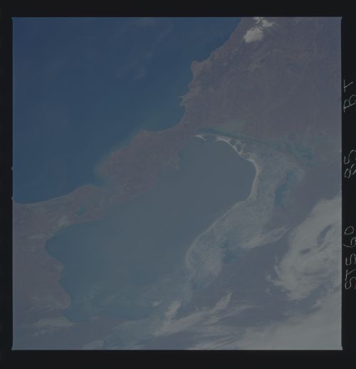
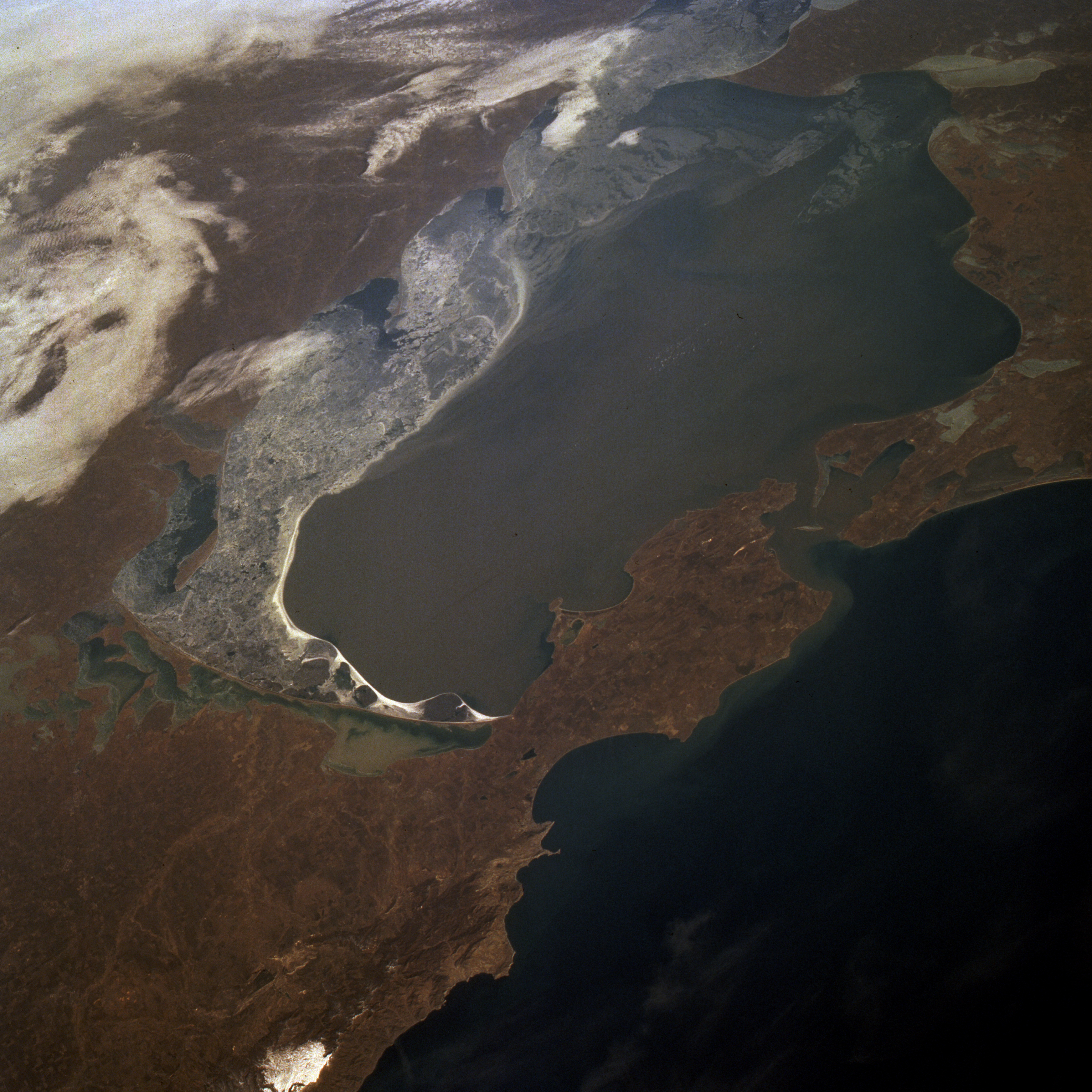
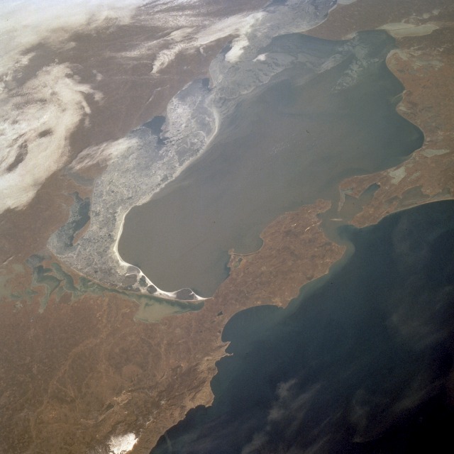
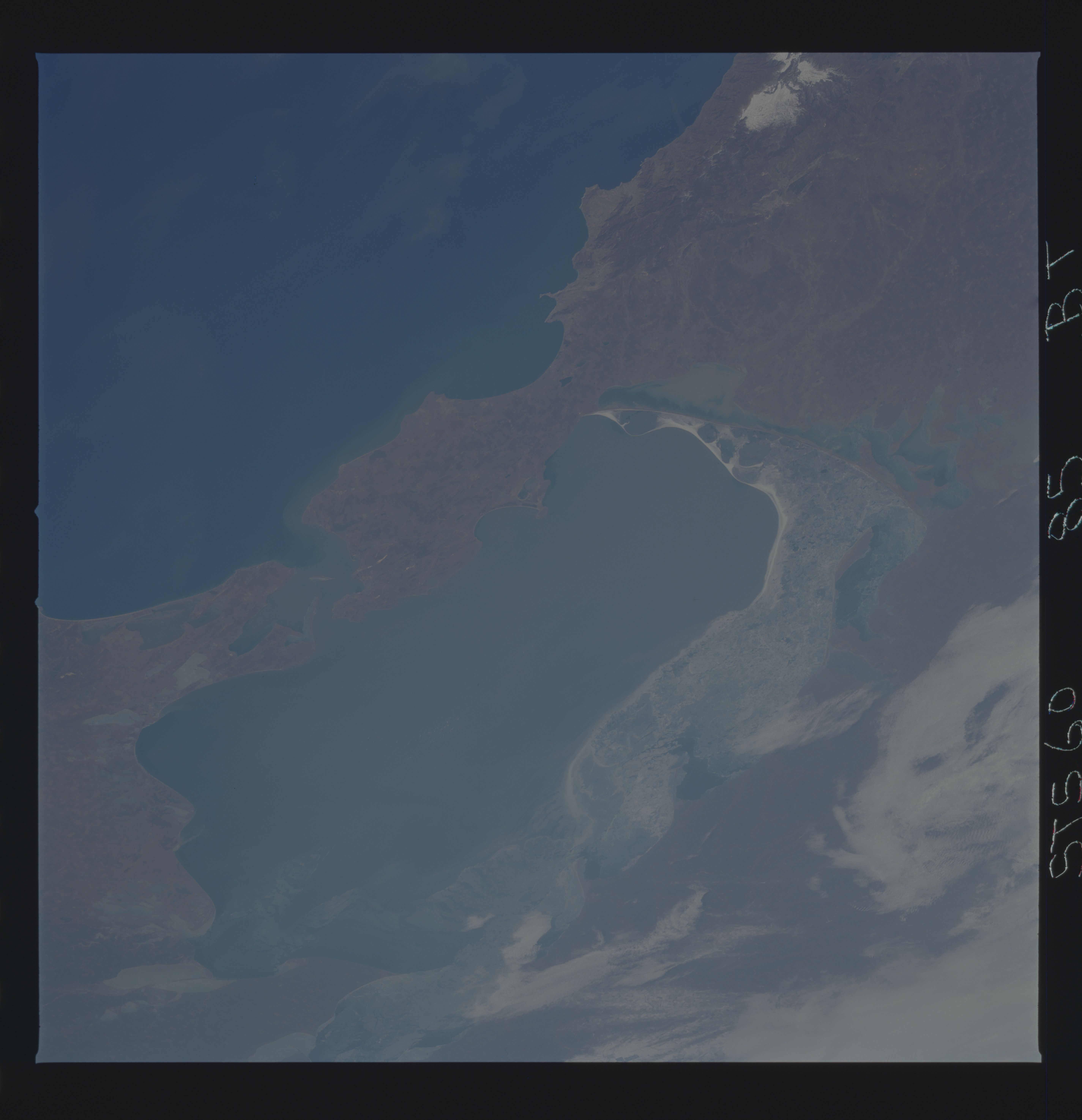
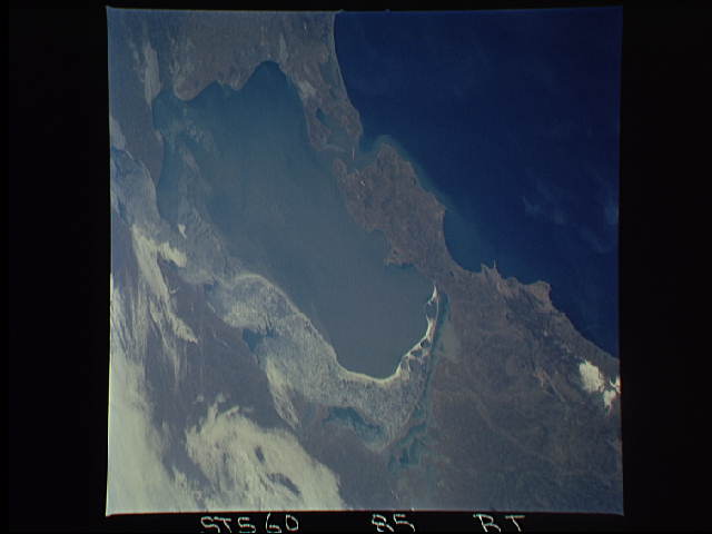
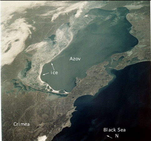
Image Caption: STS060-085-0BT Sea of Azov, Ukraine February 1994
The sediment-laden Sea of Azov (center of the photograph), an arm of the Black Sea (dark blue), can be seen in this northeast-looking, low-oblique photograph. The Sea of Azov, rich with fish, lies between the Crimean Peninsula to the west, the eastern Ukrainian coast to the north, and the north Caucasus to the east. The sea, connected to the Black Sea by Kerch Strait, is 210 miles (340 kilometers) long, 85 miles (137 kilometers) wide, and covers 14 515 square miles (37 606 square kilometers). The narrow eastern part of the sea, which forms the Gulf of Taganrogskiy, receives the Don River. To the west, the Arabat Tongue, a 70-mile- (110-kilometer-) long peninsula, separates the Sea of Azov from the Putrid Sea, a 1000-square-mile (2590-square-kilometer) salty backwater along the northeast coast of the Crimea. The flat-bottomed Sea of Azov has a maximum depth of 46 feet (14 meters) and is considered the world's shallowest sea; its water is constantly replenished by the Don and Kuban' Rivers. The coastal waters are frozen (visible in the photograph) from the end of December through February. A counterclockwise current, impelled by prevailing westerly winds, parallels the coasts.
The sediment-laden Sea of Azov (center of the photograph), an arm of the Black Sea (dark blue), can be seen in this northeast-looking, low-oblique photograph. The Sea of Azov, rich with fish, lies between the Crimean Peninsula to the west, the eastern Ukrainian coast to the north, and the north Caucasus to the east. The sea, connected to the Black Sea by Kerch Strait, is 210 miles (340 kilometers) long, 85 miles (137 kilometers) wide, and covers 14 515 square miles (37 606 square kilometers). The narrow eastern part of the sea, which forms the Gulf of Taganrogskiy, receives the Don River. To the west, the Arabat Tongue, a 70-mile- (110-kilometer-) long peninsula, separates the Sea of Azov from the Putrid Sea, a 1000-square-mile (2590-square-kilometer) salty backwater along the northeast coast of the Crimea. The flat-bottomed Sea of Azov has a maximum depth of 46 feet (14 meters) and is considered the world's shallowest sea; its water is constantly replenished by the Don and Kuban' Rivers. The coastal waters are frozen (visible in the photograph) from the end of December through February. A counterclockwise current, impelled by prevailing westerly winds, parallels the coasts.
