STS059-L22-154
| NASA Photo ID | STS059-L22-154 |
| Focal Length | 90mm |
| Date taken | 1994.04.12 |
| Time taken | 09:14:20 GMT |
Cloud masks available for this image:
Spacecraft nadir point: 25.2° N, 73.2° E
Photo center point: 22.0° N, 70.0° E
Photo center point by machine learning:
Photo center point: 22.0° N, 70.0° E
Photo center point by machine learning:
Nadir to Photo Center: Southwest
Spacecraft Altitude: 119 nautical miles (220km)
Country or Geographic Name: | INDIA |
Features: | RANN OF KUTCH |
| Features Found Using Machine Learning: | |
Cloud Cover Percentage: | 5 (1-10)% |
Sun Elevation Angle: | 56° |
Sun Azimuth: | 247° |
Camera: | Linhof |
Focal Length: | 90mm |
Camera Tilt: | High Oblique |
Format: | 5046: Kodak, natural color positive, Lumiere 100/5046, ASA 100, standard base |
Film Exposure: | Normal |
| Additional Information | |
| Width | Height | Annotated | Cropped | Purpose | Links |
|---|---|---|---|---|---|
| 5166 pixels | 4037 pixels | No | No | Earth From Space collection | Download Image |
| 639 pixels | 500 pixels | No | No | Earth From Space collection | Download Image |
| 640 pixels | 480 pixels | No | No | ISD 1 | Download Image |
Download Packaged File
Download a Google Earth KML for this Image
View photo footprint information
Download a GeoTIFF for this photo
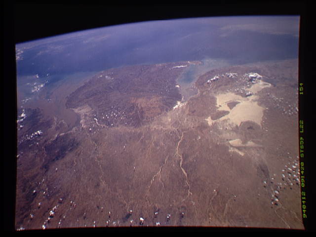
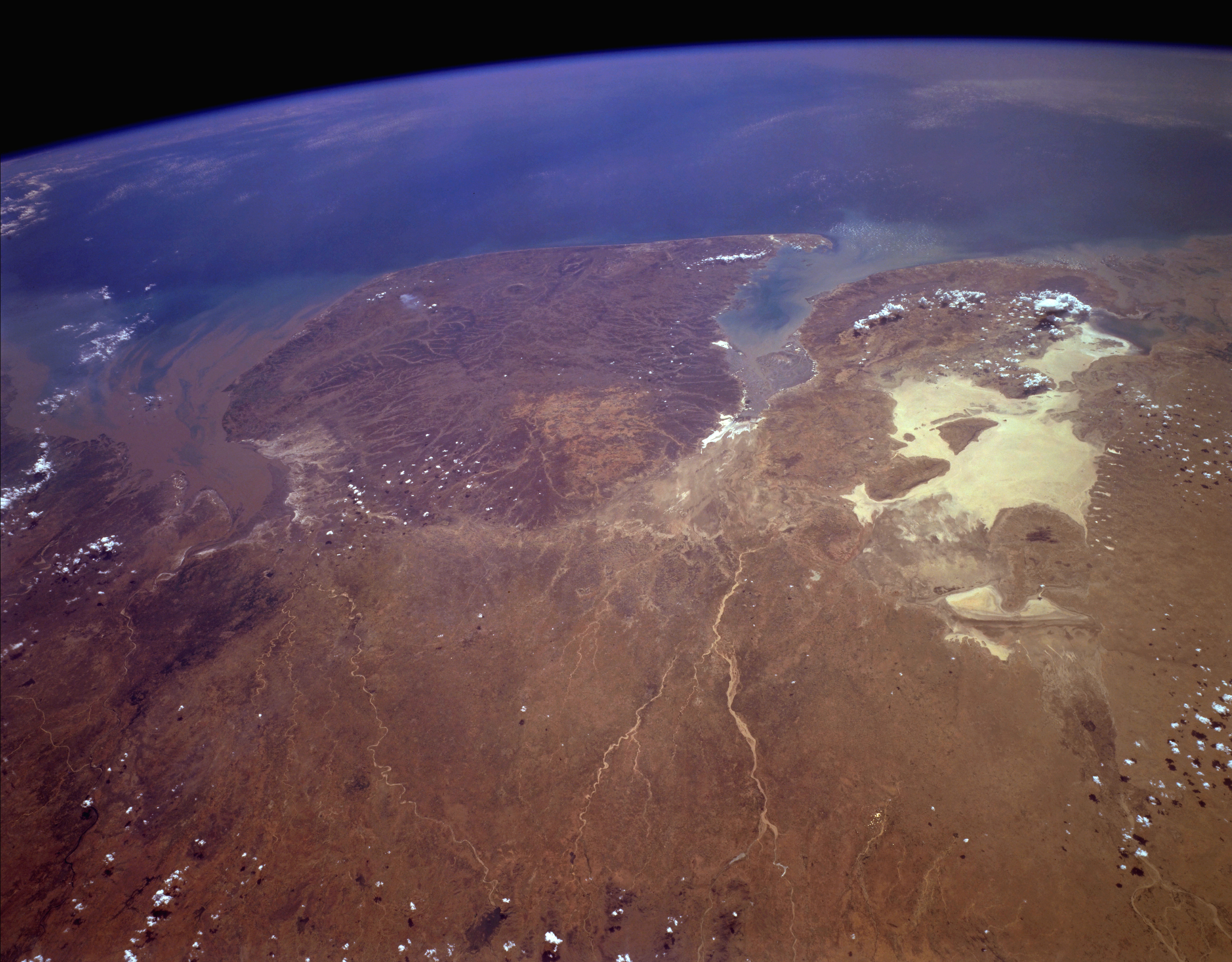
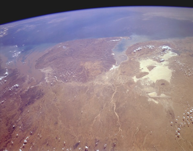
Image Caption: STS059-L22-154 West-Central India April 1994
The Kathiawar Peninsula, the sizable promontory jutting into the Arabian Sea, is bounded on the southeast by the sediment-laden Gulf of Khambhat and on the northwest by the Gulf of Kutch. The highly reflective area north of the Gulf of Kutch is the Great Rann of Kutch, a very large salt marsh that forms the border between India and southeastern Pakistan. The Great Rann of Kutch and the Kathiawar Peninsula comprise more than 75 percent of the west-central state of Gujarat. The Kathiawar Peninsula is relatively level terrain with a slightly elevated central tableland from which all rivers arise and radiate outward. Cotton is the area's leading crop. The overall brown appearance in this springtime photograph confirms that the region deserves the tropical savanna climate classification and that the area is almost totally dependent on the monsoons for rainfall for the entire year. The Kathiawar Peninsula is also the home of the endangered Indian lion.
The Kathiawar Peninsula, the sizable promontory jutting into the Arabian Sea, is bounded on the southeast by the sediment-laden Gulf of Khambhat and on the northwest by the Gulf of Kutch. The highly reflective area north of the Gulf of Kutch is the Great Rann of Kutch, a very large salt marsh that forms the border between India and southeastern Pakistan. The Great Rann of Kutch and the Kathiawar Peninsula comprise more than 75 percent of the west-central state of Gujarat. The Kathiawar Peninsula is relatively level terrain with a slightly elevated central tableland from which all rivers arise and radiate outward. Cotton is the area's leading crop. The overall brown appearance in this springtime photograph confirms that the region deserves the tropical savanna climate classification and that the area is almost totally dependent on the monsoons for rainfall for the entire year. The Kathiawar Peninsula is also the home of the endangered Indian lion.
