STS059-L22-140
| NASA Photo ID | STS059-L22-140 |
| Focal Length | 90mm |
| Date taken | 1994.04.12 |
| Time taken | 09:08:46 GMT |

Cloud masks available for this image:
Spacecraft nadir point: 42.1° N, 56.5° E
Photo center point: 44.0° N, 59.0° E
Photo center point by machine learning:
Photo center point: 44.0° N, 59.0° E
Photo center point by machine learning:
Nadir to Photo Center: Northeast
Spacecraft Altitude: 119 nautical miles (220km)
Camera: | Linhof |
Focal Length: | 90mm |
Camera Tilt: | Low Oblique |
Format: | 5046: Kodak, natural color positive, Lumiere 100/5046, ASA 100, standard base |
Film Exposure: | Normal |
| Additional Information | |
| Width | Height | Annotated | Cropped | Purpose | Links |
|---|---|---|---|---|---|
| 5121 pixels | 4022 pixels | No | No | Earth From Space collection | Download Image |
| 640 pixels | 502 pixels | No | No | Earth From Space collection | Download Image |
| 640 pixels | 480 pixels | No | No | ISD 1 | Download Image |
Download Packaged File
Download a Google Earth KML for this Image
View photo footprint information
Download a GeoTIFF for this photo
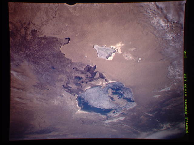
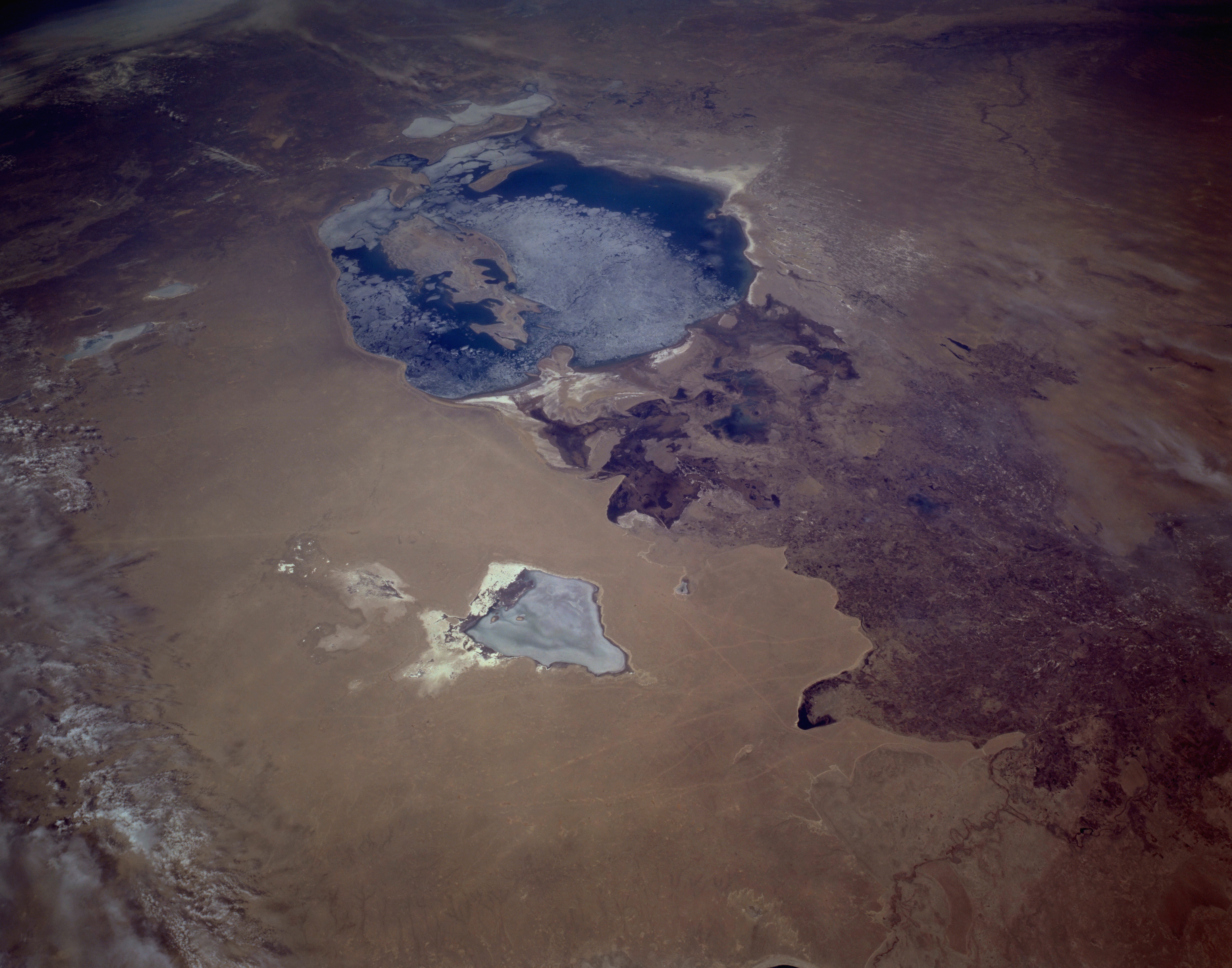
Image Caption: STS059-L22-140 Aral Sea, Kazakhstan and Uzbekistan April 1994
Parts of three independent republics (Kazakhstan, Uzbekistan, and Turkmenistan), former members of the Soviet Union, are shown in this synoptic, low-oblique, northeast-looking photograph of the Aral Sea. One feature of this springtime photograph is the Amudar'ya River that flows northward into the southern end of the partially ice-covered Aral Sea. The river's multibraided stream channels, ditches, and canals form a maze of interconnected waterways throughout the extensive delta south of the sea. A major concentration of cultivated, irrigated agricultural features (browns and tans) are evident south of the Amudar'ya delta. Cotton is the primary agricultural product on both sides of the Uzbekistan-Turkmenistan border. Because this entire region is classified as a desert, proper water management is a key concern in planning. As in other desert regions of the world, loss of moisture through evaporation produces a dry, nonvegetated environment. This sea, which straddles the Kazakhstan-Uzbekistan border, has lost more than one-half of its water surface since 1960 because streams that previously fed the sea have been diverted for irrigation. Other near-vertical photographs show more detail of the rapidly receding water level of the Aral Sea.
View northeastward across Uzbekastan to the partly-ice-covered Aral Sea and Kazakhstan. The irrigated fan-delta of the Amu Darya extends from the right side of the photograph to end in extensive salt flats at the south end of the sea. The Aral was the fourth-largest inland sea or lake in the world, until diversion and over-use of the river water for irrigation led, in this arid climate, to the sea's decline.
