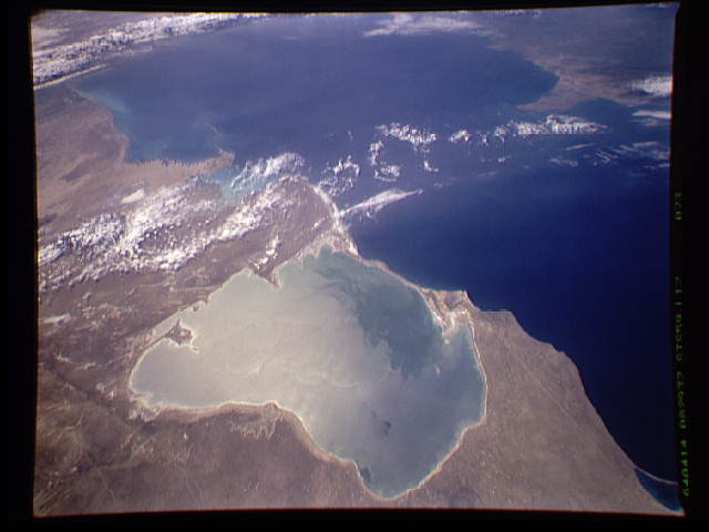
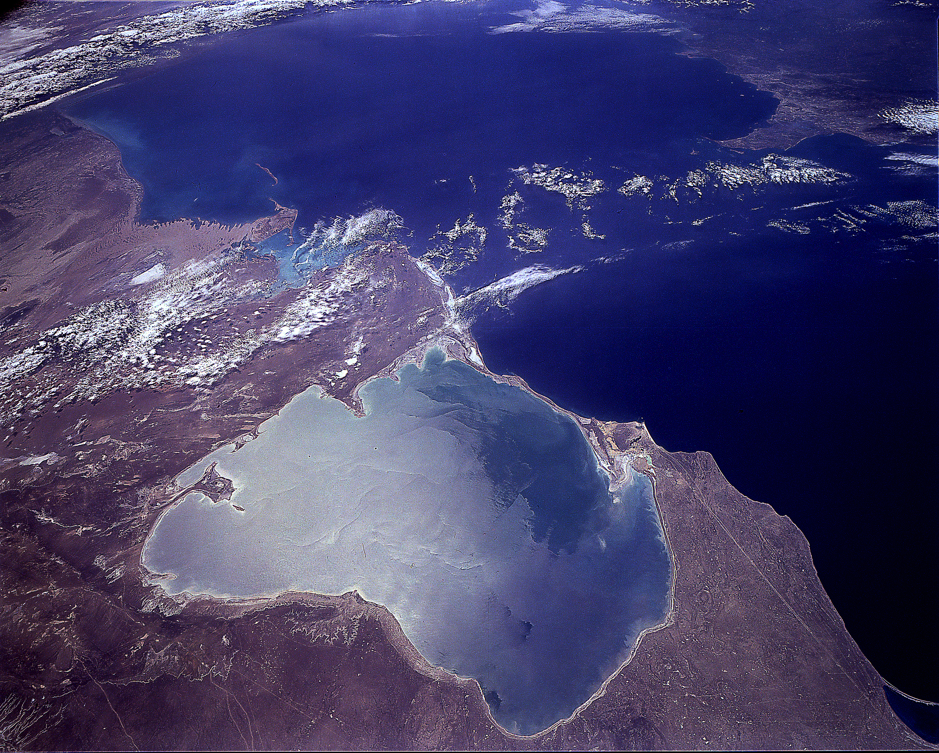
STS059-L17-73
| NASA Photo ID | STS059-L17-73 |
| Focal Length | 90mm |
| Date taken | 1994.04.14 |
| Time taken | 08:29:37 GMT |
Cloud masks available for this image:
Spacecraft nadir point: 42.7° N, 54.1° E
Photo center point: 41.0° N, 53.0° E
Photo center point by machine learning:
Photo center point: 41.0° N, 53.0° E
Photo center point by machine learning:
Nadir to Photo Center: Southwest
Spacecraft Altitude: 116 nautical miles (215km)
Country or Geographic Name: | TURKMENISTAN |
Features: | KARA-BOGAZ-GOL B, SUNGLINT |
| Features Found Using Machine Learning: | |
Cloud Cover Percentage: | 10 (1-10)% |
Sun Elevation Angle: | 57° |
Sun Azimuth: | 182° |
Camera: | Linhof |
Focal Length: | 90mm |
Camera Tilt: | 46 degrees |
Format: | 5046: Kodak, natural color positive, Lumiere 100/5046, ASA 100, standard base |
Film Exposure: | Normal |
| Additional Information | |
| Width | Height | Annotated | Cropped | Purpose | Links |
|---|---|---|---|---|---|
| 640 pixels | 480 pixels | No | No | ISD 1 | Download Image |
| 1883 pixels | 1510 pixels | Shuttle-Mir Book | Download Image |
Download Packaged File
Download a Google Earth KML for this Image
View photo footprint information
Download a GeoTIFF for this photo
Image Caption: none
