STS059-L16-56
| NASA Photo ID | STS059-L16-56 |
| Focal Length | 250mm |
| Date taken | 1994.04.14 |
| Time taken | 09:59:08 GMT |
Cloud masks available for this image:
Spacecraft nadir point: 40.6° N, 34.3° E
Photo center point: 39.0° N, 33.0° E
Photo center point by machine learning:
Photo center point: 39.0° N, 33.0° E
Photo center point by machine learning:
Nadir to Photo Center: Southwest
Spacecraft Altitude: 116 nautical miles (215km)
Country or Geographic Name: | TURKEY |
Features: | TUZ LAKE, AGRICULTURE, RIVERS |
| Features Found Using Machine Learning: | |
Cloud Cover Percentage: | 5 (1-10)% |
Sun Elevation Angle: | 59° |
Sun Azimuth: | 188° |
Camera: | Linhof |
Focal Length: | 250mm |
Camera Tilt: | 47 degrees |
Format: | 5046: Kodak, natural color positive, Lumiere 100/5046, ASA 100, standard base |
Film Exposure: | Normal |
| Additional Information | |
| Width | Height | Annotated | Cropped | Purpose | Links |
|---|---|---|---|---|---|
| 5141 pixels | 4011 pixels | No | No | Earth From Space collection | Download Image |
| 639 pixels | 499 pixels | No | No | Earth From Space collection | Download Image |
| 640 pixels | 480 pixels | No | No | ISD 1 | Download Image |
Download Packaged File
Download a Google Earth KML for this Image
View photo footprint information
Download a GeoTIFF for this photo
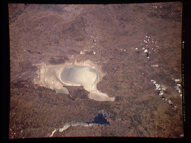
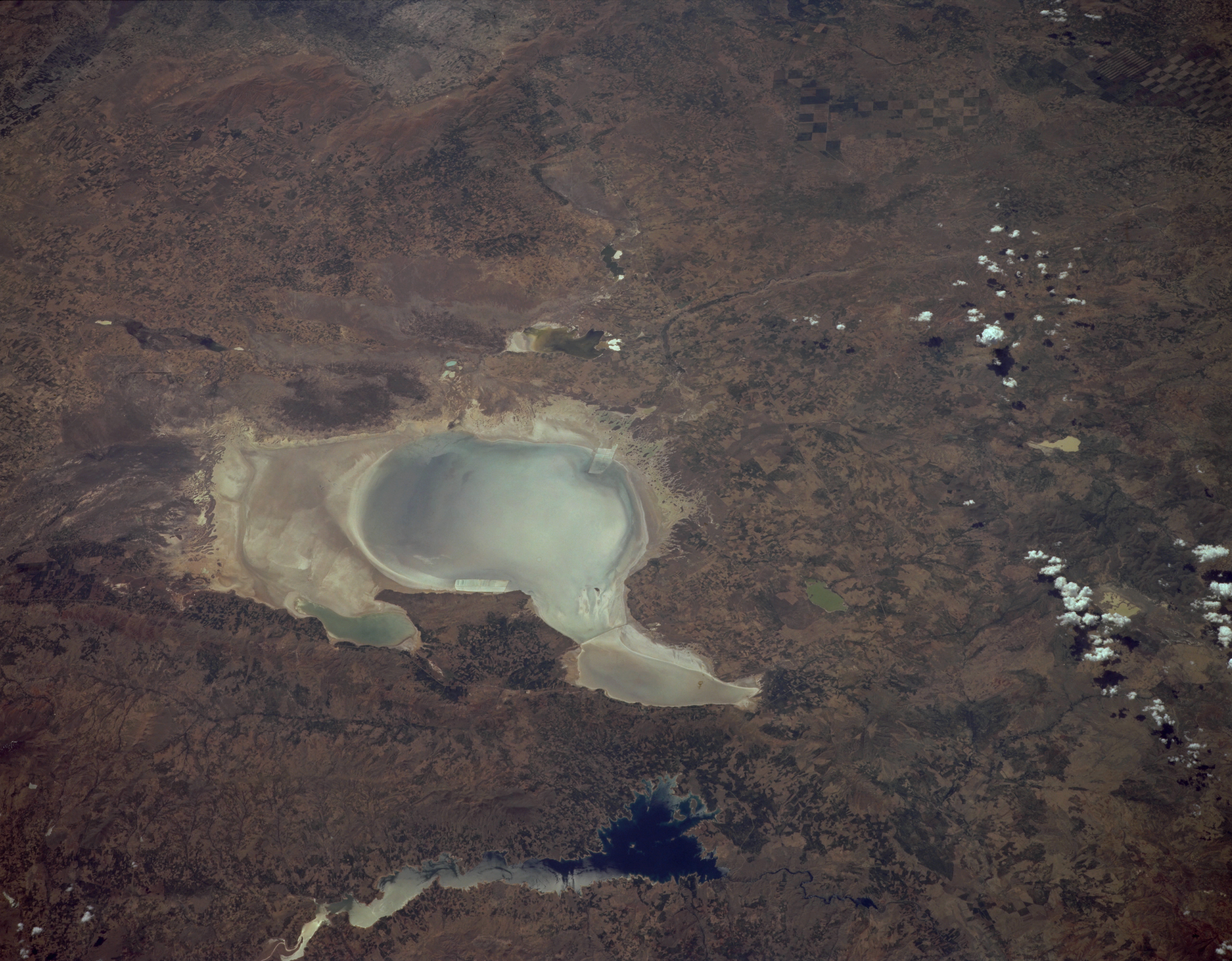
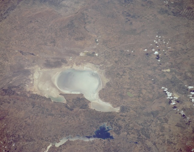
Image Caption: STS059-L16-056 Tuz Lake, Turkey April 1994
Shallow, saline Tuz Lake, located in a basin of the Konya Plain of central Turkey, is shown in this low-oblique, southwest-looking photograph. Tuz Lake covers 625 square miles (1620 square kilometers) and is nearly 2960 feet (900 meters) above sea level. A few streams feed the lake, but it has no outlet. The water level in the lake varies with precipitation received from season to season and year to year. Salt is mined from the lake's shores. The Konya Plain is a rich agricultural and livestock raising region. Numerous field patterns surround the lake. Smaller lakes can be seen north and southwest of Tuz Lake. The small Karasinir Mountain Range separates Tuz Lake and the Hirfanli Reservoir (dark blue water) of the Kizil River (northeast of the lake).
Shallow, saline Tuz Lake, located in a basin of the Konya Plain of central Turkey, is shown in this low-oblique, southwest-looking photograph. Tuz Lake covers 625 square miles (1620 square kilometers) and is nearly 2960 feet (900 meters) above sea level. A few streams feed the lake, but it has no outlet. The water level in the lake varies with precipitation received from season to season and year to year. Salt is mined from the lake's shores. The Konya Plain is a rich agricultural and livestock raising region. Numerous field patterns surround the lake. Smaller lakes can be seen north and southwest of Tuz Lake. The small Karasinir Mountain Range separates Tuz Lake and the Hirfanli Reservoir (dark blue water) of the Kizil River (northeast of the lake).
