STS059-L15-7
| NASA Photo ID | STS059-L15-7 |
| Focal Length | 90mm |
| Date taken | 1994.04.15 |
| Time taken | 18:32:30 GMT |
Cloud masks available for this image:
Spacecraft nadir point: 36.2° N, 96.6° W
Photo center point: 35.5° N, 97.5° W
Photo center point by machine learning:
Photo center point: 35.5° N, 97.5° W
Photo center point by machine learning:
Nadir to Photo Center: Southwest
Spacecraft Altitude: 114 nautical miles (211km)
Country or Geographic Name: | USA-OKLAHOMA |
Features: | OKLAHOMA CITY, CANADIAN R |
| Features Found Using Machine Learning: | |
Cloud Cover Percentage: | 5 (1-10)% |
Sun Elevation Angle: | 64° |
Sun Azimuth: | 183° |
Camera: | Linhof |
Focal Length: | 90mm |
Camera Tilt: | Near Vertical |
Format: | 5046: Kodak, natural color positive, Lumiere 100/5046, ASA 100, standard base |
Film Exposure: | Normal |
| Additional Information | |
| Width | Height | Annotated | Cropped | Purpose | Links |
|---|---|---|---|---|---|
| 5056 pixels | 3968 pixels | No | No | Earth From Space collection | Download Image |
| 640 pixels | 502 pixels | No | No | Earth From Space collection | Download Image |
| 640 pixels | 480 pixels | No | No | ISD 1 | Download Image |
Download Packaged File
Download a Google Earth KML for this Image
View photo footprint information
Download a GeoTIFF for this photo
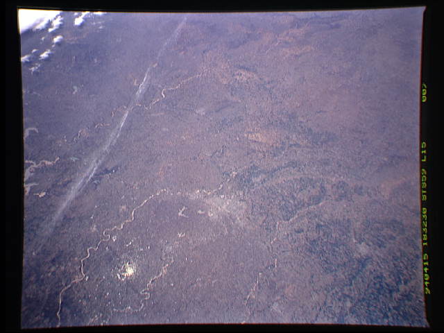
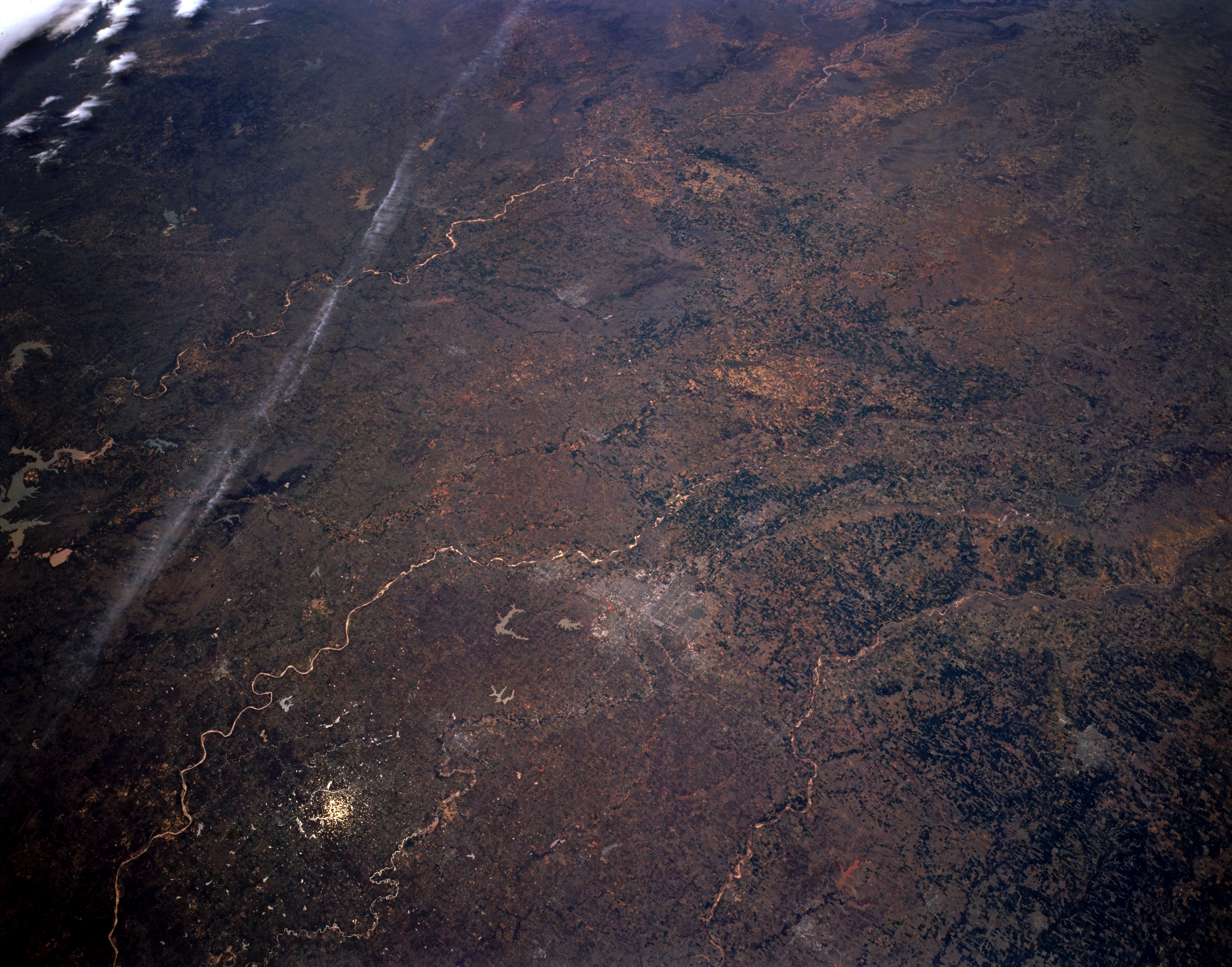
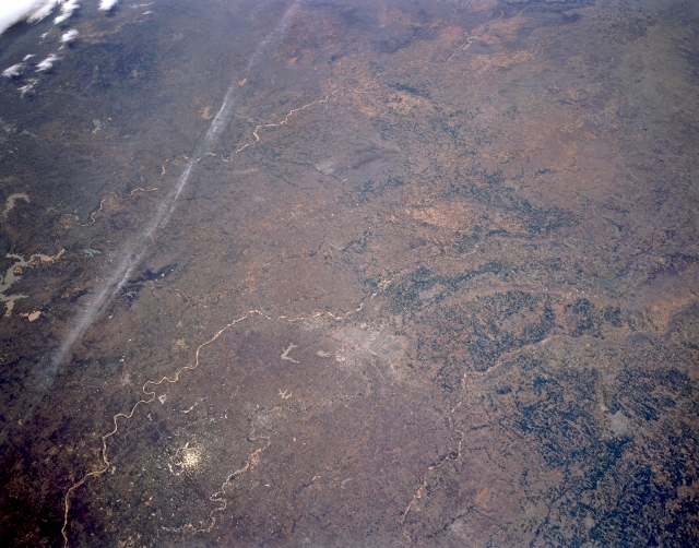
Image Caption: STS059-L15-007 South-Central and Southwestern, Oklahoma, U.S.A. April 1994
Visible in this panoramic, southwest-looking, low-oblique photograph of south-central and southwestern Oklahoma are Oklahoma City (just below center); the east-flowing Canadian River to its south; and still farther south, portions of Lake Texoma and, extending west from the lake, the Red River that separates Oklahoma and Texas. A small portion of the Caprock Escarpment in the Texas panhandle is barely discernible (upper center). The Cimarron River is apparent flowing southeastward to just north of Oklahoma City and arcing northeastward toward Tulsa and the Arkansas River.
Visible in this panoramic, southwest-looking, low-oblique photograph of south-central and southwestern Oklahoma are Oklahoma City (just below center); the east-flowing Canadian River to its south; and still farther south, portions of Lake Texoma and, extending west from the lake, the Red River that separates Oklahoma and Texas. A small portion of the Caprock Escarpment in the Texas panhandle is barely discernible (upper center). The Cimarron River is apparent flowing southeastward to just north of Oklahoma City and arcing northeastward toward Tulsa and the Arkansas River.
