STS059-L15-32
| NASA Photo ID | STS059-L15-32 |
| Focal Length | 90mm |
| Date taken | 1994.04.15 |
| Time taken | 20:00:15 GMT |
Cloud masks available for this image:
Spacecraft nadir point: 39.0° N, 122.2° W
Photo center point: 40.0° N, 121.0° W
Photo center point by machine learning:
Photo center point: 40.0° N, 121.0° W
Photo center point by machine learning:
Nadir to Photo Center: Northeast
Spacecraft Altitude: 114 nautical miles (211km)
Country or Geographic Name: | USA-CALIFORNIA |
Features: | SACRAMENTO V, CARSON SINK |
| Features Found Using Machine Learning: | |
Cloud Cover Percentage: | 0 (no clouds present) |
Sun Elevation Angle: | 61° |
Sun Azimuth: | 176° |
Camera: | Linhof |
Focal Length: | 90mm |
Camera Tilt: | 39 degrees |
Format: | 5046: Kodak, natural color positive, Lumiere 100/5046, ASA 100, standard base |
Film Exposure: | Normal |
| Additional Information | |
| Width | Height | Annotated | Cropped | Purpose | Links |
|---|---|---|---|---|---|
| 5088 pixels | 3968 pixels | No | No | Earth From Space collection | Download Image |
| 640 pixels | 499 pixels | No | No | Earth From Space collection | Download Image |
| 640 pixels | 480 pixels | No | No | ISD 1 | Download Image |
Download Packaged File
Download a Google Earth KML for this Image
View photo footprint information
Download a GeoTIFF for this photo
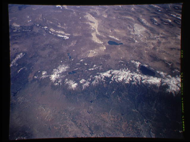
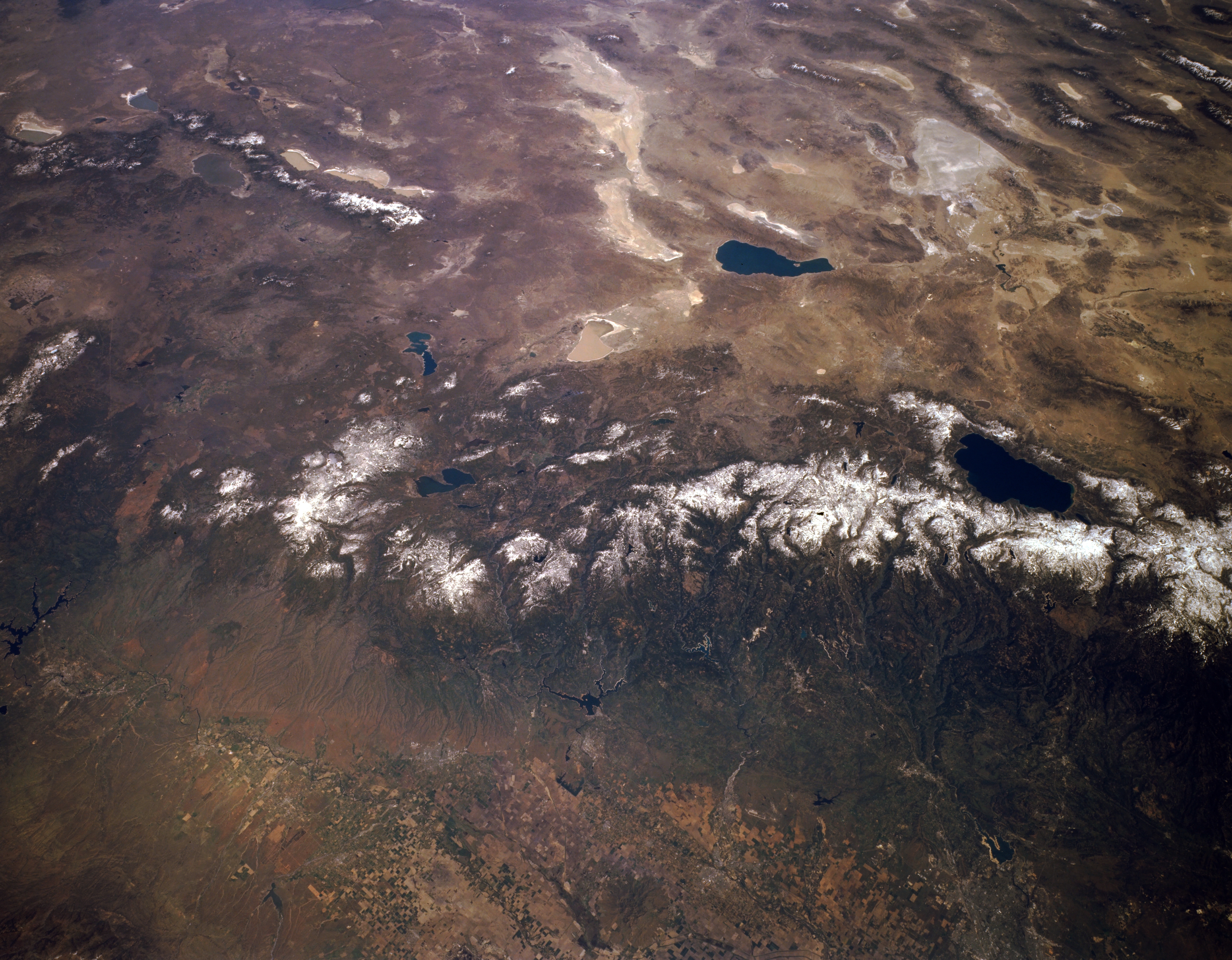
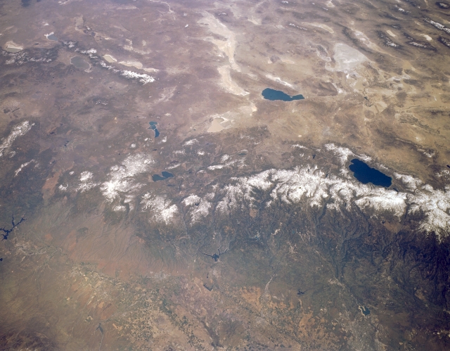
Image Caption: STS059-L15-032 Sierra Nevada Mountains, California and Nevada, U.S.A. April 1994
The snow-capped northern Sierra Nevadas are featured in this low-oblique, northeast-looking, synoptic photograph. The Sierra Nevadas, the largest tilted fault block structure in the United States, provide snowmelt to the Sacramento Valley for irrigation. Visible are dark blue Lake Tahoe, a deep basin within the Sierra Nevadas, near the center right and light blue Pyramid Lake, named for the large pyramidal rocks surrounding it, to the north and east of Lake Tahoe. Viewing from Pyramid Lake are the north-south-trending Warner Mountains to the north-northwest; the dry, alkaline lakes of Smoke Creek Desert and Black Rock Desert to the north; and white, marshy Carson Sink to the east.
The snow-capped northern Sierra Nevadas are featured in this low-oblique, northeast-looking, synoptic photograph. The Sierra Nevadas, the largest tilted fault block structure in the United States, provide snowmelt to the Sacramento Valley for irrigation. Visible are dark blue Lake Tahoe, a deep basin within the Sierra Nevadas, near the center right and light blue Pyramid Lake, named for the large pyramidal rocks surrounding it, to the north and east of Lake Tahoe. Viewing from Pyramid Lake are the north-south-trending Warner Mountains to the north-northwest; the dry, alkaline lakes of Smoke Creek Desert and Black Rock Desert to the north; and white, marshy Carson Sink to the east.
