STS059-L15-1
| NASA Photo ID | STS059-L15-1 |
| Focal Length | 90mm |
| Date taken | 1994.04.15 |
| Time taken | 18:29:23 GMT |
Cloud masks available for this image:
Spacecraft nadir point: 45.0° N, 107.8° W
Photo center point: 43.0° N, 108.5° W
Photo center point by machine learning:
Photo center point: 43.0° N, 108.5° W
Photo center point by machine learning:
Nadir to Photo Center: South
Spacecraft Altitude: 114 nautical miles (211km)
Country or Geographic Name: | USA-WYOMING |
Features: | ABSAROKA RA, BIG HORN R. |
| Features Found Using Machine Learning: | |
Cloud Cover Percentage: | 5 (1-10)% |
Sun Elevation Angle: | 54° |
Sun Azimuth: | 162° |
Camera: | Linhof |
Focal Length: | 90mm |
Camera Tilt: | 48 degrees |
Format: | 5046: Kodak, natural color positive, Lumiere 100/5046, ASA 100, standard base |
Film Exposure: | Normal |
| Additional Information | |
| Width | Height | Annotated | Cropped | Purpose | Links |
|---|---|---|---|---|---|
| 5056 pixels | 3968 pixels | No | No | Earth From Space collection | Download Image |
| 640 pixels | 502 pixels | No | No | Earth From Space collection | Download Image |
| 640 pixels | 480 pixels | No | No | ISD 1 | Download Image |
Download Packaged File
Download a Google Earth KML for this Image
View photo footprint information
Download a GeoTIFF for this photo
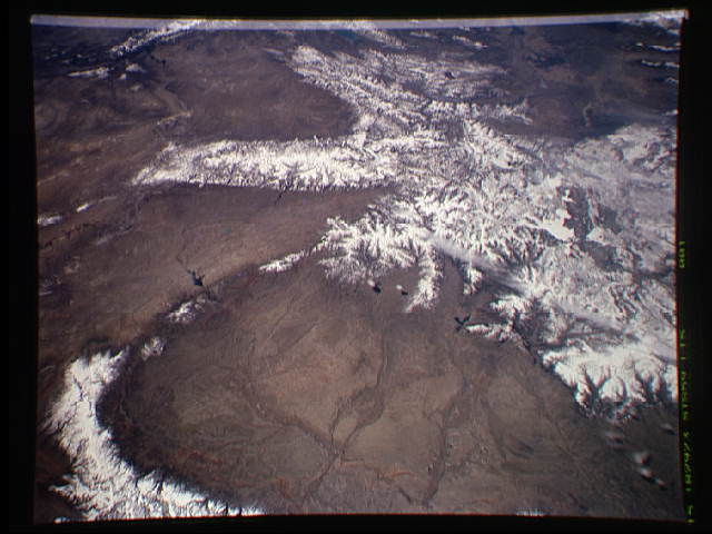
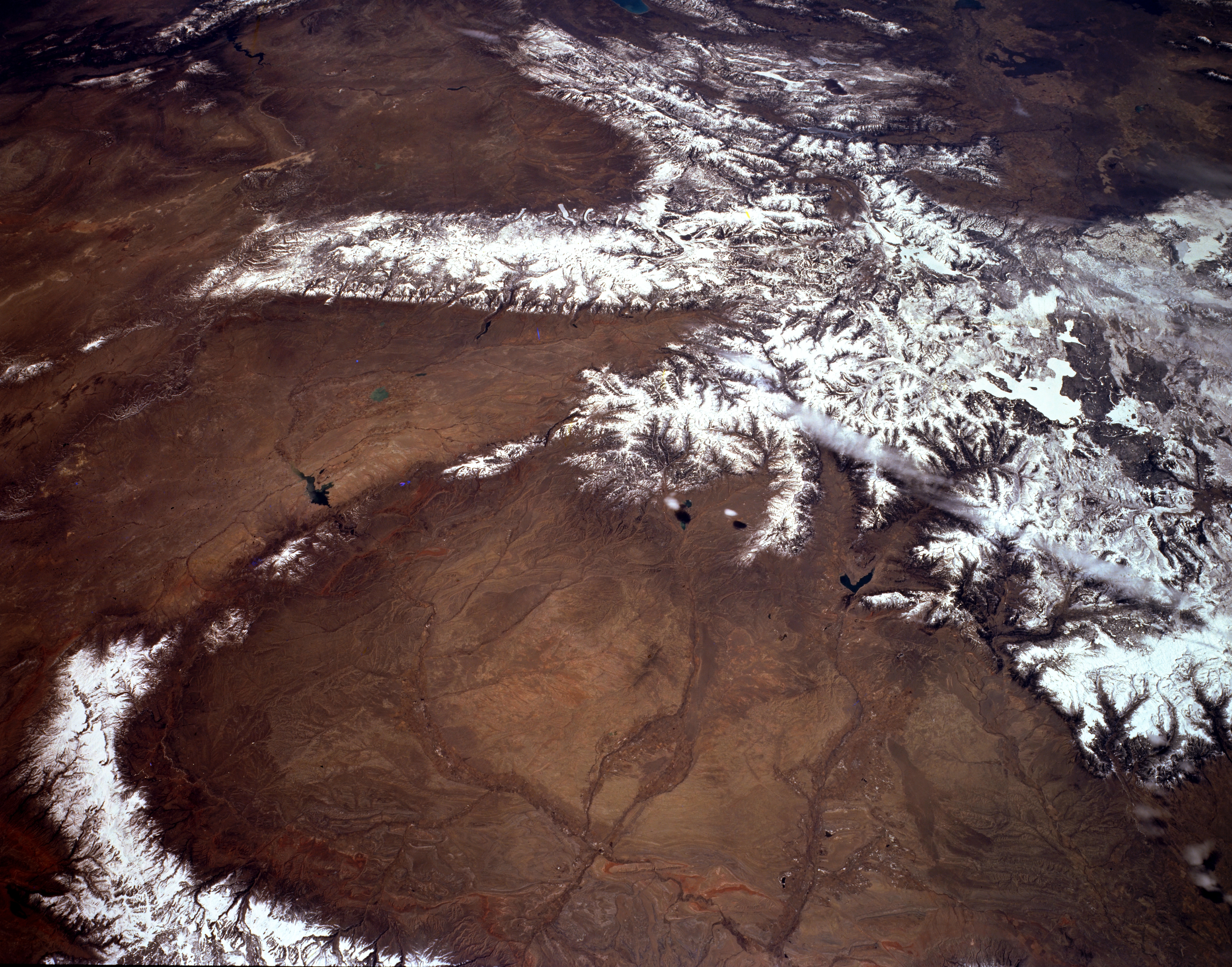
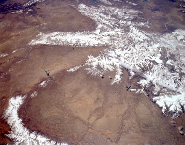
Image Caption: STS059-L15-001 Bighorn Basin and Yellowstone, Wyoming, U.S.A. April 1994
The snow-covered highlands of Yellowstone and the irrigated agricultural lands of the central Bighorn Basin are featured in this south-southwest-looking, low-oblique, panoramic photograph. Large, oval Bighorn Basin spans 10 000 square miles (25 900 square kilometers), is 120 miles (193 kilometers) long and 60 miles (97 kilometers) wide, and is surrounded by forested mountains that rise more than 13 000 feet (3965 meters) to perpetually snowcapped summits except on the north where the basin merges with the Crazy Mountain Basin of south-central Montana (not visible). The center of the basin is low, flat, and dry. To the south lies the Great Divide Basin (left side). Viewing clockwise from ice-covered Yellowstone Lake (barely discernible) are the Absaroka Range; the Bighorn Mountains (lower left); the Bridger Mountains and Owl Creek Mountains, which extend westward from the Bighorn Mountains; the Wind River Range (north of the Great Divide Basin); the Wyoming and Salt River Ranges (top center); and the Snake River Plain of eastern Idaho (top right). The Bighorn, Shoshone, Greybull, and Clarks Fork Rivers carry runoff from the Absaroka Mountains across the Bighorn Basin and eventually empty into the Yellowstone River (not visible) in southern Montana.
The snow-covered highlands of Yellowstone and the irrigated agricultural lands of the central Bighorn Basin are featured in this south-southwest-looking, low-oblique, panoramic photograph. Large, oval Bighorn Basin spans 10 000 square miles (25 900 square kilometers), is 120 miles (193 kilometers) long and 60 miles (97 kilometers) wide, and is surrounded by forested mountains that rise more than 13 000 feet (3965 meters) to perpetually snowcapped summits except on the north where the basin merges with the Crazy Mountain Basin of south-central Montana (not visible). The center of the basin is low, flat, and dry. To the south lies the Great Divide Basin (left side). Viewing clockwise from ice-covered Yellowstone Lake (barely discernible) are the Absaroka Range; the Bighorn Mountains (lower left); the Bridger Mountains and Owl Creek Mountains, which extend westward from the Bighorn Mountains; the Wind River Range (north of the Great Divide Basin); the Wyoming and Salt River Ranges (top center); and the Snake River Plain of eastern Idaho (top right). The Bighorn, Shoshone, Greybull, and Clarks Fork Rivers carry runoff from the Absaroka Mountains across the Bighorn Basin and eventually empty into the Yellowstone River (not visible) in southern Montana.
