STS059-L08-99
| NASA Photo ID | STS059-L08-99 |
| Focal Length | 90mm |
| Date taken | 1994.04.11 |
| Time taken | 18:17:22 GMT |
Cloud masks available for this image:
Spacecraft nadir point: 49.8° N, 91.0° W
Photo center point: 47.5° N, 92.5° W
Photo center point by machine learning:
Photo center point: 47.5° N, 92.5° W
Photo center point by machine learning:
Nadir to Photo Center: Southwest
Spacecraft Altitude: 118 nautical miles (219km)
Country or Geographic Name: | USA-MINNESOTA |
Features: | LAKES, AGRICULTURE, RIVERS |
| Features Found Using Machine Learning: | |
Cloud Cover Percentage: | 0 (no clouds present) |
Sun Elevation Angle: | 49° |
Sun Azimuth: | 185° |
Camera: | Linhof |
Focal Length: | 90mm |
Camera Tilt: | 54 degrees |
Format: | 5048: Kodak, natural color positive, Lumiere 100x/5048, ASA 100x, standard base |
Film Exposure: | Normal |
| Additional Information | |
| Width | Height | Annotated | Cropped | Purpose | Links |
|---|---|---|---|---|---|
| 5056 pixels | 3968 pixels | No | No | Earth From Space collection | Download Image |
| 640 pixels | 502 pixels | No | No | Earth From Space collection | Download Image |
| 640 pixels | 480 pixels | No | No | ISD 1 | Download Image |
Download Packaged File
Download a Google Earth KML for this Image
View photo footprint information
Download a GeoTIFF for this photo
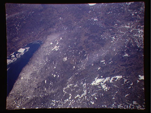
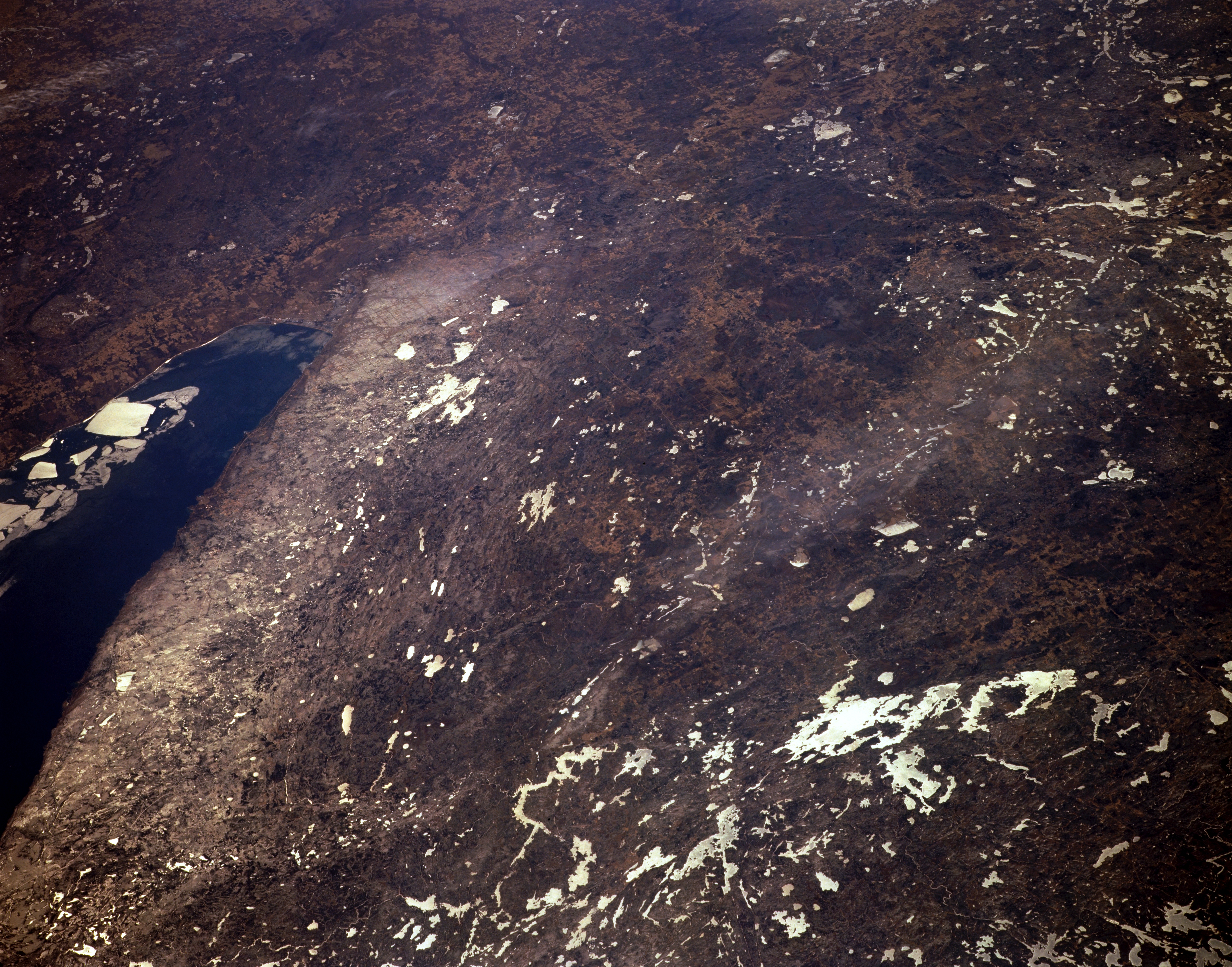
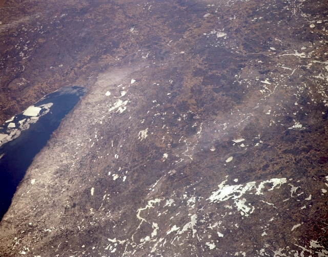
Image Caption: STS059-L08-099 Mesabi and Vermilion Ranges, Minnesota, U.S.A. April 1994
The low hills of the Mesabi and Vermilion Ranges, both rich in iron ore deposits, are discernible in the center and right center of this south-looking, low-oblique photograph. The ores in the Mesabi, found in a belt 110 miles (175 kilometers) long and from 1 to 3 miles (1 to 5 kilometers) wide between Grand Rapids and Babbitt, lie in horizontal layers near the surface and are mined by the open-pit method. In Superior National Forest north of the Mesabi Range, numerous ice-covered lakes appear, the largest of which is Vermilion Lake [35 miles (56 kilometers) long]. Also discernible are blue Lake Superior and the Northern Highlands of northwest Wisconsin (upper left).
The low hills of the Mesabi and Vermilion Ranges, both rich in iron ore deposits, are discernible in the center and right center of this south-looking, low-oblique photograph. The ores in the Mesabi, found in a belt 110 miles (175 kilometers) long and from 1 to 3 miles (1 to 5 kilometers) wide between Grand Rapids and Babbitt, lie in horizontal layers near the surface and are mined by the open-pit method. In Superior National Forest north of the Mesabi Range, numerous ice-covered lakes appear, the largest of which is Vermilion Lake [35 miles (56 kilometers) long]. Also discernible are blue Lake Superior and the Northern Highlands of northwest Wisconsin (upper left).
