STS059-L08-95
| NASA Photo ID | STS059-L08-95 |
| Focal Length | 90mm |
| Date taken | 1994.04.11 |
| Time taken | 18:16:42 GMT |
Cloud masks available for this image:
Spacecraft nadir point: 51.2° N, 94.5° W
Photo center point: 48.5° N, 96.0° W
Photo center point by machine learning:
Photo center point: 48.5° N, 96.0° W
Photo center point by machine learning:
Nadir to Photo Center: Southwest
Spacecraft Altitude: 118 nautical miles (219km)
Country or Geographic Name: | USA-MINNESOTA |
Features: | LAKE OF THE WOODS, AGRICULTURE |
| Features Found Using Machine Learning: | |
Cloud Cover Percentage: | 0 (no clouds present) |
Sun Elevation Angle: | 47° |
Sun Azimuth: | 179° |
Camera: | Linhof |
Focal Length: | 90mm |
Camera Tilt: | Low Oblique |
Format: | 5048: Kodak, natural color positive, Lumiere 100x/5048, ASA 100x, standard base |
Film Exposure: | Normal |
| Additional Information | |
| Width | Height | Annotated | Cropped | Purpose | Links |
|---|---|---|---|---|---|
| 5056 pixels | 3968 pixels | No | No | Earth From Space collection | Download Image |
| 640 pixels | 502 pixels | No | No | Earth From Space collection | Download Image |
| 640 pixels | 480 pixels | No | No | ISD 1 | Download Image |
Download Packaged File
Download a Google Earth KML for this Image
View photo footprint information
Download a GeoTIFF for this photo
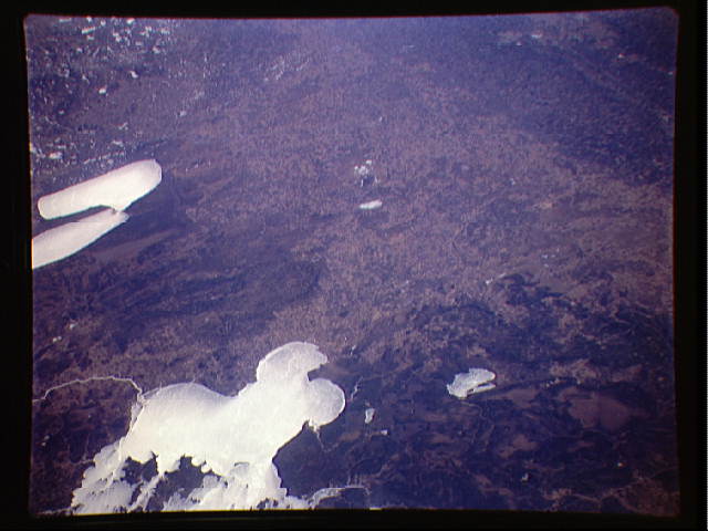
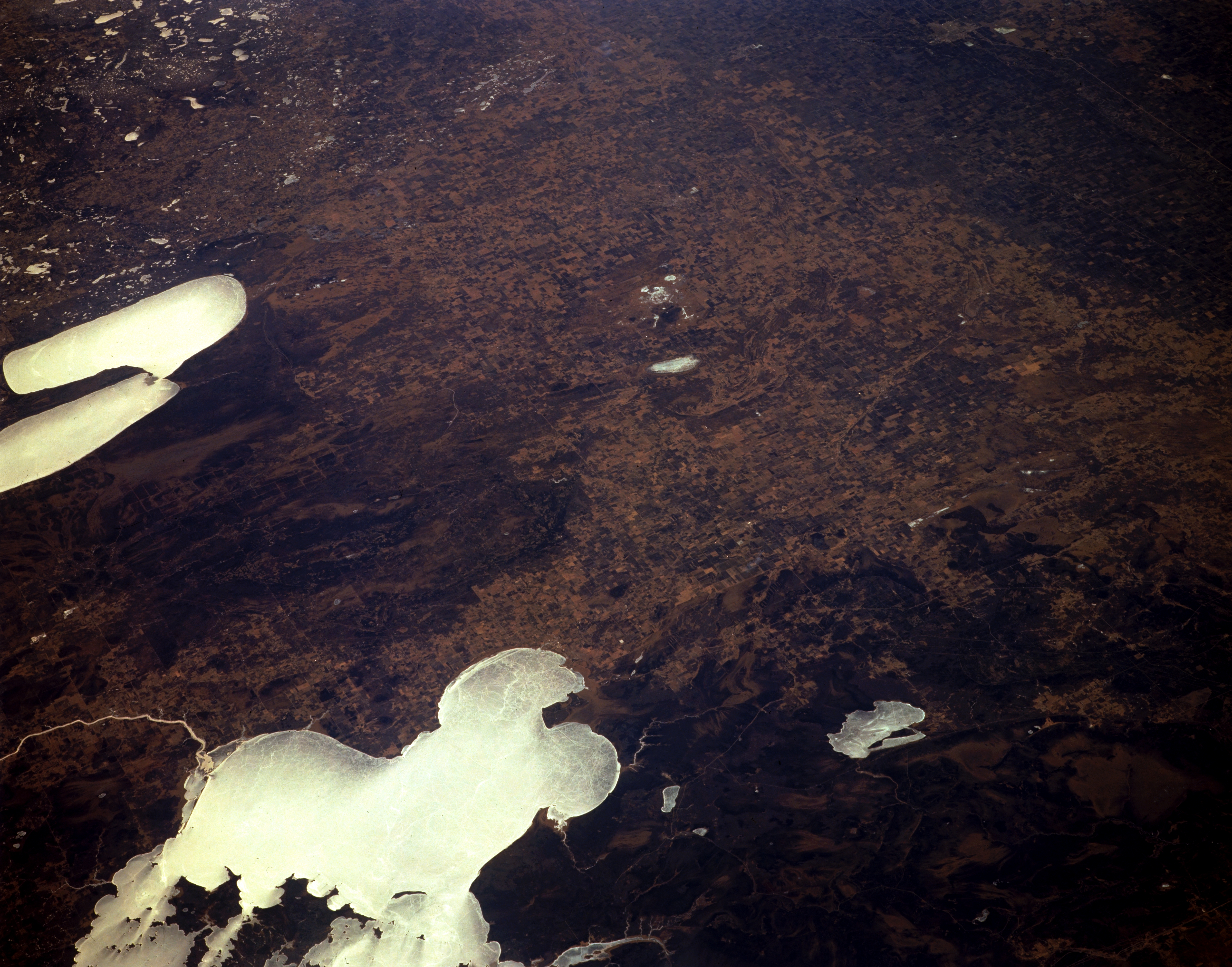
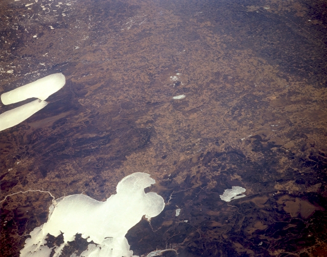
Image Caption: STS059-L08-095 Lake of the Woods and Red Lake, Minnesota, U.S.A. April 1994
Ice- and snow-covered Lake of the Woods and Red Lake are featured in this south-southwest-looking photograph. Lake of the Woods, located in the pine forest region of northwestern Minnesota, southeastern Manitoba, and southwestern Ontario, covers 1485 square miles (3846 square kilometers) and is more than 70 miles (115 kilometers) long. A remnant of glacial Lake Agassiz, the lake has an irregular shoreline and approximately 14 000 islands. Red Lake, divided into upper and lower sections, is 38 miles (61 kilometers) long and covers 451 square miles (1168 square kilometers). Abundant in fish and game, Lake of the Woods and Red Lake are resort areas. The Red River, which separates Minnesota and North Dakota, and Grand Forks are discernible near the upper right of the photograph.
Ice- and snow-covered Lake of the Woods and Red Lake are featured in this south-southwest-looking photograph. Lake of the Woods, located in the pine forest region of northwestern Minnesota, southeastern Manitoba, and southwestern Ontario, covers 1485 square miles (3846 square kilometers) and is more than 70 miles (115 kilometers) long. A remnant of glacial Lake Agassiz, the lake has an irregular shoreline and approximately 14 000 islands. Red Lake, divided into upper and lower sections, is 38 miles (61 kilometers) long and covers 451 square miles (1168 square kilometers). Abundant in fish and game, Lake of the Woods and Red Lake are resort areas. The Red River, which separates Minnesota and North Dakota, and Grand Forks are discernible near the upper right of the photograph.
