STS059-L06-77

| NASA Photo ID | STS059-L06-77 |
| Focal Length | 90mm |
| Date taken | 1994.04.15 |
| Time taken | 09:40:16 GMT |

Cloud masks available for this image:
Spacecraft nadir point: 36.2° N, 38.6° E
Photo center point: 35.0° N, 37.5° E
Photo center point by machine learning:
Photo center point: 35.0° N, 37.5° E
Photo center point by machine learning:
Nadir to Photo Center: Southwest
Spacecraft Altitude: 114 nautical miles (211km)
Country or Geographic Name: | SYRIA |
Features: | MTS, RES., AGRICULTURE, DESERT |
| Features Found Using Machine Learning: | |
Cloud Cover Percentage: | 5 (1-10)% |
Sun Elevation Angle: | 63° |
Sun Azimuth: | 188° |
Camera: | Linhof |
Focal Length: | 90mm |
Camera Tilt: | 41 degrees |
Format: | 5046: Kodak, natural color positive, Lumiere 100/5046, ASA 100, standard base |
Film Exposure: | Normal |
| Additional Information | |
| Width | Height | Annotated | Cropped | Purpose | Links |
|---|---|---|---|---|---|
| 5099 pixels | 4052 pixels | No | No | Earth From Space collection | Download Image |
| 639 pixels | 508 pixels | No | No | Earth From Space collection | Download Image |
| 640 pixels | 480 pixels | No | No | ISD 1 | Download Image |
Download Packaged File
Download a Google Earth KML for this Image
View photo footprint information
Download a GeoTIFF for this photo
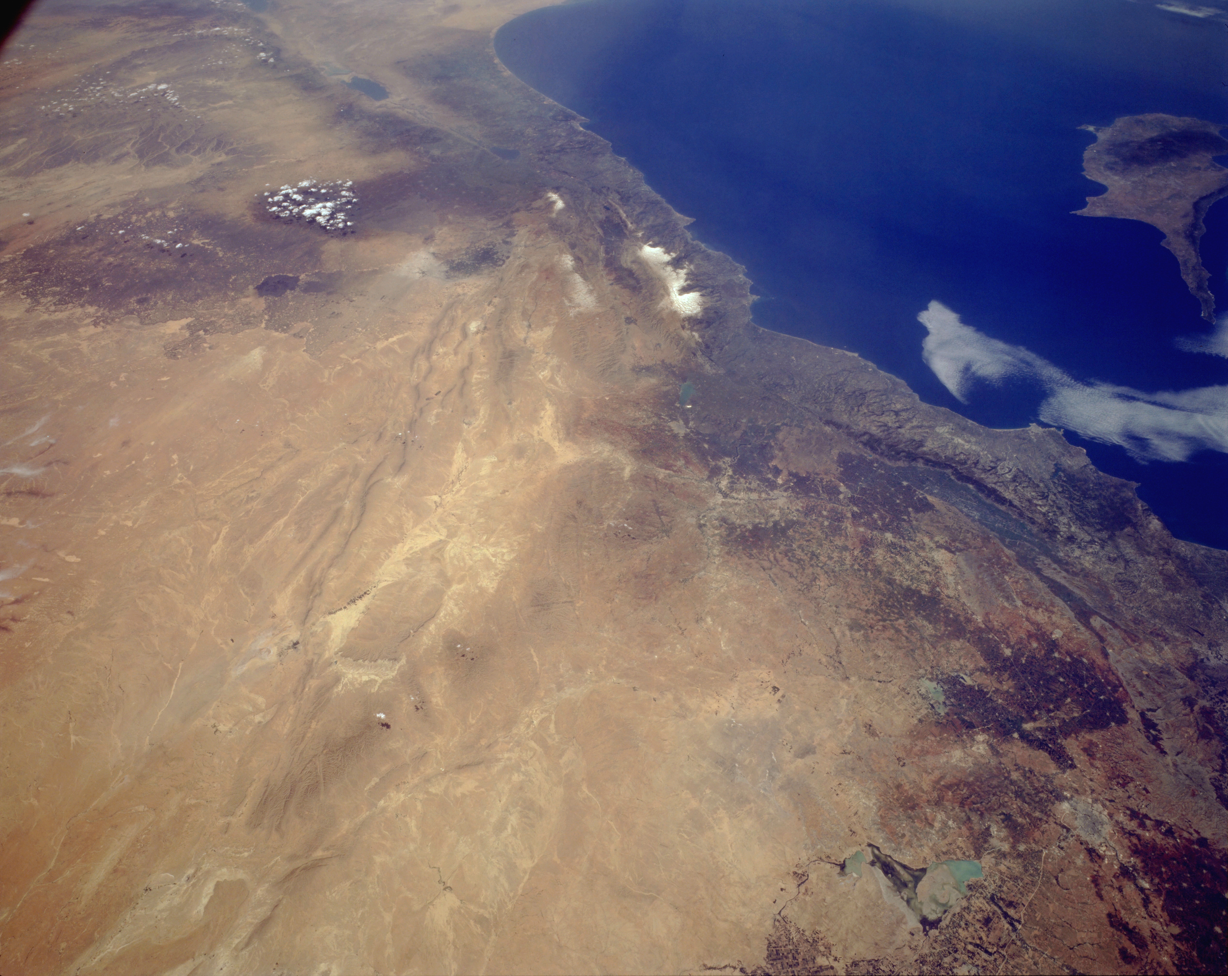
Image Caption: STS059-L06-077 Eastern Syria April 1994
Syria (the western third of the country included in this photograph) is an excellent example of a country where climate and topography dictate which regions of the country are developed. The Mediterranean coastal area of Syria receives adequate rainfall; irrigation is not required. Toward the interior in the rain shadow, or leeward side of the mountains, agriculture is possible, but in many cases irrigation is required. The darker, brownish areas indicate subregions where land is being used for agriculture. Cotton and wheat are the two leading crops grown in the northwest corner of Syria. Aleppo (Halab), a city of approximately 2 million located along an old caravan route, is barely visible near the northern edge of the photograph. This region is the intersection of three major tectonic plates (African, Arabian, and Eurasian). Although the surface manifestation of these plate boundaries tends to be subtle, the boundaries can be seen from the Dead Sea Rift Valley along a line of low, northeast-southwest-trending mountain ridges through the desert area to the east. The light brown area along the southeastern part of the photograph is the Syrian Desert. Many nomadic people graze their sheep, camels, and goats in this desert.
Syria (the western third of the country included in this photograph) is an excellent example of a country where climate and topography dictate which regions of the country are developed. The Mediterranean coastal area of Syria receives adequate rainfall; irrigation is not required. Toward the interior in the rain shadow, or leeward side of the mountains, agriculture is possible, but in many cases irrigation is required. The darker, brownish areas indicate subregions where land is being used for agriculture. Cotton and wheat are the two leading crops grown in the northwest corner of Syria. Aleppo (Halab), a city of approximately 2 million located along an old caravan route, is barely visible near the northern edge of the photograph. This region is the intersection of three major tectonic plates (African, Arabian, and Eurasian). Although the surface manifestation of these plate boundaries tends to be subtle, the boundaries can be seen from the Dead Sea Rift Valley along a line of low, northeast-southwest-trending mountain ridges through the desert area to the east. The light brown area along the southeastern part of the photograph is the Syrian Desert. Many nomadic people graze their sheep, camels, and goats in this desert.
