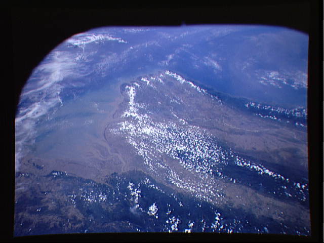
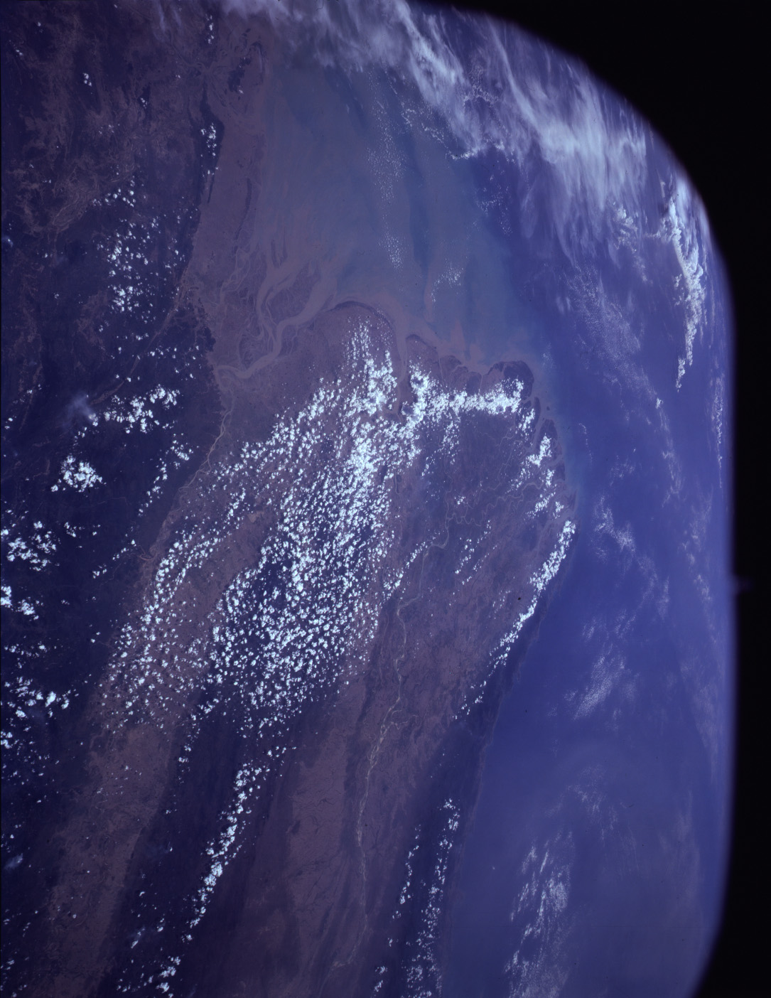
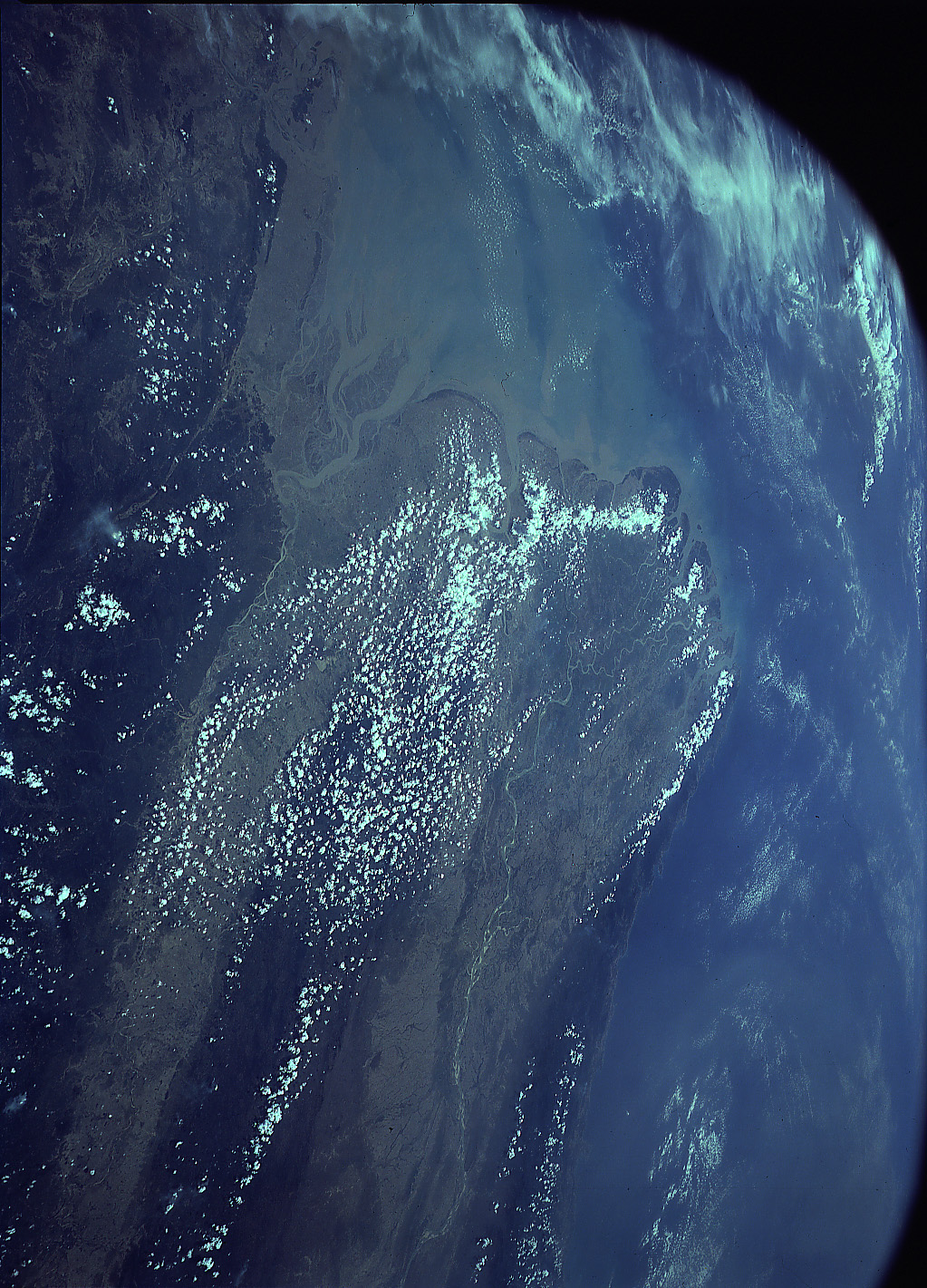
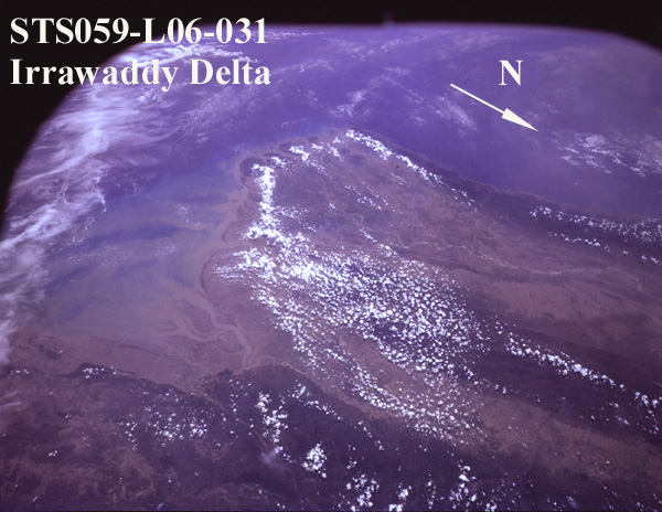
STS059-L06-31
| NASA Photo ID | STS059-L06-31 |
| Focal Length | 90mm |
| Date taken | 1994.04.15 |
| Time taken | 06:48:19 GMT |
Resolutions offered for this image:
640 x 480 pixels 1085 x 1404 pixels 1023 x 1421 pixels 600 x 464 pixels
640 x 480 pixels 1085 x 1404 pixels 1023 x 1421 pixels 600 x 464 pixels
Cloud masks available for this image:
Spacecraft nadir point: 18.7° N, 97.9° E
Photo center point: 17.0° N, 96.5° E
Photo center point by machine learning:
Photo center point: 17.0° N, 96.5° E
Photo center point by machine learning:
Nadir to Photo Center: Southwest
Spacecraft Altitude: 116 nautical miles (215km)
Country or Geographic Name: | MYANMAR (BURMA) |
Features: | IRRAWADDY R. DELTA, SED. |
| Features Found Using Machine Learning: | |
Cloud Cover Percentage: | 15 (11-25)% |
Sun Elevation Angle: | 69° |
Sun Azimuth: | 248° |
Camera: | Linhof |
Focal Length: | 90mm |
Camera Tilt: | 49 degrees |
Format: | 5046: Kodak, natural color positive, Lumiere 100/5046, ASA 100, standard base |
Film Exposure: | Normal |
| Additional Information | |
| Width | Height | Annotated | Cropped | Purpose | Links |
|---|---|---|---|---|---|
| 640 pixels | 480 pixels | No | No | ISD 1 | Download Image |
| 1085 pixels | 1404 pixels | Download Image | |||
| 1023 pixels | 1421 pixels | Download Image | |||
| 600 pixels | 464 pixels | Download Image |
Download Packaged File
Download a Google Earth KML for this Image
View photo footprint information
Download a GeoTIFF for this photo
Image Caption: none
