STS059-L04-123
| NASA Photo ID | STS059-L04-123 |
| Focal Length | 250mm |
| Date taken | 1994.04.__ |
| Time taken | GMT |
Resolutions offered for this image:
5056 x 3936 pixels 640 x 498 pixels 2141 x 2702 pixels 640 x 480 pixels
5056 x 3936 pixels 640 x 498 pixels 2141 x 2702 pixels 640 x 480 pixels

Cloud masks available for this image:
Spacecraft nadir point:
Photo center point: 40.0° N, 121.0° W
Photo center point by machine learning:
Photo center point: 40.0° N, 121.0° W
Photo center point by machine learning:
Nadir to Photo Center:
Spacecraft Altitude: nautical miles (0km)
Country or Geographic Name: | USA-CALIFORNIA |
Features: | HONEY LAKE |
| Features Found Using Machine Learning: | |
Cloud Cover Percentage: | 0 (no clouds present) |
Sun Elevation Angle: | ° |
Sun Azimuth: | ° |
Camera: | Linhof |
Focal Length: | 250mm |
Camera Tilt: | Near Vertical |
Format: | 5048: Kodak, natural color positive, Lumiere 100x/5048, ASA 100x, standard base |
Film Exposure: | Normal |
| Additional Information | |
| Width | Height | Annotated | Cropped | Purpose | Links |
|---|---|---|---|---|---|
| 5056 pixels | 3936 pixels | No | No | Earth From Space collection | Download Image |
| 640 pixels | 498 pixels | No | No | Earth From Space collection | Download Image |
| 2141 pixels | 2702 pixels | No | No | Download Image | |
| 640 pixels | 480 pixels | No | No | ISD 1 | Download Image |
Download Packaged File
Download a Google Earth KML for this Image
View photo footprint information
Download a GeoTIFF for this photo
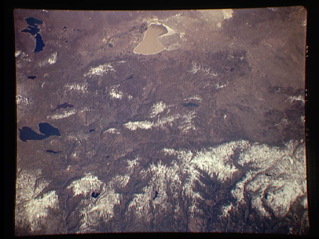
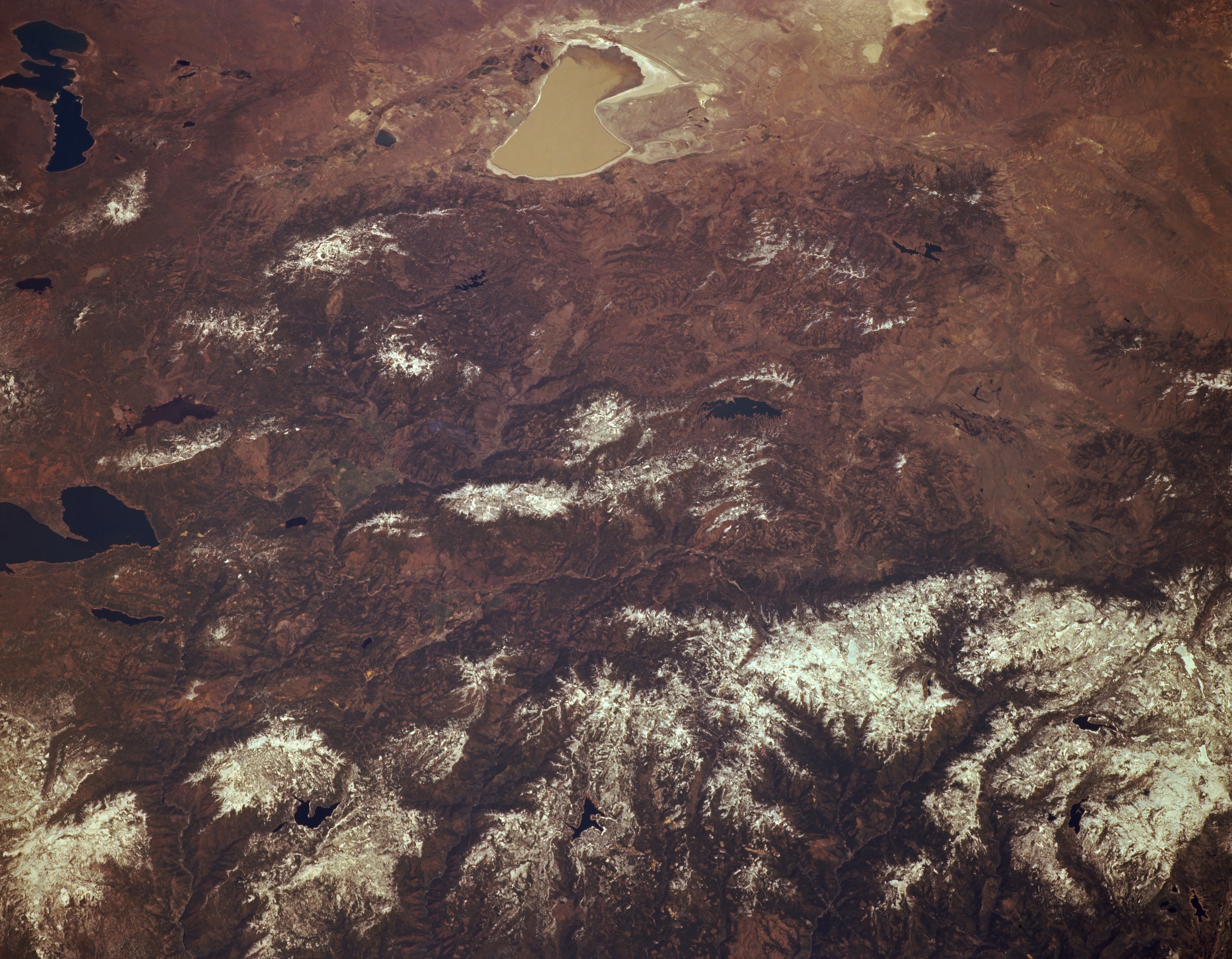
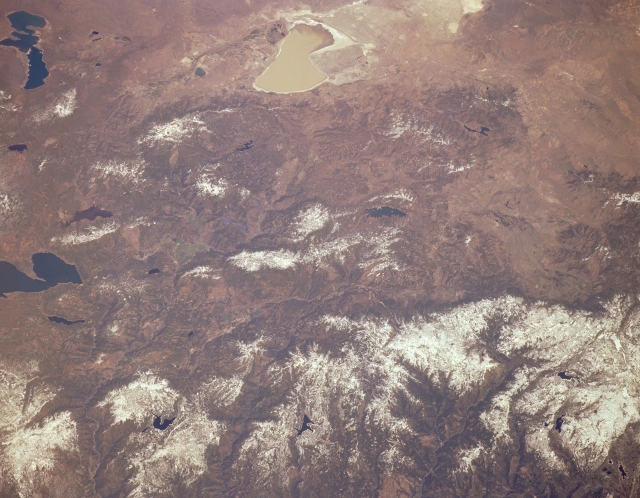
Image Caption: STS059-L04-123 Sierra Nevada Mountains and Honey Lake, California, U.S.A. April 1994
The rugged, snow-covered northern Sierra Nevada Mountains are evident in the bottom third of this northeast-looking, low-oblique photograph. Visible are Honey Lake, a 20-mile- (32-kilometer-) long salt lake near the top center; the northwest-southeast-trending Diamond Mountains west of Honey Lake; Eagle Lake near the left; Mountain Meadows Reservoir and the deep blue waters of Lake Almanor near the center left; and Lake Davis near the center of the photograph. With the exception of the terrain surrounding Honey Lake and Eagle Lake, most of the photograph shows part of Plumas National Forest.
The rugged, snow-covered northern Sierra Nevada Mountains are evident in the bottom third of this northeast-looking, low-oblique photograph. Visible are Honey Lake, a 20-mile- (32-kilometer-) long salt lake near the top center; the northwest-southeast-trending Diamond Mountains west of Honey Lake; Eagle Lake near the left; Mountain Meadows Reservoir and the deep blue waters of Lake Almanor near the center left; and Lake Davis near the center of the photograph. With the exception of the terrain surrounding Honey Lake and Eagle Lake, most of the photograph shows part of Plumas National Forest.
