STS059-98-114

| NASA Photo ID | STS059-98-114 |
| Focal Length | 250mm |
| Date taken | 1994.04.16 |
| Time taken | 09:16:46 GMT |
Resolutions offered for this image:
4073 x 4073 pixels 639 x 639 pixels 5700 x 5900 pixels 500 x 518 pixels 640 x 480 pixels
4073 x 4073 pixels 639 x 639 pixels 5700 x 5900 pixels 500 x 518 pixels 640 x 480 pixels

Cloud masks available for this image:
Spacecraft nadir point: 44.2° N, 28.1° E
Photo center point: 45.0° N, 29.5° E
Photo center point by machine learning:
Photo center point: 45.0° N, 29.5° E
Photo center point by machine learning:
Nadir to Photo Center: Northeast
Spacecraft Altitude: 114 nautical miles (211km)
Camera: | Hasselblad |
Focal Length: | 250mm |
Camera Tilt: | 40 degrees |
Format: | 2443: Kodak Aerochrome 2443, color IR, thin base, EA-5 process thru June 1999, E-6 process afterward |
Film Exposure: | Normal |
| Additional Information | |
| Width | Height | Annotated | Cropped | Purpose | Links |
|---|---|---|---|---|---|
| 4073 pixels | 4073 pixels | No | No | Earth From Space collection | Download Image |
| 639 pixels | 639 pixels | No | No | Earth From Space collection | Download Image |
| 5700 pixels | 5900 pixels | No | No | Download Image | |
| 500 pixels | 518 pixels | No | No | Download Image | |
| 640 pixels | 480 pixels | No | No | Download Image |
Download Packaged File
Download a Google Earth KML for this Image
View photo footprint information
Download a GeoTIFF for this photo
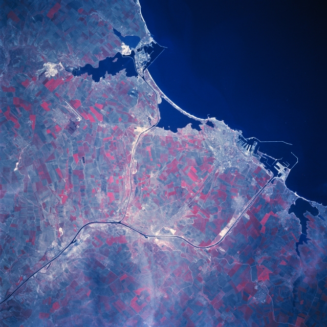
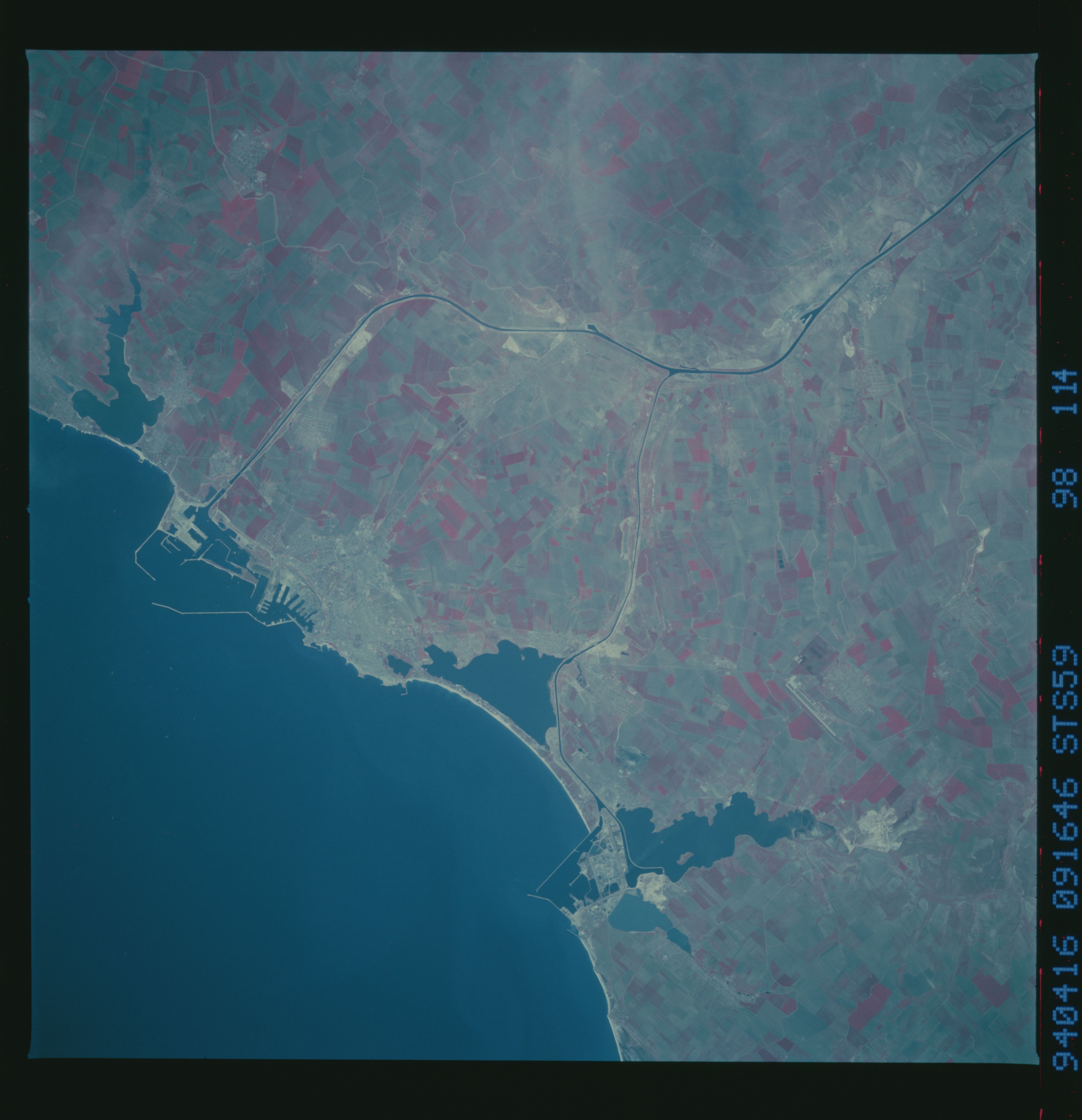
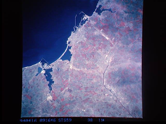
Image Caption: STS059-098-114 Constanta Area, Romania April 1994
The Romanian port city, Constanta (1989 estimated population over 300000 people), is located along the southeast coast of Romania. Much of the infrastructure of the harbor facilities (various dikes, piers, and docks) can be seen outlined against the deep blue water of the western Black Sea. The irregular-shaped, dark features adjacent to the coast are lakes. The thin, dark lines that cross the coastal plain in this part of Romania are part of the Danube - Black Sea Canal. The canal was constructed during the last half of the 1900's to reduce (by approximately 140 miles - 225 km) the distance that shipping must travel on the Danube River to reach the Black Sea. The canal network is divided into a north canal that serves the port city of Navordari, while the main canal passes immediately south of Constanta. The coastal areas north and especially south of Constanta have fine, sandy beaches with a variety of resorts ranging from deluxe villas to campsites. The large, angular, reddish-looking (green vegetation is portrayed as shades of red on color infrared images) cultivated fields west and southwest of Constanta show extensive farming on the coastal plains of southeastern Romania.
The Romanian port city, Constanta (1989 estimated population over 300000 people), is located along the southeast coast of Romania. Much of the infrastructure of the harbor facilities (various dikes, piers, and docks) can be seen outlined against the deep blue water of the western Black Sea. The irregular-shaped, dark features adjacent to the coast are lakes. The thin, dark lines that cross the coastal plain in this part of Romania are part of the Danube - Black Sea Canal. The canal was constructed during the last half of the 1900's to reduce (by approximately 140 miles - 225 km) the distance that shipping must travel on the Danube River to reach the Black Sea. The canal network is divided into a north canal that serves the port city of Navordari, while the main canal passes immediately south of Constanta. The coastal areas north and especially south of Constanta have fine, sandy beaches with a variety of resorts ranging from deluxe villas to campsites. The large, angular, reddish-looking (green vegetation is portrayed as shades of red on color infrared images) cultivated fields west and southwest of Constanta show extensive farming on the coastal plains of southeastern Romania.
