STS059-95-114
| NASA Photo ID | STS059-95-114 |
| Focal Length | 250mm |
| Date taken | 1994.04.11 |
| Time taken | 06:46:33 GMT |

Cloud masks available for this image:
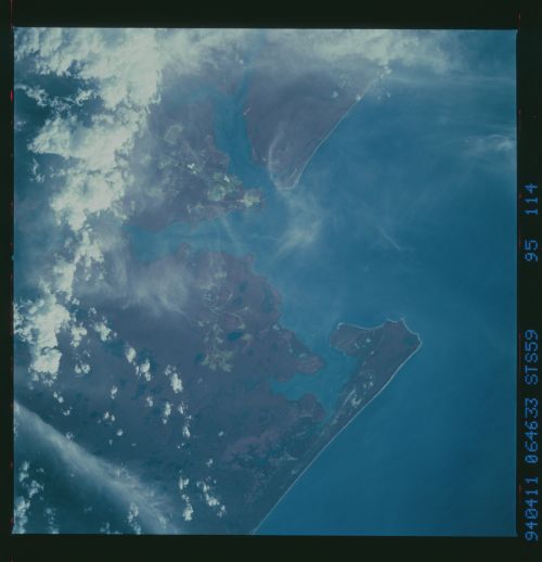
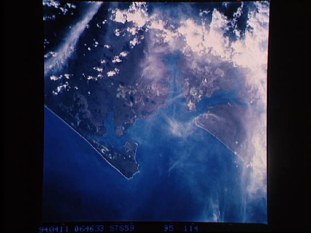
Spacecraft nadir point: 13.0° S, 142.8° E
Photo center point: 12.5° S, 141.5° E
Photo center point by machine learning:
Photo center point: 12.5° S, 141.5° E
Photo center point by machine learning:
Nadir to Photo Center: West
Spacecraft Altitude: 120 nautical miles (222km)
Country or Geographic Name: | AUSTRALIA-Q |
Features: | WEIPA SOUTH, ALBATROSS B. |
| Features Found Using Machine Learning: | |
Cloud Cover Percentage: | 15 (11-25)% |
Sun Elevation Angle: | 23° |
Sun Azimuth: | 285° |
Camera: | Hasselblad |
Focal Length: | 250mm |
Camera Tilt: | 35 degrees |
Format: | 2443: Kodak Aerochrome 2443, color IR, thin base, EA-5 process thru June 1999, E-6 process afterward |
Film Exposure: | Normal |
| Additional Information | |
| Width | Height | Annotated | Cropped | Purpose | Links |
|---|---|---|---|---|---|
| 5700 pixels | 5900 pixels | No | No | Download Image | |
| 500 pixels | 518 pixels | No | No | Download Image | |
| 640 pixels | 480 pixels | No | No | Download Image |
Download Packaged File
Download a Google Earth KML for this Image
View photo footprint information
Download a GeoTIFF for this photo
Image Caption: Community of Weipa, Queensland, east of Albatross Bay on the western coast of the Cape York Peninsula. Active strip mines (square greenish patches) and re-afforestation (light reddish patches) can be discriminated on this color infrared frame.
