STS059-89-86
| NASA Photo ID | STS059-89-86 |
| Focal Length | 250mm |
| Date taken | 1994.04.10 |
| Time taken | 21:36:59 GMT |
Resolutions offered for this image:
3904 x 3904 pixels 639 x 639 pixels 5700 x 5900 pixels 500 x 518 pixels 640 x 480 pixels
3904 x 3904 pixels 639 x 639 pixels 5700 x 5900 pixels 500 x 518 pixels 640 x 480 pixels
Cloud masks available for this image:
Spacecraft nadir point: 40.9° N, 120.2° W
Photo center point: 40.5° N, 120.5° W
Photo center point by machine learning:
Photo center point: 40.5° N, 120.5° W
Photo center point by machine learning:
Nadir to Photo Center: Southwest
Spacecraft Altitude: 119 nautical miles (220km)
Country or Geographic Name: | USA-CALIFORNIA |
Features: | EAGLE LAKE |
| Features Found Using Machine Learning: | |
Cloud Cover Percentage: | 0 (no clouds present) |
Sun Elevation Angle: | 51° |
Sun Azimuth: | 219° |
Camera: | Hasselblad |
Focal Length: | 250mm |
Camera Tilt: | 14 degrees |
Format: | 5046: Kodak, natural color positive, Lumiere 100/5046, ASA 100, standard base |
Film Exposure: | Normal |
| Additional Information | |
| Width | Height | Annotated | Cropped | Purpose | Links |
|---|---|---|---|---|---|
| 3904 pixels | 3904 pixels | No | No | Earth From Space collection | Download Image |
| 639 pixels | 639 pixels | No | No | Earth From Space collection | Download Image |
| 5700 pixels | 5900 pixels | No | No | Download Image | |
| 500 pixels | 518 pixels | No | No | Download Image | |
| 640 pixels | 480 pixels | No | No | Download Image |
Download Packaged File
Download a Google Earth KML for this Image
View photo footprint information
Download a GeoTIFF for this photo
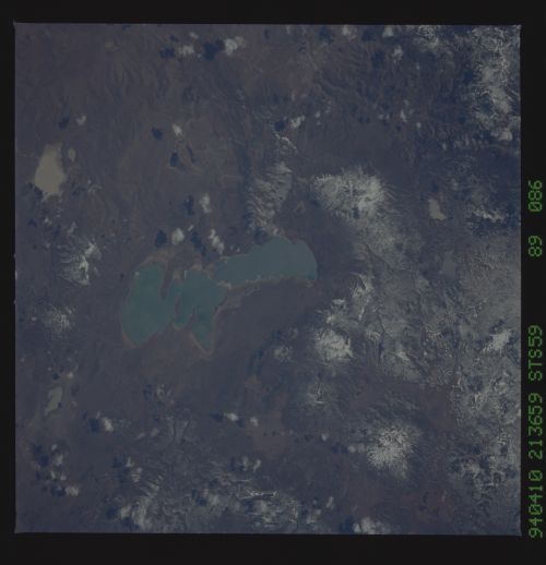
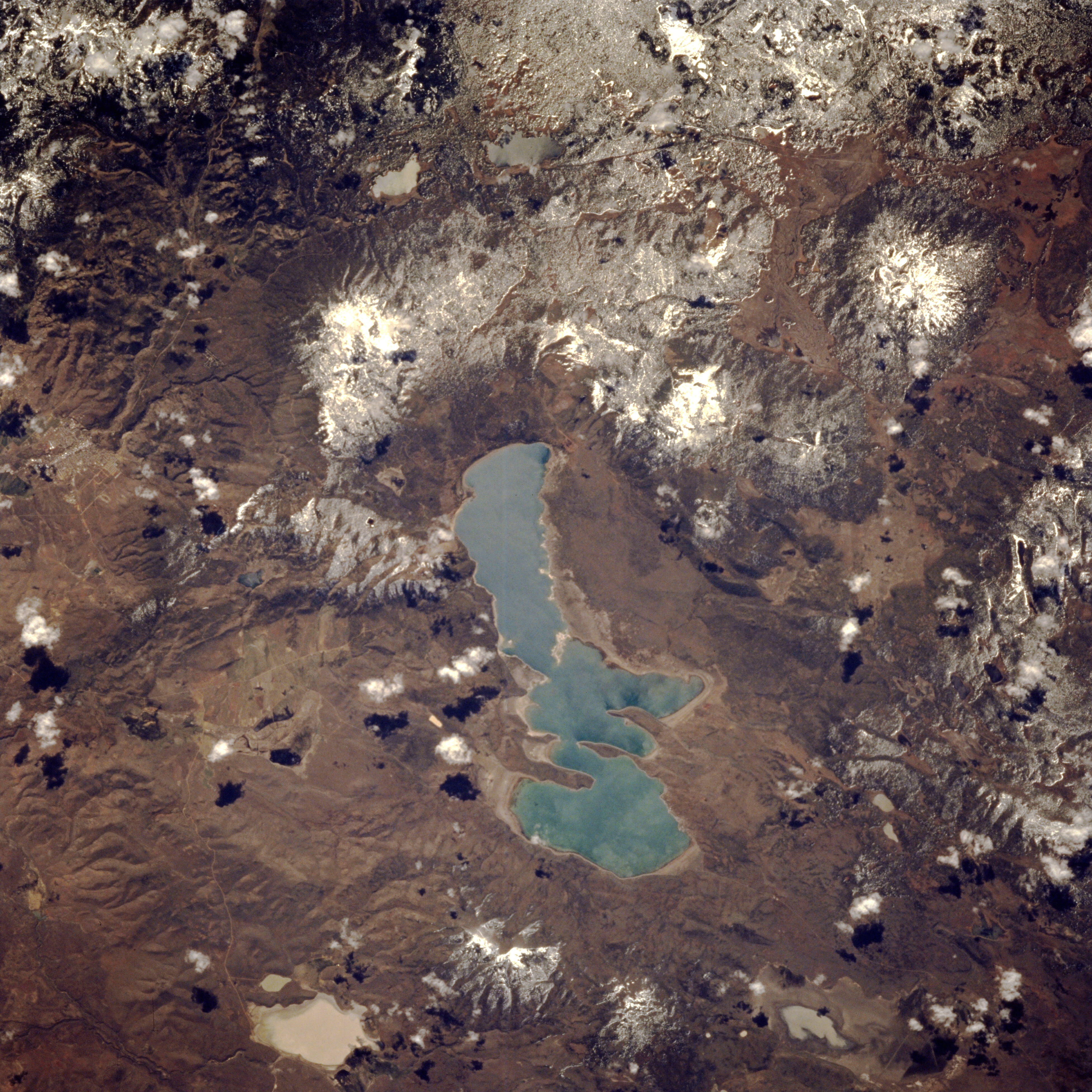
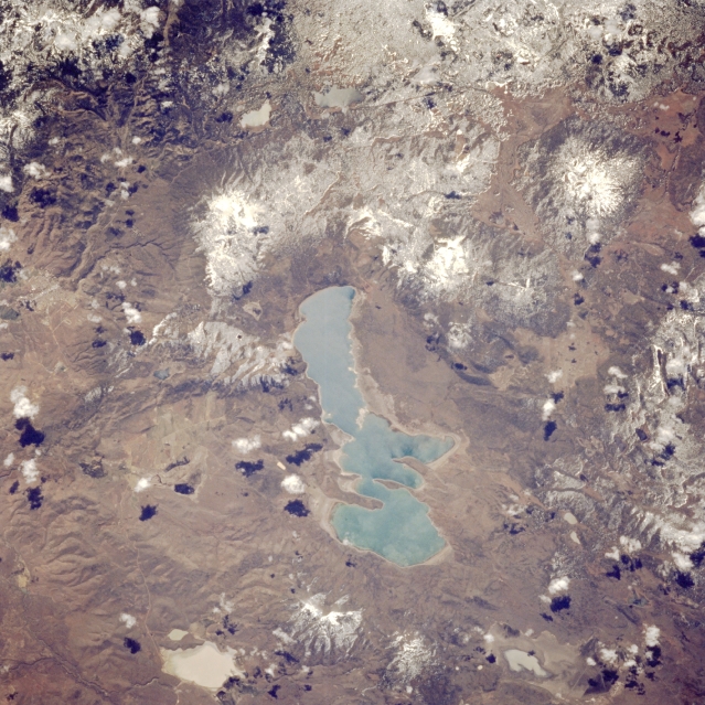
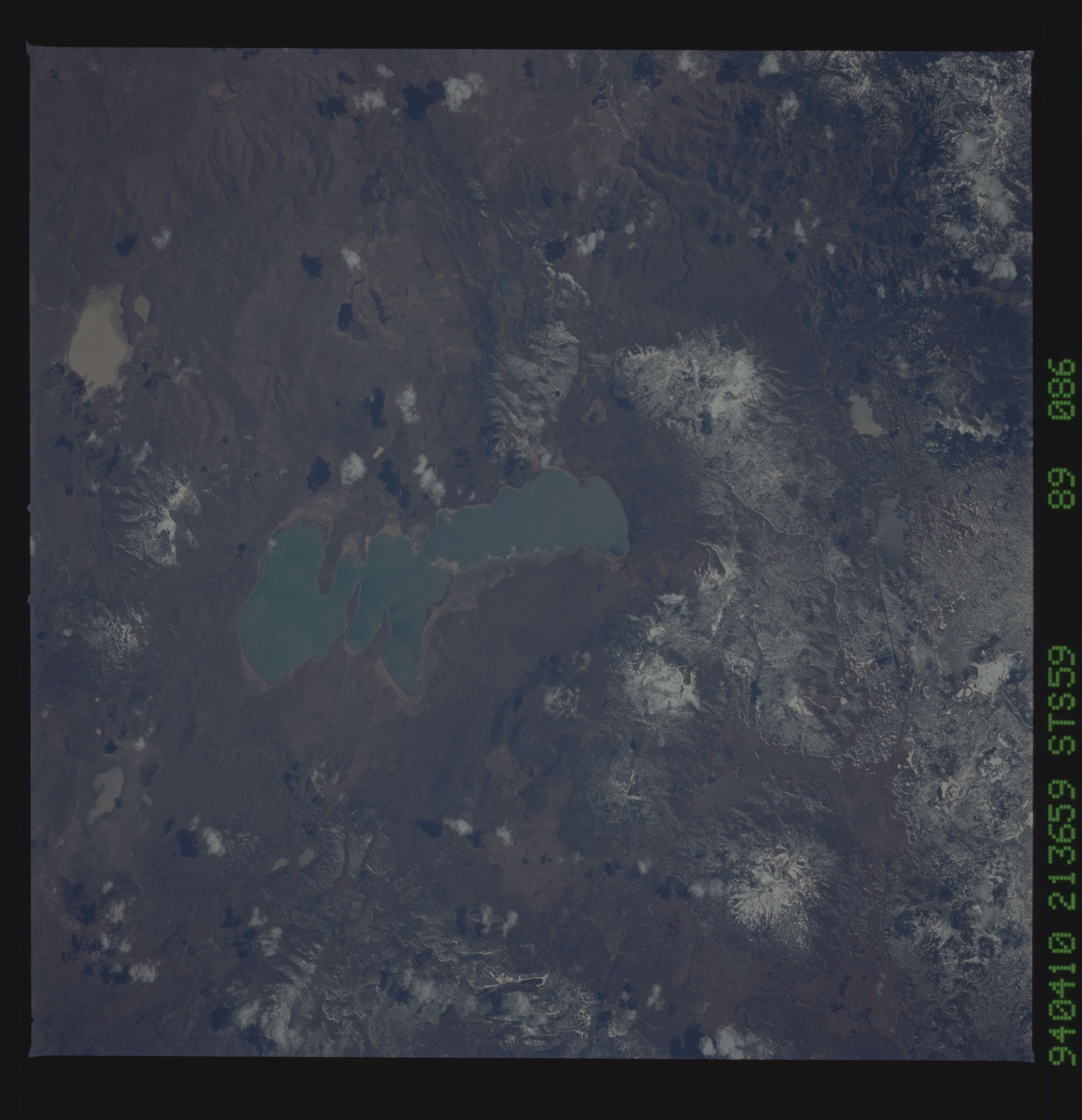
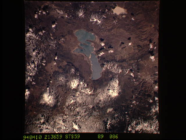
Image Caption: STS059-089-086 Eagle Lake, California, U.S.A. April 1994
Gray-green Eagle Lake is visible in this low-oblique, southwest-looking photograph. Located east of Lassen Peak Volcano, Eagle Lake sits on a semiarid, high volcanic plateau. The lake, fed by Pine Creek that originates near Lassen Peak and enters near the northwest center of the lake, empties into Willow Creek on its southeast side. Surrounding the lake are volcanic mountains--Fredonyer Peak east of the lake and Crater Mountain northwest of the lake near the top right of the photograph. The small city of Susanville near the center of the photograph; tan Horse Lake, normally a dry lake, southeast of Fredonyer Peak near the bottom left; and snow-covered Lassen National Forest to the west are discernible.
Gray-green Eagle Lake is visible in this low-oblique, southwest-looking photograph. Located east of Lassen Peak Volcano, Eagle Lake sits on a semiarid, high volcanic plateau. The lake, fed by Pine Creek that originates near Lassen Peak and enters near the northwest center of the lake, empties into Willow Creek on its southeast side. Surrounding the lake are volcanic mountains--Fredonyer Peak east of the lake and Crater Mountain northwest of the lake near the top right of the photograph. The small city of Susanville near the center of the photograph; tan Horse Lake, normally a dry lake, southeast of Fredonyer Peak near the bottom left; and snow-covered Lassen National Forest to the west are discernible.
