STS059-86-60
| NASA Photo ID | STS059-86-60 |
| Focal Length | 250mm |
| Date taken | 1994.04.11 |
| Time taken | 21:21:07 GMT |
Resolutions offered for this image:
3060 x 2142 pixels 1200 x 840 pixels 3904 x 3904 pixels 639 x 639 pixels 5700 x 5900 pixels 6000 x 6053 pixels 500 x 518 pixels 640 x 480 pixels 3177 x 3234 pixels 3391 x 3439 pixels
3060 x 2142 pixels 1200 x 840 pixels 3904 x 3904 pixels 639 x 639 pixels 5700 x 5900 pixels 6000 x 6053 pixels 500 x 518 pixels 640 x 480 pixels 3177 x 3234 pixels 3391 x 3439 pixels


Cloud masks available for this image:
Spacecraft nadir point: 33.2° N, 112.9° W
Photo center point: 33.5° N, 112.0° W
Photo center point by machine learning:
Photo center point: 33.5° N, 112.0° W
Photo center point by machine learning:
Nadir to Photo Center: East
Spacecraft Altitude: 119 nautical miles (220km)
Country or Geographic Name: | USA-ARIZONA |
Features: | PHOENIX AREA |
| Features Found Using Machine Learning: | |
Cloud Cover Percentage: | 0 (no clouds present) |
Sun Elevation Angle: | 55° |
Sun Azimuth: | 232° |
Camera: | Hasselblad |
Focal Length: | 250mm |
Camera Tilt: | 26 degrees |
Format: | 5046: Kodak, natural color positive, Lumiere 100/5046, ASA 100, standard base |
Film Exposure: | Normal |
| Additional Information | |
| Width | Height | Annotated | Cropped | Purpose | Links |
|---|---|---|---|---|---|
| 3060 pixels | 2142 pixels | No | No | Cities collection | Download Image |
| 1200 pixels | 840 pixels | No | No | Cities collection | Download Image |
| 3904 pixels | 3904 pixels | No | No | Earth From Space collection | Download Image |
| 639 pixels | 639 pixels | No | No | Earth From Space collection | Download Image |
| 5700 pixels | 5900 pixels | No | No | Download Image | |
| 6000 pixels | 6053 pixels | No | No | Scientist Request | Download Image |
| 500 pixels | 518 pixels | No | No | Download Image | |
| 640 pixels | 480 pixels | No | No | Download Image | |
| 3177 pixels | 3234 pixels | Download Image | |||
| 3391 pixels | 3439 pixels | Download Image |
Download Packaged File
Download a Google Earth KML for this Image
View photo footprint information
Download a GeoTIFF for this photo
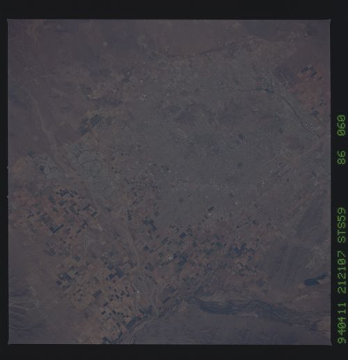
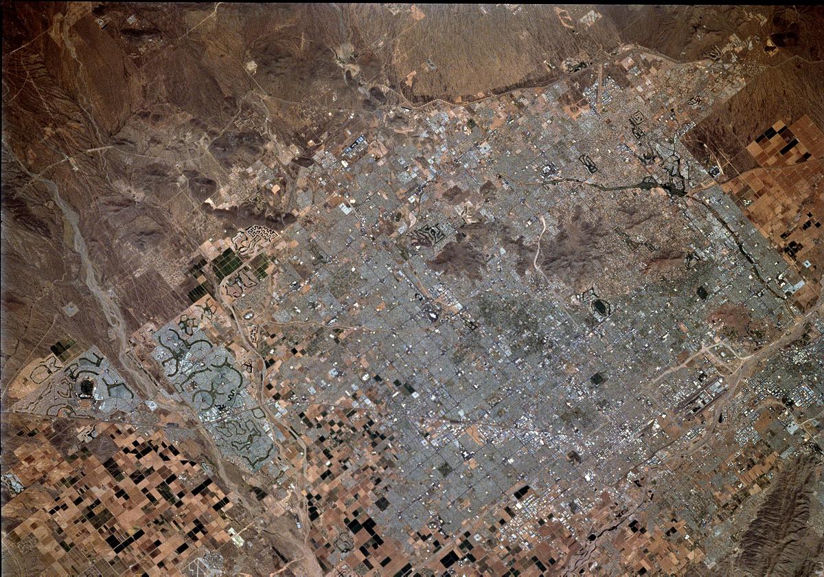
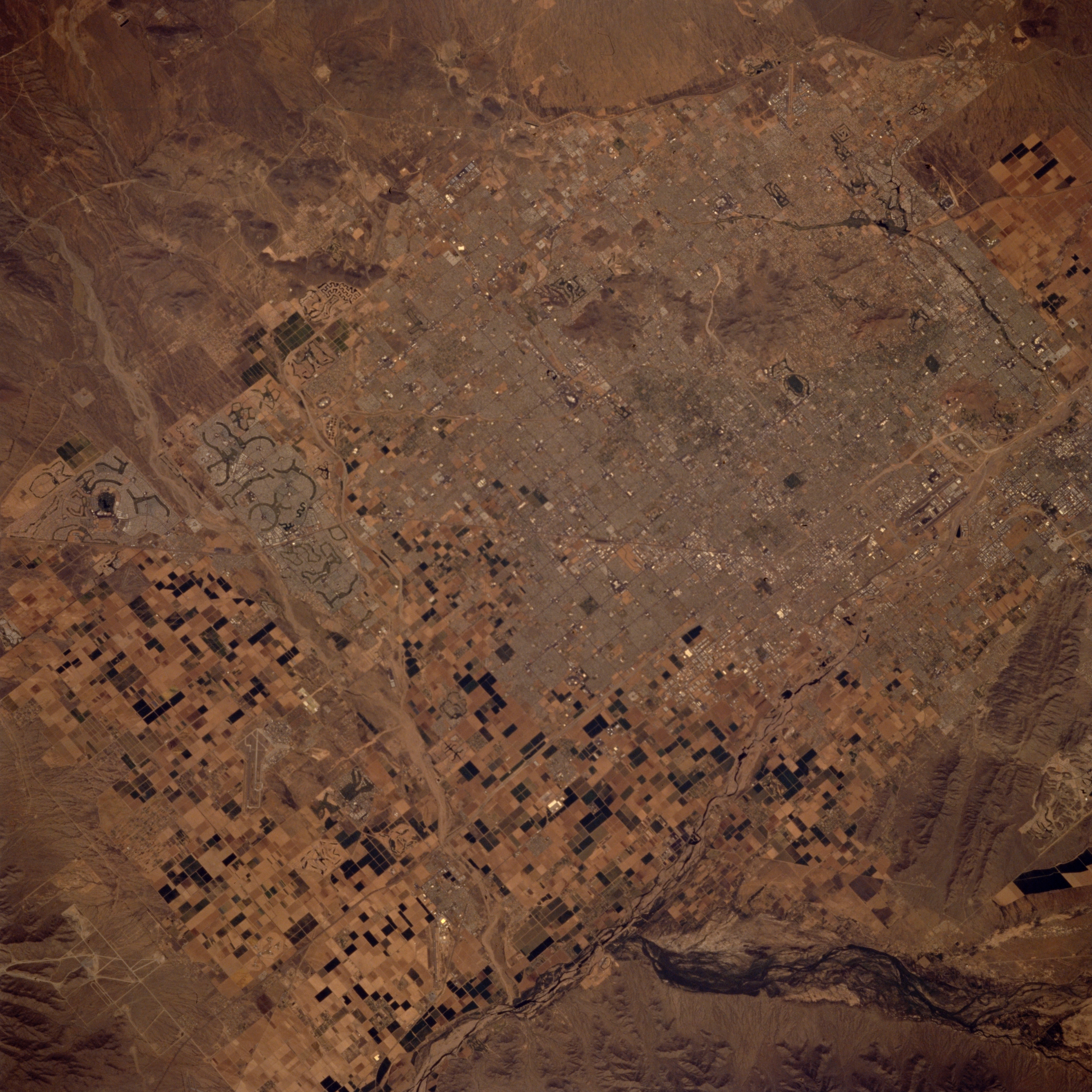
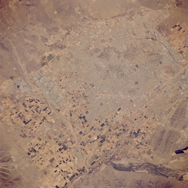
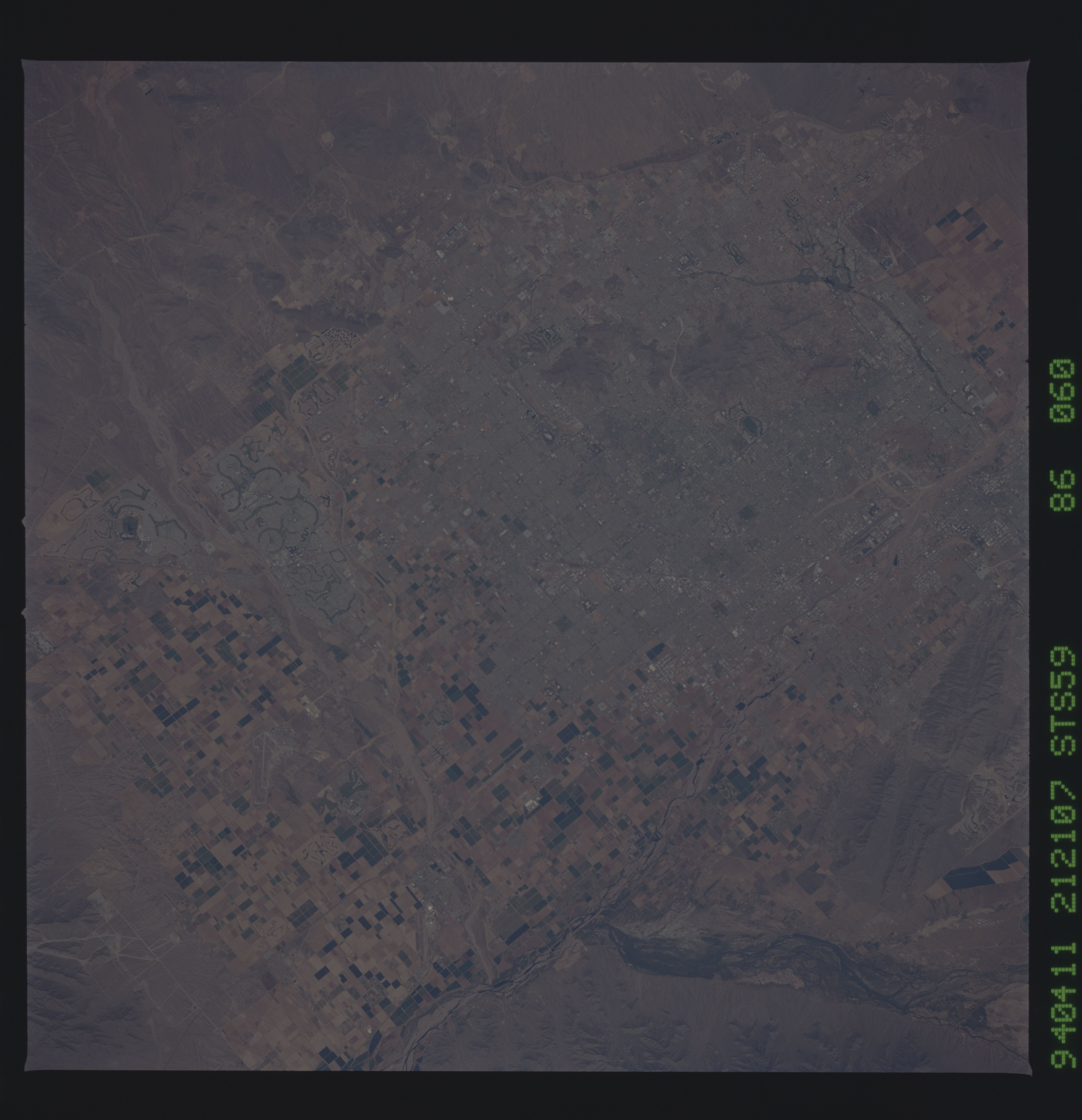
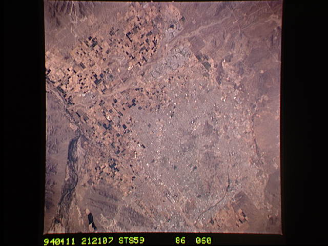
Image Caption: STS059-086-060 Phoenix, Arizona, U.S.A. April 1994
Street and highway grid patterns in metropolitan Phoenix are visible in this photograph. The population of this arid, hot region grew rapidly in the 1960s and 1970s as Arizona emerged as an industrial state. Northwest of downtown Phoenix, the distinctive, curving lines of the golf course and lakes of the Sun City retirement community are apparent; the dual runways of Phoenix's Sky Harbor International Airport near the southern edge of the city are barely discernible. Large, rectangular, cultivated field patterns can be distinguished west of the city. South of Phoenix, South Mountain and the braided stream channels of the Gila River can be identified.
Street and highway grid patterns in metropolitan Phoenix are visible in this photograph. The population of this arid, hot region grew rapidly in the 1960s and 1970s as Arizona emerged as an industrial state. Northwest of downtown Phoenix, the distinctive, curving lines of the golf course and lakes of the Sun City retirement community are apparent; the dual runways of Phoenix's Sky Harbor International Airport near the southern edge of the city are barely discernible. Large, rectangular, cultivated field patterns can be distinguished west of the city. South of Phoenix, South Mountain and the braided stream channels of the Gila River can be identified.
