STS059-85-97
| NASA Photo ID | STS059-85-97 |
| Focal Length | 100mm |
| Date taken | 1994.04.11 |
| Time taken | 19:46:56 GMT |
Resolutions offered for this image:
3904 x 3904 pixels 639 x 639 pixels 5700 x 5900 pixels 500 x 518 pixels 640 x 480 pixels
3904 x 3904 pixels 639 x 639 pixels 5700 x 5900 pixels 500 x 518 pixels 640 x 480 pixels


Cloud masks available for this image:
Spacecraft nadir point: 48.1° N, 110.1° W
Photo center point: 46.5° N, 112.0° W
Photo center point by machine learning:
Photo center point: 46.5° N, 112.0° W
Photo center point by machine learning:
Nadir to Photo Center: Southwest
Spacecraft Altitude: 118 nautical miles (219km)
Country or Geographic Name: | USA-MONTANA |
Features: | HELENA, CANYON FERRY L. |
| Features Found Using Machine Learning: | |
Cloud Cover Percentage: | 5 (1-10)% |
Sun Elevation Angle: | 50° |
Sun Azimuth: | 190° |
Camera: | Hasselblad |
Focal Length: | 100mm |
Camera Tilt: | 52 degrees |
Format: | 5046: Kodak, natural color positive, Lumiere 100/5046, ASA 100, standard base |
Film Exposure: | Normal |
| Additional Information | |
| Width | Height | Annotated | Cropped | Purpose | Links |
|---|---|---|---|---|---|
| 3904 pixels | 3904 pixels | No | No | Earth From Space collection | Download Image |
| 639 pixels | 639 pixels | No | No | Earth From Space collection | Download Image |
| 5700 pixels | 5900 pixels | No | No | Download Image | |
| 500 pixels | 518 pixels | No | No | Download Image | |
| 640 pixels | 480 pixels | No | No | Download Image |
Download Packaged File
Download a Google Earth KML for this Image
View photo footprint information
Download a GeoTIFF for this photo
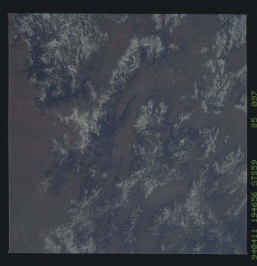
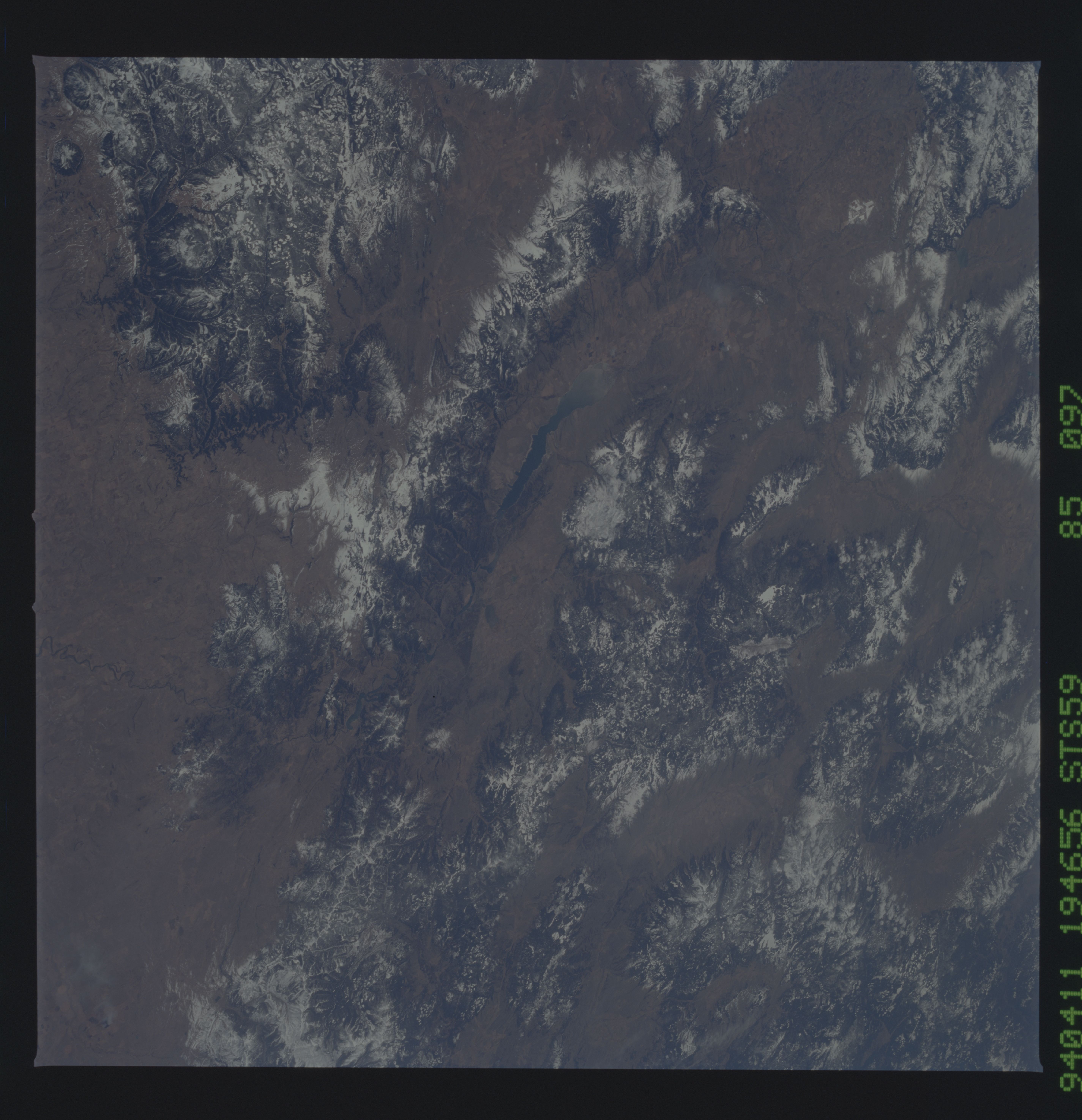
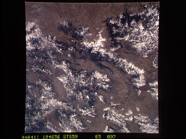
Image Caption: STS059-085-097 Canyon Ferry Lake, Big Belt Mountains, Elkhorn Mountains, Montana, U.S.A. April 1994
Many rugged, snow-covered ranges within the Rocky Mountains of Montana are visible in this south-southwest-looking, low-oblique photograph. Discernible are Canyon Ferry Lake; to its east, the northwest-southeast-trending Big Belt Mountains; and still farther east, the Little Belt Mountains. The Elkhorn Mountains lie west of Canyon Ferry Lake, south of which is the northern portion of the Madison Range. West of the Madison Range are the Tobacco Root Mountains, the Pioneer Mountains, and to the northwest the Anaconda Range. Near the bottom right of the photograph is the southern extension of the Lewis and Clark Range.
Many rugged, snow-covered ranges within the Rocky Mountains of Montana are visible in this south-southwest-looking, low-oblique photograph. Discernible are Canyon Ferry Lake; to its east, the northwest-southeast-trending Big Belt Mountains; and still farther east, the Little Belt Mountains. The Elkhorn Mountains lie west of Canyon Ferry Lake, south of which is the northern portion of the Madison Range. West of the Madison Range are the Tobacco Root Mountains, the Pioneer Mountains, and to the northwest the Anaconda Range. Near the bottom right of the photograph is the southern extension of the Lewis and Clark Range.
