STS059-79-64
| NASA Photo ID | STS059-79-64 |
| Focal Length | 40mm |
| Date taken | 1994.04.11 |
| Time taken | 10:57:23 GMT |

Cloud masks available for this image:
Spacecraft nadir point: 38.6° N, 39.4° E
Photo center point: 37.0° N, 37.5° E
Photo center point by machine learning:
Photo center point: 37.0° N, 37.5° E
Photo center point by machine learning:
Nadir to Photo Center: Southwest
Spacecraft Altitude: 119 nautical miles (220km)
Country or Geographic Name: | TURKEY |
Features: | RESERVOIRS, SUNGLINT |
| Features Found Using Machine Learning: | |
Cloud Cover Percentage: | 5 (1-10)% |
Sun Elevation Angle: | 53° |
Sun Azimuth: | 221° |
Camera: | Hasselblad |
Focal Length: | 40mm |
Camera Tilt: | High Oblique |
Format: | 5046: Kodak, natural color positive, Lumiere 100/5046, ASA 100, standard base |
Film Exposure: | Normal |
| Additional Information | |
| Width | Height | Annotated | Cropped | Purpose | Links |
|---|---|---|---|---|---|
| 5700 pixels | 5900 pixels | No | No | Download Image | |
| 500 pixels | 518 pixels | No | No | Download Image | |
| 640 pixels | 480 pixels | No | No | Download Image |
Download Packaged File
Download a Google Earth KML for this Image
View photo footprint information
Download a GeoTIFF for this photo
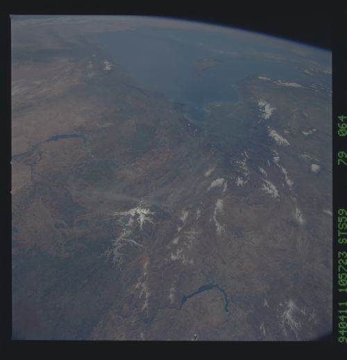
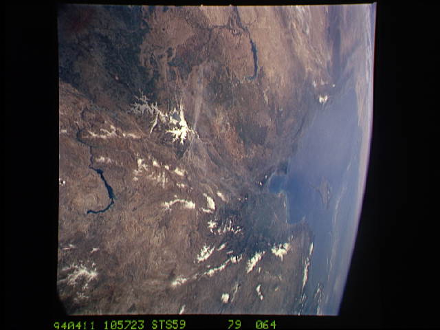
Image Caption: STS059-79-64 Central Turkey in one view
This southwest-looking view shows the two large manmade lakes on the
upper Euphrates River in central Turkey (bottom, and center in glint).
The Dead Sea Rift (continuation of the Red Sea and East African Rifts)
trends N-S near to, and parallel with the Mediterranean coast. With
associated faults and volcanoes, the Rift continues into southern
Turkey where it angles northeast (from center of view to bottom left
corner). The third lake on the Euphrates (left) is part of Syria's
major irrigation project. Cyprus appears top center and the African
coast across the top of view.
