STS059-238-88
| NASA Photo ID | STS059-238-88 |
| Focal Length | 100mm |
| Date taken | 1994.04.17 |
| Time taken | 11:58:36 GMT |
Resolutions offered for this image:
3978 x 3919 pixels 640 x 630 pixels 5700 x 5900 pixels 500 x 518 pixels 640 x 480 pixels
3978 x 3919 pixels 640 x 630 pixels 5700 x 5900 pixels 500 x 518 pixels 640 x 480 pixels
Cloud masks available for this image:
Spacecraft nadir point: 27.4° N, 0.5° E
Photo center point: 30.5° N, 0.0° E
Photo center point by machine learning:
Photo center point: 30.5° N, 0.0° E
Photo center point by machine learning:
Nadir to Photo Center: North
Spacecraft Altitude: 114 nautical miles (211km)
Country or Geographic Name: | ALGERIA |
Features: | PAN-GRAND ERG OCCIDENTAL |
| Features Found Using Machine Learning: | |
Cloud Cover Percentage: | 5 (1-10)% |
Sun Elevation Angle: | 73° |
Sun Azimuth: | 181° |
Camera: | Hasselblad |
Focal Length: | 100mm |
Camera Tilt: | High Oblique |
Format: | 5046: Kodak, natural color positive, Lumiere 100/5046, ASA 100, standard base |
Film Exposure: | Normal |
| Additional Information | |
| Width | Height | Annotated | Cropped | Purpose | Links |
|---|---|---|---|---|---|
| 3978 pixels | 3919 pixels | No | No | Earth From Space collection | Download Image |
| 640 pixels | 630 pixels | No | No | Earth From Space collection | Download Image |
| 5700 pixels | 5900 pixels | No | No | Download Image | |
| 500 pixels | 518 pixels | No | No | Download Image | |
| 640 pixels | 480 pixels | No | No | Download Image |
Download Packaged File
Download a Google Earth KML for this Image
View photo footprint information
Download a GeoTIFF for this photo
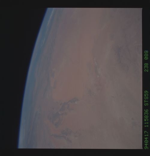
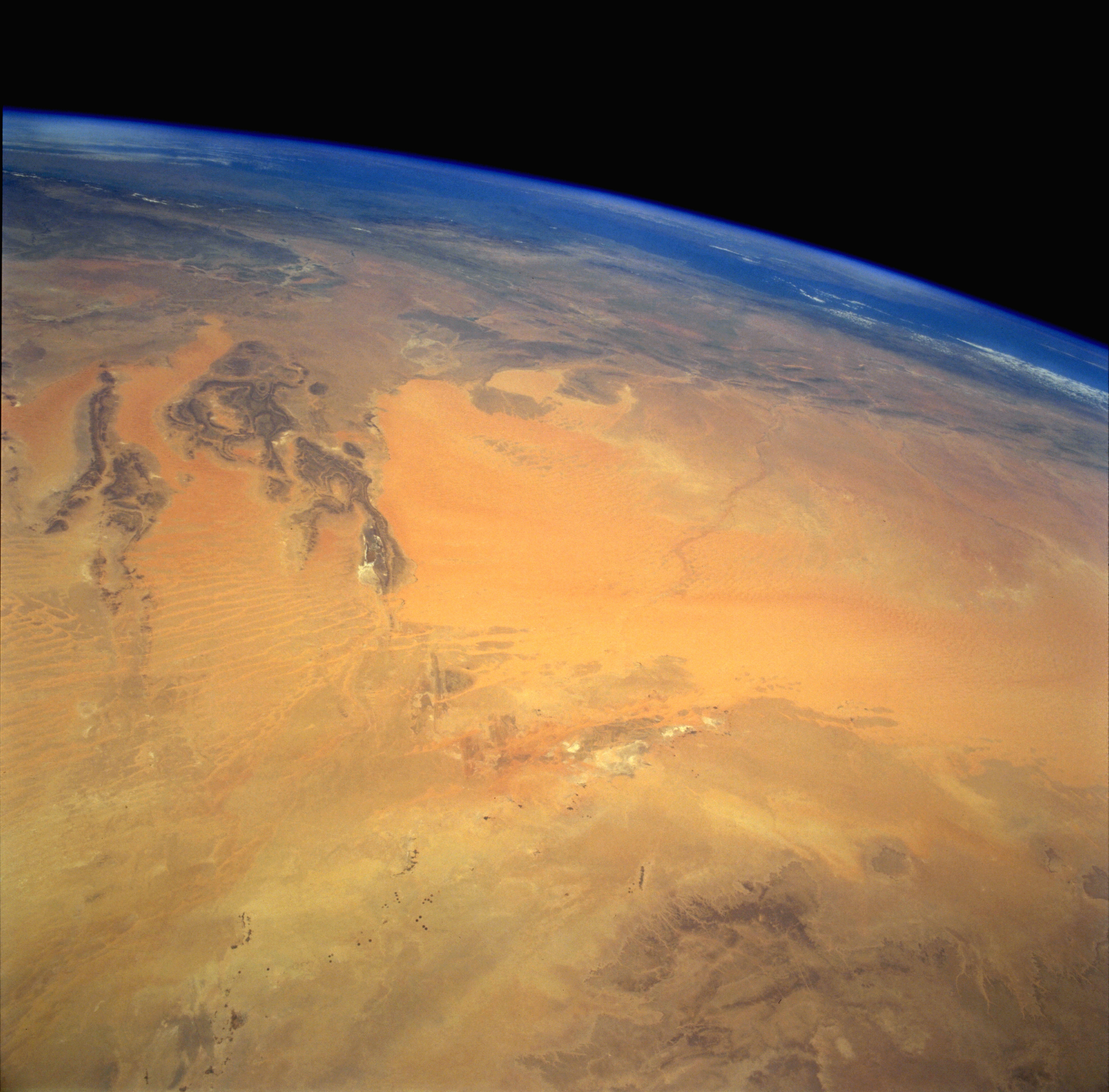
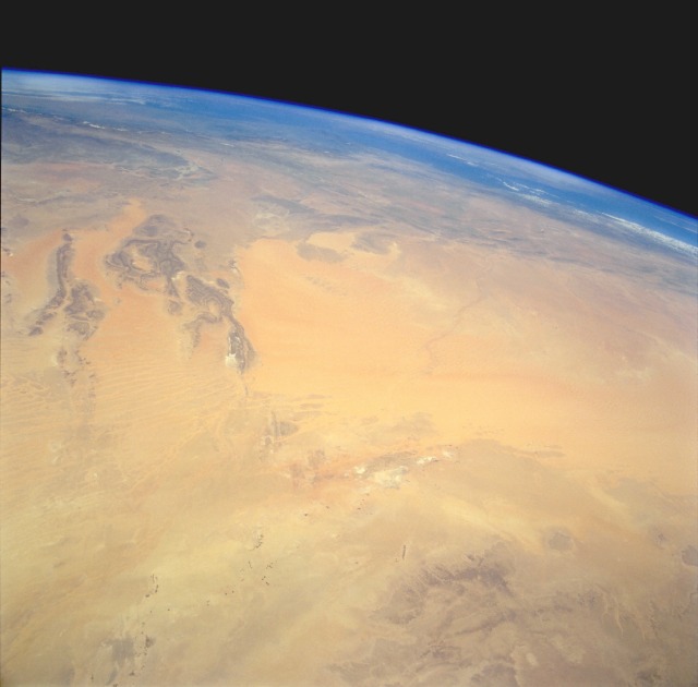
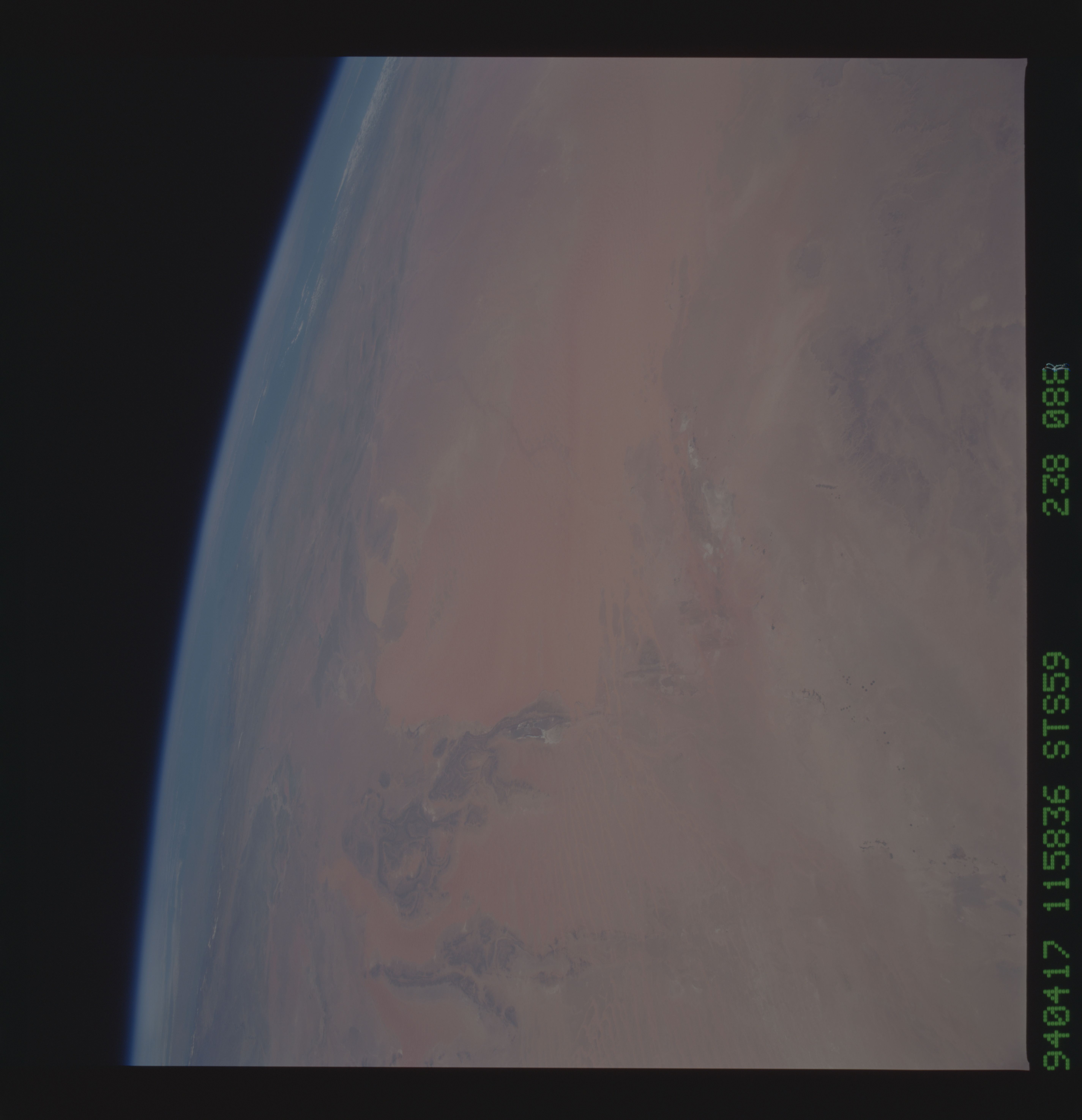
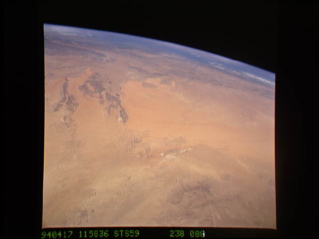
Image Caption: STS059-238-088 Grand Erg Occidental, North Central Algeria April 1994
The Grand Erg Occidental (sand dune region) of north-central Algeria is the large sandy-looking area in the center of the photograph. This true desert region receives less than 10 inches (25 centimeters) of rainfall per year. The scale of this high-oblique, northwest-looking photograph does not permit the viewer to see the assortment of sandy landforms within the Grand Erg Occidental--linear dunes, star dunes, complex dunes, compound sheets, and sand streaks. The dark features to the southeast are the northwestern edge of the Tademait Plateau. The small dark specks near the southern edge of the photograph are very small oases and a few isolated circular field patterns (center-pivot irrigated fields). Immediately south of the large sand dunes region are several playas (dry lakebeds) where surface deposits of salt produce a highly reflective surface. The darker landforms near the western side of the photograph are slightly elevated bedrock outcrops whose ridge lines average 2000 feet (610 meters) above sea level. Near the horizon, the eastern end of the Atlas Mountains is barely discernible.
The Grand Erg Occidental (sand dune region) of north-central Algeria is the large sandy-looking area in the center of the photograph. This true desert region receives less than 10 inches (25 centimeters) of rainfall per year. The scale of this high-oblique, northwest-looking photograph does not permit the viewer to see the assortment of sandy landforms within the Grand Erg Occidental--linear dunes, star dunes, complex dunes, compound sheets, and sand streaks. The dark features to the southeast are the northwestern edge of the Tademait Plateau. The small dark specks near the southern edge of the photograph are very small oases and a few isolated circular field patterns (center-pivot irrigated fields). Immediately south of the large sand dunes region are several playas (dry lakebeds) where surface deposits of salt produce a highly reflective surface. The darker landforms near the western side of the photograph are slightly elevated bedrock outcrops whose ridge lines average 2000 feet (610 meters) above sea level. Near the horizon, the eastern end of the Atlas Mountains is barely discernible.
