STS059-235-3
| NASA Photo ID | STS059-235-3 |
| Focal Length | 250mm |
| Date taken | 1994.04.17 |
| Time taken | 04:52:54 GMT |
Resolutions offered for this image:
3887 x 3948 pixels 630 x 639 pixels 5700 x 5900 pixels 500 x 518 pixels 640 x 480 pixels
3887 x 3948 pixels 630 x 639 pixels 5700 x 5900 pixels 500 x 518 pixels 640 x 480 pixels
Cloud masks available for this image:
Spacecraft nadir point: 31.6° S, 151.6° E
Photo center point: 33.0° S, 151.5° E
Photo center point by machine learning:
Photo center point: 33.0° S, 151.5° E
Photo center point by machine learning:
Nadir to Photo Center: South
Spacecraft Altitude: 115 nautical miles (213km)
Country or Geographic Name: | AUSTRALIA-NSW |
Features: | NEWCASTLE, COASTAL DUNES |
| Features Found Using Machine Learning: | |
Cloud Cover Percentage: | 5 (1-10)% |
Sun Elevation Angle: | 30° |
Sun Azimuth: | 307° |
Camera: | Hasselblad |
Focal Length: | 250mm |
Camera Tilt: | 36 degrees |
Format: | 5046: Kodak, natural color positive, Lumiere 100/5046, ASA 100, standard base |
Film Exposure: | Normal |
| Additional Information | |
| Width | Height | Annotated | Cropped | Purpose | Links |
|---|---|---|---|---|---|
| 3887 pixels | 3948 pixels | No | No | Earth From Space collection | Download Image |
| 630 pixels | 639 pixels | No | No | Earth From Space collection | Download Image |
| 5700 pixels | 5900 pixels | No | No | Download Image | |
| 500 pixels | 518 pixels | No | No | Download Image | |
| 640 pixels | 480 pixels | No | No | Download Image |
Download Packaged File
Download a Google Earth KML for this Image
View photo footprint information
Download a GeoTIFF for this photo
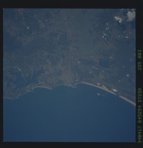
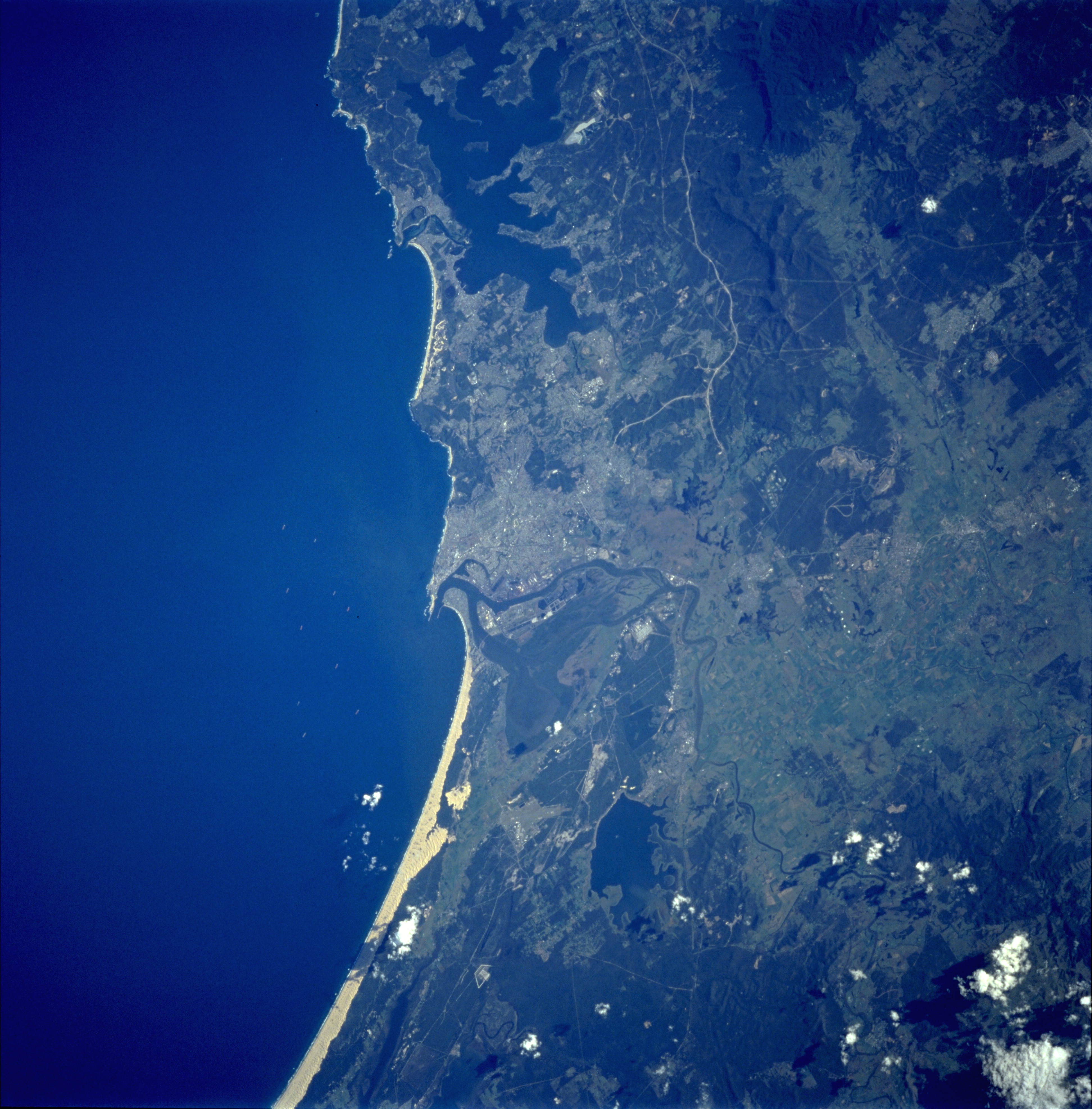
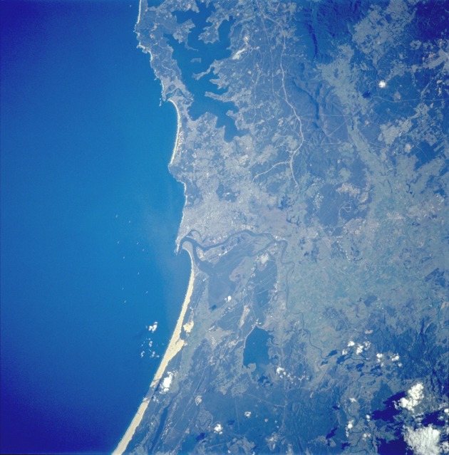
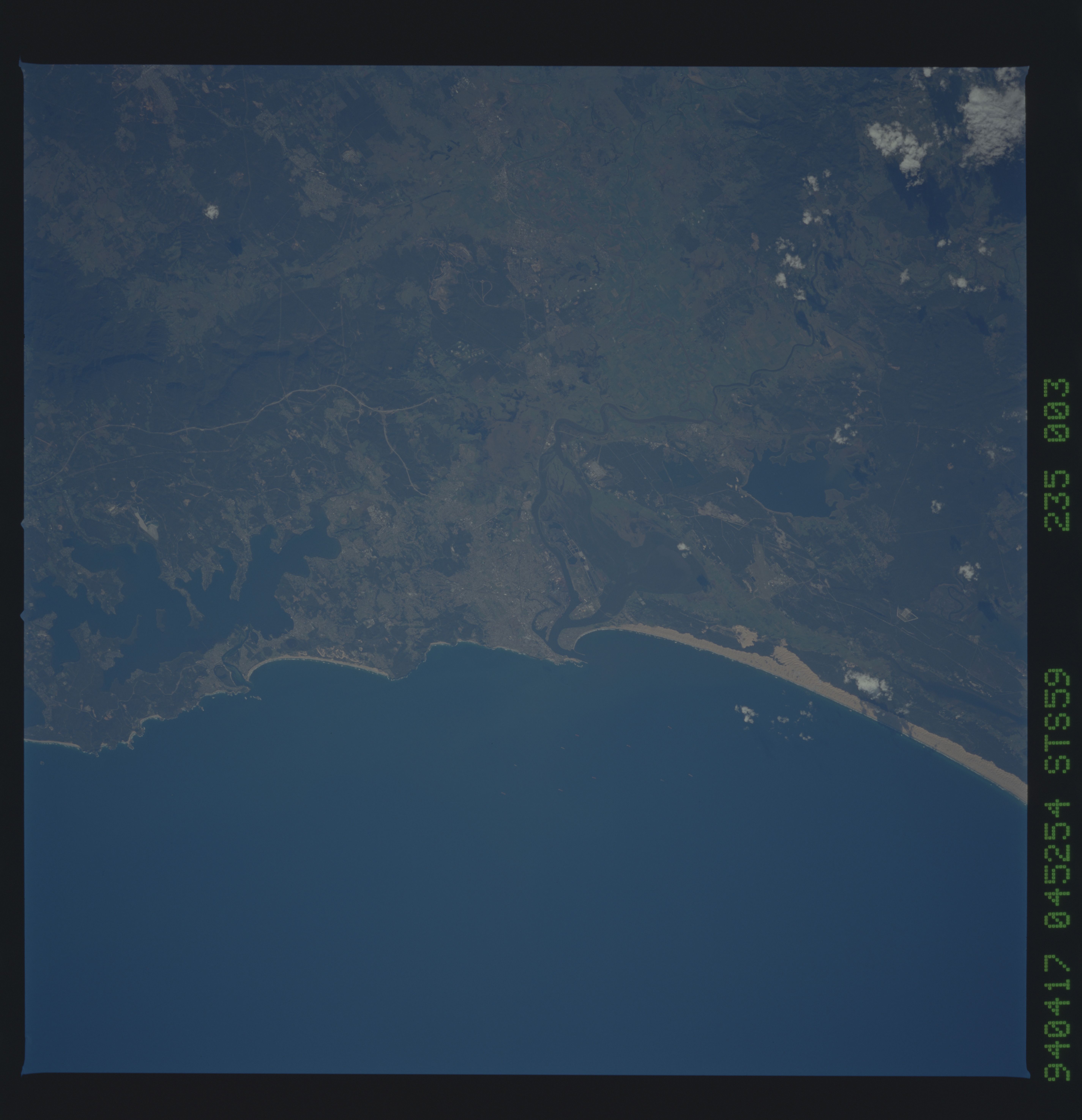
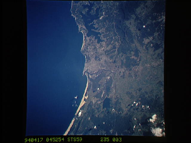
Image Caption: STS059-235-003 Newcastle, New South Wales, Australia April 1994
Located 100 miles (160 kilometers) northeast of Sydney, Newcastle is a growing industrial seaport with a population approaching 500 000. Combining the advantages of coastal location and proximity to nearby coal fields, Newcastle is visible in the center of this nearly vertical photograph. Meandering along the northern edge of the city is the Hunter River. Several other identifiable features surround the city--Grahamstown Lake to the north; broad, sandy beaches to the northeast; a narrow strip of sandy beaches to the south; a narrow, highly reflective swath through the forests to the southwest (perhaps a new ground transportation link under construction); and ground scars to the west that were created by surface mining activities in the forested foothills of the Great Dividing Range, which extends along the entire east coast of Australia.
Located 100 miles (160 kilometers) northeast of Sydney, Newcastle is a growing industrial seaport with a population approaching 500 000. Combining the advantages of coastal location and proximity to nearby coal fields, Newcastle is visible in the center of this nearly vertical photograph. Meandering along the northern edge of the city is the Hunter River. Several other identifiable features surround the city--Grahamstown Lake to the north; broad, sandy beaches to the northeast; a narrow strip of sandy beaches to the south; a narrow, highly reflective swath through the forests to the southwest (perhaps a new ground transportation link under construction); and ground scars to the west that were created by surface mining activities in the forested foothills of the Great Dividing Range, which extends along the entire east coast of Australia.
