STS059-234-51
| NASA Photo ID | STS059-234-51 |
| Focal Length | 250mm |
| Date taken | 1994.04.17 |
| Time taken | 17:51:22 GMT |
Resolutions offered for this image:
3963 x 3955 pixels 640 x 638 pixels 5700 x 5900 pixels 500 x 518 pixels 640 x 480 pixels
3963 x 3955 pixels 640 x 638 pixels 5700 x 5900 pixels 500 x 518 pixels 640 x 480 pixels

Cloud masks available for this image:
Spacecraft nadir point: 33.7° N, 95.0° W
Photo center point: 32.5° N, 93.5° W
Photo center point by machine learning:
Photo center point: 32.5° N, 93.5° W
Photo center point by machine learning:
Nadir to Photo Center: Southeast
Spacecraft Altitude: 113 nautical miles (209km)
Country or Geographic Name: | USA-LOUISIANA |
Features: | SHREVEPORT, RED RIVER |
| Features Found Using Machine Learning: | |
Cloud Cover Percentage: | 0 (no clouds present) |
Sun Elevation Angle: | 66° |
Sun Azimuth: | 162° |
Camera: | Hasselblad |
Focal Length: | 250mm |
Camera Tilt: | 46 degrees |
Format: | 5046: Kodak, natural color positive, Lumiere 100/5046, ASA 100, standard base |
Film Exposure: | Normal |
| Additional Information | |
| Width | Height | Annotated | Cropped | Purpose | Links |
|---|---|---|---|---|---|
| 3963 pixels | 3955 pixels | No | No | Earth From Space collection | Download Image |
| 640 pixels | 638 pixels | No | No | Earth From Space collection | Download Image |
| 5700 pixels | 5900 pixels | No | No | Download Image | |
| 500 pixels | 518 pixels | No | No | Download Image | |
| 640 pixels | 480 pixels | No | No | Download Image |
Download Packaged File
Download a Google Earth KML for this Image
View photo footprint information
Download a GeoTIFF for this photo
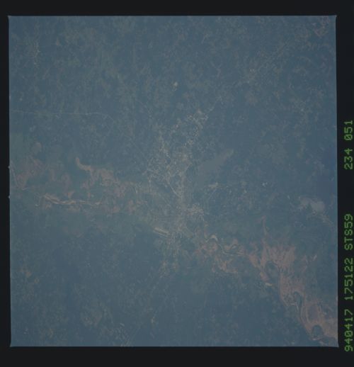
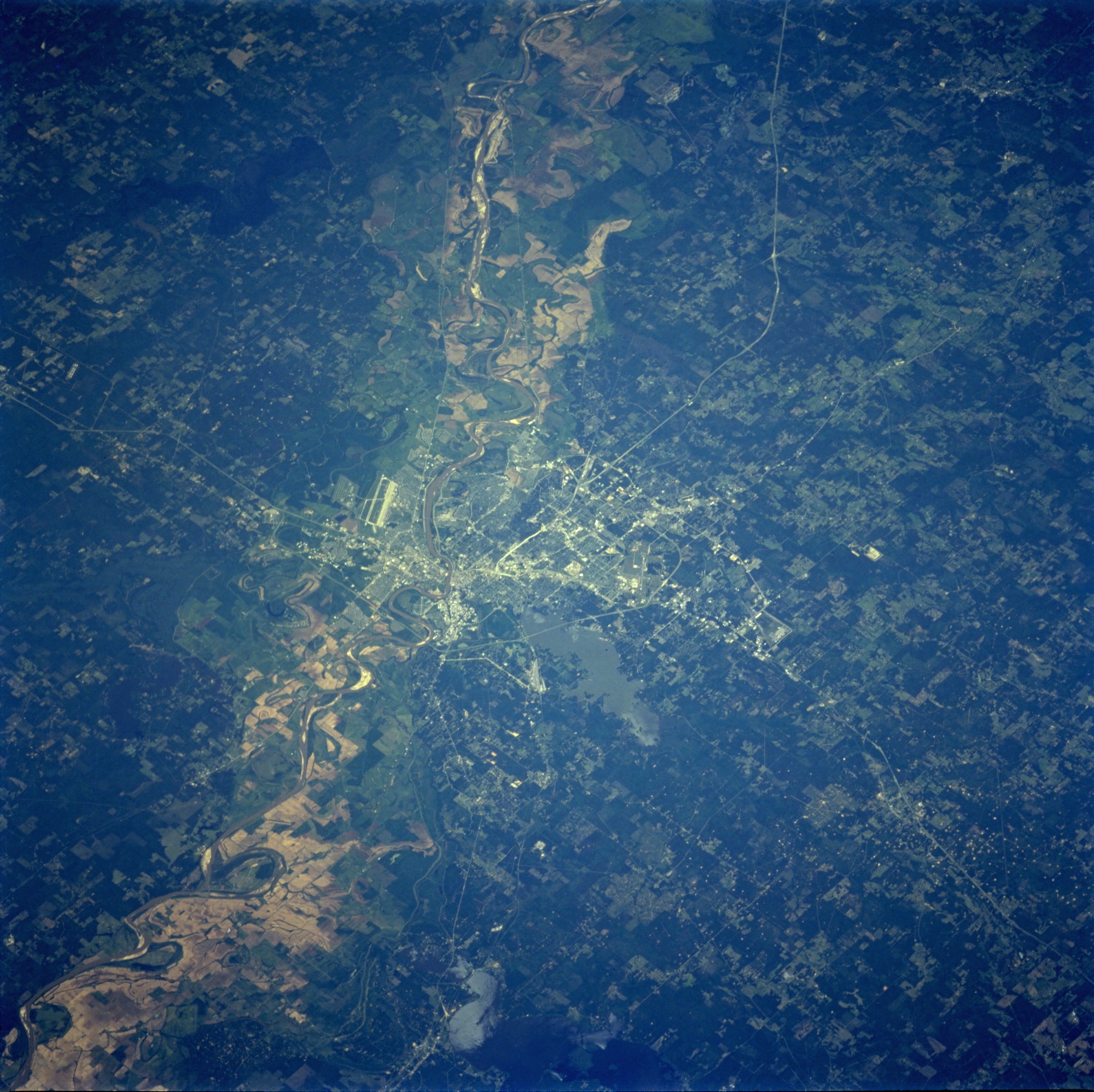
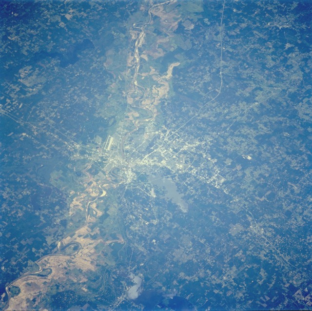
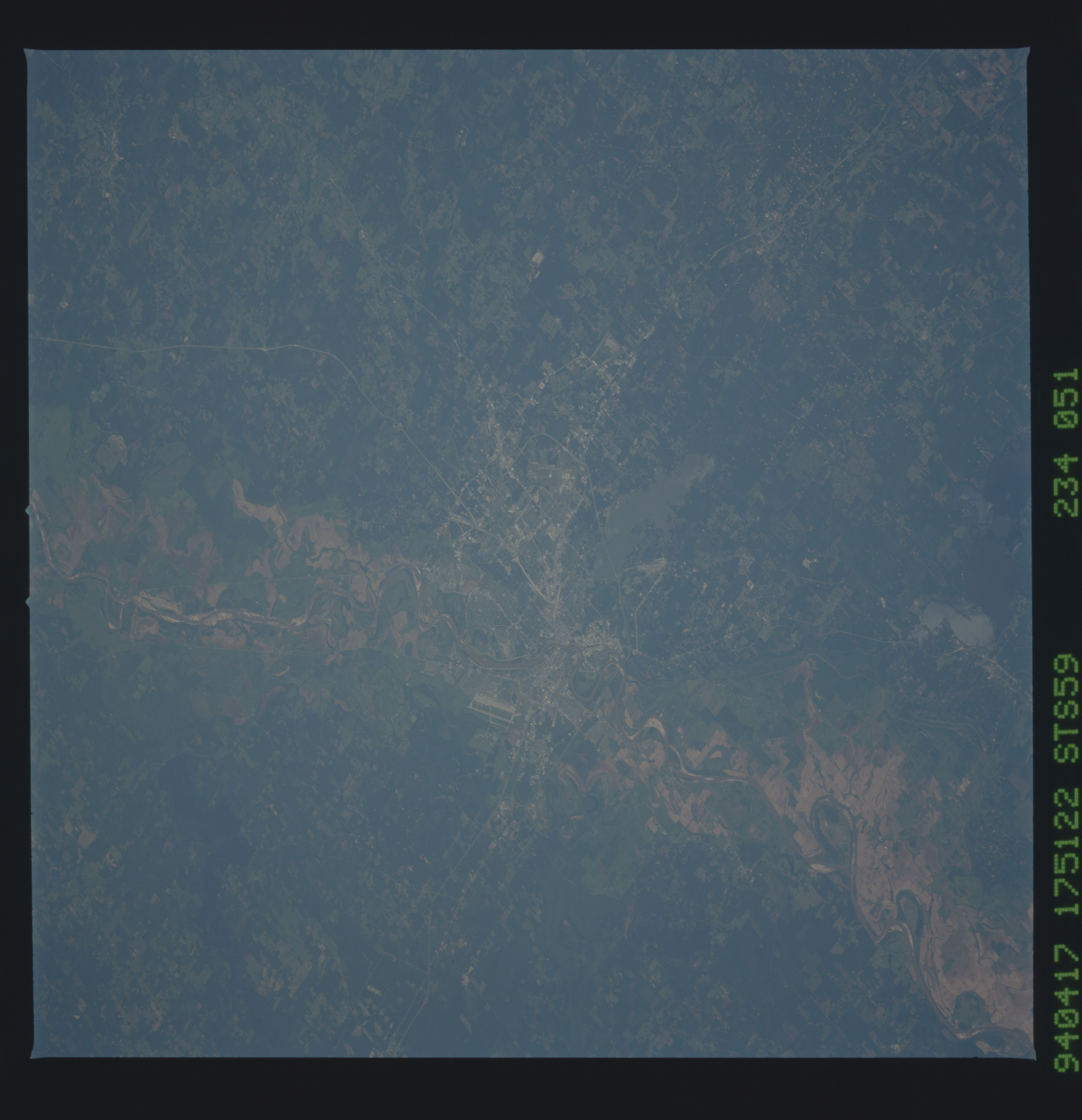
Image Caption: STS059-234-051 Shreveport, Louisiana, U.S.A. April 1994
Shreveport and the Red River Valley, with its reddish-brown agricultural fields, are prominent in this low-oblique, southeast-looking photograph. With the discovery of oil in 1906, Shreveport began to develop into a major industrial city; with a population of almost 208 000, it is an oil and natural gas center. It is also a hub for the manufacture of metals, chemicals, machinery, telephones, and defense products. Cotton, lumber, dairy goods, animal feed, and grain are also produced. The large airport runway at Barksdale Air Force Base (east of the Red River near the center of the photograph) and Cross Lake (northwest of the city) are visible in the photograph. During the Civil War, Shreveport became the Confederate capital of Louisiana in 1863.
Shreveport and the Red River Valley, with its reddish-brown agricultural fields, are prominent in this low-oblique, southeast-looking photograph. With the discovery of oil in 1906, Shreveport began to develop into a major industrial city; with a population of almost 208 000, it is an oil and natural gas center. It is also a hub for the manufacture of metals, chemicals, machinery, telephones, and defense products. Cotton, lumber, dairy goods, animal feed, and grain are also produced. The large airport runway at Barksdale Air Force Base (east of the Red River near the center of the photograph) and Cross Lake (northwest of the city) are visible in the photograph. During the Civil War, Shreveport became the Confederate capital of Louisiana in 1863.
