STS059-234-34
| NASA Photo ID | STS059-234-34 |
| Focal Length | 250mm |
| Date taken | 1994.04.17 |
| Time taken | 16:19:47 GMT |
Resolutions offered for this image:
3904 x 3904 pixels 639 x 639 pixels 5700 x 5900 pixels 500 x 518 pixels 640 x 480 pixels
3904 x 3904 pixels 639 x 639 pixels 5700 x 5900 pixels 500 x 518 pixels 640 x 480 pixels
Cloud masks available for this image:
Spacecraft nadir point: 42.3° N, 82.2° W
Photo center point: 41.5° N, 81.5° W
Photo center point by machine learning:
Photo center point: 41.5° N, 81.5° W
Photo center point by machine learning:
Nadir to Photo Center: Southeast
Spacecraft Altitude: 113 nautical miles (209km)
Camera: | Hasselblad |
Focal Length: | 250mm |
Camera Tilt: | 29 degrees |
Format: | 5046: Kodak, natural color positive, Lumiere 100/5046, ASA 100, standard base |
Film Exposure: | Normal |
| Additional Information | |
| Width | Height | Annotated | Cropped | Purpose | Links |
|---|---|---|---|---|---|
| 3904 pixels | 3904 pixels | No | No | Earth From Space collection | Download Image |
| 639 pixels | 639 pixels | No | No | Earth From Space collection | Download Image |
| 5700 pixels | 5900 pixels | No | No | Download Image | |
| 500 pixels | 518 pixels | No | No | Download Image | |
| 640 pixels | 480 pixels | No | No | Download Image |
Download Packaged File
Download a Google Earth KML for this Image
View photo footprint information
Download a GeoTIFF for this photo
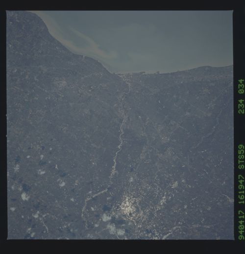
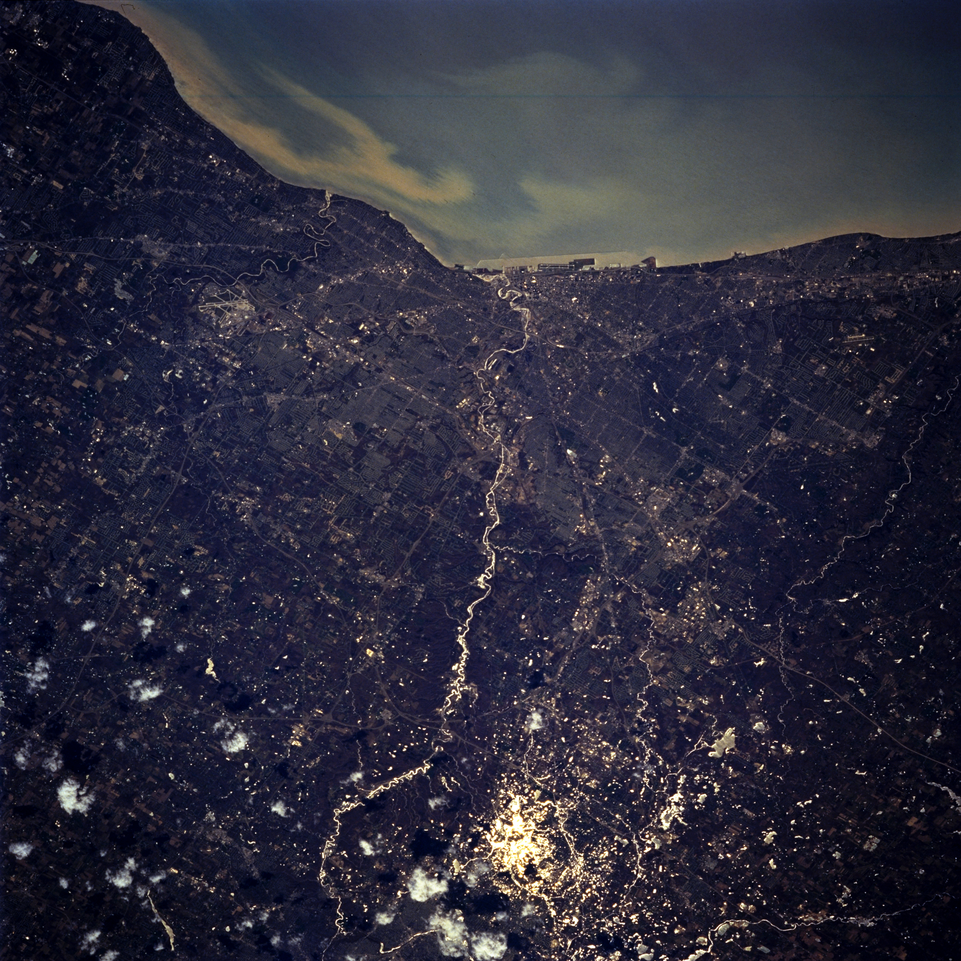
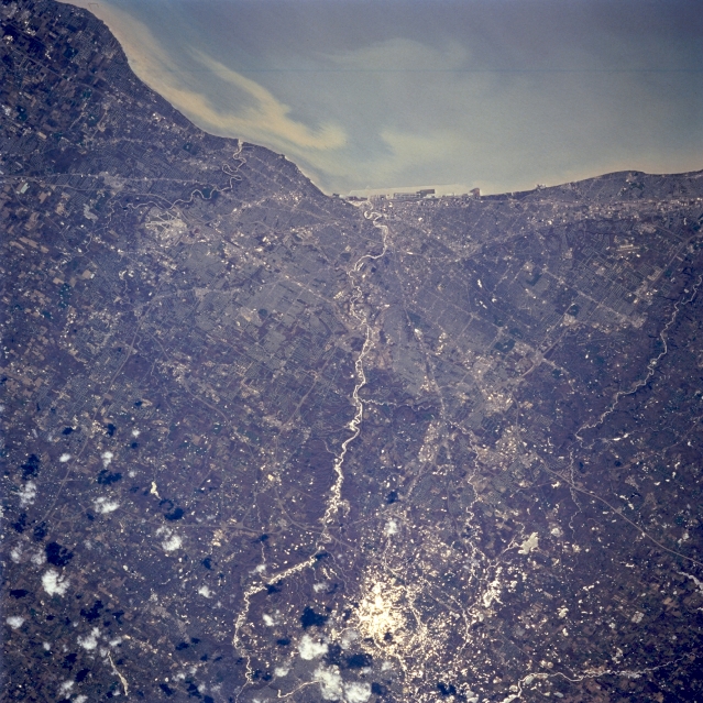
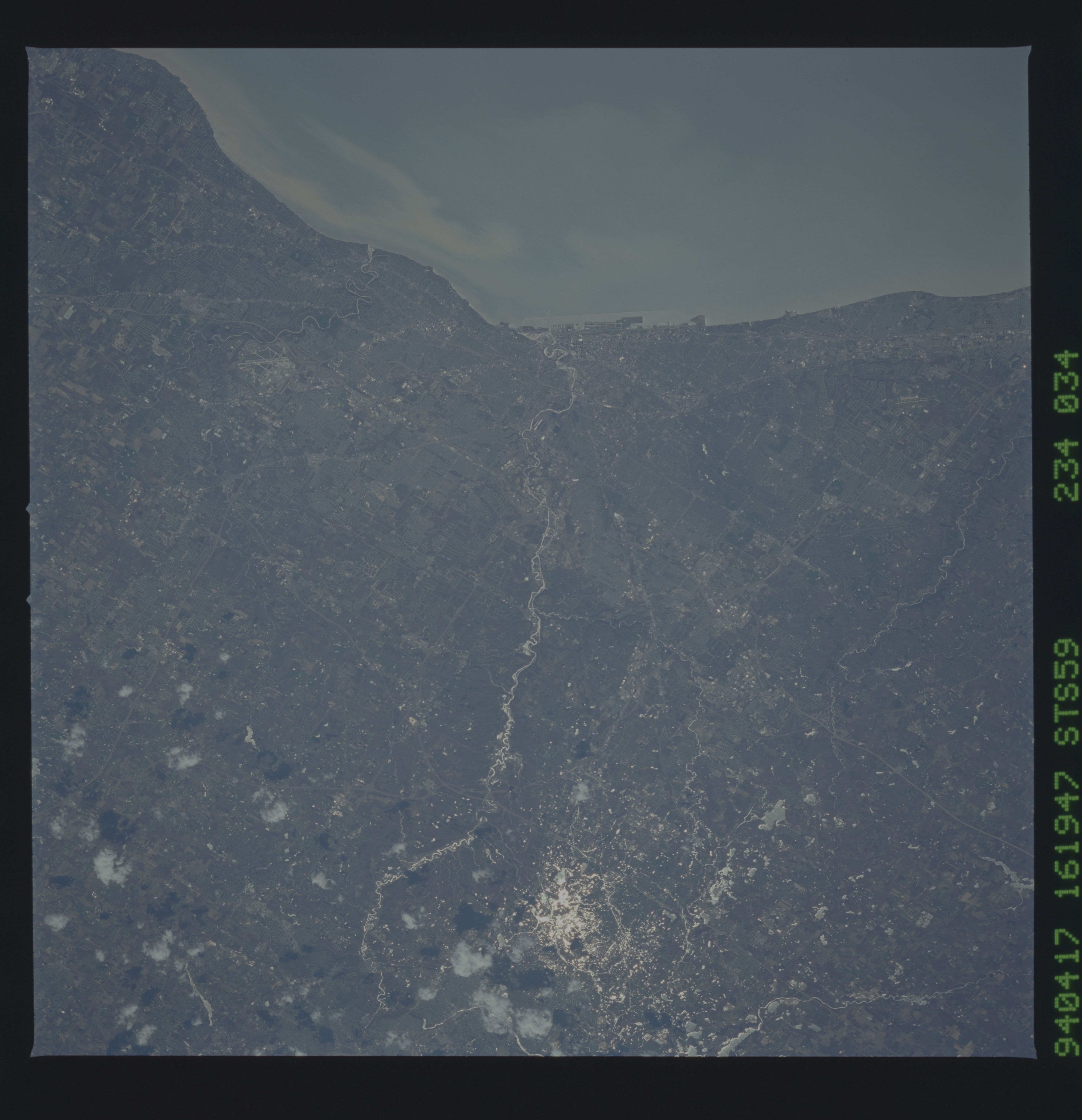
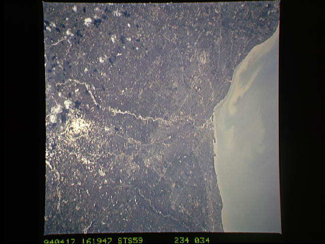
Image Caption: STS059-234-034 Cleveland, Ohio, U.S.A. April 1994
Featured in this near-vertical photograph is Cleveland, situated at the mouth of the Cuyahoga River, which empties into Lake Erie. Extending along the lake, Cleveland, the largest city in Ohio, is a Great Lakes shipping and receiving point, a major U.S. iron and steel center, and the city in which John D. Rockefeller began his oil dynasty. Subsequent to the racial and financial problems of the 1960s and 1970s, the city made a dramatic turnaround--cleaning the polluted Cuyahoga River and modernizing the city's central area. Visible west of the city are the runways of Cleveland-Hopkins International Airport, west of which is the NASA Lewis Research Center.
Featured in this near-vertical photograph is Cleveland, situated at the mouth of the Cuyahoga River, which empties into Lake Erie. Extending along the lake, Cleveland, the largest city in Ohio, is a Great Lakes shipping and receiving point, a major U.S. iron and steel center, and the city in which John D. Rockefeller began his oil dynasty. Subsequent to the racial and financial problems of the 1960s and 1970s, the city made a dramatic turnaround--cleaning the polluted Cuyahoga River and modernizing the city's central area. Visible west of the city are the runways of Cleveland-Hopkins International Airport, west of which is the NASA Lewis Research Center.
