STS059-228-94
| NASA Photo ID | STS059-228-94 |
| Focal Length | 250mm |
| Date taken | 1994.04.18 |
| Time taken | 15:48:18 GMT |
Resolutions offered for this image:
5700 x 5900 pixels 500 x 518 pixels 640 x 480 pixels 2014 x 2560 pixels 2014 x 2560 pixels
5700 x 5900 pixels 500 x 518 pixels 640 x 480 pixels 2014 x 2560 pixels 2014 x 2560 pixels


Cloud masks available for this image:
Spacecraft nadir point: 57.1° N, 138.3° W
Photo center point: 59.0° N, 138.0° W
Photo center point by machine learning:
Photo center point: 59.0° N, 138.0° W
Photo center point by machine learning:
Nadir to Photo Center: North
Spacecraft Altitude: 111 nautical miles (206km)
Country or Geographic Name: | USA-ALASKA |
Features: | DRY BAY COASTAL AREA |
| Features Found Using Machine Learning: | |
Cloud Cover Percentage: | 0 (no clouds present) |
Sun Elevation Angle: | 14° |
Sun Azimuth: | 91° |
Camera: | Hasselblad |
Focal Length: | 250mm |
Camera Tilt: | 46 degrees |
Format: | 5048: Kodak, natural color positive, Lumiere 100x/5048, ASA 100x, standard base |
Film Exposure: | Normal |
| Additional Information | |
| Width | Height | Annotated | Cropped | Purpose | Links |
|---|---|---|---|---|---|
| 5700 pixels | 5900 pixels | No | No | Download Image | |
| 500 pixels | 518 pixels | No | No | Download Image | |
| 640 pixels | 480 pixels | No | No | Download Image | |
| 2014 pixels | 2560 pixels | Earth From Space phase 2 | Download Image | ||
| 2014 pixels | 2560 pixels | Download Image |
Download Packaged File
Download a Google Earth KML for this Image
View photo footprint information
Download a GeoTIFF for this photo
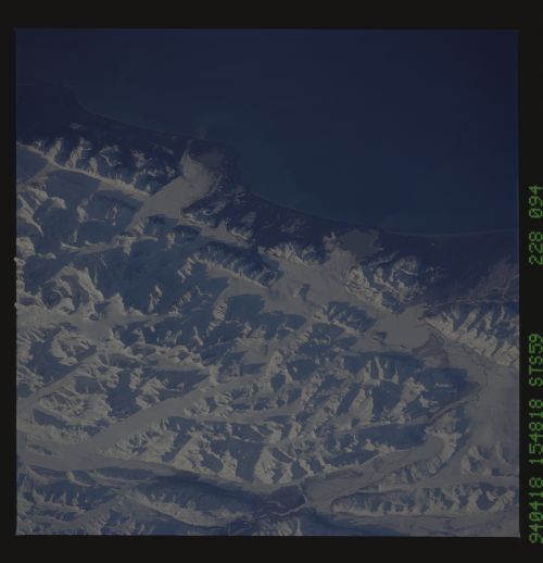
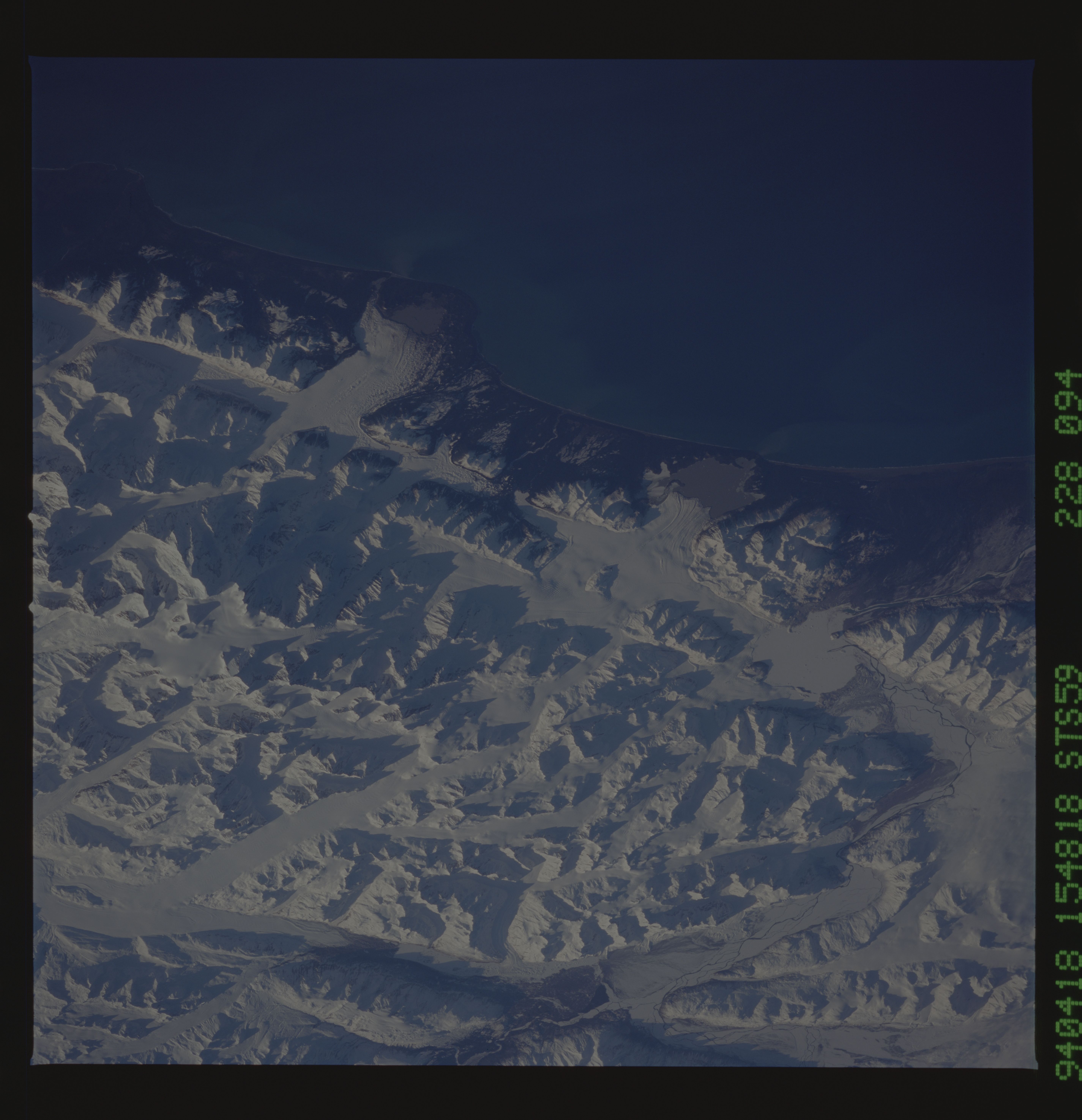
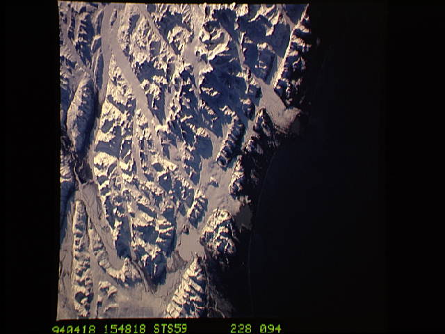
Image Caption: Mount St. Elias and glaciers spilling into the sea, Alaska Peninsula
The spring thaw along the coast of the Gulf of Alaska has not touched the St. Elias Mountains, southeast of Yakutat Bay and Malaspina Glacier. A prominent glacier flows from Mt. Fairweather (15,300 feet) at right center, to form Cape Fairweather. Another glacier to the northwest almost reaches the sea; the valley of the Alsek River forms a broad, braided plain at upper left. the low sun elevation and oblique angle of this photograph provide a 3-dimensional appearance to the black-and-white landscape.
The spring thaw along the coast of the Gulf of Alaska has not touched the St. Elias Mountains, southeast of Yakutat Bay and Malaspina Glacier. A prominent glacier flows from Mt. Fairweather (15,300 feet) at right center, to form Cape Fairweather. Another glacier to the northwest almost reaches the sea; the valley of the Alsek River forms a broad, braided plain at upper left. the low sun elevation and oblique angle of this photograph provide a 3-dimensional appearance to the black-and-white landscape.
