STS059-228-101
| NASA Photo ID | STS059-228-101 |
| Focal Length | 250mm |
| Date taken | 1994.04.18 |
| Time taken | 15:56:00 GMT |
Resolutions offered for this image:
3875 x 3904 pixels 635 x 639 pixels 5700 x 5900 pixels 500 x 518 pixels 640 x 480 pixels
3875 x 3904 pixels 635 x 639 pixels 5700 x 5900 pixels 500 x 518 pixels 640 x 480 pixels

Cloud masks available for this image:
Spacecraft nadir point: 47.3° N, 90.6° W
Photo center point: 47.0° N, 92.0° W
Photo center point by machine learning:
Photo center point: 47.0° N, 92.0° W
Photo center point by machine learning:
Nadir to Photo Center: West
Spacecraft Altitude: 112 nautical miles (207km)
Country or Geographic Name: | USA-MINNESOTA |
Features: | DULUTH |
| Features Found Using Machine Learning: | |
Cloud Cover Percentage: | 5 (1-10)% |
Sun Elevation Angle: | 45° |
Sun Azimuth: | 133° |
Camera: | Hasselblad |
Focal Length: | 250mm |
Camera Tilt: | 38 degrees |
Format: | 5048: Kodak, natural color positive, Lumiere 100x/5048, ASA 100x, standard base |
Film Exposure: | Normal |
| Additional Information | |
| Width | Height | Annotated | Cropped | Purpose | Links |
|---|---|---|---|---|---|
| 3875 pixels | 3904 pixels | No | No | Earth From Space collection | Download Image |
| 635 pixels | 639 pixels | No | No | Earth From Space collection | Download Image |
| 5700 pixels | 5900 pixels | No | No | Download Image | |
| 500 pixels | 518 pixels | No | No | Download Image | |
| 640 pixels | 480 pixels | No | No | Download Image |
Download Packaged File
Download a Google Earth KML for this Image
View photo footprint information
Download a GeoTIFF for this photo
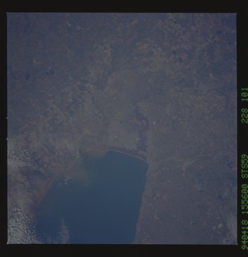
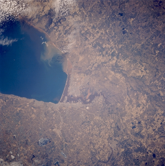
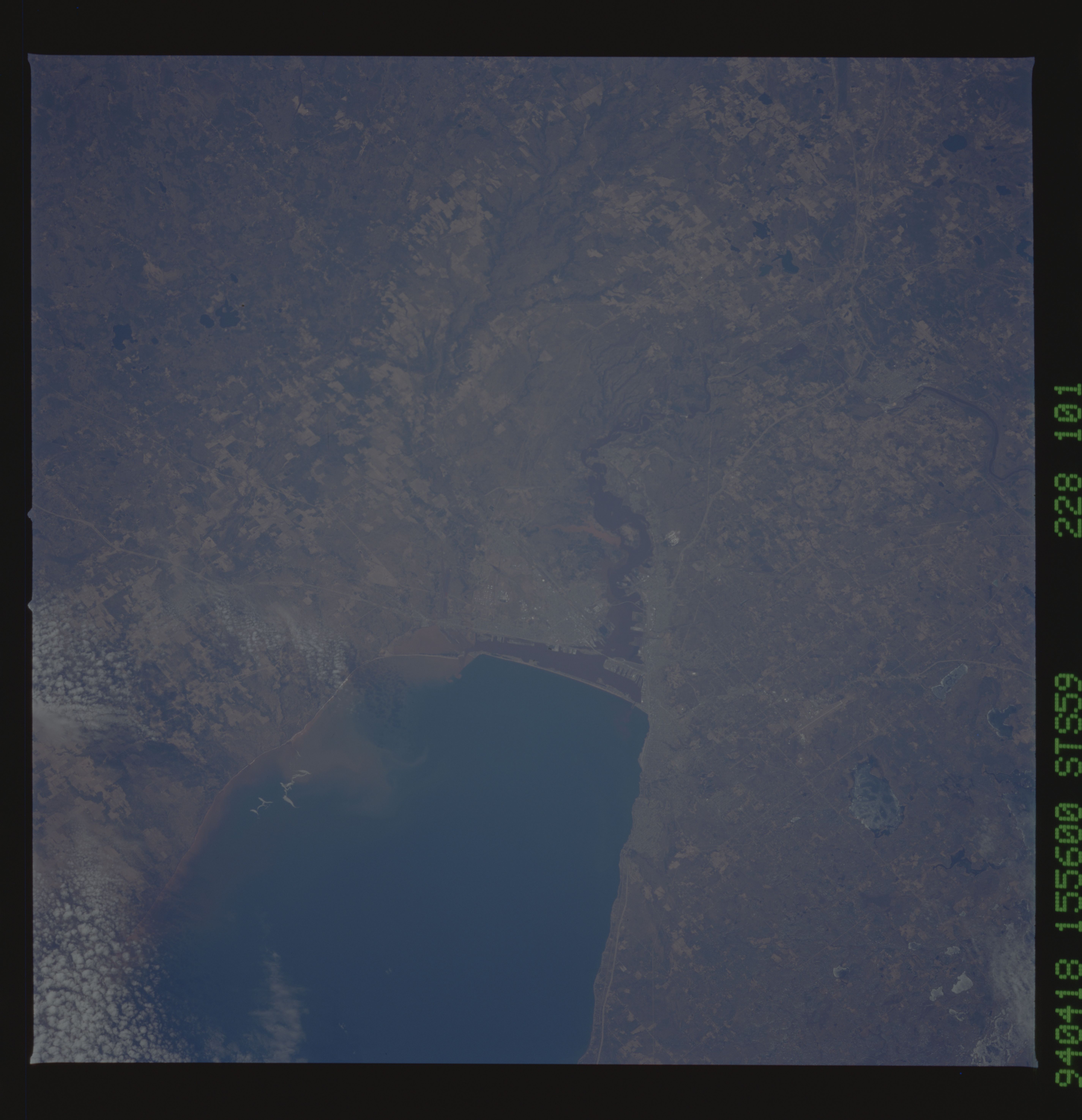
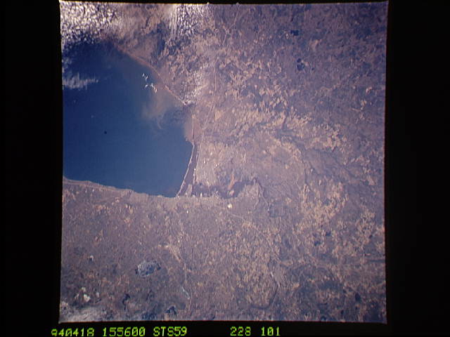
Image Caption: STS059-228-101 Duluth, Minnesota, and Superior, Wisconsin, U.S.A. April 1994
The industrial port cities of Duluth, Minnesota, and Superior, Wisconsin, and the western portion of blue Lake Superior, the largest freshwater lake in the world, are apparent in this southeast-looking, low-oblique photograph. Duluth, one of the major ports of the Great Lakes, became the chief shipping point for ore to U.S. steel mills when iron was discovered in 1865 in the Mesabi Range north-northwest of Duluth. Superior, on Superior Bay at the mouths of the Saint Louis and Nemadji Rivers, is also a shipping point for iron ore, timber, grains, and other materials to the eastern United States and the world.
The industrial port cities of Duluth, Minnesota, and Superior, Wisconsin, and the western portion of blue Lake Superior, the largest freshwater lake in the world, are apparent in this southeast-looking, low-oblique photograph. Duluth, one of the major ports of the Great Lakes, became the chief shipping point for ore to U.S. steel mills when iron was discovered in 1865 in the Mesabi Range north-northwest of Duluth. Superior, on Superior Bay at the mouths of the Saint Louis and Nemadji Rivers, is also a shipping point for iron ore, timber, grains, and other materials to the eastern United States and the world.
