STS059-223-71
| NASA Photo ID | STS059-223-71 |
| Focal Length | 40mm |
| Date taken | 1994.04.18 |
| Time taken | 07:05:35 GMT |
Resolutions offered for this image:
4064 x 4064 pixels 639 x 639 pixels 5700 x 5900 pixels 500 x 518 pixels 640 x 480 pixels
4064 x 4064 pixels 639 x 639 pixels 5700 x 5900 pixels 500 x 518 pixels 640 x 480 pixels


Cloud masks available for this image:
Spacecraft nadir point: 43.9° N, 50.3° E
Photo center point: 45.0° N, 51.0° E
Photo center point by machine learning:
Photo center point: 45.0° N, 51.0° E
Photo center point by machine learning:
Nadir to Photo Center: Northeast
Spacecraft Altitude: 112 nautical miles (207km)
Country or Geographic Name: | KAZAKHSTAN |
Features: | TYUB-KARAGAN PEN., SEA |
| Features Found Using Machine Learning: | |
Cloud Cover Percentage: | 10 (1-10)% |
Sun Elevation Angle: | 51° |
Sun Azimuth: | 142° |
Camera: | Hasselblad |
Focal Length: | 40mm |
Camera Tilt: | 35 degrees |
Format: | 5048: Kodak, natural color positive, Lumiere 100x/5048, ASA 100x, standard base |
Film Exposure: | Normal |
| Additional Information | |
| Width | Height | Annotated | Cropped | Purpose | Links |
|---|---|---|---|---|---|
| 4064 pixels | 4064 pixels | No | No | Earth From Space collection | Download Image |
| 639 pixels | 639 pixels | No | No | Earth From Space collection | Download Image |
| 5700 pixels | 5900 pixels | No | No | Download Image | |
| 500 pixels | 518 pixels | No | No | Download Image | |
| 640 pixels | 480 pixels | No | No | Download Image |
Download Packaged File
Download a Google Earth KML for this Image
View photo footprint information
Download a GeoTIFF for this photo
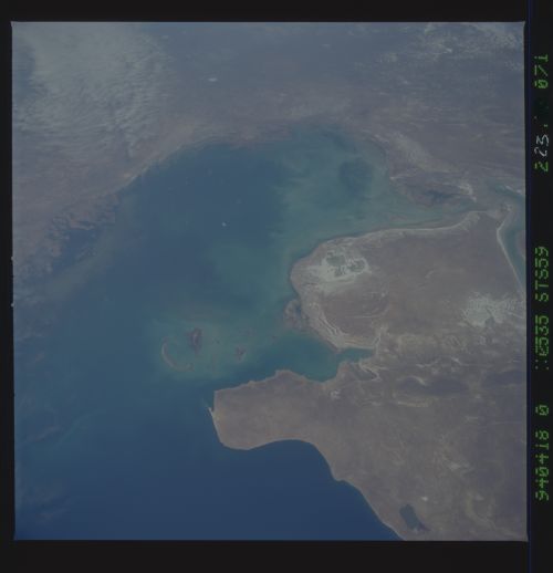
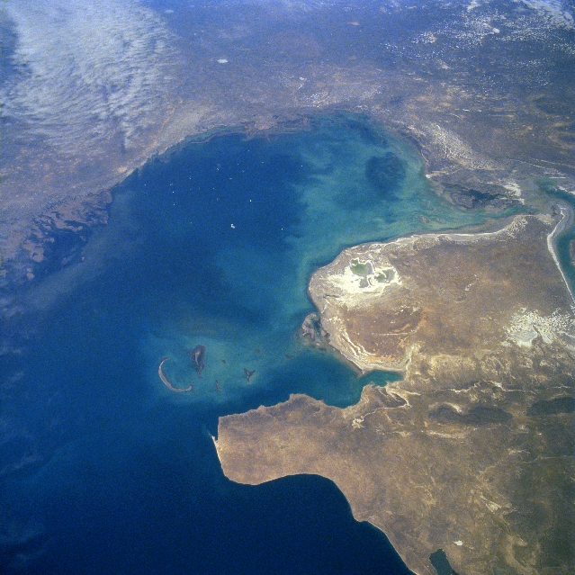
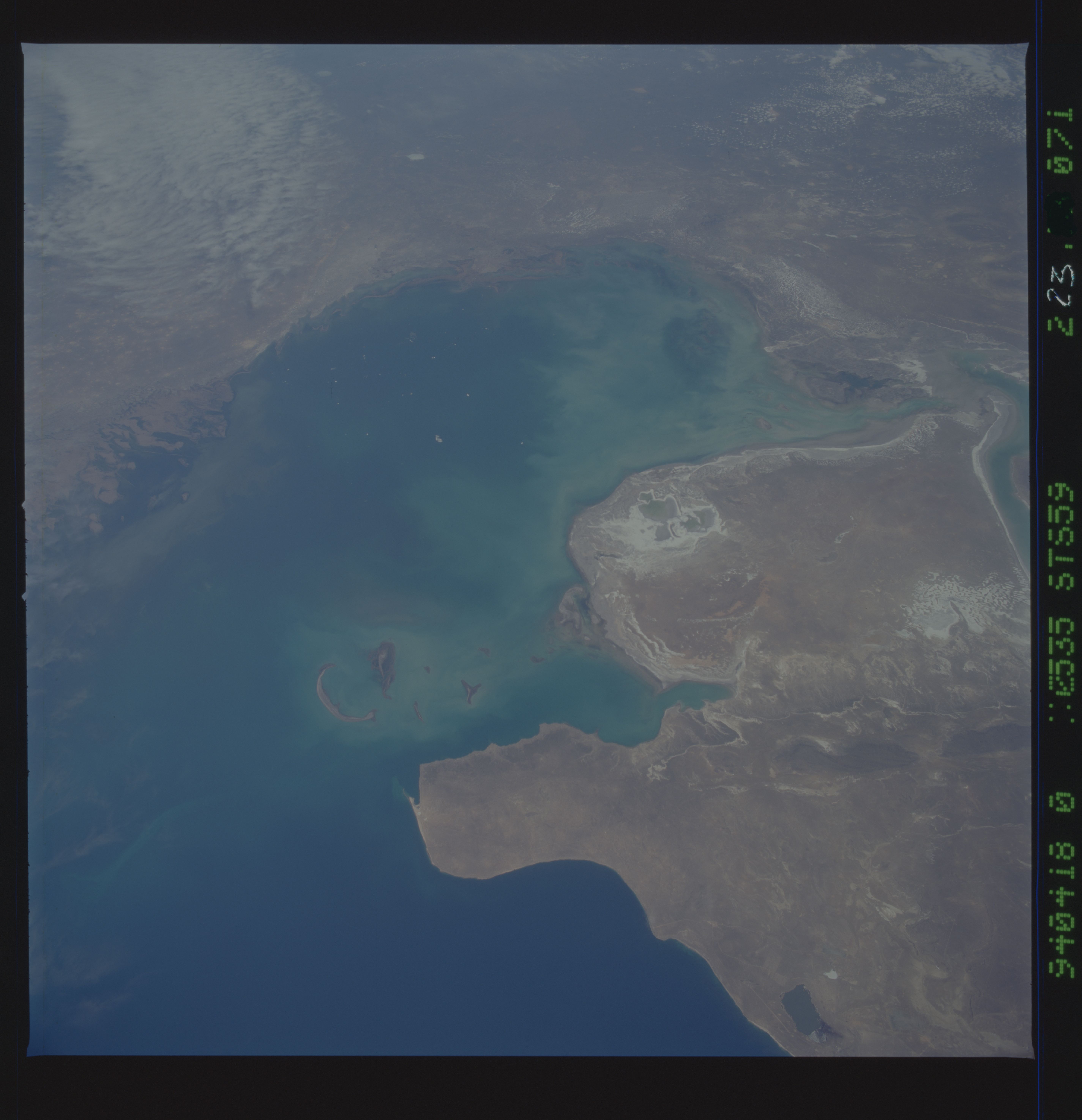
Image Caption: STS059-223-071 Northern Caspian Sea, Kazakhstan April 1994
This north-looking view shows the northern Caspian Sea and its surrounding lowlands. The Caspian Sea is the largest inland body of water in the world. The sea is presently near 88 feet (27 meters) below sea level. The water levels of the Caspian Sea rose during the decade of the 1990's. Before the decade of the 1990's, water levels had been receding due to the construction of dams and lakes on the Volga, the sea's main source of water inflow. The northern part of the Caspian Sea, as shown in this view, is shallow reaching an average depth of only 17 feet (5 meters). A good portion of the northern part of the Caspian Sea is frozen during the winter months of December through early March. Much of the land area, mostly marsh and desert surrounding this region of the Caspian Sea is below sea level. The lands around this section of the sea are known for the production of oil and gas, and manganese and coal mining. The Manglashlak Peninsula is visible extending westward into the Caspian Sea in the lower left portion of the image.
This north-looking view shows the northern Caspian Sea and its surrounding lowlands. The Caspian Sea is the largest inland body of water in the world. The sea is presently near 88 feet (27 meters) below sea level. The water levels of the Caspian Sea rose during the decade of the 1990's. Before the decade of the 1990's, water levels had been receding due to the construction of dams and lakes on the Volga, the sea's main source of water inflow. The northern part of the Caspian Sea, as shown in this view, is shallow reaching an average depth of only 17 feet (5 meters). A good portion of the northern part of the Caspian Sea is frozen during the winter months of December through early March. Much of the land area, mostly marsh and desert surrounding this region of the Caspian Sea is below sea level. The lands around this section of the sea are known for the production of oil and gas, and manganese and coal mining. The Manglashlak Peninsula is visible extending westward into the Caspian Sea in the lower left portion of the image.
