STS059-219-65
| NASA Photo ID | STS059-219-65 |
| Focal Length | 250mm |
| Date taken | 1994.04.14 |
| Time taken | 01:02:52 GMT |
Cloud masks available for this image:
Spacecraft nadir point: 49.9° N, 154.0° E
Photo center point: 49.5° N, 155.0° E
Photo center point by machine learning:
Photo center point: 49.5° N, 155.0° E
Photo center point by machine learning:
Nadir to Photo Center: East
Spacecraft Altitude: 116 nautical miles (215km)
Country or Geographic Name: | RUSSIAN FEDERATION |
Features: | ONEKOTAN I, SNOW COVERED |
| Features Found Using Machine Learning: | |
Cloud Cover Percentage: | 0 (no clouds present) |
Sun Elevation Angle: | 49° |
Sun Azimuth: | 164° |
Camera: | Hasselblad |
Focal Length: | 250mm |
Camera Tilt: | 29 degrees |
Format: | 5048: Kodak, natural color positive, Lumiere 100x/5048, ASA 100x, standard base |
Film Exposure: | Normal |
| Additional Information | |
| Width | Height | Annotated | Cropped | Purpose | Links |
|---|---|---|---|---|---|
| 5700 pixels | 5900 pixels | No | No | Download Image | |
| 500 pixels | 518 pixels | No | No | Download Image | |
| 640 pixels | 480 pixels | No | No | Download Image |
Download Packaged File
Download a Google Earth KML for this Image
View photo footprint information
Download a GeoTIFF for this photo
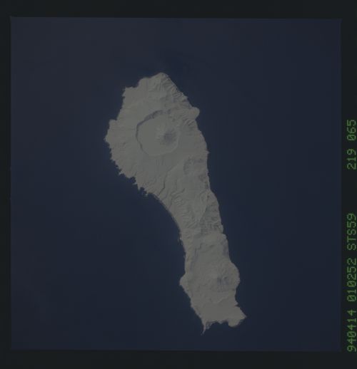
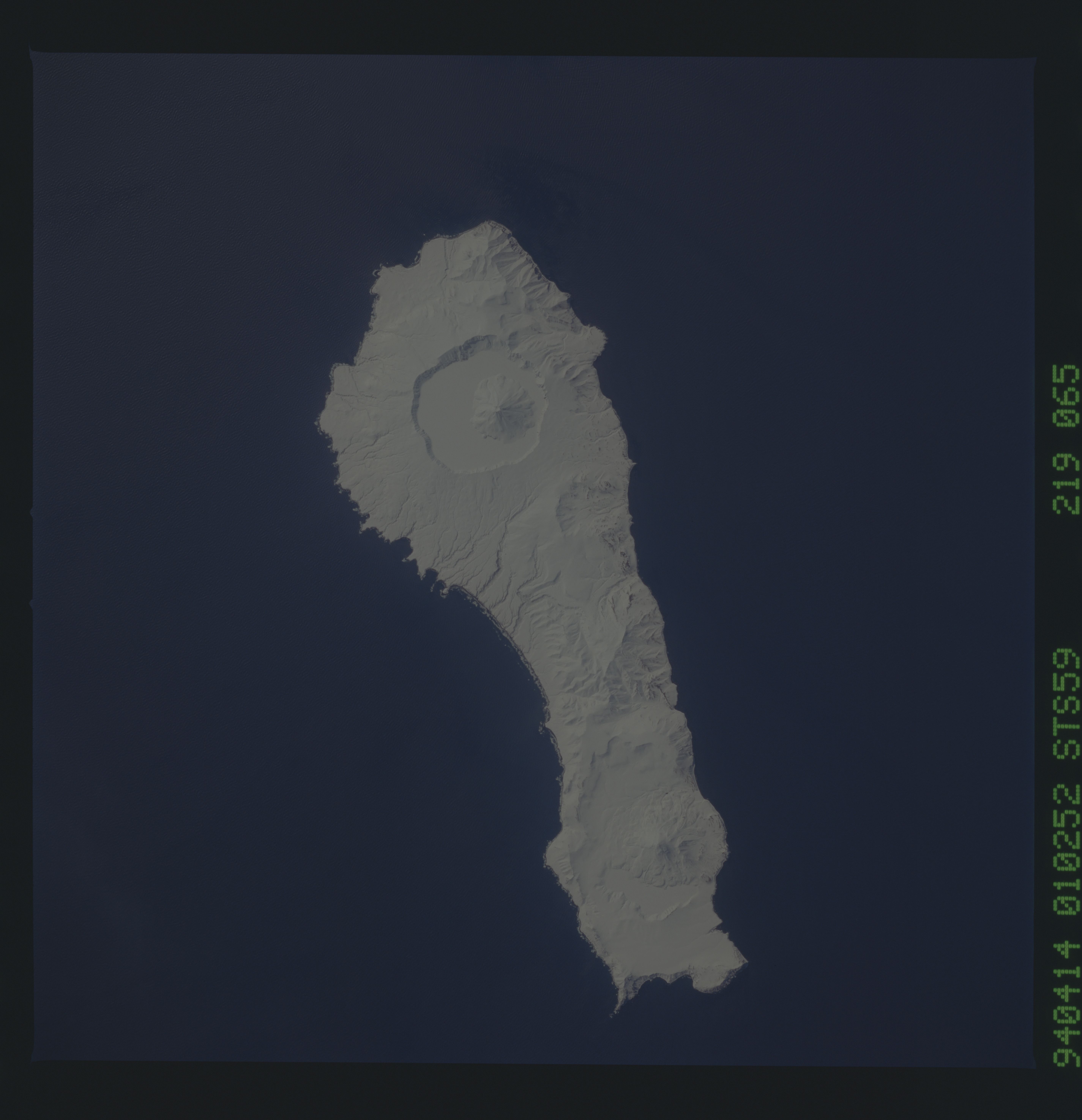
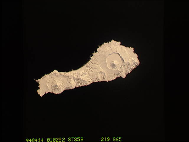
Image Caption: Onekaton Island, Kurile chain, in winter.
The narrow end of Onekotan Island is to the north by northeast. This is one of several volcanic islands extending south by southwest between the southern tip of Kamchatka and Japan. The exposure was stopped down to provide extremely fine detail in the totally snow-covered landscape, at the same time making the dark sea look completely black.
The narrow end of Onekotan Island is to the north by northeast. This is one of several volcanic islands extending south by southwest between the southern tip of Kamchatka and Japan. The exposure was stopped down to provide extremely fine detail in the totally snow-covered landscape, at the same time making the dark sea look completely black.
