STS059-217-73
| NASA Photo ID | STS059-217-73 |
| Focal Length | 250mm |
| Date taken | 1994.04.14 |
| Time taken | 17:23:15 GMT |
Resolutions offered for this image:
3940 x 3925 pixels 639 x 637 pixels 5700 x 5900 pixels 500 x 518 pixels 640 x 480 pixels
3940 x 3925 pixels 639 x 637 pixels 5700 x 5900 pixels 500 x 518 pixels 640 x 480 pixels


Cloud masks available for this image:
Spacecraft nadir point: 39.4° N, 77.0° W
Photo center point: 40.5° N, 77.0° W
Photo center point by machine learning:
Photo center point: 40.5° N, 77.0° W
Photo center point by machine learning:
Nadir to Photo Center: North
Spacecraft Altitude: 115 nautical miles (213km)
Country or Geographic Name: | USA-PENNSYLVANIA |
Features: | HARRISBURG, SUSQUEHANNA R |
| Features Found Using Machine Learning: | |
Cloud Cover Percentage: | 0 (no clouds present) |
Sun Elevation Angle: | 60° |
Sun Azimuth: | 187° |
Camera: | Hasselblad |
Focal Length: | 250mm |
Camera Tilt: | 30 degrees |
Format: | 5048: Kodak, natural color positive, Lumiere 100x/5048, ASA 100x, standard base |
Film Exposure: | Normal |
| Additional Information | |
| Width | Height | Annotated | Cropped | Purpose | Links |
|---|---|---|---|---|---|
| 3940 pixels | 3925 pixels | No | No | Earth From Space collection | Download Image |
| 639 pixels | 637 pixels | No | No | Earth From Space collection | Download Image |
| 5700 pixels | 5900 pixels | No | No | Download Image | |
| 500 pixels | 518 pixels | No | No | Download Image | |
| 640 pixels | 480 pixels | No | No | Download Image |
Download Packaged File
Download a Google Earth KML for this Image
View photo footprint information
Download a GeoTIFF for this photo
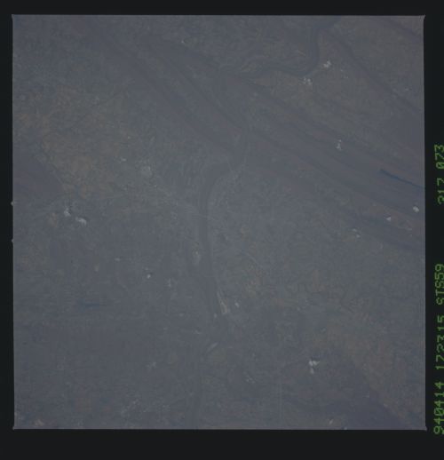
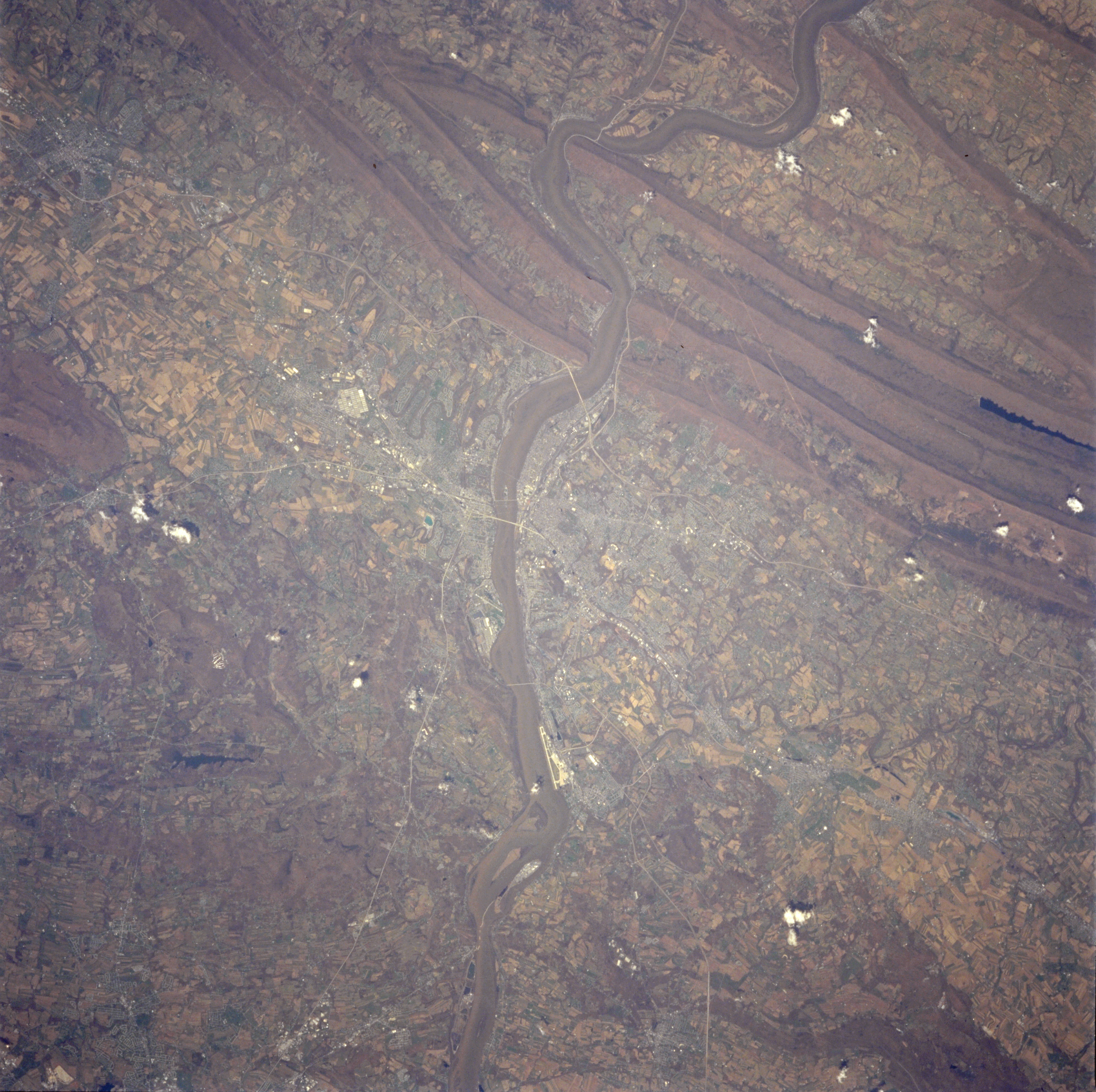
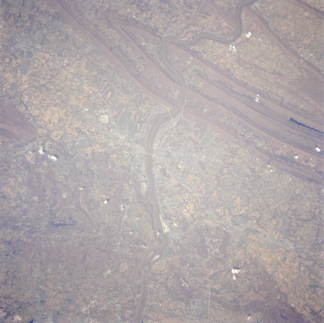
Image Caption: STS059-217-073 Greater Harrisburg Area, Pennsylvania, U.S.A. April 1994
The greater Harrisburg area is shown in this near-vertical photograph. Major physical features include a small section of the folded Appalachian Mountains with the paralleling ridge and valley pattern, the southward-flowing Susquehanna River, the rolling hills and fertile valleys surrounding the capital city, and water gaps created by the Susquehanna River as it cuts through the mountains north of Harrisburg. Several manmade features appear in this fairly detailed photograph of the Cumberland Valley (west of the Susquehanna River) and Dauphin County (east of the Susquehanna River). Visible are some highway bridges that cross the Susquehanna River and connect Harrisburg with towns on the west shore (Enola, New Cumberland, Camp Hill, and Mechanicsburg). Famous Three Mile Island in the Susquehanna River can be seen south of Harrisburg International Airport (formerly Olmsted Air Force Base). An extensive ground transportation network, including Interstate Highways 81 and 83 and the Pennsylvania Turnpike, traverses the region, linking the large east coast population with that of the midwest and southwest states. The large white block west-northwest of Harrisburg is the U.S. Navy storage depot near Mechanicsburg. Chocolate Town-USA (Hershey, Pennsylvania) is barely recognizable 12 miles (19 kilometers) east of Harrisburg as one in a string of towns. Cultivated fields of crops used primarily for beef cattle and dairy cattle feed dominate the rural scene. (Refer to STS-059-205-067 for a synoptic view that includes the northern half of this photograph.)
The greater Harrisburg area is shown in this near-vertical photograph. Major physical features include a small section of the folded Appalachian Mountains with the paralleling ridge and valley pattern, the southward-flowing Susquehanna River, the rolling hills and fertile valleys surrounding the capital city, and water gaps created by the Susquehanna River as it cuts through the mountains north of Harrisburg. Several manmade features appear in this fairly detailed photograph of the Cumberland Valley (west of the Susquehanna River) and Dauphin County (east of the Susquehanna River). Visible are some highway bridges that cross the Susquehanna River and connect Harrisburg with towns on the west shore (Enola, New Cumberland, Camp Hill, and Mechanicsburg). Famous Three Mile Island in the Susquehanna River can be seen south of Harrisburg International Airport (formerly Olmsted Air Force Base). An extensive ground transportation network, including Interstate Highways 81 and 83 and the Pennsylvania Turnpike, traverses the region, linking the large east coast population with that of the midwest and southwest states. The large white block west-northwest of Harrisburg is the U.S. Navy storage depot near Mechanicsburg. Chocolate Town-USA (Hershey, Pennsylvania) is barely recognizable 12 miles (19 kilometers) east of Harrisburg as one in a string of towns. Cultivated fields of crops used primarily for beef cattle and dairy cattle feed dominate the rural scene. (Refer to STS-059-205-067 for a synoptic view that includes the northern half of this photograph.)
