STS059-214-60
| NASA Photo ID | STS059-214-60 |
| Focal Length | 250mm |
| Date taken | 1994.04.15 |
| Time taken | 06:55:45 GMT |
Resolutions offered for this image:
3963 x 3948 pixels 640 x 637 pixels 5700 x 5900 pixels 500 x 518 pixels 640 x 480 pixels
3963 x 3948 pixels 640 x 637 pixels 5700 x 5900 pixels 500 x 518 pixels 640 x 480 pixels


Cloud masks available for this image:
Spacecraft nadir point: 6.6° S, 112.9° E
Photo center point: 7.0° S, 112.5° E
Photo center point by machine learning:
Photo center point: 7.0° S, 112.5° E
Photo center point by machine learning:
Nadir to Photo Center: Southwest
Spacecraft Altitude: 116 nautical miles (215km)
Country or Geographic Name: | INDONESIA-J |
Features: | SURABAJA AREA, COAST |
| Features Found Using Machine Learning: | |
Cloud Cover Percentage: | 20 (11-25)% |
Sun Elevation Angle: | 50° |
Sun Azimuth: | 294° |
Camera: | Hasselblad |
Focal Length: | 250mm |
Camera Tilt: | 16 degrees |
Format: | 5048: Kodak, natural color positive, Lumiere 100x/5048, ASA 100x, standard base |
Film Exposure: | Normal |
| Additional Information | |
| Width | Height | Annotated | Cropped | Purpose | Links |
|---|---|---|---|---|---|
| 3963 pixels | 3948 pixels | No | No | Earth From Space collection | Download Image |
| 640 pixels | 637 pixels | No | No | Earth From Space collection | Download Image |
| 5700 pixels | 5900 pixels | No | No | Download Image | |
| 500 pixels | 518 pixels | No | No | Download Image | |
| 640 pixels | 480 pixels | No | No | Download Image |
Download Packaged File
Download a Google Earth KML for this Image
View photo footprint information
Download a GeoTIFF for this photo
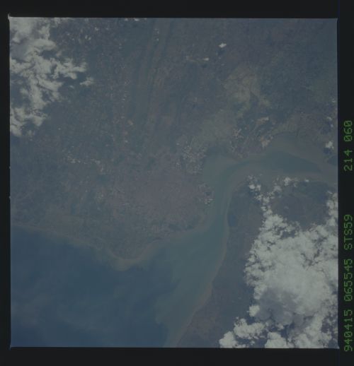
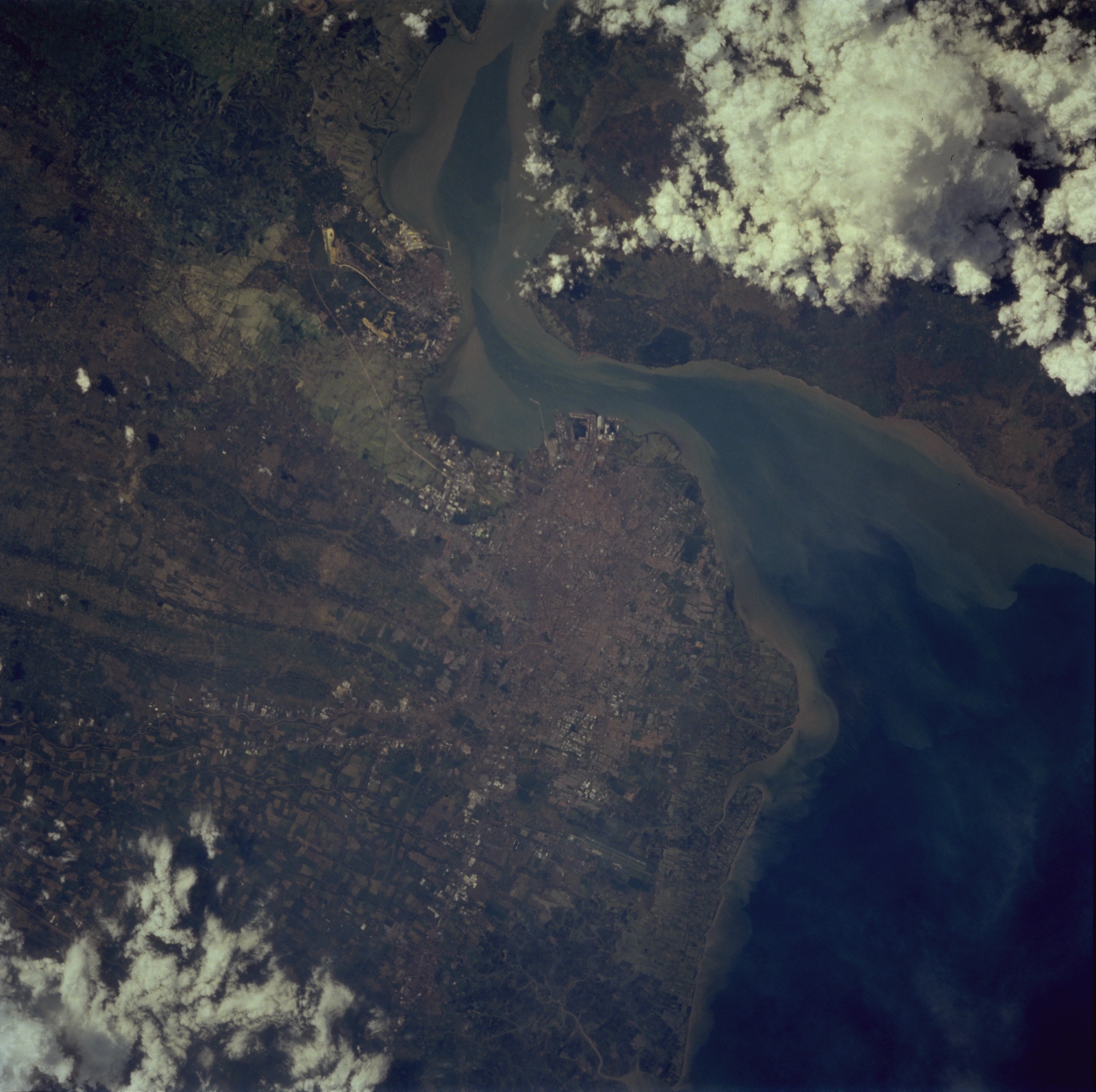
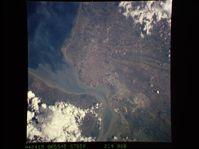
Image Caption: STS059-214-060 Surabaya, Java, Indonesia April 1994
Surabaya, Indonesia's second most-populated city, with over 2 million (Jakarta, the country's capital, has almost 8 million ), is obvious in the center of this near-vertical photograph. Agriculture is indicated by large cultivated field patterns southwest of Surabaya, which is a major industrial center, shipbuilding center, regional manufacturing and ground transportation hub for northeastern Java, and the principal naval base for Indonesia. Prior to World War II, this seaport was used by the Dutch; from 1942 to 1945 it was occupied by the Japanese. Numerous fishing ponds lie between the much smaller, but growing, coastal city of Gresik (population of approximately 100 000) and Surabaya, 8 miles (13 kilometers) southeast of Gresik. The Bay of Surabaya separates this part of Java from Madura Island to the northeast. Near-shore sediment plumes are observed along both coastlines. The larger body of water east of Surabaya is the western end of the Madura Strait.
Surabaya, Indonesia's second most-populated city, with over 2 million (Jakarta, the country's capital, has almost 8 million ), is obvious in the center of this near-vertical photograph. Agriculture is indicated by large cultivated field patterns southwest of Surabaya, which is a major industrial center, shipbuilding center, regional manufacturing and ground transportation hub for northeastern Java, and the principal naval base for Indonesia. Prior to World War II, this seaport was used by the Dutch; from 1942 to 1945 it was occupied by the Japanese. Numerous fishing ponds lie between the much smaller, but growing, coastal city of Gresik (population of approximately 100 000) and Surabaya, 8 miles (13 kilometers) southeast of Gresik. The Bay of Surabaya separates this part of Java from Madura Island to the northeast. Near-shore sediment plumes are observed along both coastlines. The larger body of water east of Surabaya is the western end of the Madura Strait.
