STS059-214-59

| NASA Photo ID | STS059-214-59 |
| Focal Length | 250mm |
| Date taken | 1994.04.15 |
| Time taken | 06:54:41 GMT |
Cloud masks available for this image:
Spacecraft nadir point: 3.0° S, 110.8° E
Photo center point: 3.0° S, 110.5° E
Photo center point by machine learning:
Photo center point: 3.0° S, 110.5° E
Photo center point by machine learning:
Nadir to Photo Center: West
Spacecraft Altitude: 116 nautical miles (215km)
Country or Geographic Name: | INDONESIA-B |
Features: | KALIMANTAN, DIULAI R, COAST |
| Features Found Using Machine Learning: | |
Cloud Cover Percentage: | 30 (26-50)% |
Sun Elevation Angle: | 53° |
Sun Azimuth: | 291° |
Camera: | Hasselblad |
Focal Length: | 250mm |
Camera Tilt: | 9 degrees |
Format: | 5048: Kodak, natural color positive, Lumiere 100x/5048, ASA 100x, standard base |
Film Exposure: | Normal |
| Additional Information | |
| Width | Height | Annotated | Cropped | Purpose | Links |
|---|---|---|---|---|---|
| 5700 pixels | 5900 pixels | No | No | Download Image | |
| 500 pixels | 518 pixels | No | No | Download Image | |
| 640 pixels | 480 pixels | No | No | Download Image |
Download Packaged File
Download a Google Earth KML for this Image
View photo footprint information
Download a GeoTIFF for this photo
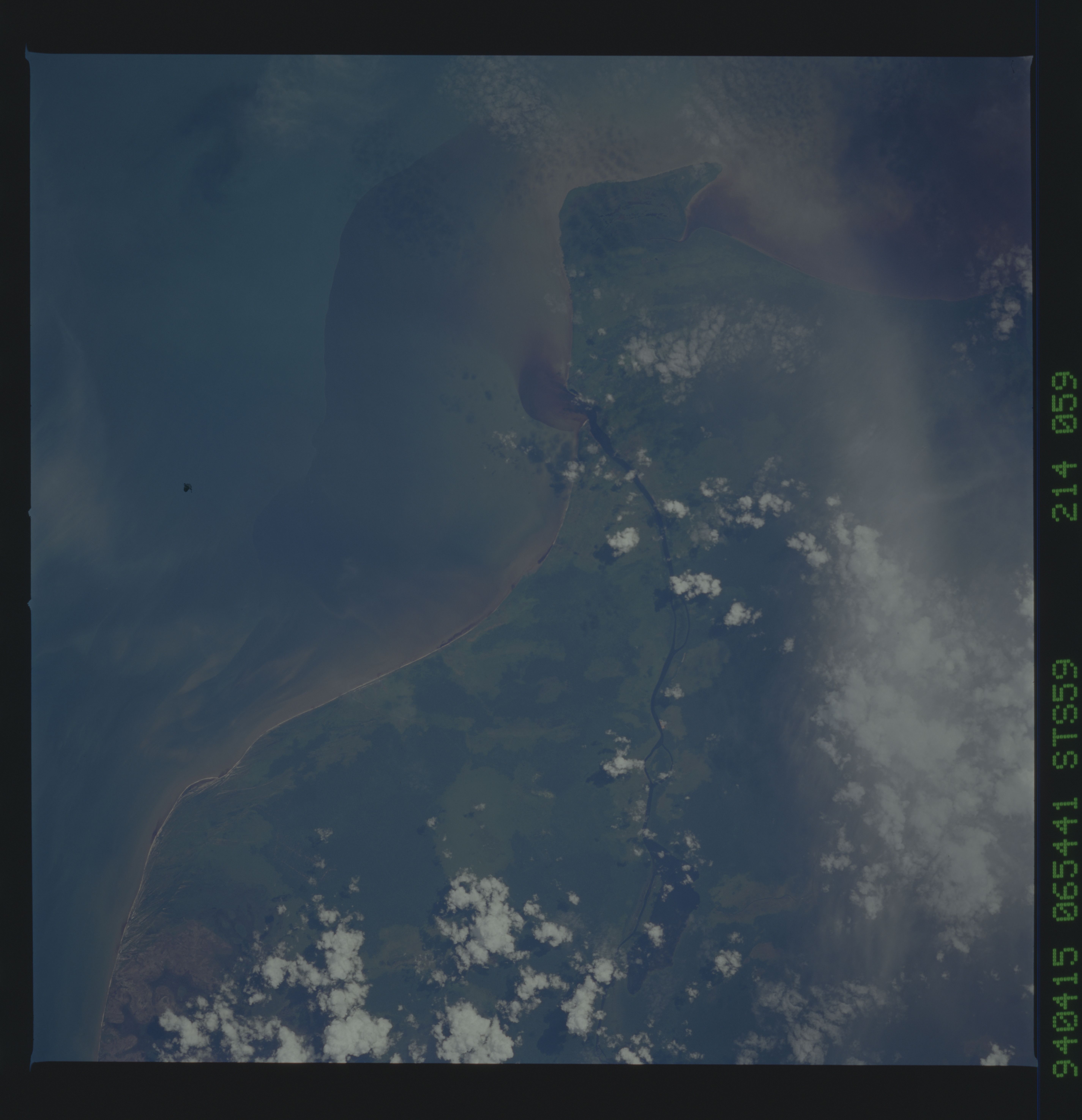
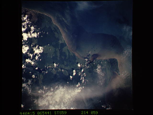
Image Caption: STS059-214-059 3.0S; 110.5E, T187 Djulai River, Kalimantan, Indonesia.
This photograph is typical of the deforestation, population
resettlement activities that are currently being promoted by the
Indonesian government. The dark water effluent is most likely a
sediment plume that is high in organic material. The Djulai River
drains this area of southwestern Kalimantan. Lighter green areas
represents areas where rainforests have been converted into productive
farm lands or pastures.
