STS059-208-68
| NASA Photo ID | STS059-208-68 |
| Focal Length | 100mm |
| Date taken | 1994.04.14 |
| Time taken | 17:23:40 GMT |
Resolutions offered for this image:
3904 x 3904 pixels 639 x 639 pixels 5700 x 5900 pixels 500 x 518 pixels 640 x 480 pixels
3904 x 3904 pixels 639 x 639 pixels 5700 x 5900 pixels 500 x 518 pixels 640 x 480 pixels

Cloud masks available for this image:
Spacecraft nadir point: 38.3° N, 75.7° W
Photo center point: 36.0° N, 77.0° W
Photo center point by machine learning:
Photo center point: 36.0° N, 77.0° W
Photo center point by machine learning:
Nadir to Photo Center: Southwest
Spacecraft Altitude: 115 nautical miles (213km)
Country or Geographic Name: | USA-NORTH CAROLINA |
Features: | ABLEMAR & PAMLICO SOUNDS |
| Features Found Using Machine Learning: | |
Cloud Cover Percentage: | 0 (no clouds present) |
Sun Elevation Angle: | 61° |
Sun Azimuth: | 191° |
Camera: | Hasselblad |
Focal Length: | 100mm |
Camera Tilt: | 54 degrees |
Format: | 5048: Kodak, natural color positive, Lumiere 100x/5048, ASA 100x, standard base |
Film Exposure: | Normal |
| Additional Information | |
| Width | Height | Annotated | Cropped | Purpose | Links |
|---|---|---|---|---|---|
| 3904 pixels | 3904 pixels | No | No | Earth From Space collection | Download Image |
| 639 pixels | 639 pixels | No | No | Earth From Space collection | Download Image |
| 5700 pixels | 5900 pixels | No | No | Download Image | |
| 500 pixels | 518 pixels | No | No | Download Image | |
| 640 pixels | 480 pixels | No | No | Download Image |
Download Packaged File
Download a Google Earth KML for this Image
View photo footprint information
Download a GeoTIFF for this photo
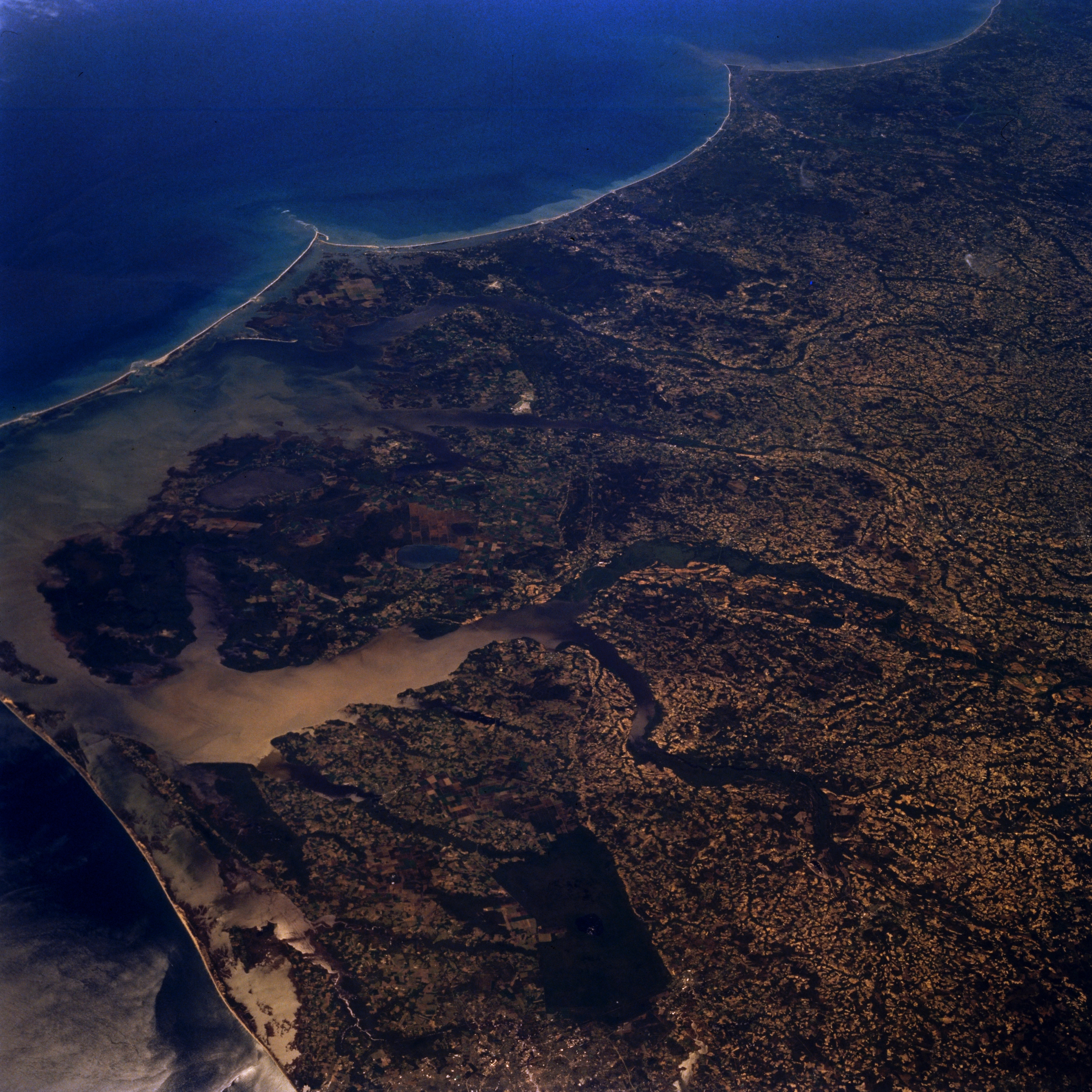
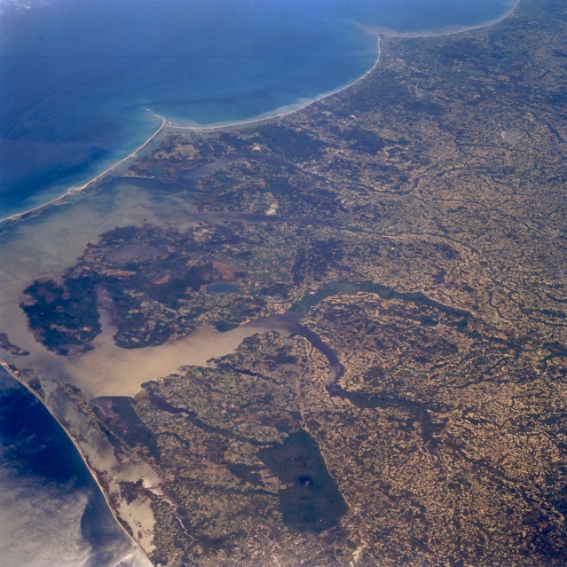
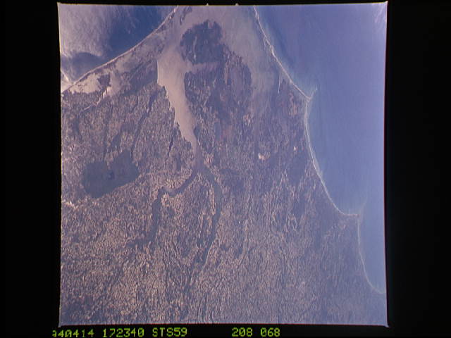
Image Caption: STS059-208-068 Pamlico Sound Area, North Carolina, U.S.A. April 1994
A large section of the coastal plains immediately west of Cape Hatteras ( just off the picture, center left) is visible in this low oblique, southerly view. Most of Pamlico Sound, the large body of water that is protected by the linear barrier islands that extend along most of the North Carolina coastline, can be seen along the left side of the picture. The two easily identified capes, Lookout and Fear, are the V-shaped promontories that extend seaward into the Atlantic Ocean (near top of picture). The floodplains (dark green linear features near center of image) of the Chowan and Roanoke Rivers can also be traced across the landscape as they both empty into Albemarle Sound. Albemarle Sound can be identified as the light colored feature caused by the suns reflection off of the surface of the water (known as sunglint or sun glitter). The uniformly, dark rectangular feature is the densely wooded Great Dismal Swamp (bottom center).
A large section of the coastal plains immediately west of Cape Hatteras ( just off the picture, center left) is visible in this low oblique, southerly view. Most of Pamlico Sound, the large body of water that is protected by the linear barrier islands that extend along most of the North Carolina coastline, can be seen along the left side of the picture. The two easily identified capes, Lookout and Fear, are the V-shaped promontories that extend seaward into the Atlantic Ocean (near top of picture). The floodplains (dark green linear features near center of image) of the Chowan and Roanoke Rivers can also be traced across the landscape as they both empty into Albemarle Sound. Albemarle Sound can be identified as the light colored feature caused by the suns reflection off of the surface of the water (known as sunglint or sun glitter). The uniformly, dark rectangular feature is the densely wooded Great Dismal Swamp (bottom center).
